- National Register of Historic Places listings in Aiken County, South Carolina
-
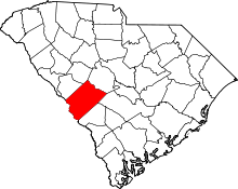 Location of Aiken County in South Carolina
This is a list of the National Register of Historic Places listings in Aiken County, South Carolina.
This is intended to be a complete list of the properties and districts on the National Register of Historic Places in Aiken County, South Carolina, United States. The locations of National Register properties and districts for which the latitude and longitude coordinates are included below, may be seen on a map.[1]
There are 38 properties and districts listed on the National Register in the county, including 1 National Historic Landmark.
-
- This National Park Service list is complete through NPS recent listings posted November 10, 2011.[2]
Current listings
[3] Landmark name [4] Image Date listed Location City or town Summary 1 Aiken Colored Cemetery March 19, 2007 Florence St. and Hampton Ave.
33°34′16″N 81°43′23″W / 33.571°N 81.722964°WAiken 2 Aiken Mile Track May 9, 1985 Banks Mill Rd.
33°32′39″N 81°41′57″W / 33.544167°N 81.699167°WAiken 3 Aiken Training Track May 9, 1985 Two Notch Rd.
33°32′35″N 81°42′30″W / 33.543056°N 81.708333°WAiken 4 Aiken Winter Colony Historic District I November 27, 1984 Off U.S. Routes 1/78
33°32′59″N 81°44′29″W / 33.549722°N 81.741389°WAiken 5 Aiken Winter Colony Historic District II November 27, 1984 Roughly bounded by railroad tracks, Colleton and 3rd Aves., and Laurens, South Boundary, and Marion Sts.
33°33′16″N 81°43′15″W / 33.554444°N 81.720833°WAiken 6 Aiken Winter Colony Historic District III November 27, 1984 Roughly bounded by Edgefield Ave., Highland Park Dr., Fauburg, and Greenville St.
33°33′47″N 81°43′40″W / 33.563056°N 81.727778°WAiken 7 Chancellor James P. Carroll House November 23, 1977 112 Gregg Ave.
33°33′59″N 81°45′28″W / 33.566389°N 81.757778°WAiken 8 The Cedars June 17, 1993 U.S. Route 278, 0.3 miles east of South Carolina Highway 125
33°25′38″N 81°52′50″W / 33.427222°N 81.880556°WBeech Island 9 Chinaberry April 29, 1982 441 York St., SE.
33°33′11″N 81°43′18″W / 33.553056°N 81.721667°WAiken 10 Coker Spring January 18, 1978 Coker Spring Rd.
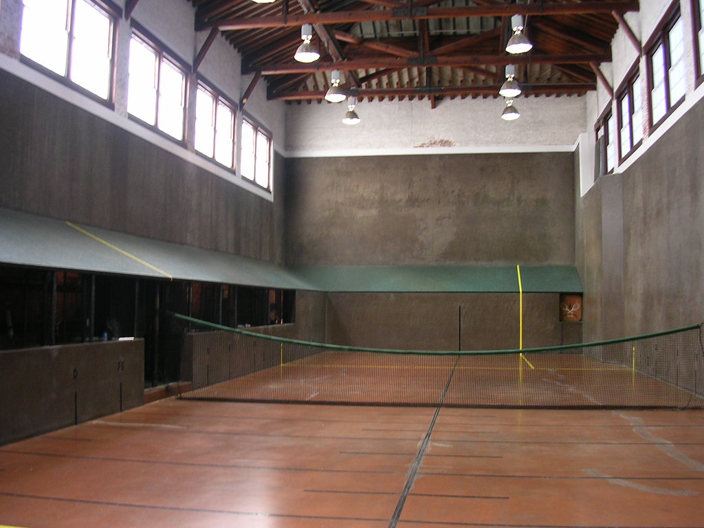
33°32′59″N 81°43′37″W / 33.549722°N 81.726944°WAiken 11 Court Tennis Building 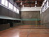
November 27, 1984 Newberry and Park Sts.
33°33′34″N 81°43′17″W / 33.559444°N 81.721389°WAiken 12 Crossways June 4, 1997 450 E. Boundary St.
33°32′46″N 81°41′27″W / 33.546111°N 81.690833°WAiken 13 Dawson-Vanderhorst House June 29, 1976 Northeast of Aiken at the junctino of Wire and New Bridge Rds.
33°34′49″N 81°40′57″W / 33.580278°N 81.6825°WAiken 14 Fort Moore-Savano Town Site August 14, 1973 Address Restricted Beech Island 15 Georgia Avenue-Butler Avenue Historic District April 5, 1984 Georgia and Butler Aves. and Martintown Rd.
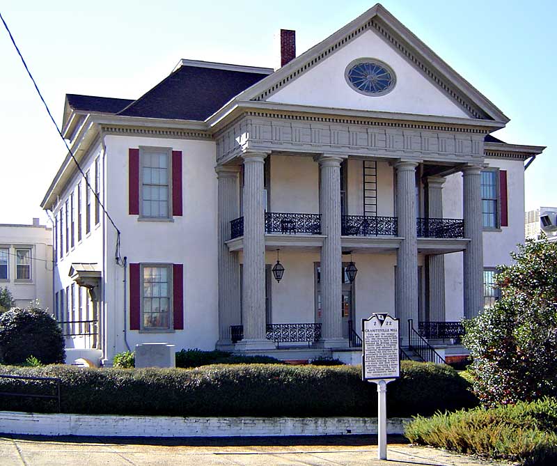
33°30′15″N 81°57′52″W / 33.504167°N 81.964444°WNorth Augusta 16 Graniteville Historic District 
June 2, 1978 South Carolina Highway 19 and Gregg St.
33°34′03″N 81°48′24″W / 33.5675°N 81.806667°WGraniteville 17 Charles Hammond House October 2, 1973 908 Martintown Rd., W.
33°31′33″N 81°58′47″W / 33.525833°N 81.979722°WNorth Augusta 18 Immanuel School June 3, 2009 120 York St., NE.
33°33′38″N 81°43′03″W / 33.560578°N 81.717586°WAiken 19 Joye Cottage September 29, 1980 463 Whiskey Rd. and 129 1st Ave.
33°33′12″N 81°43′25″W / 33.553333°N 81.723611°WAiken 20 Legare-Morgan House September 22, 1977 241 Lauren St., SW.
33°33′23″N 81°43′30″W / 33.556389°N 81.725°WAiken 21 Lookaway Hall August 13, 1992 103 W. Forest Ave.
33°29′56″N 81°58′08″W / 33.498889°N 81.968889°WNorth Augusta 22 Britton Mims Place June 4, 1997 229 Edgefield Rd.
33°31′27″N 81°56′59″W / 33.524167°N 81.949722°WNorth Augusta 23 Oakland Plantation August 19, 2011 2930 Storm Branch Rd.
33°26′59″N 81°50′17″W / 33.449722°N 81.838056°WBeech Island vicinity 24 Phelps House June 10, 1974 Barnwell Ave.
33°33′56″N 81°43′29″W / 33.565556°N 81.724722°WAiken 25 Pickens House May 19, 1983 101 Gregg Ave.
33°33′55″N 81°45′39″W / 33.565278°N 81.760833°WAiken 26 Redcliffe May 8, 1973 1.5 miles northeast of Beech Island on South Carolina Highway 125
33°24′58″N 81°52′56″W / 33.416111°N 81.882222°WBeech Island 27 Rosemary Hall April 28, 1975 804 Carolina Ave.
33°29′49″N 81°58′12″W / 33.496944°N 81.97°WNorth Augusta 28 St. Mary Help of Christians Church March 25, 1982 York St. and Park Ave.
33°33′28″N 81°43′11″W / 33.557778°N 81.719722°WAiken 29 St. Thaddeus Episcopal Church November 27, 1984 Pendleton and Richland Sts.
33°33′41″N 81°43′30″W / 33.561389°N 81.725°WAiken 30 Salley Historic District October 27, 2000 Bounded by Pine, Ferguson, Poplar, and Aldrich Sts.
33°33′56″N 81°18′17″W / 33.565556°N 81.304722°WSalley 31 Silver Bluff November 1, 1977 Address Restricted Jackson 32 US Court House-Aiken, South Carolina 
December 10, 2003 223 Park Ave., SE.
33°33′32″N 81°43′23″W / 33.558889°N 81.723056°WAiken 33 Vaucluse Mill Village Historic District 
May 7, 1996 South Carolina Highway 191, 3 miles north of Graniteville and 6 miles west of Aiken
33°36′54″N 81°48′12″W / 33.615°N 81.803333°WVaucluse 34 B.C. Wall House November 27, 1992 1008 West Ave.
33°30′08″N 81°58′18″W / 33.502222°N 81.971667°WNorth Augusta 35 Warrenville Elementary School May 22, 2002 115 Timmerman St.
33°32′53″N 81°48′24″W / 33.548056°N 81.806667°WWarrenville 36 Whitehall November 27, 1984 902 Magnolia St.
33°32′31″N 81°43′11″W / 33.541944°N 81.719722°WAiken 37 Willcox's March 19, 1982 Colleton Ave.
33°33′25″N 81°43′19″W / 33.556944°N 81.721944°WAiken 38 Zubly Cemetery January 28, 2002 Forrest Dr.
33°24′20″N 81°54′02″W / 33.405556°N 81.900556°WBeech Island See also
- List of National Historic Landmarks in South Carolina
- National Register of Historic Places listings in South Carolina
References
- ^ The latitude and longitude information provided in this table was derived originally from the National Register Information System, which has been found to be fairly accurate for about 99% of listings. For about 1% of NRIS original coordinates, experience has shown that one or both coordinates are typos or otherwise extremely far off; some corrections may have been made. A more subtle problem causes many locations to be off by up to 150 yards, depending on location in the country: most NRIS coordinates were derived from tracing out latitude and longitudes off of USGS topographical quadrant maps created under the North American Datum of 1927, which differs from the current, highly accurate WGS84 GPS system used by Google maps. Chicago is about right, but NRIS longitudes in Washington are higher by about 4.5 seconds, and are lower by about 2.0 seconds in Maine. Latitudes differ by about 1.0 second in Florida. Some locations in this table may have been corrected to current GPS standards.
- ^ "National Register of Historic Places: Weekly List Actions". National Park Service, United States Department of the Interior. Retrieved on November 10, 2011.
- ^ Numbers represent an ordering by significant words. Various colorings, defined here, differentiate National Historic Landmark sites and National Register of Historic Places Districts from other NRHP buildings, structures, sites or objects.
- ^ "National Register Information System". National Register of Historic Places. National Park Service. . http://nrhp.focus.nps.gov/natreg/docs/All_Data.html.
U.S. National Register of Historic Places in South Carolina Lists by county Abbeville • Aiken • Allendale • Anderson • Bamberg • Barnwell • Beaufort • Berkeley • Calhoun • Charleston • Cherokee • Chester • Chesterfield • Clarendon • Colleton • Darlington • Dillon • Dorchester • Edgefield • Fairfield • Florence • Georgetown • Greenville • Greenwood • Hampton • Horry • Jasper • Kershaw • Lancaster • Laurens • Lee • Lexington • Marion • Marlboro • McCormick • Newberry • Oconee • Orangeburg • Pickens • Richland • Saluda • Spartanburg • Sumter • Union • Williamsburg • York

Lists by city Other lists Municipalities and communities of Aiken County, South Carolina Cities 
Towns Jackson | Burnettown | Monetta‡ | New Ellenton | Perry | Salley | Wagener | Windsor
CDPs Unincorporated
communitiesBath | Beech Island | Ellenton | Graniteville | Langley | Spiderweb | Vaucluse | Warrenville
Footnotes ‡This populated place also has portions in an adjacent county or counties
Categories:- National Register of Historic Places in Aiken County, South Carolina
- National Register of Historic Places in South Carolina by county
-


Wikimedia Foundation. 2010.