- New Ellenton, South Carolina
-
New Mellenton, South Carolina — City — Location of New Ellenton, South Carolina
Coordinates: 33°25′17″N 81°40′51″W / 33.42139°N 81.68083°WCoordinates: 33°25′17″N 81°40′51″W / 33.42139°N 81.68083°W Country United States State South Carolina County Aiken Area - Total 5.0 sq mi (13.0 km2) - Land 5.0 sq mi (13.0 km2) - Water 0.0 sq mi (0.0 km2) Elevation 410 ft (125 m) Population (2000) - Total 2,250 - Density 449.4/sq mi (173.5/km2) Time zone Eastern (EST) (UTC-5) - Summer (DST) EDT (UTC-4) ZIP code 29809 Area code(s) 803 FIPS code 45-49705[1] GNIS feature ID 1231587[2] Website www.newellentonsc.com New Ellenton is a city in Aiken County, South Carolina, United States. The population was 2,250 at the 2000 census. It is part of the Augusta, Georgia metropolitan area.
Contents
History
New Ellenton was formed from the citizens of Ellenton a farming town chartered in 1880 situated on the Charleston and Western Carolina Railway in Barnwell County near the Aiken County line. Upon the approval of President Truman in 1950 of the Savannah River Site for the production of hydrogen bombs, the U.S. government forced 6,000 people in the surrounding area to move. The residents of Ellenton literally moved their homes and buildings 14 miles north to New Ellenton after being evicted in the 1950s.
Geography
New Ellenton is located at 33°25′17″N 81°40′51″W / 33.42139°N 81.68083°W (33.421311, -81.680856)[3].
According to the United States Census Bureau, the town has a total area of 5.0 square miles (13.0 km²), all of it land.
Demographics
As of the census[1] of 2000, there were 2,250 people, 876 households, and 616 families residing in the town. The population density was 449.4 people per square mile (173.4/km²). There were 1,079 housing units at an average density of 215.5 per square mile (83.2/km²). The racial makeup of the town was 60.62% White, 35.82% African American, 0.58% Native American, 0.36% Asian, 0.89% from other races, and 1.73% from two or more races. Hispanic or Latino of any race were 2.18% of the population.
There were 876 households out of which 28.7% had children under the age of 18 living with them, 50.3% were married couples living together, 15.3% had a female householder with no husband present, and 29.6% were non-families. 26.4% of all households were made up of individuals and 9.8% had someone living alone who was 65 years of age or older. The average household size was 2.54 and the average family size was 3.06.
In the town the population was spread out with 24.8% under the age of 18, 8.1% from 18 to 24, 26.8% from 25 to 44, 23.8% from 45 to 64, and 16.4% who were 65 years of age or older. The median age was 39 years. For every 100 females there were 91.8 males. For every 100 females age 18 and over, there were 87.3 males.
The median income for a household in the town was $38,125, and the median income for a family was $45,521. Males had a median income of $41,250 versus $21,810 for females. The per capita income for the town was $17,915. About 6.9% of families and 11.8% of the population were below the poverty line, including 16.3% of those under age 18 and 11.0% of those age 65 or over.
References
- ^ a b "American FactFinder". United States Census Bureau. http://factfinder.census.gov. Retrieved 2008-01-31.
- ^ "US Board on Geographic Names". United States Geological Survey. 2007-10-25. http://geonames.usgs.gov. Retrieved 2008-01-31.
- ^ "US Gazetteer files: 2010, 2000, and 1990". United States Census Bureau. 2011-02-12. http://www.census.gov/geo/www/gazetteer/gazette.html. Retrieved 2011-04-23.
External links
Municipalities and communities of Aiken County, South Carolina County seat: Aiken Cities 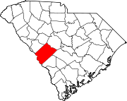
Towns CDPs Unincorporated
communitiesBath | Beech Island | Ellenton | Graniteville | Langley | Vaucluse | Warrenville
Footnotes ‡This populated place also has portions in an adjacent county or counties
Categories:- Aiken County, South Carolina
- Cities in South Carolina
- Augusta – Richmond County metropolitan area


Wikimedia Foundation. 2010.