- Hephzibah, Georgia
Infobox Settlement
official_name = Hephzibah, Georgia
other_name =
native_name =
nickname =
settlement_type = city
motto =
imagesize =
image_caption =
flag_size =
image_
seal_size =
image_shield =
shield_size =
image_blank_emblem =
blank_emblem_type =
blank_emblem_size =
imagesize =
image_caption =
flag_size =
image_
seal_size =
image_shield =
shield_size =
image_blank_emblem =
blank_emblem_type =
blank_emblem_size =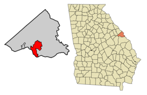
mapsize = 250px
map_caption = Location in Richmond County and the state of Georgia
mapsize1 =
map_caption1 =
image_dot_
dot_mapsize =
dot_map_caption =
dot_x =
dot_y =
pushpin_
pushpin_label_position =
pushpin_map_caption =
pushpin_mapsize =
subdivision_type = Country
subdivision_name =United States
subdivision_type1 = State
subdivision_name1 = Georgia
subdivision_type2 = Counties
subdivision_name2 = Richmond
subdivision_type3 =
subdivision_name3 =
subdivision_type4 =
subdivision_name4 =
government_footnotes =
government_type =
leader_title =
leader_name =
leader_title1 =
leader_name1 =
leader_title2 =
leader_name2 =
leader_title3 =
leader_name3 =
leader_title4 =
leader_name4 =
established_title =
established_date =
established_title2 =
established_date2 =
established_title3 =
established_date3 =
area_magnitude =
unit_pref = Imperial
area_footnotes =
area_total_km2 = 50.3
area_land_km2 = 50.1
area_water_km2 = 0.2
area_total_sq_mi = 19.5
area_land_sq_mi = 19.4
area_water_sq_mi = 0.1
area_water_percent =
area_urban_km2 =
area_urban_sq_mi =
area_metro_km2 =
area_metro_sq_mi =
area_blank1_title =
area_blank1_km2 =
area_blank1_sq_mi =
population_as_of = 2000
population_footnotes =
population_note =
population_total = 3880
population_density_km2 = 77.1
population_density_sq_mi = 199
population_metro =
population_density_metro_km2 =
population_density_metro_sq_mi =
population_urban =
population_density_urban_km2 =
population_density_urban_sq_mi =
population_blank1_title =
population_blank1 =
population_density_blank1_km2 =
population_density_blank1_sq_mi =
timezone =
utc_offset =
timezone_DST =
utc_offset_DST =
latd=
latm=
lats=
latNS=
longd=
longm=
longs=
longEW=
elevation_footnotes =
elevation_m =
elevation_ft =
postal_code_type =
postal_code =
area_code =
blank_name =
blank_info =
blank1_name =
blank1_info =
website =
footnotes = Hephzibah is a city in Richmond County, Georgia,United States . The population was 3,880 at the 2000 census. In1996 the governments of the City ofAugusta, Georgia and Richmond County combined to form a single governing body, although Hephzibah maintains a separate city government.The city is named after the spouse of the ancient monarch of the Kingdom of Judah
Hezekiah . "Hephzibah" is a Hebrew word which means "my delight is in her."Geography
Hephzibah is located at coor dms|33|18|15|N|82|5|53|W|city (33.304126, -82.097923)GR|1.
According to the
United States Census Bureau , the city has a total area of 19.4square mile s (50.3km² ), of which, 19.4 square miles (50.1 km²) of it is land and 0.1 square miles (0.2 km²) of it (0.31%) is water.Demographics
As of the
census GR|2 of 2000, there were 3,880 people, 1,374 households, and 1,090 families residing in the city. Thepopulation density was 200.4 people per square mile (77.4/km²). There were 1,570 housing units at an average density of 81.1/sq mi (31.3/km²). The racial makeup of the city was 71.37% White, 25.08% African American, 0.36% Native American, 0.62% Asian, 0.15% Pacific Islander, 0.75% from other races, and 1.68% from two or more races. Hispanic or Latino of any race were 1.96% of the population.There were 1,374 households out of which 39.5% had children under the age of 18 living with them, 57.4% were married couples living together, 17.7% had a female householder with no husband present, and 20.6% were non-families. 17.5% of all households were made up of individuals and 5.3% had someone living alone who was 65 years of age or older. The average household size was 2.81 and the average family size was 3.14.
In the city the population was spread out with 28.2% under the age of 18, 9.2% from 18 to 24, 30.3% from 25 to 44, 23.1% from 45 to 64, and 9.3% who were 65 years of age or older. The median age was 35 years. For every 100 females there were 93.2 males. For every 100 females age 18 and over, there were 90.9 males.
The median income for a household in the city was $37,123, and the median income for a family was $42,898. Males had a median income of $32,917 versus $22,841 for females. The
per capita income for the city was $15,905. About 12.9% of families and 16.3% of the population were below thepoverty line , including 19.5% of those under age 18 and 16.8% of those age 65 or over.Notable locations
*
Augusta International Raceway
*Diamond Lakes Recreation Center
*Jessie Carroll Park and Recreation Center
*Blythe Recreation Center References
External links
Wikimedia Foundation. 2010.