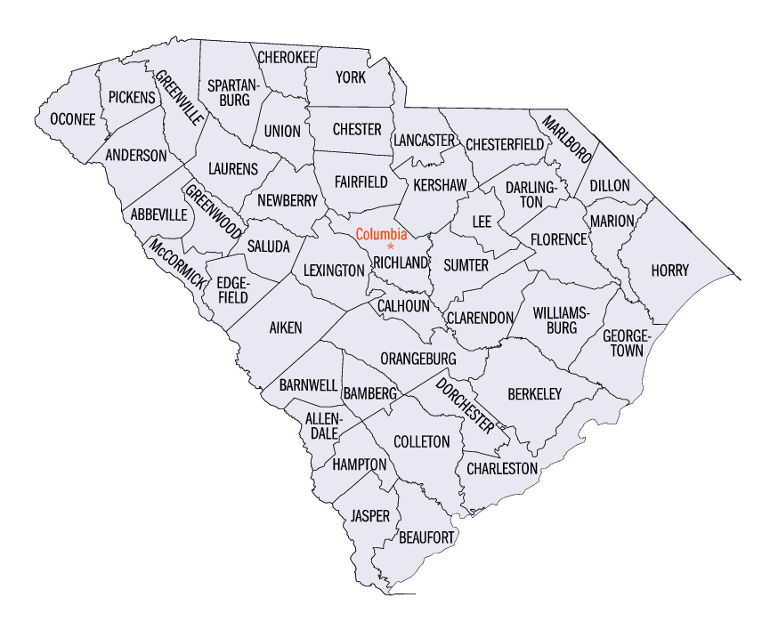
- List of counties in South Carolina
-
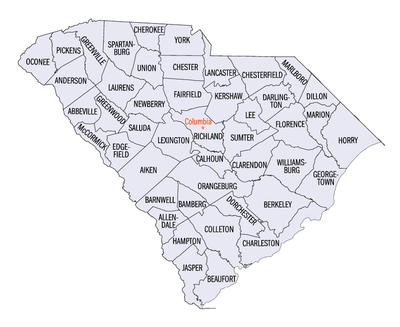 Map of the counties of South Carolina
The U.S. state of South Carolina is made up of 46 counties. They range in size from 392 square miles (1,016 square kilometers) in the case of Calhoun County to 1,358 square miles (3,517 square kilometers) in the case of Charleston County. The least populous county is McCormick County, with only 9,958 residents, while the most populous county is Greenville County, with a population of 395,357, despite the state's most populous city, Columbia, being located in Richland County.
Contents
History
In the colonial period, the land around the coast was divided into parishes corresponding to the parishes of the Church of England. There were also several counties that had judicial and electoral functions. As people settled the backcountry, judicial districts and additional counties were formed. This structure continued and grew after the Revolutionary War. In 1800, all counties were renamed as districts. In 1868, the districts were converted back to counties.[1] The South Carolina Department of Archives and History has maps that show the boundaries of counties, districts, and parishes starting in 1682.[2]
Alphabetical List
County FIPS code
[3]County seat
[4]Established
[4]Origin Etymology Population Area Map Abbeville County 001 Abbeville 1785 Ninety-Six District Abbeville, France 26,167 511 sq mi
(1,323 km2)
Aiken County 003 Aiken 1871 Barnwell, Edgefield, Lexington, and Orangeburg William Aiken, founder of the South Carolina Canal and Railroad Company 142,552 1,080 sq mi
(2,797 km2)
Allendale County 005 Allendale 1919 Barnwell and Hampton P.H. Allen, first postmaster of the new county 11,211 413 sq mi
(1,070 km2)
Anderson County 007 Anderson 1826 Pendleton District Robert Anderson, American Revolutionary War general and Southern surveyor 165,740 757 sq mi
(1,961 km2)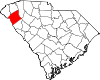
Bamberg County 009 Bamberg 1897 Barnwell Francis Marion Bamberg, Confederate general in the American Civil War 16,658 395 sq mi
(1,023 km2)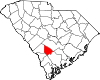
Barnwell County 011 Barnwell 1798 Orangeburg John Barnwell, South Carolina State Senator and prisoner of war during the American Revolution 23,478 557 sq mi
(1,443 km2)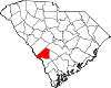
Beaufort County 013 Beaufort 1769 1769 Judicial District Henry Somerset, 1st Duke of Beaufort, colonial proprietary landowner 120,937 923 sq mi
(2,391 km2)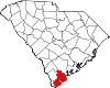
Berkeley County 015 Moncks Corner 1882 Charleston William Berkeley, colonial proprietary governor and landowner 142,651 1,228 sq mi
(3,181 km2)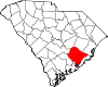
Calhoun County 017 St. Matthews 1908 Lexington and Orangeburg John C. Calhoun, U.S. Senator from South Carolina and states' rights advocate 15,185 392 sq mi
(1,015 km2)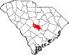
Charleston County 019 Charleston 1769 1769 Judicial District King Charles II of England 309,969 1,358 sq mi
(3,517 km2)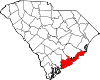
Cherokee County 021 Gaffney 1897 Spartanburg, Union, and York Cherokee Native Americans 52,327 397 sq mi
(1,028 km2)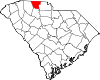
Chester County 023 Chester 1785 Camden District Chester, Pennsylvania 34,068 586 sq mi
(1,518 km2)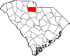
Chesterfield County 025 Chesterfield 1798 Cheraws District Philip Dormer Stanhope, 4th Earl of Chesterfield, an Enlightenment-era scholar, government official, and member of the British House of Lords 42,768 806 sq mi
(2,088 km2)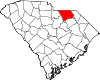
Clarendon County 027 Manning 1855 Sumter Edward Hyde, 1st Earl of Clarendon, colonial proprietary landowner 32,502 696 sq mi
(1,803 km2)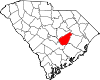
Colleton County 029 Walterboro 1800 Charleston John Colleton, colonial proprietary landowner 38,264 1,133 sq mi
(2,934 km2)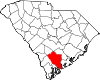
Darlington County 031 Darlington 1785 Cheraws District Darlington, England 67,394 567 sq mi
(1,469 km2)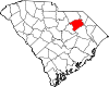
Dillon County 033 Dillon 1910 Marion J.W. Dillon, founder of the Wilson Short Cut Railroad 30,722 407 sq mi
(1,054 km2)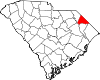
Dorchester County 035 St. George 1868 Berkeley and Colleton Dorchester, Massachusetts 96,413 577 sq mi
(1,494 km2)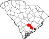
Edgefield County 037 Edgefield 1785 Ninety-Six District Disputed; either its location on the edge of the state or Edgefield, Norfolk, England 24,595 507 sq mi
(1,313 km2)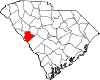
Fairfield County 039 Winnsboro 1785 Camden District The county's fair fields, as described by colonial governor Charles Cornwallis 23,454 710 sq mi
(1,839 km2)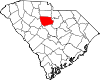
Florence County 041 Florence 1888 Clarendon, Darlington, Marion, and Williamsburg Florence Harllee, wife of Wilmington and Manchester Railroad founder W.W. Harllee 125,761 804 sq mi
(2,082 km2)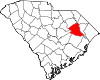
Georgetown County 043 Georgetown 1769 1769 Judicial District King George II of Great Britain 55,797 1,035 sq mi
(2,681 km2)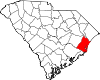
Greenville County 045 Greenville 1798 Washington District Nathanael Greene, Revolutionary War general 395,357 795 sq mi
(2,059 km2)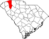
Greenwood County 047 Greenwood 1897 Abbeville and Edgefield Greenwood Plantation, the home of John McGee, the county's largest landowner 66,271 463 sq mi
(1,199 km2)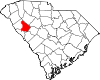
Hampton County 049 Hampton 1787 Beaufort Wade Hampton, Congressman from South Carolina and once the nation's wealthiest citizen 21,386 563 sq mi
(1,458 km2)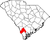
Horry County 051 Conway 1801 Georgetown Peter Horry, Revolutionary War general 217,608 1,255 sq mi
(3,250 km2)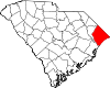
Jasper County 053 Ridgeland 1912 Beaufort and Hampton William Jasper, Revolutionary War sergeant 20,678 700 sq mi
(1,813 km2)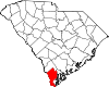
Kershaw County 055 Camden 1798 Claremont, Fairfield, Lancaster, and Richland Joseph Kershaw, one of the county's pioneering settlers 52,647 740 sq mi
(1,917 km2)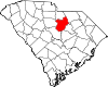
Lancaster County 057 Lancaster 1798 Camden District Lancaster County, Pennsylvania 61,351 555 sq mi
(1,437 km2)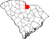
Laurens County 059 Laurens 1785 Ninety-Six District Henry Laurens, president of the Second Continental Congress and prisoner of war during the American Revolution 69,567 724 sq mi
(1,875 km2)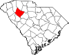
Lee County 061 Bishopville 1902 Darlington, Kershaw, and Sumter Robert E. Lee, Confederate general during the Civil War 20,119 411 sq mi
(1,064 km2)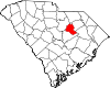
Lexington County 063 Lexington 1804 Orangeburg Battle of Lexington, opening skirmish of the Revolutionary War 216,014 758 sq mi
(1,963 km2)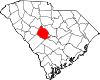
Marion County 067 Marion 1800 Georgetown Francis Marion, Revolutionary War general 35,466 494 sq mi
(1,279 km2)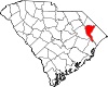
Marlboro County 069 Bennettsville 1798 Cheraws District John Churchill, 1st Duke of Marlborough, English general, diplomat, and confidant of monarchs 28,818 485 sq mi
(1,256 km2)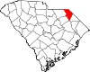
McCormick County 065 McCormick 1914 Abbeville, Edgefield, and Greenwood Cyrus McCormick, inventor of the mechanical reaper and founder of International Harvester 9,958 394 sq mi
(1,020 km2)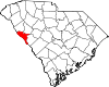
Newberry County 071 Newberry 1785 Ninety-Six District Disputed; possibly Newbury, Berkshire, England, or from early settlers' notion that the landscape was as "pretty as a new berry" 36,108 647 sq mi
(1,676 km2)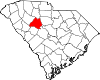
Oconee County 073 Walhalla 1868 Pickens Oconee Native Americans 66,215 674 sq mi
(1,746 km2)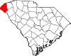
Orangeburg County 075 Orangeburg 1769 1769 Judicial District King William V of Orange 91,582 1,128 sq mi
(2,922 km2)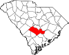
Pickens County 077 Pickens 1826 Pendleton District Andrew Pickens, Governor of South Carolina 110,757 512 sq mi
(1,326 km2)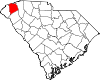
Richland County 079 Columbia 1799 Camden District The county's rich soil 320,677 772 sq mi
(1,999 km2)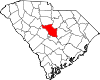
Saluda County 081 Saluda 1896 Edgefield Saluda River 19,181 462 sq mi
(1,197 km2)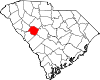
Spartanburg County 083 Spartanburg 1785 Ninety-Six District "Spartan Regiment" of the state militia, which was the key force for victory in the Revolutionary War Battle of Cowpens 253,791 819 sq mi
(2,121 km2)
Sumter County 085 Sumter 1798 Claremont, Clarendon, and Salem Thomas Sumter, Revolutionary War general and U.S. Senator from South Carolina 104,646 682 sq mi
(1,766 km2)
Union County 087 Union 1798 Ninety-Six District Union Church, the first Christian place of worship in the area 29,881 516 sq mi
(1,336 km2)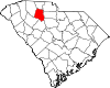
Williamsburg County 089 Kingstree 1802 Georgetown District King William III of England 37,217 937 sq mi
(2,427 km2)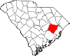
York County 091 York 1798 Camden District York County, Pennsylvania 164,614 696 sq mi
(1,803 km2)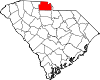
Defunct Parishes, Counties and Districts
Parishes
- St. Luke's Parish, South Carolina created by the Colonial Assembly on 23 May 1767, located on Hilton Head Island and the adjacent mainland.
Counties
- Craven County created in 1682 by the Lords Proprietors
- Granville County created in 1686 by the Lords Proprietors
- Orange County 1785-1791
- Lewisburg County 1785-1791
- Winton County present-day Barnwell County
- Liberty County present-day Marion County
- Winyah County former name of Georgetown County
- Claremont County
- Salem County
Districts
- Cheraw District created in 1769
- Camden District created in 1769
- Ninety-Six District created in 1769
- Pinckney District 1791-1798
- Washington District 1785-1798
- Pendleton District created in 1789 from Cherokee lands
Notes
- ^ Edgar, Walter, ed. The South Carolina Encyclopedia, University of South Carolina Press, 2006, pp. 230-234, ISBN 1-57003-598-2
- ^ South Carolina Department of Archives and History maps.
- ^ "EPA County FIPS Code Listing". EPA. http://www.epa.gov/enviro/html/codes/sc.html. Retrieved 2007-04-09.
- ^ a b National Association of Counties. "NACo - Find a county". http://www.naco.org/Template.cfm?Section=Find_a_County&Template=/cffiles/counties/state.cfm&state.cfm&statecode=SC. Retrieved 2007-04-26.
References
- Landrum, John Belton O'Neall (1897) Colonial and revolutionary history of upper South Carolina: embracing for the most part the primitive and colonial history of the territory comprising the original county of Spartanburg with a general review of the entire military operations in the upper portion of South Carolina and portions of North Carolina Shannon and Company, Greenville, South Carolina, OCLC 3492548
External links
- Information on County Formation timeline
- Complete South Carolina County Guide
- Map of former parishes of South Carolina South Carolina Department of Archives and History
 State of South Carolina
Regions Larger cities Smaller cities Towns CDPs Counties - Abbeville
- Aiken
- Allendale
- Anderson
- Bamberg
- Barnwell
- Beaufort
- Berkeley
- Calhoun
- Charleston
- Cherokee
- Chester
- Chesterfield
- Clarendon
- Colleton
- Darlington
- Dillon
- Dorchester
- Edgefield
- Fairfield
- Florence
- Georgetown
- Greenville
- Greenwood
- Hampton
- Horry
- Jasper
- Kershaw
- Lancaster
- Laurens
- Lee
- Lexington
- Marion
- Marlboro
- McCormick
- Newberry
- Oconee
- Orangeburg
- Pickens
- Richland
- Saluda
- Spartanburg
- Sumter
- Union
- Williamsburg
- York
Topics - History
- Famous people
- Governors
- Legislature
- State House
- Congressional districts
- Census areas
- State parks
- Rivers
- Wildlife refuges
- Historic places
- Amusement parks
- Colleges and universities
- Sports venues
- Shopping malls
- Television stations
- Radio stations
- Highways
- Airports
- Visitor attractions
Categories:- Lists of U.S. counties by state
- South Carolina counties
- South Carolina-related lists


Wikimedia Foundation. 2010.