- Marion County, South Carolina
-
For counties with a similar name, see Marion County (disambiguation).
Marion County, South Carolina 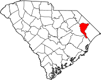
Location in the state of South Carolina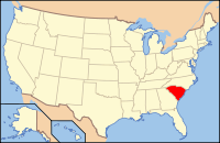
South Carolina's location in the U.S.Founded 1800 Seat Marion Area
- Total
- Land
- Water
494 sq mi (1,279 km²)
489 sq mi (1,267 km²)
5 sq mi (13 km²), 1.02%Population
- (2000)
- Density
35,466
73/sq mi (28/km²)Website www.marionsc.org Marion County is a county located in the U.S. state of South Carolina. In 2000, its population was 35,466. The 2005 Census estimate placed the population at 34,904.[1] Its county seat is Marion.[2] It was created in 1785 and was originally known as Liberty County. However, four years later it was renamed Marion County, in honor Brigadier General Francis Marion, the famous "Swamp Fox" and a hero of the American Revolutionary War.
Contents
Geography
According to the U.S. Census Bureau, the county has a total area of 494 square miles (1,280 km2), of which 489 square miles (1,270 km2) is land and 5 square miles (13 km2) (1.02%) is water.
Adjacent counties
- Dillon County, South Carolina - north
- Horry County, South Carolina - east
- Georgetown County, South Carolina - south
- Williamsburg County, South Carolina - southwest
- Florence County, South Carolina - west
National protected area
Demographics
As of the census[3] of 2000, there were 35,466 people, 13,301 households, and 9,510 families residing in the county. The population density was 72 people per square mile (28/km²). There were 15,143 housing units at an average density of 31 per square mile (12/km²). The racial makeup of the county was 41.69% White, 56.35% Black or African American, 0.25% Native American, 0.28% Asian, 0.01% Pacific Islander, 0.90% from other races, and 0.52% from two or more races. 1.79% of the population were Hispanic or Latino of any race.
There were 13,301 households out of which 32.20% had children under the age of 18 living with them, 43.30% were married couples living together, 23.60% had a female householder with no husband present, and 28.50% were non-families. 25.40% of all households were made up of individuals and 9.70% had someone living alone who was 65 years of age or older. The average household size was 2.64 and the average family size was 3.16.
In the county, the population was spread out with 27.60% under the age of 18, 9.70% from 18 to 24, 26.80% from 25 to 44, 23.80% from 45 to 64, and 12.10% who were 65 years of age or older. The median age was 35 years. For every 100 females there were 85.90 males. For every 100 females age 18 and over, there were 80.40 males.
The median income for a household in the county was $26,526, and the median income for a family was $32,932. Males had a median income of $26,133 versus $18,392 for females. The per capita income for the county was $13,878. About 18.90% of families and 23.20% of the population were below the poverty line, including 33.30% of those under age 18 and 23.50% of those age 65 or over.
Cities and towns
- Brittons Neck
- Centenary
- Gresham
- Marion
- Mullins
- Nichols
- Rains
- Sellers
- Temperance Hill
Major highways
 Interstate 73
 U.S. Route 76
 U.S. Route 301
 U.S. Route 378
 U.S. Route 501
U.S. Route 501 Business SC 9
SC 9 SC 38
SC 38
 SC 41
SC 41
South Carolina Highway 41 Alternate SC 57
SC 57 SC 576
 SC 908
 SC 917
Historic places
- Neal and Dixon's Warehouse
- Marion Courthouse
- Records Building
- Old Opera House (Gasque Motor Co.)
- Marion Public Library
- Presbyterian Church
- Masonic Lodge
- McDonald-McLendon House
- Gibson-Rogers House
- Oakenwald (Jones-Hunter House)
- Bluefields (Blue-McCollum House)
- Montgomery-Boyce House
- Gasque House
- Godbold-Davis House
- McIntyre-Ammons House
- Young-Johnson House
- Gibson-Witherspoon House
- Durantia (Durant Family)
- the Marion County Museum
- Wilcox-Turbeville House
References
- ^ http://www.census.gov/popest/counties/tables/CO-EST2005-01-45.xls
- ^ "Find a County". National Association of Counties. http://www.naco.org/Counties/Pages/FindACounty.aspx. Retrieved 2011-06-07.
- ^ "American FactFinder". United States Census Bureau. http://factfinder.census.gov. Retrieved 2008-01-31.

Dillon County Florence County 
Horry County  Marion County, South Carolina

Williamsburg County Georgetown County Municipalities and communities of Marion County, South Carolina Cities 
Towns Unincorporated
communities State of South Carolina
Regions Larger cities Smaller cities Towns CDPs Counties - Abbeville
- Aiken
- Allendale
- Anderson
- Bamberg
- Barnwell
- Beaufort
- Berkeley
- Calhoun
- Charleston
- Cherokee
- Chester
- Chesterfield
- Clarendon
- Colleton
- Darlington
- Dillon
- Dorchester
- Edgefield
- Fairfield
- Florence
- Georgetown
- Greenville
- Greenwood
- Hampton
- Horry
- Jasper
- Kershaw
- Lancaster
- Laurens
- Lee
- Lexington
- Marion
- Marlboro
- McCormick
- Newberry
- Oconee
- Orangeburg
- Pickens
- Richland
- Saluda
- Spartanburg
- Sumter
- Union
- Williamsburg
- York
Topics - History
- Famous people
- Governors
- Legislature
- State House
- Congressional districts
- Census areas
- State parks
- Rivers
- Wildlife refuges
- Historic places
- Amusement parks
- Colleges and universities
- Sports venues
- Shopping malls
- Television stations
- Radio stations
- Highways
- Airports
- Visitor attractions
Categories:- South Carolina counties
- Marion County, South Carolina
- 1800 establishments in the United States
- Counties of the United States with African American majority populations
- Populated places established in 1800


Wikimedia Foundation. 2010.