- Dorchester County, South Carolina
-
Dorchester County, South Carolina 
Seal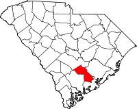
Location in the state of South Carolina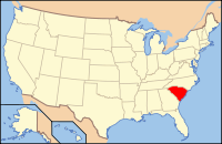
South Carolina's location in the U.S.Founded 1897 Seat St. George Area
- Total
- Land
- Water
577 sq mi (1,494 km²)
575 sq mi (1,489 km²)
2 sq mi (5 km²), 0.34%Population
- (2010)
- Density
136,555
168/sq mi (65/km²)Website www.dorchestercounty.net Dorchester County is a county located in the U.S. state of South Carolina. The 2010 census recorded its population to be 136,555. Its county seat is St. George.[1]
As defined by the U.S. Office of Management and Budget, and used by the U.S. Census Bureau for statistical purposes only, Dorchester County is included within the Charleston-North Charleston-Summerville metropolitan area.
Contents
History
Dorchester county is named for its first settlement area, which was established by Congregationalists in 1696. These settlers applied the name "Dorchester" after their last residence in Dorchester, Massachusetts.
Dorchester was not established as a separate county until 1897, however, when it was separately established from parts of the neighboring Colleton and Berkeley counties. [2]
Geography
According to the U.S. Census Bureau, the county has a total area of 577 square miles (1,494.4 km2), of which 575 square miles (1,489.2 km2) is land and 2 square miles (5.2 km2) (0.34%) is water.
Adjacent Counties
- Bamberg County, South Carolina - west
- Berkeley County, South Carolina - east
- Charleston County, South Carolina - southeast
- Colleton County, South Carolina - southwest
- Orangeburg County, South Carolina - northwest
Demographics
Historical populations Census Pop. %± 1900 16,294 — 1910 17,891 9.8% 1920 19,459 8.8% 1930 18,956 −2.6% 1940 19,928 5.1% 1950 22,601 13.4% 1960 24,383 7.9% 1970 32,276 32.4% 1980 58,761 82.1% 1990 83,060 41.4% 2000 96,413 16.1% 2010 136,555 41.6% U.S. Decennial Census As of the census[3] of 2000, there were 96,413 people, 34,709 households, and 26,309 families residing in the county. The population density was 168 people per square mile (65/km²). There were 37,237 housing units at an average density of 65 per square mile (25/km²). The racial makeup of the county was 71.05% White, 25.08% Black or African American, 0.73% Native American, 1.13% Asian, 0.07% Pacific Islander, 0.59% from other races, and 1.36% from two or more races. 1.79% of the population were Hispanic or Latino of any race.
There were 34,709 households out of which 40.00% had children under the age of 18 living with them, 57.20% were married couples living together, 14.60% had a female householder with no husband present, and 24.20% were non-families. 20.20% of all households were made up of individuals and 6.50% had someone living alone who was 65 years of age or older. The average household size was 2.72 and the average family size was 3.13.
In the county, the population was spread out with 28.90% under the age of 18, 7.70% from 18 to 24, 31.60% from 25 to 44, 22.60% from 45 to 64, and 9.10% who were 65 years of age or older. The median age was 35 years. For every 100 females there were 95.80 males. For every 100 females age 18 and over, there were 91.70 males.
The median income for a household in the county was $43,316, and the median income for a family was $50,177. Males had a median income of $35,423 versus $24,405 for females. The per capita income for the county was $18,840. About 7.10% of families and 9.70% of the population were below the poverty line, including 11.40% of those under age 18 and 13.30% of those age 65 or over.
Government and infrastructure
The South Carolina Department of Corrections operates the Lieber Correctional Institution in Ridgeville in Dorchester County.[4] The prison houses the state's male death row.[5]
Cities - Towns - Areas
- Grover - A village located south of Saint George, near the Edisto River
- Harleyville
- North Charleston - A city part in Charleston County, Berkely County and Dorchester County.
- Reevesville
- Ridgeville
- St. George
- Summerville - A town part in Charleston County, Berkely County and Dorchester County.
- Ladson- A census defined area partly divided between Charleston, Dorchester and Berkeley Counties.
See also
References
- ^ "Find a County". National Association of Counties. http://www.naco.org/Counties/Pages/FindACounty.aspx. Retrieved 2011-06-07.
- ^ Dorchester County Online
- ^ "American FactFinder". United States Census Bureau. http://factfinder.census.gov. Retrieved 2008-01-31.
- ^ "Lieber Correctional Institution." South Carolina Department of Corrections. Retrieved on August 17, 2010.
- ^ "Death Row/Capital Punishment." South Carolina Department of Corrections. Retrieved on August 17, 2010.
External links

Orangeburg County Bamberg County 
Berkeley County  Dorchester County, South Carolina

Colleton County Charleston County Municipalities and communities of Dorchester County, South Carolina City 
Towns Harleyville | Lincolnville‡ | Reevesville | Ridgeville | St. George | Summerville‡
Ghost town Footnotes ‡This populated place also has portions in an adjacent county or counties
 State of South Carolina
Regions Larger cities Smaller cities Towns CDPs Counties - Abbeville
- Aiken
- Allendale
- Anderson
- Bamberg
- Barnwell
- Beaufort
- Berkeley
- Calhoun
- Charleston
- Cherokee
- Chester
- Chesterfield
- Clarendon
- Colleton
- Darlington
- Dillon
- Dorchester
- Edgefield
- Fairfield
- Florence
- Georgetown
- Greenville
- Greenwood
- Hampton
- Horry
- Jasper
- Kershaw
- Lancaster
- Laurens
- Lee
- Lexington
- Marion
- Marlboro
- McCormick
- Newberry
- Oconee
- Orangeburg
- Pickens
- Richland
- Saluda
- Spartanburg
- Sumter
- Union
- Williamsburg
- York
Topics - History
- Famous people
- Governors
- Legislature
- State House
- Congressional districts
- Census areas
- State parks
- Rivers
- Wildlife refuges
- Historic places
- Amusement parks
- Colleges and universities
- Sports venues
- Shopping malls
- Television stations
- Radio stations
- Highways
- Airports
- Visitor attractions
Categories:- South Carolina counties
- Dorchester County, South Carolina
- 1897 establishments
- Charleston–North Charleston–Summerville metropolitan area


Wikimedia Foundation. 2010.