- Cherokee County, South Carolina
-
Cherokee County, South Carolina 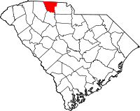
Location in the state of South Carolina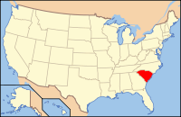
South Carolina's location in the U.S.Founded 1897 Seat Gaffney Area
- Total
- Land
- Water
397 sq mi (1,028 km²)
393 sq mi (1,018 km²)
5 sq mi (13 km²), 1.16%Population
- (2010)
- Density
55,342
135/sq mi (52/km²)Website www.cherokeecountysc.com Cherokee County is a county located in the U.S. state of South Carolina. The county was formed in 1897 from parts of York, Union, and Spartanburg Counties. It is included in the Gaffney, South Carolina Micropolitan Statistical Area. According to the 2010 United States Census, the county's population was 55,342. The county seat is Gaffney.[1]
Contents
Geography
According to the U.S. Census Bureau, the county has a total area of 397 square miles (1,028.2 km2), of which 393 square miles (1,017.9 km2) is land and 5 square miles (12.9 km2) (1.16%) is water.[2]
Adjacent Counties
- Cleveland County, North Carolina - north
- York County, South Carolina - east
- Union County, South Carolina - south
- Spartanburg County, South Carolina - west
- Rutherford County, North Carolina - northwest
National protected area
Mountain Peaks
- Draytonville Mountain
- Brown's Mountain
- Thicketty Mountain
- Whitaker Mountain
Demographics
As of the census[3] of 2000, there were 52,537 people, 20,495 households, and 14,612 families residing in the county. The population density was 134 people per square mile (52/km²). There were 22,400 housing units at an average density of 57 per square mile (22/km²). The racial makeup of the county was 46.92% White, 40.56% Black or African American, 10.20% Native American, 0.31% Asian, 0.02% Pacific Islander, 1.16% from other races, and 0.84% from two or more races. 2.08% of the population were Hispanic or Latino of any race. 39.1% were of "American", 6.8% Irish, 5.8% English and 5.6% German ancestry according to Census 2000. Most of those claiming to be of "American" ancestry are actually of English descent, but have family that has been in the country for so long, in many cases since the early seventeenth century that they choose to identify simply as "American".[4][5][6][7][8]
There were 20,495 households out of which 32.70% had children under the age of 18 living with them, 51.30% were married couples living together, 15.40% had a female householder with no husband present, and 28.70% were non-families. 25.00% of all households were made up of individuals and 9.40% had someone living alone who was 65 years of age or older. The average household size was 2.53 and the average family size was 3.01.
In the county, the population was spread out with 25.80% under the age of 18, 9.00% from 18 to 24, 29.60% from 25 to 44, 23.20% from 45 to 64, and 12.40% who were 65 years of age or older. The median age was 35 years. For every 100 females there were 93.80 males. For every 100 females age 18 and over, there were 90.70 males.
The median income for a household in the county was $33,787, and the median income for a family was $39,393. Males had a median income of $30,984 versus $21,298 for females. The per capita income for the county was $16,421. About 11.00% of families and 23.90% of the population were below the poverty line, including 16.90% of those under age 18 and 15.20% of those age 65 or over.[9]
Transportation
The lifeline of Cherokee County, I-85 runs through the city limits of Gaffney, contributing to much of the growth along Floyd Baker Blvd, the county's main thoroughfare, which bisects I-85. Much of the county's growth occurs along I-85.
One of the nation's busiest airports, Charlotte/Douglas International Airport is located in nearby Charlotte 45 minutes away. For regional and national air travel Greenville-Spartanburg Airport is located in Greer, SC.
A study to determine the feasibility of building an airport in the county revealed that an airport is desperately needed in the county. Previous studies have determined the structure of the airport and possible airport sites have been narrowed down to two sites - one located just south of Gaffney and one located outside of Blacksburg. A major economic feasibility study is now being conducted to determine if the federal government will contribute 95% of the funds needed to construct the airport. If the study fails, then no federal funding will be provided.
The county is also served by US 29 which parallels I-85 and is mostly used for local traffic. US 29 also serves as a major road in the downtown area of Gaffney. Several of the major South Carolina highways that serve the county are:
SC Highway 11, SC Highway 150, SC Highway 105, SC Highway 18 serve the Gaffney area. SC Highway 5 serves the Blacksburg area.
Entertainment
Cherokee County is the only county to have three national parks within its boundaries: Overmountain Victory National Historic Trail, this trail follows the path of major victories of American troops during the Revolutionary War, and spans South Carolina, North Carolina, Virginia, and Tennessee, Kings Mountain National Military Park, and Cowpens National Battlefield. Other historic homes dot the landscape of Cherokee County and while many of them are not open to the public several annual tours take place to display these beautiful and historic homes.
Gaffney Little Theatre and Limestone College serve theatre enthusiasts, offering plays and musicals ten to twelve times a year.
A major shopping center is Prime Outlets-Gaffney, which attracts almost 3,000,000 visitors per year, and contains over 80 retail outlets. Floyd Baker Boulevard is one of the fastest-growing commercial areas in Cherokee County, with a traffic count of almost 40,000 cars per day and a large number of stores and restaurants. Uptown Gaffney offers many upscale boutiques, shops, cafes,bowling at Westlane Bowl 16-lane center with 7, 9-foot (2.7 m) pool tables and gameroom,.
The area's newest attraction is the Cherokee County History and Arts Museum. Located at the old Central school, it is a true chance to find your roots! Cherokee County's history and its contributions to the arts weave a captivating and inspiring story of the region and its role in shaping the culture of the southeast and the nation. www.cherokeecountyhistory.org
Nuclear power plant
On March 16, 2006 Duke Power announced that a Cherokee County site had been selected for a potential new nuclear power plant, to be called the William States Lee III Nuclear Generating Station. The site is jointly owned by Duke Power and Southern Company. Duke plans to develop the site for two Westinghouse Electric Company AP1000 (advanced passive) pressurized water reactors. Each reactor is capable of producing approximately 1,117 megawatts. (See Nuclear Power 2010 Program.)
On December 14, 2007 Duke Power submitted a Combined Construction and Operating License to the Nuclear Regulatory Commission, with an announcement that it will spend $160 million in 2008 on the plant with a total cost of 5-6 billion dollars.[10]
This site will be adjacent to the old Cherokee Nuclear Power Plant site, which was never completed and ultimately abandoned. It was used by James Cameron as a set for the 1989 film The Abyss.
Cities and towns
Incorporated
- Blacksburg
- Chesnee (territory in Spartanburg and Cherokee Counties)
- Gaffney
- Smyrna (territory in York and Cherokee Counties)
Unincorporated
See also
- National Register of Historic Places listings in Cherokee County, South Carolina
- Tryon County, North Carolina
References
- ^ "Find a County". National Association of Counties. http://www.naco.org/Counties/Pages/FindACounty.aspx. Retrieved 2011-06-07.
- ^ "US Gazetteer files: 2010, 2000, and 1990". United States Census Bureau. 2011-02-12. http://www.census.gov/geo/www/gazetteer/gazette.html. Retrieved 2011-04-23.
- ^ "American FactFinder". United States Census Bureau. http://factfinder.census.gov. Retrieved 2008-01-31.
- ^ Sharing the Dream: White Males in a Multicultural America By Dominic J. Pulera.
- ^ Reynolds Farley, 'The New Census Question about Ancestry: What Did It Tell Us?', Demography, Vol. 28, No. 3 (August 1991), pp. 414, 421.
- ^ Stanley Lieberson and Lawrence Santi, 'The Use of Nativity Data to Estimate Ethnic Characteristics and Patterns', Social Science Research, Vol. 14, No. 1 (1985), pp. 44-6.
- ^ Stanley Lieberson and Mary C. Waters, 'Ethnic Groups in Flux: The Changing Ethnic Responses of American Whites', Annals of the American Academy of Political and Social Science, Vol. 487, No. 79 (September 1986), pp. 82-86.
- ^ Mary C. Waters, Ethnic Options: Choosing Identities in America (Berkeley: University of California Press, 1990), p. 36.
- ^ http://www.census.gov/popest/counties/tables/CO-EST2005-01-45.xls
- ^ UPDATE 1-Duke Energy files to build new nuclear power plant | Reuters
External links
- Cherokee County Government official website
- Cherokee County Development Board
- Cherokee County Historical & Preservation Society
- Cherokee County Chamber of Commerce
- Cherokee County School District
- County Population Information
- South Carolina Transportation Information
Municipalities and communities of Cherokee County, South Carolina Cities 
Towns Blacksburg | Smyrna‡
CDP Unincorporated
communitiesCashion Crossroads | Draytonville | Macedonia | Thicketty
Footnotes ‡This populated place also has portions in an adjacent county or counties
 State of South Carolina
Regions Larger cities Smaller cities Towns CDPs Counties - Abbeville
- Aiken
- Allendale
- Anderson
- Bamberg
- Barnwell
- Beaufort
- Berkeley
- Calhoun
- Charleston
- Cherokee
- Chester
- Chesterfield
- Clarendon
- Colleton
- Darlington
- Dillon
- Dorchester
- Edgefield
- Fairfield
- Florence
- Georgetown
- Greenville
- Greenwood
- Hampton
- Horry
- Jasper
- Kershaw
- Lancaster
- Laurens
- Lee
- Lexington
- Marion
- Marlboro
- McCormick
- Newberry
- Oconee
- Orangeburg
- Pickens
- Richland
- Saluda
- Spartanburg
- Sumter
- Union
- Williamsburg
- York
Topics - History
- Famous people
- Governors
- Legislature
- State House
- Congressional districts
- Census areas
- State parks
- Rivers
- Wildlife refuges
- Historic places
- Amusement parks
- Colleges and universities
- Sports venues
- Shopping malls
- Television stations
- Radio stations
- Highways
- Airports
- Visitor attractions
Categories:- South Carolina counties
- Cherokee County, South Carolina
- 1897 establishments


Wikimedia Foundation. 2010.