- Mount Pleasant, South Carolina
-
For other uses, see Mount Pleasant (disambiguation).
Mount Pleasant, South Carolina — Town — 
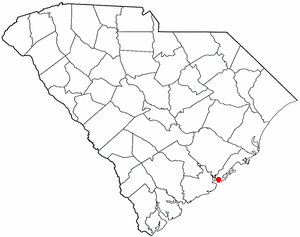
SealLocation of Mount Pleasant in
South CarolinaCoordinates: 32°49′23″N 79°50′44″W / 32.82306°N 79.84556°WCoordinates: 32°49′23″N 79°50′44″W / 32.82306°N 79.84556°W Country United States State South Carolina County Charleston Government – Mayor Billy Swails Area – Total 49.5 sq mi (128.3 km2) – Land 41.9 sq mi (108.5 km2) – Water 7.6 sq mi (19.8 km2) Elevation 10 ft (3 m) Population (2010) – Total 67,843 – Density 1,136.5/sq mi (438.8/km2) Time zone EST (UTC-5) – Summer (DST) EDT (UTC-4) ZIP codes 29464-29466 Area code 843 FIPS code 45-48535[1] GNIS feature ID 1224770[2] Website www.townofmountpleasant.com Mount Pleasant is a large suburban town in Charleston County, South Carolina, United States. It is a member of the Charleston–North Charleston–Summerville Metropolitan Statistical Area, for statistical purpose only, as designated by the U.S. Office of Management and Budget. (OMB) . It is the fifth largest municipality in South Carolina, and for several years it was one of the state's fastest growing areas, literally doubling in population size between 1990 and 2000. The population was 67,843 at the 2010 census. Mount Pleasant is included within the Charleston-North Charleston Urbanized Area and is the 3rd largest municipality in this metro behind Charleston and North Charleston.
At the foot of the Arthur Ravenel Bridge is Patriot's Point, a naval and maritime museum, home to the World War II aircraft carrier USS Yorktown, which is now a museum ship. The Ravenel Bridge, an eight lane highway that was completed in 2005, spans the Cooper River and links Mount Pleasant with downtown Charleston.
Contents
Demographics
Historical populations Census Pop. %± 1980 14,464 — 1990 30,108 108.2% 2000 47,609 58.1% 2010 67,843 42.5% U.S. Decennial Census As of the census[1] of 2000, there were 47,609 people, 19,025 households, and 12,860 families residing in the town. The population density was 1,136.5 people per square mile (438.8/km²). There were 20,197 housing units at an average density of 482.1 per square mile (186.2/km²). The racial makeup of the town was 90.17% White, 7.25% African American, 0.17% Native American, 1.18% Asian, 0.02% Pacific Islander, 0.39% from other races, and 0.82% from two or more races. Hispanic or Latino of any race were 1.33% of the population.
There were 19,025 households out of which 33.9% had children under the age of 18 living with them, 56.9% were married couples living together, 8.3% had a female householder with no husband present, and 32.4% were non-families. 24.1% of all households were made up of individuals and 6.0% had someone living alone who was 65 years of age or older. The average household size was 2.47 and the average family size was 2.99.
In the town the age distribution of the population shows 25.1% under the age of 18, 6.5% from 18 to 24, 35.3% from 25 to 44, 22.8% from 45 to 64, and 10.3% who were 65 years of age or older. The median age was 36 years. For every 100 females there were 92.0 males. For every 100 adult females, there were 88.3 adult males.
The median income for a household in the town was $61,054, and the median income for a family was $71,165. Males had a median income of $50,673 versus $31,640 for females. The per capita income for the town was $30,823. About 3.2% of families and 5.0% of the population were below the poverty line, including 5.3% of those under age 18 and 6.6% of those age 65 or over.
History
The site of Mount Pleasant was originally occupied by the Sewee Indians. The first white settlers arrived from England on July 6, 1680 under the leadership of Captain Florentia O’Sullivan. Captain O’Sullivan had been granted 2,340 acres (950 ha) which included not only the island that bears his name, but also the land that was to become Mount Pleasant. On the earliest map of the time this area was called "North Point."
In 1696, 51 new settlers arrived. Each family was allotted several hundred acres in the area that became known as Christ Church parish. In 1706 the Province of Carolina withstood several attacks by the Spanish and the French and were victorious in defeating French invaders in an area known as "Abcaw".
The area of "Abcaw" was Hobcaw Plantation, located between Shem Creek and the Wando River. Later, it was also known as Shipyard Plantation because its deep water and abundance of good timber made it ideal for a prosperous shipbuilding enterprise. Lands adjacent to Hobcaw Point were owned at different times by several different families, many of which maintained ferries which served Mount Pleasant.
On September 24, 1860, a public meeting was held in Mount Pleasant that produced the first secession resolution of the state. The secession convention met in Charleston December 20, 1860. With the advent of the Civil War, Battery Gary and an adjacent floating battery between Mount Pleasant and Sullivan's Island were instrumental in defense of the town, as well as attacks on Fort Sumter. The town was also defended by a line of fortifications from Elliot's Creek at Boone Hall to Copahee Sound. Mount Pleasant was also the secret training ground for the nine-man crew of the Confederate submarine H. L. Hunley. It was from Breach Inlet in 1864 that this small vessel was launched to attack and sink the USS Housatonic.
As a result of the Civil War, slaves who worked the area plantations were free to seek their own enterprise. Of special note is Scanlonville, one of the first African-American communities to be formed in Charleston after the Civil War which still exists today in Mount Pleasant. Robert Scanlon, a former slave and freedman carpenter, purchased the 614-acre (248 ha) property known as Remley's Plantation bordering Charleston Harbor along the Wando River in Mount Pleasant. Robert Scanlon was the president and founder of the Charleston Land Company, formed by 100 poor African-American men of Charleston who paid $10 per share to purchase large tracts of land in the area. The Charleston Land Company then divided it up for possession by freed slaves seeking to own their own land. Remley's Plantation was divided into farm lots and town lots (which were smaller) to form the community of Scanlonville. The Charleston Land Company and Scanlonville are one of the only four known cooperative ventures among African-American freedmen after the Civil War.
West of Scanlonville was Riverside, the largest and oldest of five black beaches in Charleston County. Riverside "officially" opened in 1930 and featured a dance pavilion, athletics field, bathhouse, playground and a boardwalk along the Wando River. Riverside Pavilion was the only venue for black Charlestonians to see musical legends like Duke Ellington, Count Basie, Louis Armstrong, B. B. King, and Ivory Joe Hunter. Music performances at the Pavilion spawned juke joints, or night clubs, in Scanlonville and eventually a hotel called White's Paradise – where James Brown was known to have frequented. After the original park owner died in 1975, operations of the Riverside property were taken over by Charleston County who eventually sold it to a company that developed it into a gated community.
On September 23, 1989, Mount Pleasant was hit by Hurricane Hugo, a category four hurricane. While the town was spared from the worst of the storm (category 4 conditions were experienced further north of the town), it and its two barrier islands were still hard-hit. Children who lived through the storm were featured in an early episode of Nickelodeon's Nick News along with children from Hurricane Andrew. Ironically the town experienced its largest growth spurt a year after the storm as more people moved to the area, going from a population of roughly 23,000 in 1990 to one of roughly 47,000 in 2000.
Mount Pleasant is separated from Charleston by the Cooper River. For many years it was primarily populated seasonally by Charleston residents wealthy enough to afford summer homes across the river from the Charleston peninsula. The population of Mount Pleasant was centered in an area of the town now known as "The Old Village".
The county seat for Berkeley County was located in Mount Pleasant from 1882 until 1895, when it was moved to Moncks Corner.
In 1928, a bridge from the Charleston Peninsula to Mount Pleasant was built. Spanning Town Creek and the Cooper River and crossing the uninhabited Drum Island, the two-lane Grace Memorial Bridge was opened as a toll bridge. A second and larger bridge, the Silas N. Pearman Bridge, opened in 1966.
On July 16, 2005, the eight-lane Arthur Ravenel Bridge opened for automotive traffic, replacing the two aging bridges. A week before the new bridge, one of the longest cable-stayed bridges in the western hemisphere, officially opened, pedestrians were allowed to cross the bridge, and commemorative coins were distributed. Also, a fireworks display was a part of the ceremonies leading up to the actual opening of the bridge. Several cars from the same time period as the Grace Memorial Bridge, including several restored Model A Fords, made a final crossing of the old bridges. The remaining portions of the old bridges were demolished. Local residents watched as the bridges were blown up in spectacular shows over several weeks, ending the following summer in 2006.
In 2004, Mount Pleasant became one of the first cities in the United States to pass a "pay-before-you-pump" gas ordinance.[3]
Broadcast television
These TV stations have studios in and broadcast from Mt. Pleasant, South Carolina.
- WCBD-TV (2, NBC, CW): owned by Media General
- WCIV-TV (4, ABC): owned by (Allbritton Communications)
Government
The town is run by an elected Mayor-council government system.
Mayor
Billy Swails
Town Administrator
Eric Demoura
Council members
John Burn, Elton Carrier, Nick Collins, Paul Gawrych (Mayor Pro Tem), Ken Glasson, Linda Page, Craig Rhyne, Thomasena Stokes-Marshall
Public safety
Fire and emergency services
The Mount Pleasant Fire Department has provided fire suppression and emergency services since 1837, initially as a volunteer agency, and eventually today's full-time fire department. Today, the fire department has 118 paid personnel augmented by 15 volunteers. It is internationally accredited by the Commission on Fire Accreditation International (CFAI). The Mt. Pleasant Fire Department was originally accredited in 2001 becoming the first accredited fire department in the state of South Carolina. Firefighters work twenty-four hour rotating shifts. The corporate area and its surroundings are served by five strategically located fire stations. The fire department administrative office is located within the Town Municipal Complex. Mount Pleasant fire stations are staffed daily by 33 personnel. In 2007, under the supervision of Chief Herb Williams and Captain Robert Wronski, the Mount Pleasant Fire Department established a "Paramedic Engine" program, in which firefighters trained as Paramedics will carry the same equipment on the fire engines as in the ambulances. Currently, all engines in Mt Pleasant are now operating as "Paramedic Engines". This means in the event Charleston County EMS is delayed, the Mount Pleasant Fire Department will be able to provide life-saving procedures until the ambulance arrives.
Police
The Mount Pleasant Police Department, a 2006 CALEA Flagship Award recipient,[4] employs 132 sworn officers and 43 civilian personnel, serving the entire municipal population. The Police Department, which is a nationally accredited agency, sanctioned by the Commission on Accreditation for Law Enforcement Agencies, has adopted the Problem Oriented Policing philosophy of service delivery, which requires officers to work together with citizens to identify community problems, determine the underlying cause, and develop solutions which address these causes in order to resolve the problem. Led by Chief Harry Sewell, Jr, the police response time to the majority of the calls for service beats the national average. The Department has divided the Town of Mount Pleasant, which encompasses 55 square miles (142 km2), into seven patrol neighborhoods. Each patrol neighborhood is assigned to a specific officer on each shift, who is responsible for maintaining protection and problem resolution on a continuing basis. The Mount Pleasant Police Department was featured in the November 1996 issue of Good Housekeeping as one of the Top Eight Suburban Police Departments in the nation.[citation needed]
Notable residents
- Ben Bridwell, lead singer of Band of Horses
- Ron Motley, trial lawyer
- Melanie Thornton, American/German R&B, Pop, Dance singer
- Bill Murray, actor, comedian
- Darius Rucker, lead singer of Hootie & the Blowfish
- D.J. Trahan, PGA Tour Golfer
Schools
Mount Pleasant's public schools are part of the Charleston County School District.[5]
Elementary schools (Public)
- James B. Edwards Elementary School
- Belle Hall Elementary School
- Mount Pleasant Academy
- Charles Pinckney Elementary School
- Jennie Moore Elementary School
- Whitesides Elementary School
- Laurel Hill Primary School
Middle schools (Public)
- Moultrie Middle School
- Laing Middle School
- Thomas Cario Middle School
Both Laing Middle School and Moultrie Middle School served as the town's high schools before Wando High School was built.
High schools (Public)
Independent schools
- Trident Academy
- University School of the Lowcountry
Religious schools
- Christ Our King - Stella Maris Catholic School-(Catholic Diocese of Charleston)
- Grades K-8
- Coastal Christian Preparatory School (formerly First Baptist Church School of Mt. Pleasant)
- Grades K-12
- Palmetto Christian Academy
- Preschool-12th Grade
County parks
The Charleston County Park and Recreation Commission (CCPRC) [2] operates numerous facilities within Charleston County. The following are in Mount Pleasant.
- Mt. Pleasant Pier
- Palmetto Islands County Park
- Splash Island at Palmetto Islands County Park
- Future Park -- (Laurel Hill Plantation) off of Hwy 41
- Future Park -- off of Rifle Range Road
References
- ^ a b "American FactFinder". United States Census Bureau. http://factfinder.census.gov. Retrieved 2008-01-31.
- ^ "US Board on Geographic Names". United States Geological Survey. 2007-10-25. http://geonames.usgs.gov. Retrieved 2008-01-31.
- ^ "Rising gas prices mean more thievery at pumps". Rutland Herald. June 5, 2005. http://www.rutlandherald.com/apps/pbcs.dll/article?AID=/20050605/NEWS/506050315/1011. Retrieved 2008-01-17.
- ^ [1]
- ^ "Schools directory". Charleston County School District. Archived from the original on 2007-08-29. http://web.archive.org/web/20070829132816/http://www.ccsdschools.com/districts.cfm?subject_id=2&district=2#2. Retrieved 2008-01-17.
External links
- The Town of Mount Pleasant website
- The Post and Courier Charleston Metro Area newspaper
- Patriot's Point Naval and Maritime Museum
- History of Old Mt. Pleasant
- Mount Pleasant at the Open Directory Project
Municipalities and communities of Charleston County, South Carolina Cities 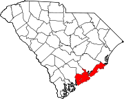
Towns Awendaw | Hollywood | James Island | Kiawah Island | Lincolnville‡ | McClellanville | Meggett | Mount Pleasant | Ravenel | Rockville | Seabrook Island | Sullivan's Island | Summerville‡
CDP Unincorporated
communityFootnotes ‡This populated place also has portions in an adjacent county or counties
 State of South Carolina
Regions Larger cities Smaller cities Towns CDPs Counties - Abbeville
- Aiken
- Allendale
- Anderson
- Bamberg
- Barnwell
- Beaufort
- Berkeley
- Calhoun
- Charleston
- Cherokee
- Chester
- Chesterfield
- Clarendon
- Colleton
- Darlington
- Dillon
- Dorchester
- Edgefield
- Fairfield
- Florence
- Georgetown
- Greenville
- Greenwood
- Hampton
- Horry
- Jasper
- Kershaw
- Lancaster
- Laurens
- Lee
- Lexington
- Marion
- Marlboro
- McCormick
- Newberry
- Oconee
- Orangeburg
- Pickens
- Richland
- Saluda
- Spartanburg
- Sumter
- Union
- Williamsburg
- York
Topics - History
- Famous people
- Governors
- Legislature
- State House
- Congressional districts
- Census areas
- State parks
- Rivers
- Wildlife refuges
- Historic places
- Amusement parks
- Colleges and universities
- Sports venues
- Shopping malls
- Television stations
- Radio stations
- Highways
- Airports
- Visitor attractions
Categories:- Charleston County, South Carolina
- Towns in South Carolina
- Charleston–North Charleston–Summerville metropolitan area

Wikimedia Foundation. 2010.