- McClellanville, South Carolina
-
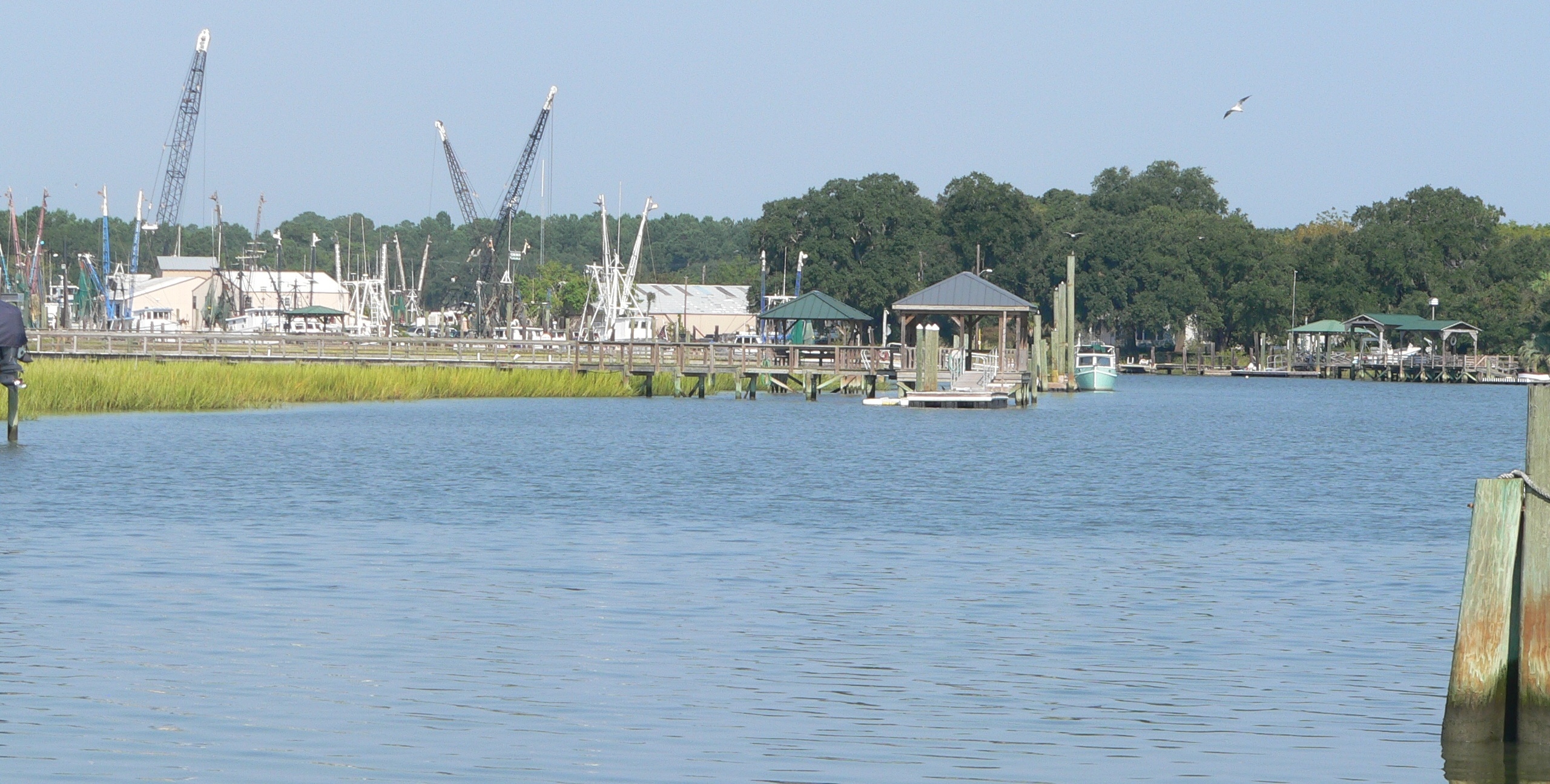
McClellanville, South Carolina — Town — Jeremy Creek at McClellanville; looking upstream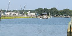 Location of McClellanville in
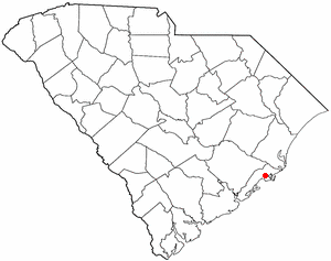
South CarolinaCoordinates: 33°51′17″N 79°28′1″W / 33.85472°N 79.46694°WCoordinates: 33°51′17″N 79°28′1″W / 33.85472°N 79.46694°W Country United States State South Carolina County Charleston Government – Mayor Rutledge B. Leland III Area – Total 2.2 sq mi (5.6 km2) – Land 2.1 sq mi (5.4 km2) – Water 0.1 sq mi (0.2 km2) Elevation 3 ft (1 m) Population (2000) – Total 459 – Density 220.7/sq mi (85.2/km2) Time zone EST (UTC-5) – Summer (DST) EDT (UTC-4) ZIP code 29458 Area code(s) 843 FIPS code 45-43585[1] GNIS feature ID 1252622[2] Website www.townofmcclellanville-sc.net McClellanville is a small fishing town in Charleston County, South Carolina, United States. The population was 459 at the 2000 census. It is situated on the Atlantic coast, on land surrounded by Francis Marion National Forest and has traditionally derived its livelihood from the sea and coastal marshes by fishing, shrimping and oystering. As defined by the U.S. Office of Management and Budget, and used by the U.S. Census Bureau for statistical purposes only, McClellanville is included within the Charleston-North Charleston-Summerville metropolitan area and the Charleston-North Charleston Urbanized Area.
Contents
History
McClellanville village began in the late 1860s when local plantation owners A.J. McClellan and R.T. Morrison sold lots in the vicinity of Jeremy Creek to planters of the Santee Delta, who sought relief from summer fevers. The first store opened soon after the Civil War, and the village became the social and economic center for a wide area that produced timber, rice, cotton, naval stores, and seafoods. Incorporated in 1926, McClellanville township became, and remains, best known for its shrimping fleet and seafood industries.
In 1989 the town was devastated by the full brunt of Hurricane Hugo which destroyed homes, downed century old oaks, deposited shrimp boats in front yards, and otherwise altered much of the picturesque character of this historic fishing village. The stronger north side of the eyewall passed directly over the village while a Category 4 hurricane. Residents taking refuge in the local high school, a designated storm shelter, were surprised by a storm surge which threatened to drown the refugees. Helping one another in complete darkness, they managed to crawl into a space above the false ceilings of the building and, fortunately, none were lost.
Geography
McClellanville is located at 33°5′17″N 79°28′1″W / 33.08806°N 79.46694°W (33.088056, -79.466888)[3].
According to the United States Census Bureau, the town has a total area of 2.2 square miles (5.6 km²), of which, 2.1 square miles (5.4 km²) of it is land and 0.1 square miles (0.3 km²) of it (4.59%) is water.
Demographics
As of the census[1] of 2000, there were 459 people, 206 households, and 138 families residing in the town. The population density was 220.9 people per square mile (85.2/km²). There were 254 housing units at an average density of 122.2 per square mile (47.1/km²). The racial makeup of the town was 92% White and 7.14% African American. Hispanic or Latino of any race were 2.18% of the population.
There were 206 households out of which 20.4% had children under the age of 18 living with them, 58.7% were married couples living together, 5.8% had a female householder with no husband present, and 33.0% were non-families. 29.6% of all households were made up of individuals and 12.1% had someone living alone who was 65 years of age or older. The average household size was 2.23 and the average family size was 2.75.
In the town the population was spread out with 16.3% under the age of 18, 7.0% from 18 to 24, 20.9% from 25 to 44, 36.4% from 45 to 64, and 19.4% who were 65 years of age or older. The median age was 48 years. For every 100 females there were 96.2 males. For every 100 females age 18 and over, there were 92.0 males.
The median income for a household in the town was $42,500, and the median income for a family was $50,000. Males had a median income of $36,750 versus $25,781 for females. The per capita income for the town was $22,425. About 8.3% of families and 11.8% of the population were below the poverty line, including 21.8% of those under age 18 and 8.6% of those age 65 or over.
Government
The city is run by an elected Mayor-council government system.
Mayor
Rutledge B. Leland III
Council members
Aaron Baldwin, Robert J. Gannon, Gussie Humes, James E. Scott IV.
References
- ^ a b "American FactFinder". United States Census Bureau. http://factfinder.census.gov. Retrieved 2008-01-31.
- ^ "US Board on Geographic Names". United States Geological Survey. 2007-10-25. http://geonames.usgs.gov. Retrieved 2008-01-31.
- ^ "US Gazetteer files: 2010, 2000, and 1990". United States Census Bureau. 2011-02-12. http://www.census.gov/geo/www/gazetteer/gazette.html. Retrieved 2011-04-23.
External links
Municipalities and communities of Charleston County, South Carolina Cities 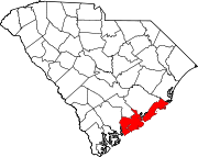
Towns Awendaw | Hollywood | James Island | Kiawah Island | Lincolnville‡ | McClellanville | Meggett | Mount Pleasant | Ravenel | Rockville | Seabrook Island | Sullivan's Island | Summerville‡
CDP Edisto Island‡ | Ladson‡
Unincorporated
communityFootnotes ‡This populated place also has portions in an adjacent county or counties
Categories:- Populated places in Charleston County, South Carolina
- Towns in South Carolina
- Charleston–North Charleston–Summerville metropolitan area

Wikimedia Foundation. 2010.