- Charleston County, South Carolina
-
Charleston County, South Carolina 
Seal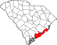
Location in the state of South Carolina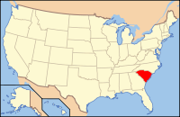
South Carolina's location in the U.S.Founded 1769 Seat Charleston Area
- Total
- Land
- Water
1,358 sq mi (3,517 km²)
919 sq mi (2,380 km²)
440 sq mi (1,140 km²), 32.37%Population
- (2000)
- Density
330,368
337/sq mi (130/km²)Website www.charlestoncounty.org Charleston County is a county located in the U.S. state of South Carolina. According to a 2005 U.S. Census Bureau estimate, its population was 330,368. Its county seat is Charleston.[1] It is the third-most populous county in the state (behind Greenville and Richland counties). Charleston County was created in 1901 by an act of the South Carolina State Legislature.
As defined by the U.S. Office of Management and Budget, and used by the U.S. Census Bureau for statistical purposes only, Charleston County is included within the Charleston-North Charleston-Summerville metropolitan area.
Contents
Geography
According to the U.S. Census Bureau, the county has a total area of 1,358 square miles (3,517.2 km2), the largest county in South Carolina, of which 919 square miles (2,380.2 km2) is land and 440 square miles (1,139.6 km2) (32.37%) is water.
Adjacent counties
- Berkeley County, South Carolina - north
- Georgetown County, South Carolina - northeast
- Colleton County, South Carolina - west
- Dorchester County, South Carolina - northwest
National protected areas
- Cape Romain National Wildlife Refuge
- Charles Pinckney National Historic Site
- Ernest F. Hollings ACE Basin National Wildlife Refuge (part)
- Fort Moultrie National Monument
- Fort Sumter National Monument
- Francis Marion National Forest (part)
Demographics
As of the census[2] of 2000, there were 309,969 people, 143,326 households, and 97,448 families residing in the county. The population density was 338 people per square mile (130/km²). There were 141,031 housing units at an average density of 154 per square mile (59/km²). The racial makeup of the county was 61.9% White, 34.5% Black or African American, 0.26% Native American, 1.12% Asian, 0.06% Pacific Islander, 0.99% from other races, and 1.16% from two or more races. 2.40% of the population were Hispanic or Latino of any race. 9.6% were of American, 9.5% English, 9.1% German and 7.6% Irish ancestry according to Census 2000.
There were 123,326 households out of which 28.70% had children under the age of 18 living with them, 43.20% were married couples living together, 15.90% had a female householder with no husband present, and 37.20% were non-families. 28.30% of all households were made up of individuals and 8.10% had someone living alone who was 65 years of age or older. The average household size was 2.42 and the average family size was 3.01.
In the county, the age distribution of the population shows 23.70% under the age of 18, 12.00% from 18 to 24, 30.30% from 25 to 44, 22.00% from 45 to 64, and 11.90% who were 65 years of age or older. The median age was 34 years. For every 100 females there were 93.50 males. For every 100 females age 18 and over, there were 90.50 males.
The median income for a household in the county is $37,810, and the median income for a family was $47,139. Males had a median income of $32,681 versus $25,530 for females. The per capita income for the county was $21,393. About 12.40% of families and 16.40% of the population were below the poverty line, including 22.90% of those under age 18 and 12.70% of those age 65 or over.
In the 2000 census, the county population was classified as about 86% urban. The Charleston-North Charleston Metropolitan Statistical Area includes the populations of Charleston, Berkeley, and Dorchester counties.
Cities located in Charleston County
Towns located in Charleston County
- Awendaw
- Hollywood
- James Island
- Kiawah Island
- Lincolnville
- McClellanville
- Meggett
- Mount Pleasant
- Ravenel
- Rockville
- Seabrook Island
- Sullivan's Island
Districts
- Awendaw Special Tax District - Made up of unincorporated parts of Northern Charleston County, the Town of Awendaw, and the Town of McClellanville.
- James Island Public Service District - Made up of all of the Town of James Island and unincorporated parts of the island.
- North Charleston Public Service District - Responsible for sewer lines and treatment in the City of North Charleston.
- Saint Johns Public Service District - Made up of unincorporated parts of Johns Island.
- Saint Andrews Public Service District - Made up of unincorporated parts of West Ashley.
- St. Pauls Fire District - Made up of all of the Towns of Hollywood, Ravenel, Meggett and unincorporated parts of the southern end of Charleston County.
County parks
The Charleston County Park and Recreation Commission (CCPRC) [1] operates numerous facilities within Charleston County.
Beach parks:
- Kiawah Beachwalker County Park, Kiawah Island, South Carolina
- Isle of Palms County Park, Isle of Palms, South Carolina
- Folly Beach County Park, Folly Beach, South Carolina
Fishing piers:
- Folly Beach Fishing Pier, Folly Beach, South Carolina
- Mt. Pleasant Pier, Mount Pleasant, South Carolina
Marinas and boat landings:
- Cooper River Marina
- Multiple county-wide boat landings
Day parks:
- Palmetto Islands County Park, Mount Pleasant, South Carolina
- Caw Caw Nature and History Interpretive Center, Ravenel, South Carolina
- North Charleston Wannamaker County Park, North Charleston, South Carolina
- Mullet Hall Equestrian Center, Johns Island, South Carolina
- James Island County Park, Charleston, South Carolina
Water parks:
- Splash Island at Palmetto Islands County Park
- Splash Zone at James Island County Park
- Whirlin' Waters at North Charleston Wannamaker County Park
Off-leash dog parks are offered at James Island, Palmetto Islands, and North Charleston Wannamaker County Park.
James Island County Park, approximately 11 minutes by car from downtown Charleston, features a 50-foot climbing wall and bouldering cave; cabin, RV, and tent camping facilities; rental facilities, fishing dock, challenge course, kayaking programs, summer camps, paved trails, and many special events such as the Lowcountry Cajun Festival (usually the first weekend in April), East Coast Canoe and Kayak Festival (3rd weekend in April), Holiday Festival of Lights (mid-November through the first of the year), and the summer outdoor reggae concerts.
Emergency services
Emergency Medical Services (EMS)
Charleston County Emergency Medical Service Department (EMS) provides prehospital medical care and transportation to emergency rooms for citizens and visitors of the county. Charleston County EMS was created in 1973 by a group of concerned citizens, local physicians, and members of the Charleston County Government. Before this time, emergency medical care was provided by two private ambulance services. One of the first countywide emergency medical service systems in the state, Charleston County EMS provides access to advanced levels of emergency medical care regardless of the emergency's location or the patient's ability to pay.
Awendaw Fire Department
"The Awendaw Fire Department provides fire and life safety services including: Medical First Responder, Rural Search & Rescue, Auto Extrication, Wildland Fire Suppression, Fire Inspection and Public Fire Education services to the citizens of the unincorporated areas of Charleston County north of Mount Pleasant. Serving 365 square miles (950 km2) with a suburban/rural interface, federal forest land and coastal areas, the Fire Department's direct service area includes the Awendaw area, Boone Hall, McClellanville, South Santee, and Germantown area and the towns of Awendaw and McClellanville.
Services are provided by both career and volunteer members who operate out of six station locations. All stations are under the command of a Battalion Chief and are divided into three working shifts (A, B and C). The department works a 24/48-work schedule.
The Fire Chief reports directly to the County Emergency Management Director. The Battalion Chief reports directly to the Fire Chief, and duties include emergency response and incident command, the direction of training, and the daily supervision and direction of the station Lieutenants and Firefighters.
The Awendaw Fire Department maintains a high level of professional standards, focusing on education, certifications, performance measures and fitness. Among other certifications, many full-time personnel are certified medical first responders. A constant state of readiness is maintained to be fully prepared to respond to various emergencies (firefighting, medical, vehicle extrication, hazardous materials, etc.). In 2001, the Insurance Services Office (ISO) gave the Department a rating of 6, acknowledging its professional achievements and therefore saving homeowners thousands of dollars in insurance premiums.
One of the most popular Fire Department members is "Dottie", a Dalmatian dog permanently assigned to Fire Station 2. Dottie assists department personnel with public education events, parades, etc."[3]
Volunteer Rescue Squad
The Volunteer Rescue Squad is a volunteer organization consisting of over 50 members and a medical control physician. Members are certified in a variety of emergency skills, including auto extrication, fire fighting, structural collapse/urban search and rescue, diving, large animal rescue, rural search and rescue, and high angle/ technical rescue. In addition, many squad members are First Responders, EMT's and Paramedics.
For more information, please visit the organization's Web site: http://www.chasrescue.com
Emergency Management Department
"The Emergency Management Division (EMD) provides leadership and assistance to reduce the loss of life and property in Charleston County from a variety of man-made and natural hazards through an effective emergency management program.
In May 1956, newspaper clippings referred to the Charleston County Civil Defense Council, the predecessor of Emergency Preparedness Division (EPD). In 1960, County Council created the Civil Defense Advisory Council to guide the Director of Civil Defense on personnel selection, appropriations and policy issues. The department existed under various titles prior to July 5, 1983, when County Council officially created the County's Emergency Preparedness Division. On June 20, 1987, the renewed agency got its first real field exposure when lightning started a fire of an 80-million-US-gallon (300,000 m3) fuel tank at the Hess Terminal. EPD was once again designated as a separate department in 1990, after Hurricane Hugo. In 2010 the Emergency Prepaedness Division was consolidated with the Hazardious Materials Division and places under EMD as a single agency. The EMD Director is also responsible for the County Volunteer Rescue Squad and Awendaw Fire Department. "[4]
Notable residents
- Pernessa C. Seele (1954- ), immunologist, founder and CEO of the Balm in Gilead, Inc., an international organization based in Harlem, New York for 30 years to promote religious communities' role in education and prevention of HIV/AIDS, and support of families.[5]
- Also see List of people from Charleston, South Carolina for many more notable residents
See also
References
- ^ "Find a County". National Association of Counties. http://www.naco.org/Counties/Pages/FindACounty.aspx. Retrieved 2011-06-07.
- ^ "American FactFinder". United States Census Bureau. http://factfinder.census.gov. Retrieved 2008-01-31.
- ^ "Awendaw Fire Department" Retrieved on 13 March 2009
- ^ "Emergency Preparedness" Retrieved on 13 March 2009
- ^ Dorie J. Gilbert and Ednita M. Wright, African American Women and HIV/AIDS, Westport, Connecticut: Greenwood Publishing Company, 2003, p. 154, accessed 23 January 2009
External links
Coordinates: 32°49′N 79°54′W / 32.82°N 79.90°W
Municipalities and communities of Charleston County, South Carolina County seat: Charleston Cities 
Towns Awendaw | Hollywood | James Island | Kiawah Island | Lincolnville‡ | McClellanville | Meggett | Mount Pleasant | Ravenel | Rockville | Seabrook Island | Sullivan's Island | Summerville‡
CDP Unincorporated
communityFootnotes ‡This populated place also has portions in an adjacent county or counties
Categories:- South Carolina counties
- Charleston County, South Carolina
- 1769 establishments
- Charleston – North Charleston – Summerville metropolitan area


Wikimedia Foundation. 2010.