- List of counties in Alabama
-
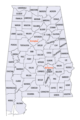 Alabama counties (clickable map)
The U.S. state of Alabama has 67 counties. Each county serves as the local level of government within its borders. The land enclosed by the present state borders was joined to the United States of America gradually. Following the American Revolutionary War, West Florida was ceded to Spain by treaty while the remainder was organized primarily as the Mississippi Territory, and later the Alabama Territory.[1] The territorial assembly established some of the earliest county divisions that have survived to the present, including the earliest county formation, that of Washington County, created on June 4, 1800.[2] In 1814, the Treaty of Fort Jackson opened the territory to American settlers, which in turn led to a more rapid rate of county creation. Alabama was admitted to the Union as the 22nd state in 1819.[3] The Alabama state legislature formed additional counties from former Indian lands as the Indian Removal Act took effect and settlers populated different areas of Alabama.[4] In 1820, Alabama had 29 counties. By 1830 there were 36 and Native Americans still occupied large areas of land in northeast and far western Alabama. By 1840, 49 counties had been created; 52 by 1850; 65 by 1870; and the present 67 counties by 1903.[5] Houston County was the last county created in the state, on February 9, 1903.[2]
According to 2010 U. S. Census data, the average population of Alabama's 67 counties is 71,399, with Jefferson County as the most populous (658,466), and Greene County (9,045) the least.[6] The average land area is 756 sq mi (1,958 km2). The largest county is Baldwin (1,590 sq mi, 4,118 km2) and the smallest is Etowah (535 sq mi, 1,386 km2).[7] The Constitution of Alabama requires that any new county in Alabama cover at least 600 square miles (1,600 km2) in area, effectively limiting the creation of new counties in the state.[8]
The Alabama Department of Revenue's Motor Vehicle Division issues standard automobile license plates that bear a one- or two-digit number identifying the county in which the vehicle is registered. This number is given in the fourth column in the table below. The first three prefixes are reserved for the state's historically most populous counties, and thereafter proceed alphabetically. Individual license plate numbers are assigned sequentially in each licensing office. The numbers are in the format XA1111A or XXA111A, depending on whether the prefix is one or two digits. Overflow registrations are accommodated by substituting a letter for one of the registration numbers, such that XXZ999Z is followed by XXA0A0A.[9]
The Federal Information Processing Standard (FIPS) code, used by the United States government to uniquely identify counties, is provided with each entry. The FIPS code links in the table point to U. S. Census "quick facts" pages for each county.
Contents
Counties
County FIPS code
[10]County seat
[2]License #
[11]Created
[2]Formed from
[12]Etymology
[5][13]Population
[6]Area
[7]Map Autauga County 001 Prattville 4 1818 Montgomery County The Autauga or Atagi people, Native Americans who were a sub-group of the Alibamu 54,571 594 sq mi (1,538 km2) 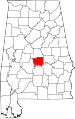
Baldwin County 003 Bay Minette 5 1809 Washington County and West Florida Abraham Baldwin (1754–1807), U.S. legislator from Georgia 182,265 1,590 sq mi
(4,118 km2)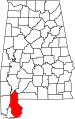
Barbour County 005 Clayton 6 1832 Pike County James Barbour (1775–1842), Governor of Virginia and U.S. Senator 27,457 885 sq mi
(2,292 km2)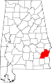
Bibb County 007 Centreville 7 1818 Montgomery County (as Cahawba County) William Wyatt Bibb (1781–1820), 1st Governor of Alabama 22,915 623 sq mi
(1,614 km2)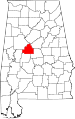
Blount County 009 Oneonta 8 1818 Montgomery County and Indian territories Willie Blount (1768–1835), Governor of Tennessee. 57,322 645 sq mi
(1,671 km2)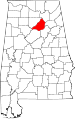
Bullock County 011 Union Springs 9 1866 Barbour, Macon, Montgomery, and Pike counties Edward Bullock (1822–1861), colonel in the Confederate States Army 10,914 623 sq mi
(1,614 km2)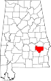
Butler County 013 Greenville 10 1819 Conecuh and Monroe counties William Butler (?–1818), captain in Creek War 20,947 777 sq mi
(2,012 km2)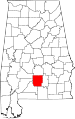
Calhoun County 015 Anniston 11 1832 St. Clair County (as Benton County) John C. Calhoun (1782–1850), 7th U.S. Vice President 118,572 606 sq mi
(1,570 km2)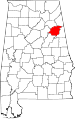
Chambers County 017 LaFayette 12 1832 Montgomery County Henry H. Chambers (1790–1826), U.S. Senator 34,215 597 sq mi
(1,546 km2)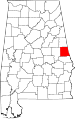
Cherokee County 019 Centre 13 1836 Cherokee territory Cherokee people, whose lands included Alabama 25,989 554 sq mi
(1,435 km2)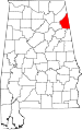
Chilton County 021 Clanton 14 1868 Autauga, Bibb, Perry, and Shelby counties (as Baker County) William Parish Chilton (1810–1871), Alabama Supreme Court Justice and Confederate congressman 43,643 693 sq mi
(1,795 km2)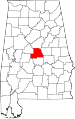
Choctaw County 023 Butler 15 1847 Sumter and Washington counties Choctaw people, whose lands included Alabama 13,859 914 sq mi
(2,367 km2)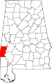
Clarke County 025 Grove Hill 16 1812 Washington County John Clarke (1766–1832), general from Georgia 25,833 1,238 sq mi
(3,206 km2)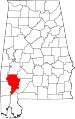
Clay County 027 Ashland 17 1866 Randolph and Talladega counties Henry Clay (1777–1852), U.S. legislator from Kentucky 13,932 604 sq mi
(1,564 km2)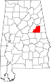
Cleburne County 029 Heflin 18 1866 Calhoun, Randolph , and Talladega counties Patrick Cleburne (1828–1864), major general in Confederate States Army 14,972 560 sq mi
(1,450 km2)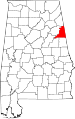
Coffee County 031 Elba and Enterprise[14] 19 1841 Dale County John Coffee (1772–1833), military leader in War of 1812 and Creek War 49,948 679 sq mi
(1,759 km2)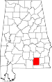
Colbert County 033 Tuscumbia 20 1867 Franklin County George Colbert (1764–1839) and Levi Colbert (1759–1834), Chickasaw chiefs 54,428 593 sq mi
(1,536 km2)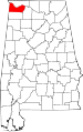
Conecuh County 035 Evergreen 21 1818 Monroe County The Conecuh River, which flows through the county 13,228 850 sq mi
(2,201 km2)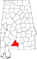
Coosa County 037 Rockford 22 1832 Montgomery County The Coosa River, which flows through the county, and is itself named after a Native American village 11,539 651 sq mi
(1,686 km2)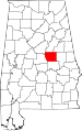
Covington County 039 Andalusia 23 1821 Henry County Leonard Covington (1768–1813), brigadier general in War of 1812 and U.S. Congressman 37,765 1,030 sq mi
(2,668 km2)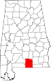
Crenshaw County 041 Luverne 24 1866 Butler, Coffee, Covington, Lowndes, and Pike Counties Anderson Crenshaw (1783–1847), Alabama Supreme Court justice and early settler 13,906 609 sq mi
(1,577 km2)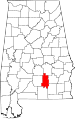
Cullman County 043 Cullman 25 1877 Blount, Morgan, and Winston counties Colonel John G. Cullmann (1823–1895), founder of county seat 80,406 735 sq mi
(1,904 km2)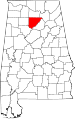
Dale County 045 Ozark 26 1824 Covington and Henry counties Samuel Dale (1772–1841), brigadier general and state legislator 50,251 561 sq mi
(1,453 km2)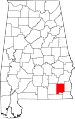
Dallas County 047 Selma 27 1818 Monroe and Montgomery counties Alexander James Dallas (1759–1817) , U.S. Secretary of Treasury 43,820 979 sq mi
(2,536 km2)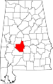
DeKalb County 049 Fort Payne 28 1836 Cherokee territory Johann de Kalb (1721–1780), major general in American Revolutionary War 71,109 777 sq mi
(2,012 km2)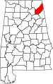
Elmore County 051 Wetumpka 29 1866 Autauga, Coosa, Montgomery, and Tallapoosa counties John Archer Elmore (1762–1834), Revolutionary War veteran 79,303 618 sq mi
(1,601 km2)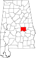
Escambia County 053 Brewton 30 1868 Baldwin and Conecuh counties Escambia Creek, a tributary of the Conecuh River 38,319 945 sq mi
(2,448 km2)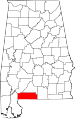
Etowah County 055 Gadsden 31 1866 Blount, Calhoun, Cherokee, DeKalb, Marshall, and St. Clair counties (as Baine County) Etowah Indian Mounds 104,430 535 sq mi
(1,386 km2)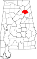
Fayette County 057 Fayette 32 1824 Marion, Pickens, Tuscaloosa, and Walker counties Marquis de La Fayette (1757–1834), Revolutionary War commander 17,241 628 sq mi
(1,627 km2)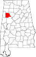
Franklin County 059 Russellville 33 1818 Cherokee territory Benjamin Franklin (1706–1790), politician, diplomat, inventor, and publisher 31,704 634 sq mi
(1,642 km2)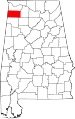
Geneva County 061 Geneva 34 1868 Coffee, Dale, and Henry counties Named after Geneva, New York, the origin of several early settlers 26,790 574 sq mi
(1,487 km2)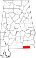
Greene County 063 Eutaw 35 1819 Marengo and Tuscaloosa counties Nathanael Greene (1742–1786), Revolutionary War general 9,045 647 sq mi
(1,676 km2)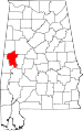
Hale County 065 Greensboro 36 1867 Greene, Marengo, Perry, and Tuscaloosa counties Stephen F. Hale (1816–1862), lieutenant colonel in Confederate States Army 15,760 644 sq mi
(1,668 km2)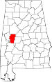
Henry County 067 Abbeville 37 1819 Conecuh County Patrick Henry (1736–1799), Revolutionary War patriot and Governor of Virginia 17,302 562 sq mi
(1,456 km2)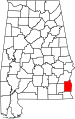
Houston County 069 Dothan 38 1903 Dale, Geneva, and Henry counties George S. Houston (1811–1879), 24th Governor of Alabama and U.S. Congressman 101,547 580 sq mi
(1,502 km2)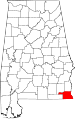
Jackson County 071 Scottsboro 39 1819 Cherokee territory Andrew Jackson (1767–1845), 7th U.S. President 53,227 1,078 sq mi
(2,792 km2)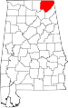
Jefferson County 073 Birmingham 1 1819 Blount County Thomas Jefferson (1743–1826), 3rd U.S. President 658,466 1,111 sq mi
(2,877 km2)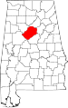
Lamar County 075 Vernon 40 1867 Fayette and Marion counties (as Jones County) Lucius Q. C. Lamar (1825–1893), U.S. Supreme Court justice 14,564 605 sq mi
(1,567 km2)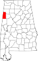
Lauderdale County 077 Florence 41 1818 Cherokee and Chickasaw territories James Lauderdale (1780–1814), Colonel in War of 1812 92,709 668 sq mi
(1,730 km2)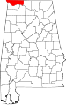
Lawrence County 079 Moulton 42 1818 Cherokee territory James Lawrence (1781–1813), naval officer in War of 1812 34,339 691 sq mi
(1,790 km2)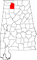
Lee County 081 Opelika 43 1866 Chambers, Macon, Russell, and Tallapoosa counties Robert E. Lee (1807–1870), Commander of the Confederate States Army 140,247 608 sq mi
(1,575 km2)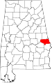
Limestone County 083 Athens 44 1818 Elk and Madison counties Limestone Creek, named for local geological deposits 82,782 560 sq mi
(1,450 km2)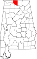
Lowndes County 085 Hayneville 45 1830 Butler, Dallas, and Montgomery counties William Lowndes (1782–1822), U.S. Congressman from South Carolina 11,299 716 sq mi
(1,854 km2)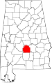
Macon County 087 Tuskegee 46 1832 Montgomery County Nathaniel Macon (1758–1837), U.S. legislator from North Carolina 21,452 609 sq mi
(1,577 km2)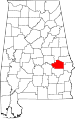
Madison County 089 Huntsville 47 1808 Cherokee and Chickasaw territories James Madison (1751–1836), 4th U.S. President 334,811 802 sq mi
(2,077 km2)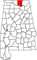
Marengo County 091 Linden 48 1818 Choctaw territory Battle of Marengo 21,027 977 sq mi
(2,530 km2)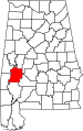
Marion County 093 Hamilton 49 1818 Tuscaloosa County Francis Marion (1732–1795), military leader in American Revolutionary War 30,776 742 sq mi
(1,922 km2)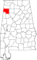
Marshall County 095 Guntersville 50 1836 Blount and Jackson counties and Cherokee territory John Marshall (1755–1835), Chief Justice of the United States 1801–1835 93,019 566 sq mi
(1,466 km2)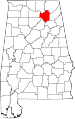
Mobile County 097 Mobile 2 1812 Mobile District of West Florida after annexation into Mississippi Territory Mobile Bay, on which county is located, and which is itself named after the Maubila tribe of Native Americans 412,992 1,229 sq mi
(3,183 km2)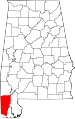
Monroe County 099 Monroeville 51 1815 Creek territory James Monroe (1758–1831), 5th U.S. President 23,068 1,026 sq mi
(2,657 km2)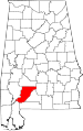
Montgomery County 101 Montgomery 3 1816 Monroe County Lemuel P. Montgomery (1786–1814), Major in Creek War 229,363 784 sq mi
(2,031 km2)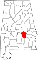
Morgan County 103 Decatur 52 1818 Cherokee territory (as Cotaco County) Daniel Morgan (1736–1802), U.S. Congressman 119,490 579 sq mi
(1,500 km2)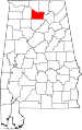
Perry County 105 Marion 53 1819 Cahawba, Dallas, Marengo, and Tuscaloosa counties Oliver Hazard Perry (1795–1819), naval officer in War of 1812 10,591 720 sq mi
(1,865 km2)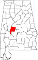
Pickens County 107 Carrollton 54 1820 Tuscaloosa County Andrew Pickens (1739–1817), General in the Revolutionary War 19,746 881 sq mi
(2,282 km2)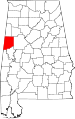
Pike County 109 Troy 55 1821 Henry and Montgomery counties Zebulon Pike (1779–1813), explorer and officer in War of 1812 32,899 672 sq mi
(1,740 km2)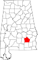
Randolph County 111 Wedowee 56 1832 St. Clair and Shelby counties John Randolph (1773–1833), U.S. Senator from Virginia 22,913 581 sq mi
(1,505 km2)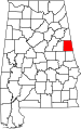
Russell County 113 Phenix City 57 1832 Montgomery and Pike counties Gilbert C. Russell (1782-1861), officer in Creek War 52,947 641 sq mi
(1,660 km2)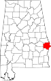
St. Clair County 115 Ashville and Pell City 59 1818 Shelby County Arthur St. Clair (1736–1818), President of Continental Congress 83,593 632 sq mi
(1,637 km2)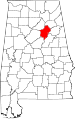
Shelby County 117 Columbiana 58 1818 Montgomery County Isaac Shelby (1750–1826), Governor of Kentucky 195,085 785 sq mi
(2,033 km2)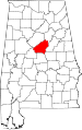
Sumter County 119 Livingston 60 1832 Choctaw territory Thomas Sumter (1734–1832), U.S. Congressman from South Carolina 13,763 904 sq mi
(2,341 km2)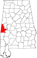
Talladega County 121 Talladega 61 1832 St. Clair and Shelby counties Talatigi, Creek Indian name for the county seat, meaning "border town" 82,291 737 sq mi
(1,909 km2)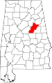
Tallapoosa County 123 Dadeville 62 1832 Montgomery and Shelby counties Tallapoosa River 41,616 717 sq mi
(1,857 km2)
Tuscaloosa County 125 Tuscaloosa 63 1818 Montgomery County and Choctaw territory Iroquoian name for the Black Warrior River 194,656 1,322 sq mi
(3,424 km2)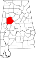
Walker County 127 Jasper 64 1823 Blount, Jefferson, and Tuscaloosa counties John Williams Walker (1783–1823), U.S. Senator from Alabama 67,023 791 sq mi
(2,049 km2)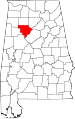
Washington County 129 Chatom 65 1800 Adams and Pickering counties of Mississippi Territory George Washington (1732–1799), 1st U.S. President 17,581 1,080 sq mi
(2,797 km2)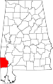
Wilcox County 131 Camden 66 1819 Dallas and Monroe counties Joseph M. Wilcox (1790–1814), lieutenant in Creek War 11,670 888 sq mi
(2,300 km2)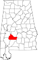
Winston County 133 Double Springs 67 1850 Walker County (as Hancock County) John A. Winston (1812–1871), 15th Governor of Alabama 24,484 613 sq mi
(1,588 km2)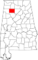
Former county names
County[5] Named for[5] Changed to[2] Baine County David W. Baine, Colonel in the Civil War Etowah County in 1868 Baker County Alfred Baker, a local landowner Chilton County in 1874 Benton County Thomas Hart Benton, U. S. Senator from Missouri Calhoun County in 1858, honoring Benton's rival John C. Calhoun of South Carolina after Benton's renunciation of slavery Cahawba County former state capitol of Cahawba Bibb County in 1820 Cotaco County Cotaco Creek, a tributary of the Tennessee River Morgan County in 1821 Elk County Elk River Lauderdale County and Limestone County in 1818 Hancock County John Hancock, signer of the Declaration of Independence Winston County in 1858 Jones County Josiah Jones, a local political leader Covington County (its former name) in 1868 after Jones refused the honor Jones County E.P. Jones, a local landowner Sanford County, which subsequently became Lamar County in 1877 Sanford County H.C. Sanford, a local landowner Lamar County in 1877 Former counties
County Named for Notes Decatur County Commodore Stephen Decatur of the United States Navy. Created in 1822 with Woodville as its county seat. Abolished several years later, divided between Madison County and Jackson County. See also
- List of census county divisions in Alabama
References
- General
- "CountyState.info Alabama". Official County Websites. http://www.countystate.info/alabama.htm. Retrieved 2007-09-13.
- Specific
- ^ "Alabama History Timeline, 1701-1800". Alabama Department of Archives and History. http://www.archives.state.al.us/timeline/al1702.html. Retrieved 2009-05-18.
- ^ a b c d e National Association of Counties. "NACo - Find a county". http://www.naco.org/Template.cfm?Section=Find_a_County&Template=/cffiles/counties/state.cfm&state.cfm&statecode=AL. Retrieved 2008-04-30.
- ^ "Alabama History Timeline, 1801-1860". Alabama Department of Archives and History. http://www.archives.state.al.us/timeline/al1801.html. Retrieved 2009-05-18.
- ^ "Alabama Counties: Cherokee". Alabama Department of Archives and History. http://www.archives.state.al.us/counties/cherokee.html. Retrieved 2008-12-29.
- ^ a b c d Foscue, Virginia O. (1989) Place Names in Alabama. Tuscaloosa, Alabama: University of Alabama Press. ISBN 081730410X
- ^ a b "American FactFinder". U.S. Census Bureau. http://factfinder2.census.gov/main.html. Retrieved 13 March 2011.
- ^ a b "2010 Census U.S. Gazetteer Files". U.S. Census Bureau. http://www.census.gov/geo/www/gazetteer/gazetteer2010.html. Retrieved 13 March 2011.
- ^ "Alabama Constitution of 1901". Wikisource, The Free Library. http://en.wikisource.org/wiki/Alabama_State_Constitution_of_1901/Initial_Constitution#Section_39. Retrieved 2008-12-29.
- ^ Nicholson, David. "Alabama License Plates, 1969-present". License Plates of North America, 1969–present. http://www.15q.net/al.html. Retrieved 2007-08-08.
- ^ "EPA County FIPS Code Listing". EPA.gov. http://www.epa.gov/enviro/html/codes/al.html. Retrieved 2008-02-23.
- ^ Nicholson, David. "Alabama County Codes". License Plates of North America, 1969–present. http://www.15q.net/alco.html. Retrieved 2009-05-25.
- ^ Owen, Thomas McAdory; Owen, Marie Bankhead (1921). History of Alabama and Dictionary of Alabama Biography. Chicago: S.J. Clarke Publishing Company.
- ^ "Alabama Counties". Alabama Department of Archives and History. http://www.archives.state.al.us/counties.html. Retrieved 2009-06-01.
- ^ Coffee County, Alabama. "History of Coffee County". http://www.coffeecounty.us/History.html. Retrieved 2011-08-19.
External links
- Map series showing evolution of county boundaries. Cartographic Research Laboratory. University of Alabama Department of Geography.
 State of Alabama
Topics - Index
- History
- Geography
- People
- Delegations
- Government
- Governors
- Lieutenant Governors
- Metropolitan Areas
- Visitor Attractions
- National Historic Landmarks
Regions Metros - Greater Birmingham
- Montgomery Metro Area
- Mobile Metro Area
- Huntsville Metro Area
Larger cities Counties - Autauga
- Baldwin
- Barbour
- Bibb
- Blount
- Bullock
- Butler
- Calhoun
- Chambers
- Cherokee
- Chilton
- Choctaw
- Clarke
- Clay
- Cleburne
- Coffee
- Colbert
- Conecuh
- Coosa
- Covington
- Crenshaw
- Cullman
- Dale
- Dallas
- DeKalb
- Elmore
- Escambia
- Etowah
- Fayette
- Franklin
- Geneva
- Greene
- Hale
- Henry
- Houston
- Jackson
- Jefferson
- Lamar
- Lauderdale
- Lawrence
- Lee
- Limestone
- Lowndes
- Macon
- Madison
- Marengo
- Marion
- Marshall
- Mobile
- Monroe
- Montgomery
- Morgan
- Perry
- Pickens
- Pike
- Randolph
- Russell
- Shelby
- St. Clair
- Sumter
- Talladega
- Tallapoosa
- Tuscaloosa
- Walker
- Washington
- Wilcox
- Winston
Categories:- Alabama counties
- Lists of U.S. counties by state
- Lists of places in Alabama
- U.S. county name etymologies


Wikimedia Foundation. 2010.