- Jefferson County, Mississippi
-
Jefferson County, Mississippi 
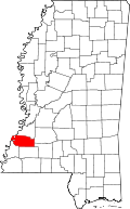
Location in the state of Mississippi
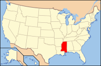
Mississippi's location in the U.S.Founded 1799 Seat Fayette Largest city Fayette Area
- Total
- Land
- Water
527.19 sq mi (1,365 km²)
519.39 sq mi (1,345 km²)
7.81 sq mi (20 km²), 1.48%Population
- (2010)
- Density
7,726
18/sq mi (7/km²)Jefferson County is a county located in the U.S. state of Mississippi. As of 2010, the population was 7,726. Its county seat is Fayette[1]. Jefferson County has the highest percentage of African Americans of any county in the United States, as well as the most statistically obese in the nation. It is also one of the poorest counties in the nation.[2] Jefferson County is named after U.S. President Thomas Jefferson.[citation needed]
Contents
Geography
According to the 2000 census, the county has a total area of 527.19 square miles (1,365.4 km2), of which 519.39 square miles (1,345.2 km2) (or 98.52%) is land and 7.81 square miles (20.2 km2) (or 1.48%) is water.[3]
Major highways
 U.S. Highway 61
 Mississippi Highway 28
 Mississippi Highway 33
Adjacent counties
- Claiborne County (north)
- Copiah County (northeast)
- Lincoln County (southeast)
- Franklin County (south)
- Adams County (southwest)
- Tensas Parish, Louisiana (west)

Claiborne County Copiah County 
Tensas Parish, Louisiana 
 Jefferson County, Mississippi

Adams County Franklin County Lincoln County National protected areas
- Homochitto National Forest (part)
- Natchez Trace Parkway (part)
Demographics
Historical populations Census Pop. %± 1800 2,940 — 1810 4,001 36.1% 1820 6,822 70.5% 1830 9,755 43.0% 1840 11,650 19.4% 1850 13,193 13.2% 1860 15,349 16.3% 1870 13,848 −9.8% 1880 17,314 25.0% 1890 18,947 9.4% 1900 21,292 12.4% 1910 18,221 −14.4% 1920 15,946 −12.5% 1930 14,291 −10.4% 1940 13,969 −2.3% 1950 11,306 −19.1% 1960 10,142 −10.3% 1970 9,295 −8.4% 1980 9,181 −1.2% 1990 8,653 −5.8% 2000 9,740 12.6% 2010 7,726 −20.7% MS Counties 1900-1990
GeoHive - 2000 & 2010 statisticsAs of the census[4] of 2000, there were 9,740 people, 3,308 households, and 2,338 families residing in the county. The population density was 19 people per square mile (7/km²). There were 3,819 housing units at an average density of 7 per square mile (3/km²). The racial makeup of the county was 13.06% White, 86.49% Black or African American, 0.08% Native American, 0.10% Asian, 0.01% Pacific Islander, 0.02% from other races, and 0.24% from two or more races. 0.66% of the population were Hispanic or Latino of any race. Jefferson County has the highest percentage of black residents of any U.S. county.
There were 3,308 households out of which 36.60% had children under the age of 18 living with them, 36.00% were married couples living together, 28.50% had a female householder with no husband present, and 29.30% were non-families. 27.10% of all households were made up of individuals and 10.10% had someone living alone who was 65 years of age or older. The average household size was 2.75 and the average family size was 3.36.
In the county the population was much younger than the national average with 28.80% under the age of 18, 12.10% from 18 to 24, 28.50% from 25 to 44, 19.60% from 45 to 64, and 10.90% who were 65 years of age or older. The median age was 32 years. For every 100 females there were 99.00 males. For every 100 females age 18 and over, there were 99.00 males.
The median income for a household in the county was $18,447, and the median income for a family was $23,188. Males had a median income of $25,726 versus $18,000 for females. The per capita income for the county was $9,709. About 32.50% of families and 36.00% of the population were below the poverty line, including 46.00% of those under age 18 and 34.40% of those age 65 or over.
Jefferson County has the lowest per capita income in Mississippi and the 17th lowest in the United States.
In 2009 Jefferson County was the fourth poorest county in the United States.[5]
Communities
- Cities
- Unincorporated places
- Church Hill
- Harriston
- Lorman
- Perth
- Red Lick
- Union Church
- Ghost towns
Trivia
According to a May 2004 Time Magazine article on obesity in the United States, Jefferson County had the highest percentage of obese adult residents (26.1%) of any county in the U.S. In that context, the percentage measured were those with a body mass index between 30 and 40 (any measure greater than 40 corresponds to morbid obesity).
Jefferson County has one of the highest rates of Bank Card Delinquency rates in the United States at 6.21% (2009Q1). [6]
See also
References
- ^ "Find a County". National Association of Counties. http://www.naco.org/Counties/Pages/FindACounty.aspx. Retrieved 2011-06-07.
- ^ King: They'll take small victories in struggling Mississippi county
- ^ "Census 2000 U.S. Gazetteer Files: Counties". United States Census. http://www.census.gov/tiger/tms/gazetteer/county2k.txt. Retrieved 2011-02-13.
- ^ "American FactFinder". United States Census Bureau. http://factfinder.census.gov. Retrieved 2008-01-31.
- ^ "King: They'll take small victories in struggling Mississippi county." CNN. Friday September 25, 2009. Retrieved on September 26, 2009.
- ^ http://data.newyorkfed.org/creditconditionsmap/ Retrieved 2009-07-07
Municipalities and communities of Jefferson County, Mississippi City Unincorporated
communitiesAlcorn | Church Hill | Harriston | Lorman | Red Lick | Rodney | Union Church
Categories:- Mississippi counties
- Jefferson County, Mississippi
- Populated places established in 1799
- Counties of the United States with African American majority populations
- Mississippi counties on the Mississippi River
Wikimedia Foundation. 2010.

