- Neshoba County, Mississippi
-
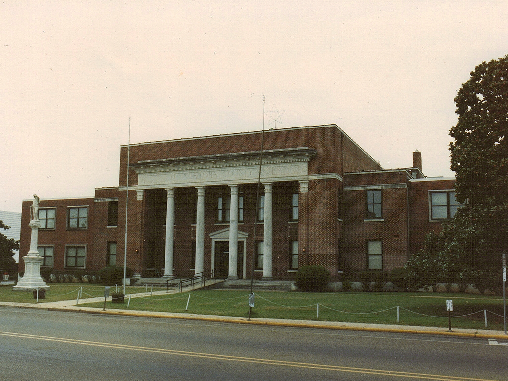
Neshoba County, Mississippi  Neshoba County courthouse in Philadelphia, Mississippi
Location in the state of Mississippi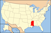
Mississippi's location in the U.S.Founded 1833 Seat Philadelphia Largest city Philadelphia Area
- Total
- Land
- Water
571.64 sq mi (1,481 km²)
570.00 sq mi (1,476 km²)
1.64 sq mi (4 km²), 0.29%Population
- (2010)
- Density
29,676
49/sq mi (19/km²)Neshoba County is a county located in the U.S. state of Mississippi. As of the 2010 census, the population was 29,676. Its county seat is Philadelphia[1].
Neshoba, derived from the Choctaw word nashoba, means Wolf. [2]
Neshoba County is known as the site of one of the most famous race-related crimes in American history. In 1964, three civil rights workers were murdered brutally by white supremacists, allegedly including a deputy county sheriff, in Philadelphia, the county seat. The crime and decades-long legal aftermath inspired the 1988 movie Mississippi Burning.
President Ronald Reagan launched his 1980 presidential campaign from the Neshoba County Fair, delivering a speech about economic policy that drew attention for the use of the phrase "states' rights" in an area associated with the 1964 murders.[3] [4]
The county is known for the Neshoba County Fair and harness horse races. It is also home of the Williams Brothers Store, which has been in operation since the early 1900s.
The Mississippi Band of Choctaw Indians (MBCI) own one of the largest casino complexes in the state. The Silver Star and Golden Moon casinos are the first land based casinos in Mississippi. These casinos are part of the MBCI's Pearl River Resort.
Contents
Geography
According to the 2000 census, the county has a total area of 571.64 square miles (1,480.5 km2), of which 570.00 square miles (1,476.3 km2) (or 99.71%) is land and 1.64 square miles (4.2 km2) (or 0.29%) is water.[5]
Major highways
Adjacent counties
- Winston County (north)
- Kemper County (east)
- Newton County (south)
- Leake County (west)

Winston County Leake County 
Kemper County  Neshoba County, Mississippi

Newton County Demographics
Historical populations Census Pop. %± 1840 2,437 — 1850 4,728 94.0% 1860 8,343 76.5% 1870 7,439 −10.8% 1880 8,741 17.5% 1890 11,146 27.5% 1900 12,726 14.2% 1910 17,980 41.3% 1920 19,303 7.4% 1930 26,691 38.3% 1940 27,882 4.5% 1950 25,730 −7.7% 1960 20,927 −18.7% 1970 20,802 −0.6% 1980 23,789 14.4% 1990 24,800 4.2% 2000 28,684 15.7% 2010 29,676 3.5% MS Counties 1900-1990
GeoHive - 2000 & 2010 statisticsAs of the census[6] of 2000, there were 28,684 people, 10,694 households, and 7,742 families residing in the county. The population density was 50 people per square mile (19/km²). There were 11,980 housing units at an average density of 21 per square mile (8/km²). The racial makeup of the county was 65.50% White, 19.33% Black or African American, 13.80% Native American, 0.19% Asian, 0.02% Pacific Islander, 0.34% from other races, and 0.81% from two or more races. 1.16% of the population were Hispanic or Latino of any race. 28.6% were of American, 8.8% Irish and 6.1% English ancestry according to Census 2000. Those who self-identify as having "American" ancestry are predominantly of English descent, but have ancestry that has been in North America for so long that they choose to identify simply as American.[7][8] 88.7% spoke English and 10.2% Choctaw as their first language.
There were 10,694 households out of which 34.90% had children under the age of 18 living with them, 52.50% were married couples living together, 15.60% had a female householder with no husband present, and 27.60% were non-families. 24.70% of all households were made up of individuals and 11.50% had someone living alone who was 65 years of age or older. The average household size was 2.63 and the average family size was 3.11.
In the county the population was spread out with 28.20% under the age of 18, 9.00% from 18 to 24, 27.00% from 25 to 44, 21.60% from 45 to 64, and 14.20% who were 65 years of age or older. The median age was 35 years. For every 100 females there were 91.10 males. For every 100 females age 18 and over, there were 88.30 males.
The median income for a household in the county was $28,300, and the median income for a family was $33,439. Males had a median income of $28,112 versus $19,882 for females. The per capita income for the county was $14,964. About 17.90% of families and 21.00% of the population were below the poverty line, including 27.20% of those under age 18 and 22.00% of those age 65 or over.
Communities
- Cities
- Towns
- Union (mostly in Newton County)
- Census-designated places
- Bogue Chitto (partly in Kemper County)
- Pearl River
- Tucker
See also
External links
- Mississippi Region Grapples with Legacy of Civil Rights Murders, a 40th anniversary story from All Things Considered
- Neshoba Democrat's 40th anniversary stories
Citations
- ^ "Find a County". National Association of Counties. http://www.naco.org/Counties/Pages/FindACounty.aspx. Retrieved 2011-06-07.
- ^ Byington, Cyrus (1909). Choctaw Language Dictionary. Global Bible Society.
- ^ Jim Prince: "War over Reagan's Words." Madison County Journal (11/22/2007)
- ^ Montaldo, Charles. "The Mississippi Burning Case". http://crime.about.com/od/history/p/ms_burn.htm.
- ^ "Census 2000 U.S. Gazetteer Files: Counties". United States Census. http://www.census.gov/tiger/tms/gazetteer/county2k.txt. Retrieved 2011-02-13.
- ^ "American FactFinder". United States Census Bureau. http://factfinder.census.gov. Retrieved 2008-01-31.
- ^ Lieberson, Stanley & Waters, Mary C. (1986). "Ethnic Groups in Flux: The Changing Ethnic Responses of American Whites". Annals of the American Academy of Political and Social Science 487 (79): 82–86. doi:10.1177/0002716286487001004.
- ^ Fischer, David Hackett (1989). Albion's Seed: Four British Folkways in America. New York: Oxford University Press. pp. 633–639. ISBN 0195037944.
Municipalities and communities of Neshoba County, Mississippi City 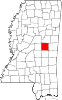
Town CDPs Other
communitiesFootnotes ‡This populated place also has portions in an adjacent county or counties
Categories:- Mississippi counties
- Neshoba County, Mississippi


Wikimedia Foundation. 2010.