- Lowndes County, Mississippi
-
Lowndes County, Mississippi 
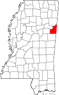
Location in the state of Mississippi
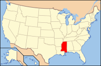
Mississippi's location in the U.S.Founded 1830 Seat Columbus Largest city Columbus Area
- Total
- Land
- Water
516.45 sq mi (1,338 km²)
502.30 sq mi (1,301 km²)
14.15 sq mi (37 km²), 2.74%Population
- (2010)
- Density
59,779
122/sq mi (47/km²)Lowndes County is a county located in the U.S. state of Mississippi. As of 2010, the population was 59,779. Its county seat is Columbus[1]. Lowndes County is named for U.S. Congressman William Jones Lowndes.
The Columbus Micropolitan Statistical Area includes all of Lowndes County.
Contents
Geography
According to the 2000 census, the county has a total area of 516.45 square miles (1,337.6 km2), of which 502.30 square miles (1,301.0 km2) (or 97.26%) is land and 14.15 square miles (36.6 km2) (or 2.74%) is water.[2]
Major highways
 U.S. Highway 45
 U.S. Highway 82
 Mississippi Highway 12
 Mississippi Highway 50
 Mississippi Highway 69
 Mississippi Highway 182
Adjacent counties
- Noxubee County (south)
- Oktibbeha County (west)
- Clay County (northwest)
- Monroe County (north)
- Lamar County, Alabama (northeast)
- Pickens County, Alabama (southeast)
Demographics
Historical populations Census Pop. %± 1830 3,173 — 1840 14,513 357.4% 1850 19,544 34.7% 1860 23,625 20.9% 1870 30,502 29.1% 1880 28,244 −7.4% 1890 27,047 −4.2% 1900 29,095 7.6% 1910 30,703 5.5% 1920 27,632 −10.0% 1930 29,987 8.5% 1940 35,245 17.5% 1950 37,852 7.4% 1960 46,639 23.2% 1970 49,700 6.6% 1980 57,304 15.3% 1990 59,308 3.5% 2000 61,586 3.8% 2010 59,779 −2.9% MS Counties 1900-1990
GeoHive - 2000 & 2010 statisticsAs of the census[3] of 2000, there were 61,586 people, 22,849 households, and 16,405 families residing in the county. The population density was 123 people per square mile (47/km²). There were 25,104 housing units at an average density of 50 per square mile (19/km²). The racial makeup of the county was 56.47% White, 41.56% Black or African American, 0.17% Native American, 0.54% Asian, 0.03% Pacific Islander, 0.39% from other races, and 0.85% from two or more races. 1.11% of the population were Hispanic or Latino of any race.
There were 22,849 households out of which 36.50% had children under the age of 18 living with them, 49.20% were married couples living together, 18.70% had a female householder with no husband present, and 28.20% were non-families. 24.60% of all households were made up of individuals and 8.90% had someone living alone who was 65 years of age or older. The average household size was 2.61 and the average family size was 3.13.
In the county the population was spread out with 28.60% under the age of 18, 10.60% from 18 to 24, 29.20% from 25 to 44, 20.40% from 45 to 64, and 11.20% who were 65 years of age or older. The median age was 33 years. For every 100 females there were 89.90 males. For every 100 females age 18 and over, there were 84.20 males.
The median income for a household in the county was $32,123, and the median income for a family was $38,248. Males had a median income of $31,792 versus $20,640 for females. The per capita income for the county was $16,514. About 18.00% of families and 21.30% of the population were below the poverty line, including 31.80% of those under age 18 and 16.80% of those age 65 or over.
Education
Primary and secondary schools
Portions of Lowndes County are served by the Columbus Municipal School District and the Lowndes County School District.
The Columbus Municipal School District includes[4]:
- Columbus High School
- S.D. Lee Middle School
- R.E. Hunt Intermediate School
- Cook Elementary Fine Arts Magnet School
- Fairview Elementary Aerospace & Science Magnet
- Franklin Elementary Medical Sciences & Wellness Magnet School
- Sale Elementary International Studies Magnet
- Stokes-Beard Elementary Technology & Communication Magnet.
The Lowndes County School District has 3 areas, each with an elementary school, a middle school, and a high school[5]:
- Caledonia
- New Hope
- West Lowndes.
Colleges and universities
Lowndes County is within the service area of the East Mississippi Community College system.[6] The Golden Triangle Campus is located in Mayhew, an unincorporated area in Lowndes County. The system also offers classes in the Columbus Air Force Base Extension in Columbus.[7]
Communities
- Cities
- Census-designated places
- Columbus AFB
- New Hope
- Unincorporated places
- Ghost towns
See also
References
- ^ "Find a County". National Association of Counties. http://www.naco.org/Counties/Pages/FindACounty.aspx. Retrieved 2011-06-07.
- ^ "Census 2000 U.S. Gazetteer Files: Counties". United States Census. http://www.census.gov/tiger/tms/gazetteer/county2k.txt. Retrieved 2011-02-13.
- ^ "American FactFinder". United States Census Bureau. http://factfinder.census.gov. Retrieved 2008-01-31.
- ^ School District, Columbus Municipal (2005). "Schools: Columbus Municipal School District, Columbus, Mississippi" (in English) (HTML). http://www.columbuscityschools.org/schools.html. Retrieved 2009-05-23.
- ^ School District, Lowndes County (2007-2008). "The Lowndes County School District" (in English) (HTML). http://www.lowndes.k12.ms.us/Profile.htm. Retrieved 2009-05-23.[dead link]
- ^ "CATALOG 2007-2009." East Mississippi Community College. 3 (3/147). Retrieved on March 1, 2011.
- ^ "CATALOG 2007-2009." East Mississippi Community College. 10 (10/147). Retrieved on March 1, 2011.
Municipalities and communities of Lowndes County, Mississippi City Towns CDPs Unincorporated
communitiesBent Oak | Billups | Flint Hill | Forreston | Kolola Springs | Mayhew | McCrary | Penns | Plum Grove | Plymouth | Steens | Trinity | Wells | Whitebury | Woodlawn
Categories:- Mississippi counties
- Lowndes County, Mississippi
Wikimedia Foundation. 2010.

