- Benton County, Mississippi
-
Benton County, Mississippi 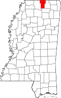
Location in the state of Mississippi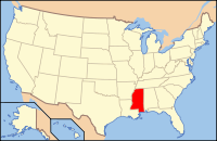
Mississippi's location in the U.S.Founded 1870 Seat Ashland Largest Town Ashland Area
- Total
- Land
- Water
408.65 sq mi (1,058 km²)
406.79 sq mi (1,054 km²)
1.86 sq mi (5 km²), 0.46%Population
- (2010)
- Density
8,729
21/sq mi (8/km²)Benton County is a county located in the U.S. state of Mississippi. In 2010, the population was 8,729. Its county seat is Ashland[1]. Local lore has it that residents convinced the reconstruction government that Benton County was to be named for U.S. Senator Thomas Hart Benton, but the name was actually chosen to honor Confederate General Samuel Benton from nearby Holly Springs.
Contents
Geography
According to the 2000 census, the county has a total area of 408.65 square miles (1,058.4 km2), of which 406.79 square miles (1,053.6 km2) (or 99.54%) is land and 1.86 square miles (4.8 km2) (or 0.46%) is water.[2]
The headwaters of the Wolf River meander and braid their way north and west across northern Benton County from Baker's Pond, the river's source spring (highest origin of continuous flow) in the Holly Springs National Forest approximately one mile southwest of where U.S. Highway 72 passes into Tippah County, Mississippi. The Wolf River passes into Fayette County, Tennessee between Michigan City (on the Mississippi side) and La Grange, Tennessee.
Major highways
 U.S. Highway 72
 U.S. Highway 78
 Mississippi Highway 2
 Mississippi Highway 4
 Mississippi Highway 5
 Mississippi Highway 7
Adjacent counties
- Hardeman County, Tennessee (northeast)
- Tippah County (east)
- Union County (south)
- Marshall County (west)
- Fayette County, Tennessee (northwest)

Fayette County, Tennessee Hardeman County, Tennessee Marshall County 
Tippah County  Benton County, Mississippi

Union County National protected area
Demographics
Historical populations Census Pop. %± 1880 11,023 — 1890 10,585 −4.0% 1900 10,510 −0.7% 1910 10,245 −2.5% 1920 9,851 −3.8% 1930 9,813 −0.4% 1940 10,429 6.3% 1950 8,793 −15.7% 1960 7,723 −12.2% 1970 7,505 −2.8% 1980 8,153 8.6% 1990 8,046 −1.3% 2000 8,026 −0.2% 2010 8,729 8.8% MS Counties 1900-1990
GeoHive - 2000 & 2010 statisticsAt the 2000 census[3], there were 8,026 people, 2,999 households and 2,216 families residing in the county. The population density was 20 per square mile (8/km²). There were 3,456 housing units at an average density of 8 per square mile (3/km²). The racial makeup of the county was 61.72% White, 36.76% Black or African American, 0.59% Native American, 0.05% Asian, 0.01% Pacific Islander, 0.29% from other races, and 0.59% from two or more races. 1.05% of the population were Hispanic or Latino of any race.
There were 2,999 households of which 33.40% had children under the age of 18 living with them, 54.20% were married couples living together, 14.80% had a female householder with no husband present, and 26.10% were non-families. 23.80% of all households were made up of individuals and 11.70% had someone living alone who was 65 years of age or older. The average household size was 2.64 and the average family size was 3.12.
Age distribution was 26.90% under the age of 18, 10.00% from 18 to 24, 25.80% from 25 to 44, 22.00% from 45 to 64, and 15.30% who were 65 years of age or older. The median age was 36 years. For every 100 females there were 94.60 males. For every 100 females age 18 and over, there were 91.80 males.
The median household income was $24,149, and the median family income was $29,907. Males had a median income of $26,291 versus $19,519 for females. The per capita income for the county was $12,212. About 19.20% of families and 23.20% of the population were below the poverty line, including 28.00% of those under age 18 and 24.80% of those age 65 or over.
Communities
- Unincorporated places
- Canaan
- Lamar
- Michigan City
- Winborn
See also
- Dry counties
References
- ^ "Find a County". National Association of Counties. http://www.naco.org/Counties/Pages/FindACounty.aspx. Retrieved 2011-06-07.
- ^ "Census 2000 U.S. Gazetteer Files: Counties". United States Census. http://www.census.gov/tiger/tms/gazetteer/county2k.txt. Retrieved 2011-02-13.
- ^ "American FactFinder". United States Census Bureau. http://factfinder.census.gov. Retrieved 2008-01-31.
Municipalities and communities of Benton County, Mississippi Towns 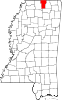
Unincorporated
communitiesCanaan | Hopewell | Lamar | Michigan City | Winborn
Categories:- Mississippi counties
- Benton County, Mississippi


Wikimedia Foundation. 2010.