- Vicksburg, Mississippi
-
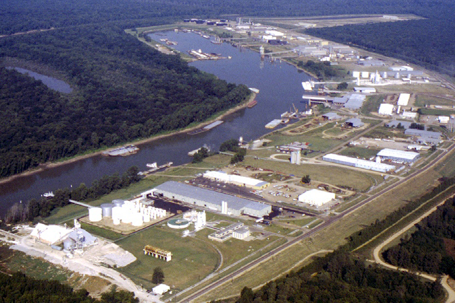
Vicksburg, Mississippi — City — Aerial view of Vicksburg Harbor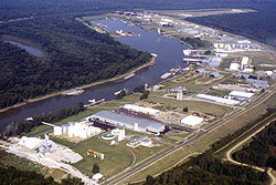
Nickname(s): Red Carpet City of the South Location of Vicksburg in Warren County
Coordinates: 32°20′10″N 90°52′31″W / 32.33611°N 90.87528°WCoordinates: 32°20′10″N 90°52′31″W / 32.33611°N 90.87528°W Country United States State Mississippi County Warren Founded Incorporated 1826 Government – Mayor Paul Winfield Area – City 35.3 sq mi (98.32 km2) – Land 32.9 sq mi (85.2 km2) – Water 2.4 sq mi (6.2 km2) Elevation 240 ft (82 m) Population (2000) – City 26,407 – Density 803.1/sq mi (310.1/km2) – Metro 49,644 Time zone CST (UTC-6) – Summer (DST) CDT (UTC-5) ZIP codes 39180-39183 Area code(s) 601 FIPS code 28-76720 GNIS feature ID 0679216 Website www.vicksburg.org Vicksburg is a city in Warren County, Mississippi, United States. It is the only city in Warren County. It is located 234 miles (377 km) northwest of New Orleans on the Mississippi and Yazoo rivers, and 40 miles (64 km) due west of Jackson, the state capital. In 1900, 14,834 people lived in Vicksburg; in 1910, 20,814; in 1920, 17,931; and in 1940, 24,460. The population was 26,407 at the 2000 census with a Micropolitan population of 49,644. It is the county seat of Warren County.
Vicksburg is the principal city of the Vicksburg Micropolitan Statistical Area, which includes all of Warren County.
Contents
History
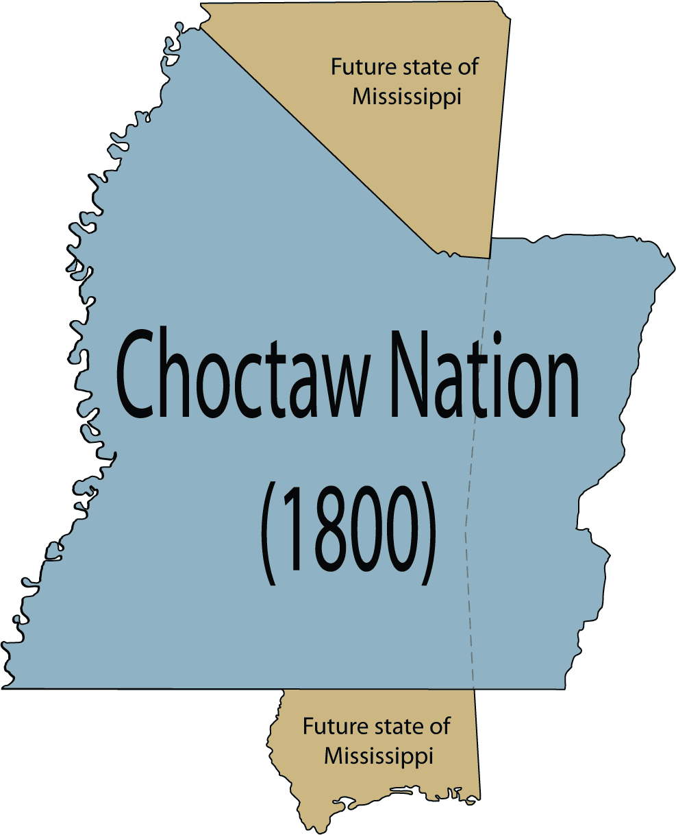
 The entire Choctaw Nation's location compared to the U.S. state of Mississippi.
The area which is now Vicksburg was previously part of the Natchez Native Americans' territory. The first Europeans who settled the area were French colonists, who built Fort-Saint-Pierre in 1719 on the high bluffs overlooking the Yazoo River at present-day Redwood. On 28 November 1729, the Natchez Native Americans attacked the fort and plantations in and around Natchez, killing several hundred settlers, including the Jesuit Father Paul Du Poisson, and carrying off a number of women and children. The Natchez War was a disaster for French Louisiana as the colonial population of the Natchez District never recovered. However, with the help of the Choctaw, traditional enemies of the Natchez, the French defeated and scattered the Natchez and their allies, the Yazoo.
The Choctaw Nation took over the area by right of conquest and inhabited it for several decades. Under pressure from the US government, in 1801 the Choctaw agreed to cede nearly 2,000,000 acres (8,100 km2) of land to the US under the terms of the Treaty of Fort Adams. The treaty was the first of a series that eventually led to the removal of most of the Choctaw to Indian Territory west of the Mississippi River in 1830. Nonetheless, many Choctaw remained in Mississippi, citing article XIV of the Treaty of Dancing Rabbit Creek.
In 1790 the Spanish founded a military outpost on the site, which they called Fort Nogales (nogales meaning "walnut trees"). When the Americans took possession in 1798, they changed the name to Walnut Hills. A sprawling community developed which officially incorporated in 1825 as Vicksburg. It was named after Newitt Vick, a Methodist minister. He had been a conscientious objector during the Revolution.
In 1835, during the Murrell Excitement, a mob from Vicksburg attempted to expel the gamblers from the city, because the citizens were sick of the rougher element treating the city with nothing but contempt. Five gamblers were hanged as a result. The events caused a national and international outcry against the people of Vicksburg.[1]
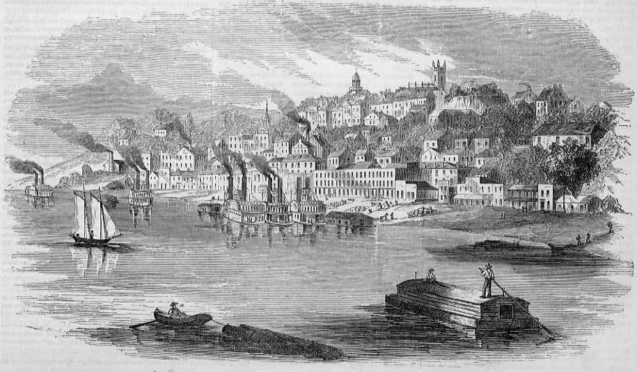
 View of Vicksburg in 1855
During the American Civil War, the city finally had to surrender during the Siege of Vicksburg, after which the Union Army gained control of the entire Mississippi River. The 47-day siege was intended to starve the city into submission. Otherwise its location atop a high bluff overlooking the Mississippi River proved impregnable to assault by federal troops. The surrender of Vicksburg by Confederate General John C. Pemberton on July 4, 1863, together with the defeat of General Robert E. Lee at Gettysburg the day before, has historically marked the turning point in the Civil War. The residents of Vicksburg did not celebrate the national holiday of 4th of July again until 1945.
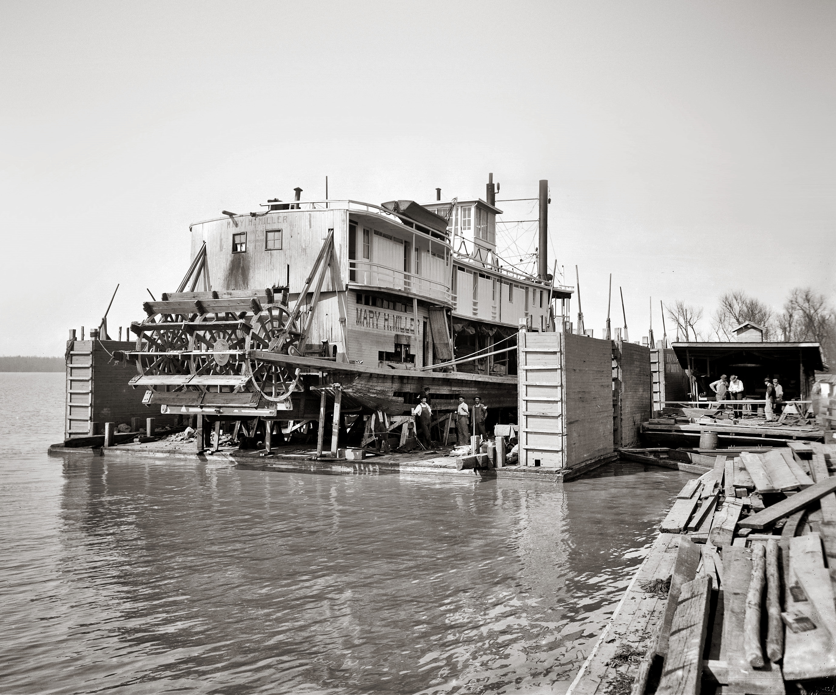
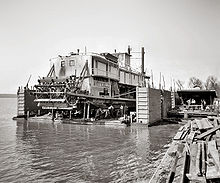 Floating drydock in Vicksburg, circa 1905
Because of the city's location on the Mississippi River, in the 19th century it built an extensive trade from the river's prodigious steamboat traffic. Between 1881 and 1894, the Anchor Line, a prominent steamboat company on the Mississippi River from 1859 to 1898, operated a steamboat called the City of Vicksburg. In 1876 a Mississippi River flood cut off the large meander flowing past Vicksburg, leaving limited access to the new channel.
The United States Army Corps of Engineers diverted the Yazoo River in 1903 into the old, shallowing channel to rejuvenate the waterfront. Railroad access to the west was by transfer steamers and ferry barges until a combination railroad-highway bridge was built in 1929. This is the only Mississippi River rail crossing between Baton Rouge and Memphis. It is the only highway crossing between Natchez and Greenville.
Interstate 20 bridged the river after 1973. Freight rail traffic still crosses via the old bridge. North-South transportation links are by the Mississippi River and U.S. Highway 61.
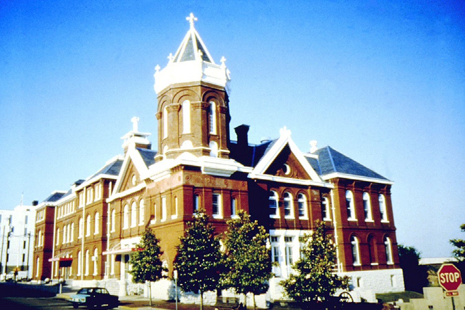
 The historic 1894 Mississippi River Commission Building
On March 12, 1894, the popular soft drink Coca-Cola was bottled for the first time in Vicksburg by Joseph Biedenharn, a local confectioner. Today, surviving nineteenth-century Biedenharn soda bottles are prized by collectors of Coca-Cola memorabilia. His original candy store has been renovated as the Biedenharn Coca-Cola Museum.
Vicksburg served as the primary refugee gathering point, and relief parties put up temporary housing during the Great Mississippi Flood of 1927. It submerged a large percentage of the Mississippi Delta. That flood was the impetus towards the US Army Corps of Engineers establishing the Waterways Experiment Station as the primary hydraulics laboratory, to develop protection of important croplands and cities from the river. Now known as the Engineer Research and Development Center, it applies military engineering, information technology, environmental engineering, hydraulic engineering, and geotechnical engineering.
In December 1953, a severe tornado swept across Vicksburg causing 38 deaths and destroying nearly 1,000 buildings.
Racial unrest
In the first few years after the war, the Ku Klux Klan became active but was suppressed about 1870. By the mid-1870s, new paramilitary groups had arisen in the Deep South. On December 7, 1874 in the Vicksburg Massacre, white men killed at least 50 black residents. Alternate accounts[who?] estimated that upwards of 300 blacks were killed in the city and the surrounding area. The Red Shirts, a paramilitary organization that acted as an arm of the Democratic Party, was active in Vicksburg and other Mississippi areas. President Ulysses S. Grant sent Federal troops to Vicksburg to quell the violence. In the aftermath of the Vicksburg Massacre, other states adopted what they called the Mississippi Plan. At election times, paramilitary groups' intimidated black Republican voters into staying away from the polls, thereby preventing the election of any Republicans or blacks, despite their legal right to vote. By the late 1870s, the Democrats had regained power in state legislatures across the former Confederacy.
Lynchings and other forms of vigilante violence continued to occur in Vicksburg after the turn of the century as well. In May 1903, for example, two black men charged with murdering a planter were taken from jail by a mob of 200 farmers and lynched before they went to trial.[2]
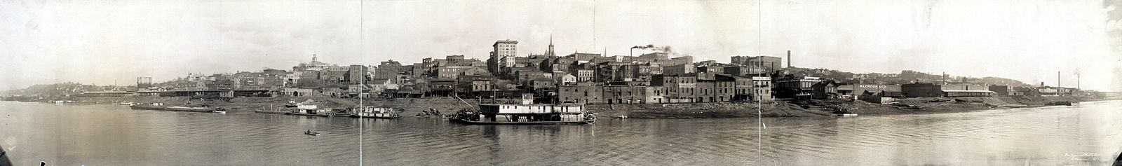

1910 panorama Contemporary Vicksburg
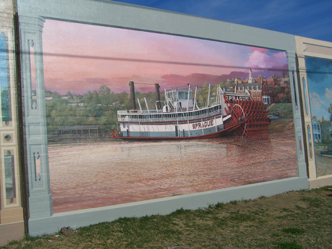
 Mural of the Sprague on Vicksburg floodwall
In 2001 a group of Vicksburg residents visited the Paducah, Kentucky mural project.[3] In 2002 the Vicksburg Riverfront murals program was begun by Louisiana mural artist Robert Dafford and his team on the floodwall located on the waterfront in downtown.[4] Subjects for the murals were drawn from the history of Vicksburg and the surrounding area and include President Theodore Roosevelt's bear hunt, the SS Sultana, the Sprague, the Siege of Vicksburg, the Kings Crossing site, Willie Dixon, the Flood of 1927, the 1953 Vicksburg, Mississippi tornado outbreak, and the Vicksburg National Military Park.[5] The project was finished in 2009 with the completion of the Jitney Jungle/Glass Kitchen mural.[4] In the fall of 2010 a new 55 foot mural was painted on a section of wall on Grove Hill across the street from the original project by former Dafford muralists Benny Graeff and Herb Roe. The mural's subject is the annual "Run thru History" held in the Vicksburg National Military Park.[6][7]
Geography
Vicksburg is located at 32°20′10″N 90°52′31″W / 32.33611°N 90.87528°W (32.335986, -90.875356).[8] According to the United States Census Bureau, the city has a total area of 35.3 square miles (91 km2), of which 32.9 square miles (85.2 km²) is land and 2.4 square miles (6.2 km2) (6.78%) is water.
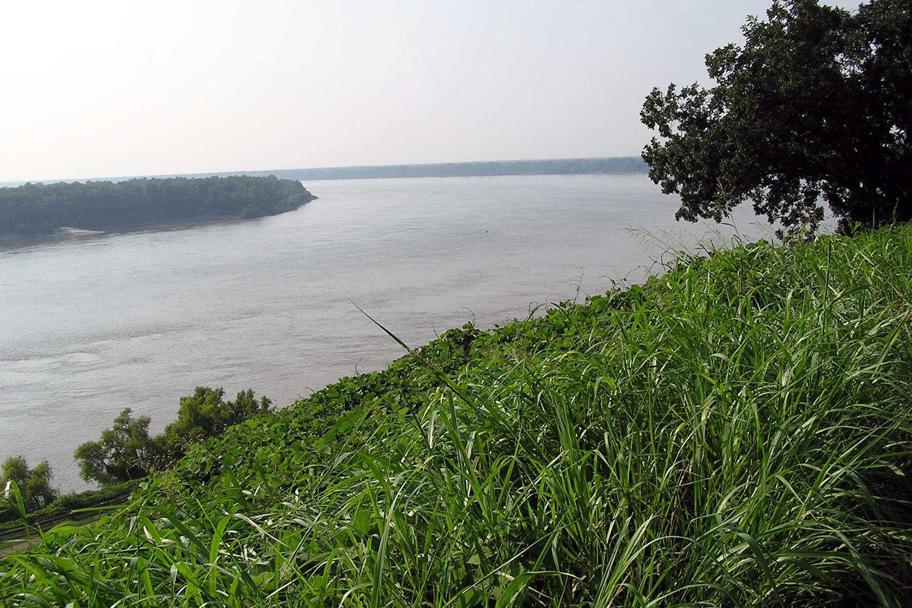
Vicksburg is located at the confluence of the Mississippi River and Yazoo River. Much of the city is on top of a high bluff on the east bank of the Mississippi River.
Demographics
 Mississippi River at Vicksburg
As of the census[9] of 2000, there were 26,407 people with a Micropolitan population of 49,644, 10,364 households, and 6,612 families residing in the city. The population density was 803.1 people per square mile (310.1/km²). There were 11,654 housing units for an average density of 354.4 per square mile (136.9/km²). The racial makeup of the city was 60.43% African American, 37.80% White, 0.15% Native American, 0.61% Asian, 0.02% Pacific Islander, 0.41% from other races, and 0.59% from two or more races. Hispanic or Latino of any race were 1.04% of the population. There were 10,364 households out of which 32.2% had children under the age of 18 living with them, 34.9% were married couples living together, 24.2% had a female householder with no husband present, and 36.2% were non-families. 32.0% of all households were made up of individuals and 13.6% had someone living alone who was 65 years of age or older. The average household size was 2.49 and the average family size was 3.15.
In the city the population was spread out with 28.4% under the age of 18, 9.3% from 18 to 24, 27.9% from 25 to 44, 19.6% from 45 to 64, and 14.8% who were 65 years of age or older. The median age was 34 years. For every 100 females there were 82.9 males. For every 100 females age 18 and over, there were 77.3 males.
The median income for a household in the city was $28,466, and the median income for a family was $34,380. Males had a median income of $29,420 versus $20,728 for females. The per capita income for the city was $16,174. About 19.3% of families and 23.0% of the population were below the poverty line, including 34.8% of those under age 18 and 16.5% of those age 65 or over.
The city is also home to three large Corps of Engineers installations, the Engineer Research and Development Center (ERDC), the Mississippi Valley Division headquarters, and the Vicksburg District headquarters.
Government
The city government consists of a mayor who is elected at large. The current mayor is Paul Winfield, who defeated incumbent Mayor Leyens in the June 2009 election. There are also two aldermembers who are elected from one of two wards.
Education
The City of Vicksburg is served by the Vicksburg-Warren School District.
Schools
High Schools
- Vicksburg High School
- 1988-1989 National Blue Ribbon School[10]
- Warren Central High School
Junior High Schools
- Vicksburg Junior High School
- Warren Central Junior High School
Elementary Schools
- Beechwood Elementary School
- Bovina Elementary School
- Bowmar Avenue Magnet School
- Dana Road Elementary School
- Redwood Elementary School
- Sherman Avenue Elementary School
- South Park Elementary School
- Warrenton Elementary School
- Vicksburg Intermediate School
- Warren Central Intermediate School
Private Schools
- Vicksburg Community School (K-12)
- Porters Chapel Academy
- Vicksburg Catholic School- St. Francis Xavier Elementary & St. Aloysius Catholic High School*
Former Schools
- Hall's Ferry Road Elementary School
- 1985-1986 National Blue Ribbon School[10]
- Culkin Elementary School
- Jett Elementary School
- Cedars Elementary School
- Vicksburg Middle School
- All Saints' Episcopal School was a local boarding school located on Confederate Avenue, which closed in 2006 after 98 years in operation. The historic campus is currently used by Americorps as a regional training center.
Culture
A made-for-TV movie version of I Know Why the Caged Bird Sings, based on Maya Angelou's memoir, was filmed in Vicksburg. Some of the movie O Brother, Where Art Thou? was filmed here. The Stokes campaign dinner was filmed in the Southern Cultural Heritage Center's auditorium.
Vicksburg is home to the McRaven House, said to be one of the most haunted houses in America.[citation needed]
Every summer, Vicksburg plays host to the Miss Mississippi Pageant and Parade.
Cultural references
- Vicksburg is mentioned in the Pulitzer Prize winning play Crimes of the Heart by Beth Henley.
- Vicksburg is mentioned in the song "Dixie Lily" from Elton John's 8th studio album Caribou, in the last line of the chorus: "...down from Louisiana on the Vicksburg run."
- Vicksburg is mentioned in the song High Water (For Charley Patton) by Bob Dylan.
- The city is mentioned multiple times in the series of books surrounding the Logan family including Roll of Thunder, Hear My Cry (1976) and Let The Circle Be Unbroken (1981), by Mildred Taylor.
Notable residents
- William Wirt Adams, Confederate Army officer and member of the Mississippi House of Representatives[11]
- Edwin C. Bearss, historian
- Jan-Michael Vincent, actor, famous for the series Airwolf'.
- Tommy Bishop, country guitarist; godfather of "rockabilly" guitar.
- Roosevelt Brown, former Major League Baseball outfielder for the Chicago Cubs
- Ellis Burks, former MLB outfielder
- Charles Burnett, filmmaker
- Jack Christian, businessman; mayor-president of Baton Rouge, Louisiana, from 1957–1964, was born in Vicksburg in 1911.
- Odia Coates, country singer
- Rod Coleman, defensive tackle for the Atlanta Falcons
- Mart Crowley, playwright, TV executive
- Jefferson Davis, Mexican war hero, U.S. Congressman, Senator, Secretary of War, and President of the Confederate States of America.
- Willie Dixon, blues bassist, singer, songwriter, and producer.
- John "Kayo" Dottley, college All-American and professional football player
- Louis Green, linebacker for the Denver Broncos
- Milt Hinton, jazz bassist
- Joseph Holt, longest-serving Judge Advocate General of the Army.
- Hank Jones, jazz pianist, born in Vicksburg.
- Patrick Kelly, fashion designer.
- George McConnell, former guitarist for Widespread Panic, Kudzu Kings, and Beanland
- Michael Myers, defensive tackle for the Cincinnati Bengals.
- Evelyn Preer, African-American film actress
- George Reed, former running back for the Saskatchewan Roughriders, CFL Hall of Fame member.
- Beah Richards, African-American film and television actress
- Roy C. Strickland, businessman and politician in Louisiana and Texas, was born in Vicksburg in 1942.
- Taylor Tankersley, Florida Marlins relief pitcher.
- Robert Walker, first African-American mayor
- Carl Westcott, American entrepreneur, founder of 1-800-Flowers and Westcott Communications
- Nanette Workman, singer-songwriter, actress, and author; honored by Gov. Haley Barbour at the opening of The Nanette Workman French (Francophone) House
- Delmon Young, outfielder for the Minnesota Twins
- Dmitri Young, first baseman for the Washington Nationals
Sites of interest
- Historic Anchuca Mansion
- Biedenharn Coca-Cola Museum
- McRaven House
- Old Court House Museum
- U.S.S. Cairo Gunboat & Museum, part of Vicksburg National Military Park
- Pemberton's Headquarters, part of Vicksburg National Military Park
- Vicksburg Battlefield Museum
- Vicksburg National Military Park
- Vicksburg Theatre Guild
- Yesterday's Children -- Antique Doll & Toy Museum
- Balfour House
- The Jacqueline House African American Museum
- Catfish Row Art Park
Sources
- This article incorporates text from an edition of the New International Encyclopedia that is in the public domain.
- Cox, James L. The Mississippi Almanac. (2001). ISBN 0-9643545-2-7.
- History of Vicksburg's Jewish community
References
- ^ {{*Sandlin, Lee (2010). Wicked River: The Mississippi When It Last Ran Wild. Pantheon. }}
- ^ "Lynched for Murder…". New York Times. May 4, 1903. http://query.nytimes.com/gst/abstract.html?res=9B06E7DA1F30E733A25757C0A9639C946297D6CF&scp=8&sq=vicksburg+lynched&st=p.
- ^ Vicksburg Riverfront Murals It Took A Community To Raise A Mural!
- ^ a b Vicksburg Riverfront Murals "Celebrating Vicksburg:A Great American Community"
- ^ Vicksburg Riverfront Murals
- ^ Mural on Grove hill to highlight Run Thru History
- ^ Ready to Roll
- ^ "US Gazetteer files: 2010, 2000, and 1990". United States Census Bureau. 2011-02-12. http://www.census.gov/geo/www/gazetteer/gazette.html. Retrieved 2011-04-23.
- ^ "American FactFinder". United States Census Bureau. http://factfinder.census.gov. Retrieved 2008-01-31.
- ^ a b [1]
- ^ Who Was Who in America, Historical Volume, 1607-1896. Chicago: Marquis Who's Who. 1963.
External links
- City of Vicksburg, Mississippi
- Warren County-Vicksburg Public Library
- Vicksburg Foundation for Historic Preservation
- Southern Cultural Heritage Foundation
- Vicksburg Convention & Visitors Bureau
- The Vicksburg Post -- local daily newspaper
- Vicksburg, Mississippi Chamber of Commerce
- Vicksburg travel guide from Wikitravel
Municipalities and communities of Warren County, Mississippi County seat: VicksburgCities Vicksburg
Unincorporated
communitiesBovina | Eagle Bend | Flowers | Redwood | Waltersville | Warrenton | Yokena
Categories:- Vicksburg, Mississippi
- Cities in Mississippi
- Populated places in Warren County, Mississippi
- Mississippi populated places on the Mississippi River
- County seats in Mississippi
- Populated places in Mississippi with African American majority populations
- Populated places established in 1826
- Micropolitan areas of Mississippi


Wikimedia Foundation. 2010.