- Bolivar County, Mississippi
-
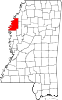
Bolivar County, Mississippi 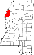
Location in the state of Mississippi
Mississippi's location in the U.S.Founded 1836 Seat Rosedale and Cleveland Largest city Cleveland Area
- Total
- Land
- Water
905.76 sq mi (2,346 km²)
876.28 sq mi (2,270 km²)
29.47 sq mi (76 km²), 3.25%Population
- (2010)
- Density
34,145
18/sq mi (7/km²)Website www.co.bolivar.ms.us Bolivar County is a county located in the Mississippi Delta region of the U.S. state of Mississippi. As of 2010, the population was 34,145. It is named in honor of Simón Bolívar, leader of the liberation of several South American countries from Spain in the early 19th century. Its county seats are Rosedale and Cleveland[1].
The Cleveland Micropolitan Statistical Area includes all of Bolivar County.
Contents
Geography
According to the 2000 census, the county has a total area of 905.76 square miles (2,345.9 km2), of which 876.28 square miles (2,269.6 km2) (or 96.75%) is land and 29.47 square miles (76.3 km2) (or 3.25%) is water.[2]
Major highways
 U.S. Highway 61
 Mississippi Highway 1
 Mississippi Highway 8
 Mississippi Highway 32
Adjacent counties
- Coahoma County (north)
- Sunflower County (east)
- Washington County (south)
- Desha County, Arkansas (west)

Coahoma County Desha County, Arkansas 
Sunflower County  Bolivar County, Mississippi

Washington County National protected area
Demographics
As of the census[3] of 2000, there were 40,633 people, 13,776 households, and 9,725 families residing in the county. The population density was 46 people per square mile (18/km²). There were 14,939 housing units at an average density of 17 per square mile (7/km²). The racial makeup of the county was 65.11% Black or African American, 33.24% White, 0.10% Native American, 0.49% Asian, 0.01% Pacific Islander, 0.48% from other races, and 0.56% from two or more races. 1.17% of the population were Hispanic or Latino of any race.
By 2005 the county had a population that was 32.6% non-Hispanic white. African-Americans made up 65.7% of the county population. The only other census identified group over on e percent was Latinos who constituted 1.2% of the population.
Historical populations Census Pop. %± 1840 1,356 — 1850 2,577 90.0% 1860 10,471 306.3% 1870 9,732 −7.1% 1880 18,652 91.7% 1890 29,980 60.7% 1900 35,427 18.2% 1910 48,905 38.0% 1920 57,669 17.9% 1930 71,051 23.2% 1940 67,564 −4.9% 1950 63,004 −6.7% 1960 54,464 −13.6% 1970 49,409 −9.3% 1980 45,965 −7.0% 1990 41,875 −8.9% 2000 40,633 −3.0% 2010 34,145 −16.0% MS Counties 1900-1990
GeoHive - 2000 & 2010 statisticsThere were 13,776 households out of which 35.20% had children under the age of 18 living with them, 38.20% were married couples living together, 27.30% had a female householder with no husband present, and 29.40% were non-families. 25.30% of all households were made up of individuals and 9.90% had someone living alone who was 65 years of age or older. The average household size was 2.79 and the average family size was 3.36.
In the county the population was spread out with 29.60% under the age of 18, 14.00% from 18 to 24, 25.70% from 25 to 44, 19.60% from 45 to 64, and 11.00% who were 65 years of age or older. The median age was 30 years. For every 100 females there were 87.80 males. For every 100 females age 18 and over, there were 81.70 males.
The median income for a household in the county was $23,428, and the median income for a family was $27,301. Males had a median income of $27,643 versus $20,774 for females. The per capita income for the county was $12,088. About 27.90% of families and 33.30% of the population were below the poverty line, including 43.90% of those under age 18 and 27.90% of those age 65 or over.
Government
Bolivar County is governed via a five-member board of supervisors. Each member is elected from an individual district. The county is led by a county administrator who is appointed.
Communities
- Cities
- Cleveland
- Rosedale
- Mound Bayou
- Shaw (small portion in Sunflower County)
- Shelby
- Villages
- Unincorporated places
- Choctaw (Bolivar County)
- Deeson
- Hushpuckena
- Lamont
- Litton
- Malvina
- O'Reilly
- Perthshire
- Round Lake
- Scott
- Skene
- Stringtown
- Symonds
Education
- Colleges and Universities
- Delta State University (Cleveland)
- Public School Districts
- Benoit School District (Benoit)
- Cleveland School District (Cleveland)
- Mound Bayou School District (Mound Bayou)
- North Bolivar School District (Shelby)
- Shaw School District (Shaw)
- West Bolivar School District (Rosedale)
- Private Schools
- Bayou Academy (Cleveland)
Notable people
- Charles Capps
- Medgar Evers
- T.R.M. Howard
- Amzie Moore
- Peter B. Starke, state representative and state senator, Confederate general in the Civil War
See also
References
- ^ "Find a County". National Association of Counties. http://www.naco.org/Counties/Pages/FindACounty.aspx. Retrieved 2011-06-07.
- ^ "Census 2000 U.S. Gazetteer Files: Counties". United States Census. http://www.census.gov/tiger/tms/gazetteer/county2k.txt. Retrieved 2011-02-13.
- ^ "American FactFinder". United States Census Bureau. http://factfinder.census.gov. Retrieved 2008-01-31.
External links
Municipalities and communities of Bolivar County, Mississippi Cities Cleveland | Rosedale | Mound Bayou | Shaw‡ | Shelby
Towns Village Unincorporated
communitiesChoctaw | Deeson | Hushpuckena | Lamont | Litton | Malvina | O'Reilly | Perthshire | Round Lake | Scott | Skene | Stringtown | Symonds
Footnotes ‡This populated place also has portions in an adjacent county or counties
Categories:- Mississippi counties
- Bolivar County, Mississippi
- Counties of the United States with African American majority populations
- 1836 establishments in the United States
- Populated places established in 1836
- Mississippi counties on the Mississippi River


Wikimedia Foundation. 2010.