- Merigold, Mississippi
-
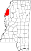
Merigold, Mississippi — Town — Location of Merigold, Mississippi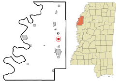
Coordinates: 33°50′17″N 90°43′37″W / 33.83806°N 90.72694°WCoordinates: 33°50′17″N 90°43′37″W / 33.83806°N 90.72694°W Country United States State Mississippi County Bolivar Area - Total 1.0 sq mi (2.5 km2) - Land 1.0 sq mi (2.5 km2) - Water 0.0 sq mi (0.0 km2) Elevation 144 ft (44 m) Population (2000) - Total 664 - Density 686.1/sq mi (264.9/km2) Time zone Central (CST) (UTC-6) - Summer (DST) CDT (UTC-5) ZIP code 38759 Area code(s) 662 FIPS code 28-46720 GNIS feature ID 0673494 [1] Merigold (sometimes misspelled as Marigold or Merrigold) is a town in Bolivar County, Mississippi, United States. The population was 664 at the 2000 census.
Contents
Geography
Merigold is located at 33°50′17″N 90°43′37″W / 33.838094°N 90.726848°W.[2]
According to the United States Census Bureau, the town has a total area of 1.0-square-mile (2.6 km2), all land.
Demographics
As of the census[3] of 2000, there were 664 people, 268 households, and 191 families residing in the town. The population density was 686.1 people per square mile (264.3/km²). There were 280 housing units at an average density of 289.3 per square mile (111.5/km²). The racial makeup of the town was 42.62% White, 56.93% African American, 0.15% Asian, 0.15% from other races, and 0.15% from two or more races. Hispanic or Latino of any race were 0.75% of the population.
There were 268 households out of which 28.0% had children under the age of 18 living with them, 42.9% were married couples living together, 23.1% had a female householder with no husband present, and 28.7% were non-families. 24.6% of all households were made up of individuals and 10.8% had someone living alone who was 65 years of age or older. The average household size was 2.48 and the average family size was 2.96.
In the town the population was spread out with 23.8% under the age of 18, 9.3% from 18 to 24, 25.8% from 25 to 44, 24.2% from 45 to 64, and 16.9% who were 65 years of age or older. The median age was 39 years. For every 100 females there were 82.4 males. For every 100 females age 18 and over, there were 78.8 males.
The median income for a household in the town was $24,375, and the median income for a family was $27,500. Males had a median income of $26,250 versus $21,250 for females. The per capita income for the town was $16,185. About 21.4% of families and 23.7% of the population were below the poverty line, including 35.6% of those under age 18 and 18.4% of those age 65 or over.
Education
The Town of Merigold is served by the Cleveland School District.
As of 2002 some children in Merigold attended the North Sunflower Academy in unincorporated Sunflower County.[4]
Entertainment
Po' Monkey's is a juke joint located approximately 1 mile west of Merigold. The Mississippi Blues Commission placed a historic marker at the Po Monkey's Lounge in 2009 designating it as a site on the Mississippi Blues Trail for its contribution to the development of the blues (and one of the few authentic juke joints that is still operating today).[5]
References
- ^ "Merigold, Mississsippi". Geographic Names Information System, U.S. Geological Survey. http://geonames.usgs.gov/pls/gnispublic/f?p=gnispq:3:::NO::P3_FID:673494.
- ^ "US Gazetteer files: 2010, 2000, and 1990". United States Census Bureau. 2011-02-12. http://www.census.gov/geo/www/gazetteer/gazette.html. Retrieved 2011-04-23.
- ^ "American FactFinder". United States Census Bureau. http://factfinder.census.gov. Retrieved 2008-01-31.
- ^ "No simple solutions to education, workforce training problems. (Focus Delta & River Cities)." Mississippi Business Journal. May 27, 2002. Retrieved on August 10, 2010.
- ^ "Po' Monkey's" "Mississippi Blues Trail, 22 June 2009". http://www.msbluestrail.org/_webapp_2726471/Po'_Monkey's "Po' Monkey's". Retrieved 2011-01-07.
Municipalities and communities of Bolivar County, Mississippi Cities Cleveland | Rosedale | Mound Bayou | Shaw‡ | Shelby
Towns Village Unincorporated
communitiesChoctaw | Deeson | Hushpuckena | Lamont | Litton | Malvina | O'Reilly | Perthshire | Round Lake | Scott | Skene | Stringtown | Symonds
Footnotes ‡This populated place also has portions in an adjacent county or counties
Categories:- Populated places in Bolivar County, Mississippi
- Towns in Mississippi
- Populated places in Mississippi with African American majority populations
- Mississippi Blues Trail


Wikimedia Foundation. 2010.