- Shaw, Mississippi
Infobox Settlement
official_name = Shaw, Mississippi
settlement_type =City
nickname =
motto =
imagesize =
image_caption =
image_
imagesize =
image_caption =
image_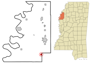
mapsize = 250px
map_caption = Location of Shaw, Mississippi
mapsize1 =
map_caption1 =subdivision_type = Country
subdivision_name =United States
subdivision_type1 = State
subdivision_name1 =Mississippi
subdivision_type2 = Counties
subdivision_name2 = Bolivar, Sunflower
government_footnotes =
government_type =
leader_title =
leader_name =
leader_title1 =
leader_name1 =
established_title =
established_date =unit_pref = Imperial
area_footnotes =area_magnitude =
area_total_km2 = 2.9
area_land_km2 = 2.9
area_water_km2 = 0.0
area_total_sq_mi = 1.1
area_land_sq_mi = 1.1
area_water_sq_mi = 0.0population_as_of = 2000
population_footnotes =
population_total = 2312
population_density_km2 = 804.2
population_density_sq_mi = 2082.8timezone = Central (CST)
utc_offset = -6
timezone_DST = CDT
utc_offset_DST = -5
elevation_footnotes =
elevation_m = 40
elevation_ft = 131
latd = 33 |latm = 36 |lats = 6 |latNS = N
longd = 90 |longm = 46 |longs = 15 |longEW = Wpostal_code_type =
ZIP code
postal_code = 38773
area_code = 662
blank_name = FIPS code
blank_info = 28-67000
blank1_name = GNIS feature ID
blank1_info = 0677626
website =
footnotes =Shaw is a city in Bolivar and Sunflower Counties in the
U.S. state ofMississippi , in theMississippi Delta region. The population was 2,312 at the 2000 census.Geography
Shaw is located at coor dms|33|36|6|N|90|46|15|W|city (33.601549, -90.770720)GR|1. The city is almost entirely in Bolivar County. A small portion extends east into adjacent Sunflower County. [ [http://factfinder.census.gov/servlet/MapItDrawServlet?geo_id=16000US2867000&_bucket_id=50&tree_id=4001&context=AdvSearch&_lang=en American FactFinder Reference Map] ] In the 2000 census, all of the city's 2,313 residents lived in Bolivar County. Although no residents lived in the Sunflower County portion in 2000, that figure had risen to 1 by 2006. [cite web | url = http://www.census.gov/popest/cities/files/SUB-EST2006_28.csv | title = Subcounty population estimates: Mississippi 2000-2006| format = CSV | publisher =
United States Census Bureau , Population Division | date =2007-06-28 | accessdate = 2007-07-21]According to the
United States Census Bureau , the city has a total area of 1.1square mile s (2.9km² ).None of the area is covered with water.Demographics
As of the
census GR|2 of 2000, there were 2,312 people, 753 households, and 573 families residing in the city. Thepopulation density was 2,082.8 people per square mile (804.2/km²). There were 785 housing units at an average density of 707.2/sq mi (273.1/km²). The racial makeup of the city was 7.31% White, 92.08% African American, 0.04% Native American, 0.09% Asian, 0.04% Pacific Islander, 0.22% from other races, and 0.22% from two or more races. Hispanic or Latino of any race were 0.99% of the population.There were 753 households out of which 37.6% had children under the age of 18 living with them, 33.5% were married couples living together, 37.8% had a female householder with no husband present, and 23.9% were non-families. 21.4% of all households were made up of individuals and 8.6% had someone living alone who was 65 years of age or older. The average household size was 3.07 and the average family size was 3.58.
In the city the population was spread out with 33.9% under the age of 18, 11.7% from 18 to 24, 25.6% from 25 to 44, 18.9% from 45 to 64, and 9.9% who were 65 years of age or older. The median age was 29 years. For every 100 females there were 82.9 males. For every 100 females age 18 and over, there were 74.6 males.
The median income for a household in the city was $18,878, and the median income for a family was $19,393. Males had a median income of $21,181 versus $18,816 for females. The
per capita income for the city was $9,070. About 41.3% of families and 41.6% of the population were below thepoverty line , including 53.5% of those under age 18 and 31.3% of those age 65 or over.Education
Most of Shaw is served by the
Shaw School District , while the small portion of the city that lies in Sunflower County is served by theSunflower County School District .Famous residents
*
David Honeyboy Edwards , blues singer and guitarist (b. 1915)
*Dave Meadows "Boo" Ferriss - Famous professional baseball player (Boston Red Sox)Crime
1914-06-30 : Mr. Jack Farmer, an African American resident of Shaw, was being searched for by a Vigilante Posse for the alleged murder of Mr. Earl Chase, a White resident. The search got so frustrated that two ancillary murders took place. Ms. Jennie Collins, an African American who was thought to have assisted Mr. Farmer in his flight, and Mr. James Jolly, a White member of the posse who was mistaken for Mr. Farmer in the darkness, were shot. The posse was sweeping through a local swamp because it was supposed that Mr. Farmer was hiding there. Mr. Farmer was never found [Atlanta Constitution ;Atlanta, Georgia ;1914-07-01 ] .References
External links
Wikimedia Foundation. 2010.