- Mathiston, Mississippi
-
Mathiston, Mississippi — Town — Location of Mathiston, Mississippi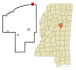
Coordinates: 33°32′12″N 89°7′36″W / 33.53667°N 89.12667°WCoordinates: 33°32′12″N 89°7′36″W / 33.53667°N 89.12667°W Country United States State Mississippi Counties Webster, Choctaw Area – Total 2.5 sq mi (6.4 km2) – Land 2.5 sq mi (6.4 km2) – Water 0.0 sq mi (0.0 km2) Elevation 420 ft (128 m) Population (2000) – Total 720 – Density 289.7/sq mi (111.8/km2) Time zone Central (CST) (UTC-6) – Summer (DST) CDT (UTC-5) ZIP code 39752 Area code(s) 662 FIPS code 28-45720 GNIS feature ID 0673240 Mathiston is a town in Choctaw and Webster Counties in the U.S. state of Mississippi. The population was 720 at the 2000 census.
Contents
Geography
Mathiston is located at 33°32′12″N 89°7′36″W / 33.53667°N 89.12667°W (33.536549, -89.126529)[1]. Most of the town is in Webster County with a portion on the south side extending into Choctaw County.[2] In the 2000 census, 643 of the town's 720 residents (89.3%) lived in Webster County and 77 (10.7%) in Choctaw County.[3]
According to the United States Census Bureau, the town has a total area of 2.5 square miles (6.4 km²).None of the area is covered with water.
Demographics
As of the census[4] of 2000, there were 720 people, 294 households, and 194 families residing in the town. The population density was 289.7 people per square mile (111.6/km²). There were 323 housing units at an average density of 130.0 per square mile (50.1/km²). The racial makeup of the town was 80.00% White, 18.33% African American, 0.69% Asian, 0.69% from other races, and 0.28% from two or more races. Hispanic or Latino of any race were 1.81% of the population.
There were 294 households out of which 33.0% had children under the age of 18 living with them, 49.7% were married couples living together, 13.6% had a female householder with no husband present, and 33.7% were non-families. 32.0% of all households were made up of individuals and 19.7% had someone living alone who was 65 years of age or older. The average household size was 2.45 and the average family size was 3.11.
In the town the population was spread out with 27.8% under the age of 18, 9.9% from 18 to 24, 24.3% from 25 to 44, 22.1% from 45 to 64, and 16.0% who were 65 years of age or older. The median age was 36 years. For every 100 females there were 82.3 males. For every 100 females age 18 and over, there were 75.7 males.
The median income for a household in the town was $23,125, and the median income for a family was $28,889. Males had a median income of $27,875 versus $23,472 for females. The per capita income for the town was $12,222. About 21.4% of families and 25.2% of the population were below the poverty line, including 42.5% of those under age 18 and 25.2% of those age 65 or over.
Education
Most of Mathiston is served by the Webster County School District. The Choctaw County portion of Mathiston is served by the Choctaw County School District.
Woods Junior College was located in Mathiston. By 2004 lost Southern Association of Colleges and Schools (SACS) accreditation and later closed.[5]
References
- ^ "US Gazetteer files: 2010, 2000, and 1990". United States Census Bureau. 2011-02-12. http://www.census.gov/geo/www/gazetteer/gazette.html. Retrieved 2011-04-23.
- ^ American FactFinder Reference Map
- ^ "Subcounty population estimates: Mississippi 2000-2006" (CSV). United States Census Bureau, Population Division. 2007-06-28. http://www.census.gov/popest/cities/files/SUB-EST2006_28.csv. Retrieved 2007-07-21.
- ^ "American FactFinder". United States Census Bureau. http://factfinder.census.gov. Retrieved 2008-01-31.
- ^ Kanengiser, Andy. "Probation survived by 2 Ala. schools." The Clarion-Ledger. December 12, 2004. Main A1. Retrieved on March 1, 2011. "A couple of years earlier, Wood College in Mathiston also lost SACS accreditation and eventually closed its doors."
Municipalities and communities of Choctaw County, Mississippi Towns Ackerman | French Camp | Mathiston‡ | Weir

Unincorporated
communitiesReform
Ghost towns Footnotes ‡This populated place also has portions in an adjacent county or counties
Municipalities and communities of Webster County, Mississippi City 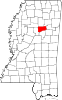
Towns Maben | Mathiston‡
Villages Communities Bellefontaine | Hohenlinden | Tomnolen
Footnotes ‡This populated place also has portions in an adjacent county or counties
Categories:- Populated places in Choctaw County, Mississippi
- Populated places in Webster County, Mississippi
- Towns in Mississippi


Wikimedia Foundation. 2010.