- State Line, Mississippi
Infobox Settlement
official_name = State Line, Mississippi
settlement_type =Town
nickname =
motto =
imagesize =
image_caption =
image_
imagesize =
image_caption =
image_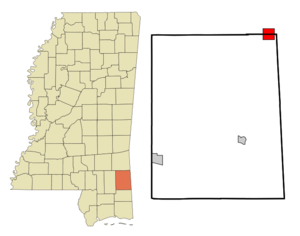
mapsize = 250px
map_caption = Location of State Line, Mississippi
mapsize1 =
map_caption1 =subdivision_type = Country
subdivision_name =United States
subdivision_type1 = State
subdivision_name1 =Mississippi
subdivision_type2 = Counties
subdivision_name2 = Greene, Wayne
government_footnotes =
government_type =
leader_title =
leader_name =
leader_title1 =
leader_name1 =
established_title =
established_date =unit_pref = Imperial
area_footnotes =area_magnitude =
area_total_km2 = 11.1
area_land_km2 = 11.1
area_water_km2 = 0.1
area_total_sq_mi = 4.3
area_land_sq_mi = 4.3
area_water_sq_mi = 0.0population_as_of = 2000
population_footnotes =
population_total = 555
population_density_km2 = 50.2
population_density_sq_mi = 130.1timezone = Central (CST)
utc_offset = -6
timezone_DST = CDT
utc_offset_DST = -5
elevation_footnotes =
elevation_m = 77
elevation_ft = 253
latd = 31 |latm = 26 |lats = 16 |latNS = N
longd = 88 |longm = 28 |longs = 34 |longEW = Wpostal_code_type =
ZIP code
postal_code = 39362
area_code = 601
blank_name = FIPS code
blank_info = 28-70320
blank1_name = GNIS feature ID
blank1_info = 0678229
website =
footnotes =State Line is a town in Greene and Wayne Counties in the
U.S. state ofMississippi . The population was 555 at the 2000 census.Geography
State Line is located at coor dms|31|26|16|N|88|28|34|W|city (31.437799, -88.476104)GR|1. The town is on the boundary between Wayne County on the north and Greene County on the south, with the town's area approximately equally in both. [ [http://factfinder.census.gov/servlet/MapItDrawServlet?geo_id=16000US2870320&_bucket_id=50&tree_id=4001&context=AdvSearch&_lang=en American FactFinder Reference Map] ] In the 2000 census, 327 of the town's 555 residents (58.9%) lived in Greene County and 228 (41.1%) in Wayne County. [cite web | url = http://www.census.gov/popest/cities/files/SUB-EST2006_28.csv | title = Subcounty population estimates: Mississippi 2000-2006| format = CSV | publisher =
United States Census Bureau , Population Division | date =2007-06-28 | accessdate = 2007-07-21]According to the
United States Census Bureau , the town has a total area of 4.3square mile s (11.1km² ), of which, 4.3 square miles (11.1 km²) of it is land and 0.04 square miles (0.1 km²) of it (0.70%) is water.Demographics
As of the
census GR|2 of 2000, there were 555 people, 197 households, and 148 families residing in the town. Thepopulation density was 130.1 people per square mile (50.2/km²). There were 230 housing units at an average density of 53.9/sq mi (20.8/km²). The racial makeup of the town was 42.70% White, 56.94% African American, and 0.36% from two or more races.There were 197 households out of which 39.1% had children under the age of 18 living with them, 41.1% were married couples living together, 29.9% had a female householder with no husband present, and 24.4% were non-families. 21.8% of all households were made up of individuals and 9.6% had someone living alone who was 65 years of age or older. The average household size was 2.82 and the average family size was 3.29.
In the town the population was spread out with 34.4% under the age of 18, 11.4% from 18 to 24, 26.8% from 25 to 44, 16.8% from 45 to 64, and 10.6% who were 65 years of age or older. The median age was 28 years. For every 100 females there were 82.6 males. For every 100 females age 18 and over, there were 72.5 males.
The median income for a household in the town was $22,500, and the median income for a family was $27,083. Males had a median income of $26,563 versus $20,625 for females. The
per capita income for the town was $9,030. About 28.4% of families and 33.6% of the population were below thepoverty line , including 46.9% of those under age 18 and 25.4% of those age 65 or over.Education
The Wayne County portion of State Line is served by the Wayne County School District. The Greene County portion is served by the Greene County School District.
References
External links
Wikimedia Foundation. 2010.