- Bogue Chitto, Mississippi
Infobox Settlement
official_name = Bogue Chitto, Mississippi
settlement_type = CDP
nickname =
motto =
imagesize =
image_caption =
image_
imagesize =
image_caption =
image_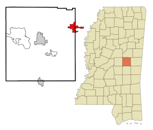
mapsize = 250px
map_caption = Location of Bogue Chitto, Mississippi
mapsize1 =
map_caption1 =subdivision_type = Country
subdivision_name =United States
subdivision_type1 = State
subdivision_name1 =Mississippi
subdivision_type2 = Counties
subdivision_name2 = Neshoba, Kemper
government_footnotes =
government_type =
leader_title =
leader_name =
leader_title1 =
leader_name1 =
established_title =
established_date =unit_pref = Imperial
area_footnotes =area_magnitude =
area_total_km2 = 16.4
area_land_km2 = 16.3
area_water_km2 = 0.1
area_total_sq_mi = 6.3
area_land_sq_mi = 6.3
area_water_sq_mi = 0.0population_as_of = 2000
population_footnotes =
population_total = 533
population_density_km2 = 32.7
population_density_sq_mi = 84.6timezone = Central (CST)
utc_offset = -6
timezone_DST = CDT
utc_offset_DST = -5
elevation_footnotes =
elevation_m = 148
elevation_ft = 486
latd = 32 |latm = 49 |lats = 47 |latNS = N
longd = 88 |longm = 55 |longs = 12 |longEW = Wpostal_code_type =
postal_code =
area_code =
blank_name = FIPS code
blank_info = 28-07330
blank1_name = GNIS feature ID
blank1_info = 0685013
website =
footnotes =Bogue Chitto is a
census-designated place (CDP) in Kemper and Neshoba Counties in theU.S. state ofMississippi . The population was 533 at the 2000 census. It should not be confused with the otherBogue Chitto , which is an unincorporated area in Lincoln County.Geography
Bogue Chitto is located at coor dms|32|49|47|N|88|55|12|W|city (32.829842, -88.920118)GR|1. Most of the town is in Neshoba County with a portion extending into western Kemper County. [ [http://factfinder.census.gov/servlet/MapItDrawServlet?geo_id=16000US2807330&_bucket_id=50&tree_id=420&context=saff&_lang=en&_sse=on American FactFinder Reference Map] ]
According to the
United States Census Bureau , the CDP has a total area of 6.3square mile s (16.4km² ), of which, 6.3 square miles (16.3 km²) of it is land and 0.04 square miles (0.1 km²) of it (0.63%) is water.Demographics
As of the
census GR|2 of 2000, there were 533 people, 160 households, and 127 families residing in the CDP. Thepopulation density was 84.6 people per square mile (32.7/km²). There were 169 housing units at an average density of 26.8/sq mi (10.4/km²). The racial makeup of the CDP was 5.82% White, 0.38% African American, 92.68% Native American, and 1.13% from two or more races. Hispanic or Latino of any race were 0.38% of the population.There were 160 households out of which 40.6% had children under the age of 18 living with them, 31.9% were married couples living together, 31.9% had a female householder with no husband present, and 20.6% were non-families. 11.9% of all households were made up of individuals and 3.1% had someone living alone who was 65 years of age or older. The average household size was 3.33 and the average family size was 3.48.
In the CDP the population was spread out with 34.1% under the age of 18, 11.1% from 18 to 24, 31.0% from 25 to 44, 16.9% from 45 to 64, and 6.9% who were 65 years of age or older. The median age was 28 years. For every 100 females there were 94.5 males. For every 100 females age 18 and over, there were 86.7 males.
The median income for a household in the CDP was $18,641, and the median income for a family was $16,597. Males had a median income of $18,250 versus $15,240 for females. The
per capita income for the CDP was $6,080. About 56.1% of families and 54.2% of the population were below thepoverty line , including 58.3% of those under age 18 and 80.6% of those age 65 or over.Education
The Neshoba County portion of Bogue Chitto is served by the
Neshoba County School District . TheKemper County School District serves the portion of Bogue Chitto that lies in Kemper County.Native American students are eligible to attend schools in the
Choctaw Tribal School System , a non-public district operated by the Mississippi Band ofChoctaw Indians.References
External links
Wikimedia Foundation. 2010.