- Lumberton, Mississippi
Infobox Settlement
official_name = Lumberton, Mississippi
settlement_type =City
nickname =
motto =
imagesize =
image_caption =
image_
imagesize =
image_caption =
image_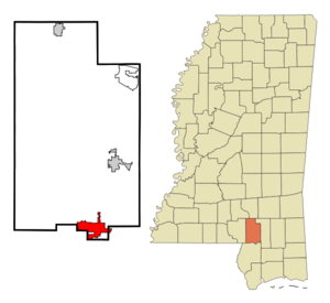
mapsize = 250px
map_caption = Location of Lumberton, Mississippi
mapsize1 =
map_caption1 =subdivision_type = Country
subdivision_name =United States
subdivision_type1 = State
subdivision_name1 =Mississippi
subdivision_type2 = Counties
subdivision_name2 = Lamar, Pearl River
government_footnotes =
government_type =
leader_title =
leader_name =
leader_title1 =
leader_name1 =
established_title =
established_date =unit_pref = Imperial
area_footnotes =area_magnitude =
area_total_km2 = 18.9
area_land_km2 = 18.8
area_water_km2 = 0.1
area_total_sq_mi = 7.3
area_land_sq_mi = 7.3
area_water_sq_mi = 0.0population_as_of = 2000
population_footnotes =
population_total = 2228
population_density_km2 = 118.6
population_density_sq_mi = 307.1timezone = Central (CST)
utc_offset = -6
timezone_DST = CDT
utc_offset_DST = -5
elevation_footnotes =
elevation_m = 90
elevation_ft = 295
latd = 31 |latm = 0 |lats = 14 |latNS = N
longd = 89 |longm = 27 |longs = 13 |longEW = Wpostal_code_type =
ZIP code
postal_code = 39455
area_code = 601
blank_name = FIPS code
blank_info = 28-42640
blank1_name = GNIS feature ID
blank1_info = 0693845
website =
footnotes =Lumberton is a city in Lamar and Pearl River Counties in the
U.S. state ofMississippi . It is part of the Hattiesburg, Mississippi Metropolitan Statistical Area. The population was 2,228 at the 2000 census.Geography
Lumberton is located at coor dms|31|0|14|N|89|27|13|W (31.003888, -89.453544)GR|1. Most of the city is in Lamar County, with a small portion extending east into adjacent Pearl River County. [ [http://factfinder.census.gov/servlet/MapItDrawServlet?geo_id=16000US2842640&_bucket_id=50&tree_id=4001&context=AdvSearch&_lang=en American Factfinder Reference Map] ] In the 2000 census, 2,200 of the city's 2,228 residents (98.7%) lived in Lamar County and 28 (1.3%) in Pearl River County. [cite web | url = http://www.census.gov/popest/cities/files/SUB-EST2006_28.csv | title = Subcounty population estimates: Mississippi 2000-2006| format = CSV | publisher =
United States Census Bureau , Population Division | date =2007-06-28 | accessdate = 2007-07-21]According to the
United States Census Bureau , the city has a total area of 7.3square mile s (18.9km² ), of which, 7.3 square miles (18.8 km²) of it is land and 0.04 square miles (0.1 km²) of it (0.27%) is water.Demographics
As of the
census GR|2 of 2000, there were 2,228 people, 829 households, and 602 families residing in the city. Thepopulation density was 307.1 people per square mile (118.5/km²). There were 920 housing units at an average density of 126.8/sq mi (48.9/km²). The racial makeup of the city was 45.56% White, 53.64% African American, 0.27% Native American, 0.09% Asian, 0.04% from other races, and 0.40% from two or more races. Hispanic or Latino of any race were 0.45% of the population.There were 829 households out of which 36.9% had children under the age of 18 living with them, 42.2% were married couples living together, 25.8% had a female householder with no husband present, and 27.3% were non-families. 25.8% of all households were made up of individuals and 10.4% had someone living alone who was 65 years of age or older. The average household size was 2.66 and the average family size was 3.17.
In the city the population was spread out with 31.7% under the age of 18, 9.4% from 18 to 24, 26.5% from 25 to 44, 20.2% from 45 to 64, and 12.2% who were 65 years of age or older. The median age was 31 years. For every 100 females there were 85.4 males. For every 100 females age 18 and over, there were 82.8 males.
The median income for a household in the city was $23,178, and the median income for a family was $26,603. Males had a median income of $26,563 versus $16,821 for females. The
per capita income for the city was $11,384. About 23.2% of families and 30.8% of the population were below thepoverty line , including 42.7% of those under age 18 and 29.3% of those age 65 or over.Education
The City of Lumberton is served by the
Lumberton Public School District .References
External links
Wikimedia Foundation. 2010.