- National Register of Historic Places listings in Lowndes County, Mississippi
-
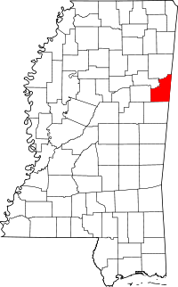 Location of Lowndes County in Mississippi
This is a list of the National Register of Historic Places listings in Lowndes County, Mississippi.
This is intended to be a complete list of the properties and districts on the National Register of Historic Places in Lowndes County, Mississippi, United States. Latitude and longitude coordinates are provided for many National Register properties and districts; these locations may be seen together in a Google map.[1]
There are 33 properties and districts listed on the National Register in the county, including 1 National Historic Landmark.
-
- This National Park Service list is complete through NPS recent listings posted November 10, 2011.[2]
Current listings
[3] Landmark name [4] Image Date listed Location City or town Summary 1 Brownrigg-Harris-Kennebrew House 
May 22, 1978 515 9th St. N.
33°30′07″N 88°25′24″W / 33.501944°N 88.423333°WColumbus 2 Butler Mound and Village Site December 8, 1978 Address Restricted Columbus 3 The Cedars 
March 29, 1979 1311 Military Rd.
33°30′36″N 88°25′09″W / 33.51°N 88.419167°WColumbus 4 Columbus Bridge 
November 16, 1988 Spans the Tombigbee River on Old U.S. Route 82
33°29′37″N 88°26′03″W / 33.493611°N 88.434167°WColumbus 5 Columbus Central Commercial Historic District April 23, 1980 U.S. Routes 45 and 82
33°29′47″N 88°25′39″W / 33.496389°N 88.4275°WColumbus 6 Cox-Uithoven House 
May 8, 1980 North of Columbus on Old Aberdeen Rd.
33°36′03″N 88°27′28″W / 33.600833°N 88.457778°WColumbus 7 William E. Ervin House December 1, 1989 Armstrong Rd./Route 4, southeast of Columbus
33°28′33″N 88°20′40″W / 33.475833°N 88.344444°WColumbus 8 Factory Hill-Frog Bottom-Burns Bottom Historic District September 2, 1980 Roughly bounded by 2nd and 6th Aves. and 2nd and 5th Sts.
33°29′52″N 88°25′51″W / 33.497778°N 88.430833°WColumbus 9 Friendship Cemetery July 23, 1980 1300 4th St.
33°28′51″N 88°25′50″W / 33.480833°N 88.430556°WColumbus 10 Kenneth Gatchell House March 21, 1978 1411 College St.
33°29′45″N 88°25′00″W / 33.495833°N 88.416667°WColumbus 11 Harris-Banks House November 16, 1978 122 7th Ave., S.
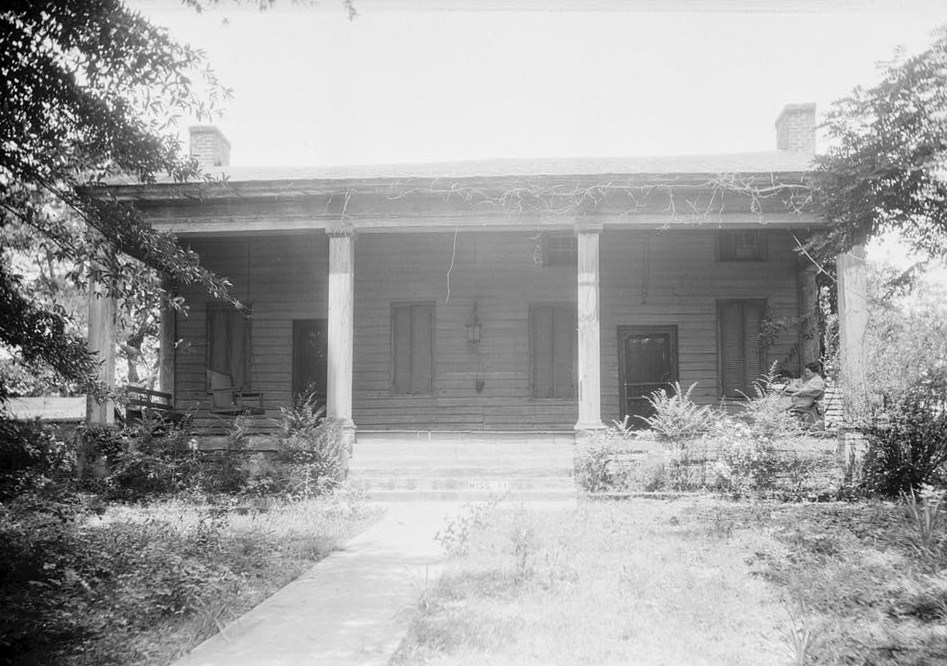
33°29′17″N 88°25′52″W / 33.488056°N 88.431111°WColumbus 12 Hickory Sticks April 29, 1977 1206 N. 7th St.
33°30′32″N 88°25′31″W / 33.508889°N 88.425278°WColumbus 13 James Creek No. 1 Site May 23, 1978 Address Restricted Columbus 14 Jones-Banks-Leigh House October 31, 1985 824 8th St., N.
33°30′12″N 88°25′35″W / 33.503333°N 88.426389°WColumbus 15 S.D. Lee House 
May 6, 1971 314 N. 7th St.
33°29′54″N 88°25′32″W / 33.498333°N 88.425556°WColumbus 16 Lindamood Building of Palmer Home for Children June 24, 1993 912 11th Ave., S.
33°29′04″N 88°25′17″W / 33.484444°N 88.421389°WColumbus 17 MacKay Mound August 25, 1978 Address Restricted Columbus 18 Charles McLaran House 
December 12, 1976 514 2nd St., S.
33°29′24″N 88°25′54″W / 33.49°N 88.431667°WColumbus 19 Motley Slough Bridge November 16, 1988 Spans Motley Slough on Shaeffer's Chapel Rd.
33°26′21″N 88°31′08″W / 33.439167°N 88.518889°WColumbus 20 Mt. Pleasant Methodist Church July 5, 2007 2382 Wright Rd.
33°36′31″N 88°20′11″W / 33.608611°N 88.336389°WCaledonia 21 Old Fort House 
October 31, 1985 510 7th St., N.
33°30′00″N 88°25′34″W / 33.5°N 88.426111°WColumbus 22 Old St. Paul's Episcopal Church Rectory July 12, 1996 300 Main St.
33°29′40″N 88°25′49″W / 33.494444°N 88.430278°WColumbus 23 Owen-Richardson-Owen House March 7, 2007 1709 9th St., S.
33°28′37″N 88°25′20″W / 33.476944°N 88.422222°WColumbus 24 Plymouth April 22, 1980 Address Restricted Columbus 25 Rosedale 
June 24, 1994 1523 9th St., S.
33°28′49″N 88°25′15″W / 33.480278°N 88.420833°WColumbus 26 Sims-Brown House October 30, 1997 324 9th St., N.
33°29′56″N 88°25′25″W / 33.498889°N 88.423611°WColumbus 27 Snowdoun October 19, 1978 906 3rd Ave., N.
33°29′54″N 88°25′23″W / 33.498333°N 88.423056°WColumbus 28 South Columbus Historic District June 8, 1982 U.S. Route 82; also 1124 Main St.
33°28′27″N 88°25′18″W / 33.474167°N 88.421667°WColumbus 1124 Main represents a boundary increase of July 27, 2005 29 Sykes-Leigh House March 14, 1985 719-7th St., N.
33°30′08″N 88°25′40″W / 33.502222°N 88.427778°WColumbus 30 Symons House March 28, 1979 304 4th Ave., S.
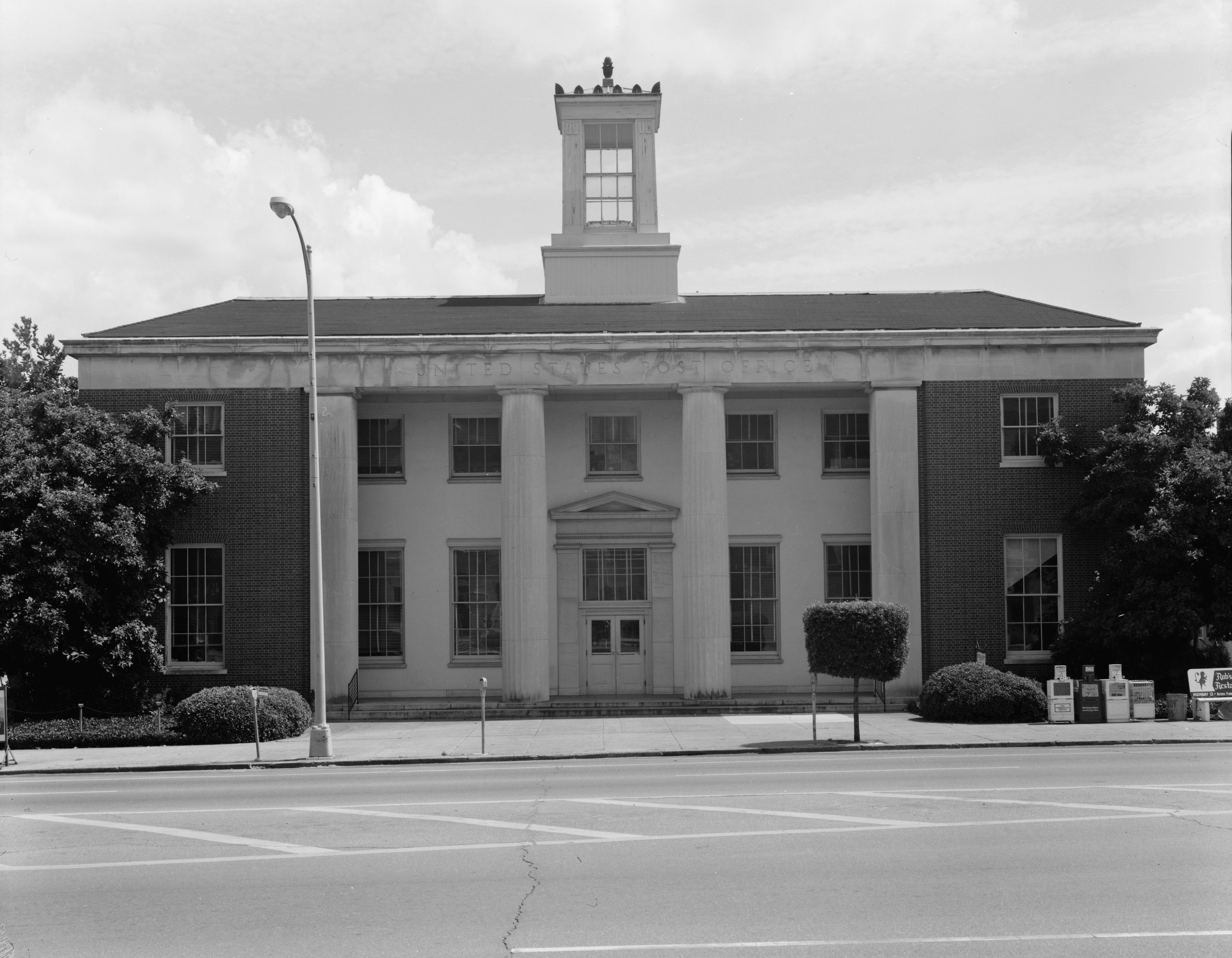
33°29′30″N 88°25′47″W / 33.491667°N 88.429722°WColumbus 31 U.S. Post Office 
April 21, 1983 524 Main St.
33°29′42″N 88°25′37″W / 33.495°N 88.426944°WColumbus 32 Waverly Bridge March 20, 1989 Spans the Tombigbee River on the Columbus and Greenville Railway
33°33′54″N 88°29′48″W / 33.565°N 88.496667°WColumbus Extends into Clay County 33 Weaver Place November 16, 1978 216 3rd Ave., S.
33°29′33″N 88°25′46″W / 33.4925°N 88.429444°WColumbus See also
- List of National Historic Landmarks in Mississippi
- National Register of Historic Places listings in Mississippi
References
- ^ The latitude and longitude information provided in this table was derived originally from the National Register Information System, which has been found to be fairly accurate for about 99% of listings. For about 1% of NRIS original coordinates, experience has shown that one or both coordinates are typos or otherwise extremely far off; some corrections may have been made. A more subtle problem causes many locations to be off by up to 150 yards, depending on location in the country: most NRIS coordinates were derived from tracing out latitude and longitudes off of USGS topographical quadrant maps created under the North American Datum of 1927, which differs from the current, highly accurate WGS84 GPS system used by Google maps. Chicago is about right, but NRIS longitudes in Washington are higher by about 4.5 seconds, and are lower by about 2.0 seconds in Maine. Latitudes differ by about 1.0 second in Florida. Some locations in this table may have been corrected to current GPS standards.
- ^ "National Register of Historic Places: Weekly List Actions". National Park Service, United States Department of the Interior. Retrieved on November 10, 2011.
- ^ Numbers represent an ordering by significant words. Various colorings, defined here, differentiate National Historic Landmark sites and National Register of Historic Places Districts from other NRHP buildings, structures, sites or objects.
- ^ "National Register Information System". National Register of Historic Places. National Park Service. . http://nrhp.focus.nps.gov/natreg/docs/All_Data.html.
U.S. National Register of Historic Places Topics Lists by states Alabama • Alaska • Arizona • Arkansas • California • Colorado • Connecticut • Delaware • Florida • Georgia • Hawaii • Idaho • Illinois • Indiana • Iowa • Kansas • Kentucky • Louisiana • Maine • Maryland • Massachusetts • Michigan • Minnesota • Mississippi • Missouri • Montana • Nebraska • Nevada • New Hampshire • New Jersey • New Mexico • New York • North Carolina • North Dakota • Ohio • Oklahoma • Oregon • Pennsylvania • Rhode Island • South Carolina • South Dakota • Tennessee • Texas • Utah • Vermont • Virginia • Washington • West Virginia • Wisconsin • WyomingLists by territories Lists by associated states Other Municipalities and communities of Lowndes County, Mississippi City 
Towns CDPs Unincorporated
communitiesBent Oak | Billups | Flint Hill | Forreston | Kolola Springs | Mayhew | McCrary | Penns | Plum Grove | Plymouth | Steens | Trinity | Wells | Whitebury | Woodlawn
Categories:- Lowndes County, Mississippi
- National Register of Historic Places in Mississippi by county
- Buildings and structures in Lowndes County, Mississippi
-


Wikimedia Foundation. 2010.