| [2] |
Landmark name[3] |
Image |
Date listed |
Location |
Summary |
| 1 |
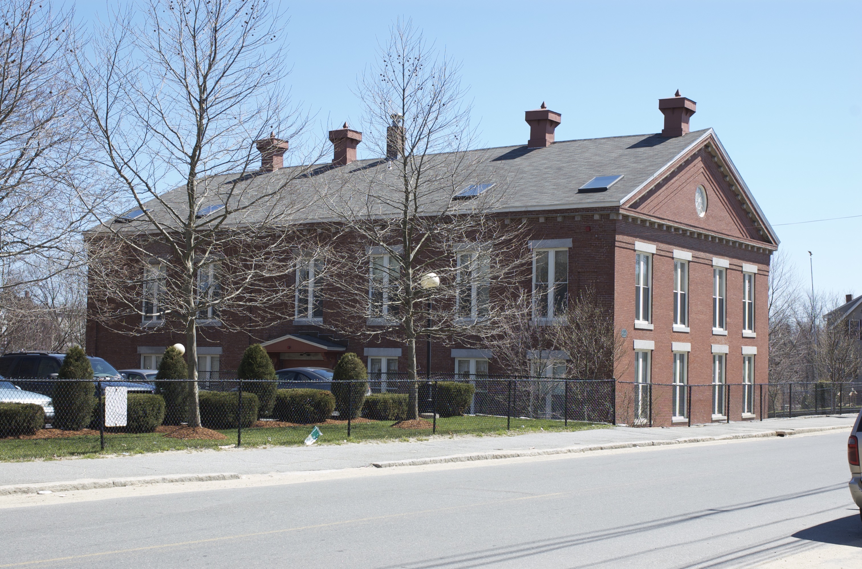
Allen House |
 |
01982-08-11 August 11, 1982 |
2 Solomont Way
42°38′33″N 71°20′12″W / 42.6425°N 71.33667°W / 42.6425; -71.33667 (Allen House) |
Listed at 57 Rolfe Street, now on the campus of University of Massachusetts Lowell. |
| 2 |
Andover Street Historic District |
 |
02000-06-02 June 2, 2000 |
245–834 Andover St., 569, 579 E. Merrimack St.
42°38′37″N 71°17′11″W / 42.64361°N 71.28639°W / 42.64361; -71.28639 (Andover Street Historic District) |
|
| 3 |
Belvidere Hill Historic District |
 |
01995-05-26 May 26, 1995 |
Fairview, Talbot and Summit Sts. and parts of Nesmith, Mansur and Fairmount Sts. and Belmont Ave.
42°38′17″N 71°17′34″W / 42.63806°N 71.29278°W / 42.63806; -71.29278 (Belvidere Hill Historic District) |
|
| 4 |
Jerathmell Bowers House |
 |
01994-01-28 January 28, 1994 |
150 Wood St.
42°37′50″N 71°21′19″W / 42.63056°N 71.35528°W / 42.63056; -71.35528 (Bowers, Jerathmell, House) |
|
| 5 |
Jonathan Bowers House |
 |
01976-06-18 June 18, 1976 |
58 Wannalancit St.
42°38′46″N 71°19′42″W / 42.64611°N 71.32833°W / 42.64611; -71.32833 (Bowers, Jonathan, House) |
|
| 6 |
Brown-Maynard House |
 |
01986-07-02 July 2, 1986 |
84 Tenth St.
42°39′16″N 71°17′58″W / 42.65444°N 71.29944°W / 42.65444; -71.29944 (Brown-Maynard House) |
|
| 7 |
Butler School |
 |
01995-02-02 February 2, 1995 |
812 Gorham St.
42°37′50″N 71°18′30″W / 42.63056°N 71.30833°W / 42.63056; -71.30833 (Butler School) |
|
| 8 |
Chelmsford Glass Works' Long House |
|
01973-01-25 January 25, 1973 |
139–141 Baldwin St.
42°38′02″N 71°20′57″W / 42.633943°N 71.34921°W / 42.633943; -71.34921 (Chelmsford Glass Works' Long House) |
|
| 9 |
City Hall Historic District |
 |
01975-04-21 April 21, 1975 |
Roughly area between Broadway and French Sts., Colburn St. and both sides of Kirk St.
42°38′46″N 71°18′48″W / 42.64611°N 71.31333°W / 42.64611; -71.31333 (City Hall Historic District) |
Boundary increase (added 1988-10-13): 165 Market St. |
| 10 |
Colburn School |
 |
01995-05-19 May 19, 1995 |
136 Lawrence St.
42°38′23″N 71°18′16″W / 42.63972°N 71.30444°W / 42.63972; -71.30444 (Colburn School) |
|
| 11 |
Flagg-Coburn House |
 |
01986-05-15 May 15, 1986 |
722 E. Merrimack St.
42°38′45″N 71°17′14″W / 42.64583°N 71.28722°W / 42.64583; -71.28722 (Flagg-Coburn House) |
|
| 12 |
Warren Fox Building |
 |
01989-10-12 October 12, 1989 |
190–196 Middlesex St.
42°38′26″N 71°18′45″W / 42.64056°N 71.3125°W / 42.64056; -71.3125 (Fox, Warren, Building) |
|
| 13 |
Grace Universalist Church |
|
02011-03-11 March 11, 2011 |
44 Princeton Boulevard
42°38′7″N 71°19′58″W / 42.63528°N 71.33278°W / 42.63528; -71.33278 (Grace Universalist Church) |
Now known as the St. George Hellenic Orthodox Church |
| 14 |
Holy Trinity Greek Orthodox Church |
 |
01977-04-13 April 13, 1977 |
62 Lewis St.
42°38′44″N 71°19′2″W / 42.64556°N 71.31722°W / 42.64556; -71.31722 (Holy Trinity Greek Orthodox Church) |
|
| 15 |
Howe Building |
 |
01989-10-12 October 12, 1989 |
208 Middlesex St.
42°38′26″N 71°18′46″W / 42.64056°N 71.31278°W / 42.64056; -71.31278 (Howe Building) |
|
| 16 |
Hoyt-Shedd Estate |
 |
01984-05-17 May 17, 1984 |
386–396 Andover St., 569–579 E. Merrimack St.
42°38′35″N 71°17′28″W / 42.64306°N 71.29111°W / 42.64306; -71.29111 (Hoyt-Shedd Estate) |
|
| 17 |
Lowell Cemetery |
 |
01998-05-20 May 20, 1998 |
984 Lawrence St.
42°37′40″N 71°17′42″W / 42.62778°N 71.295°W / 42.62778; -71.295 (Lowell Cemetery) |
|
| 18 |
Lowell Historic Preservation District |
 |
02001-01-19 January 19, 2001 |
Lowell area around Merrimack River |
|
| 19 |
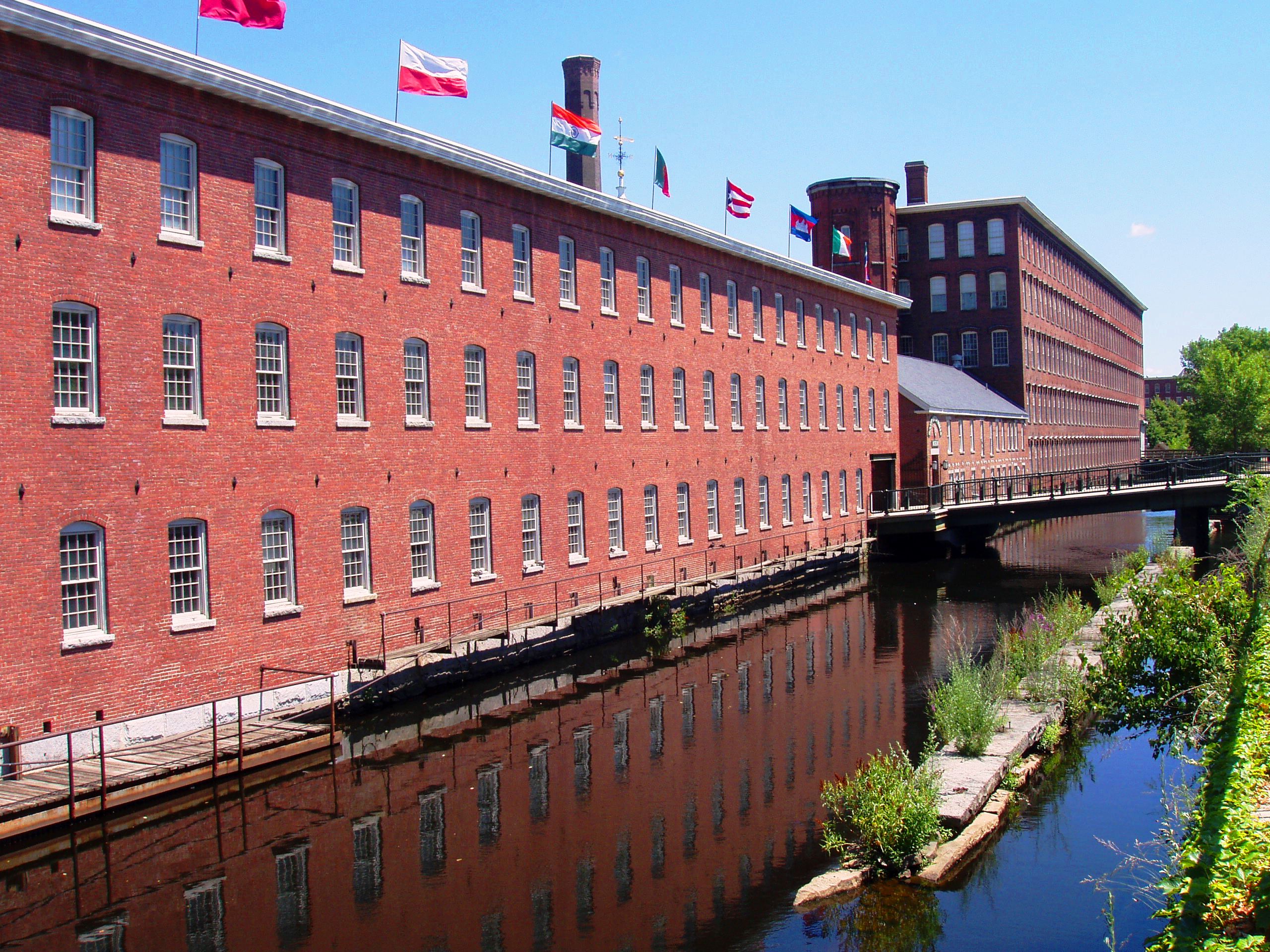
Lowell Locks and Canals Historic District |
 |
01976-08-13 August 13, 1976 |
Between Middlesex St. and the Merrimack River
42°38′44″N 71°19′12″W / 42.64556°N 71.32°W / 42.64556; -71.32 (Lowell Locks and Canals Historic District) |
National Historic Landmark |
| 20 |
Lowell National Historical Park |
 |
01978-06-05 June 5, 1978 |
Merrimack St.
42°38′47″N 71°19′11″W / 42.64639°N 71.31972°W / 42.64639; -71.31972 (Lowell National Historical Park) |
|
| 21 |
Lowell Post Office |
 |
02002-10-04 October 4, 2002 |
89 Appleton St.
42°38′28″N 71°18′34″W / 42.64111°N 71.30944°W / 42.64111; -71.30944 (Lowell Post Office) |
|
| 22 |
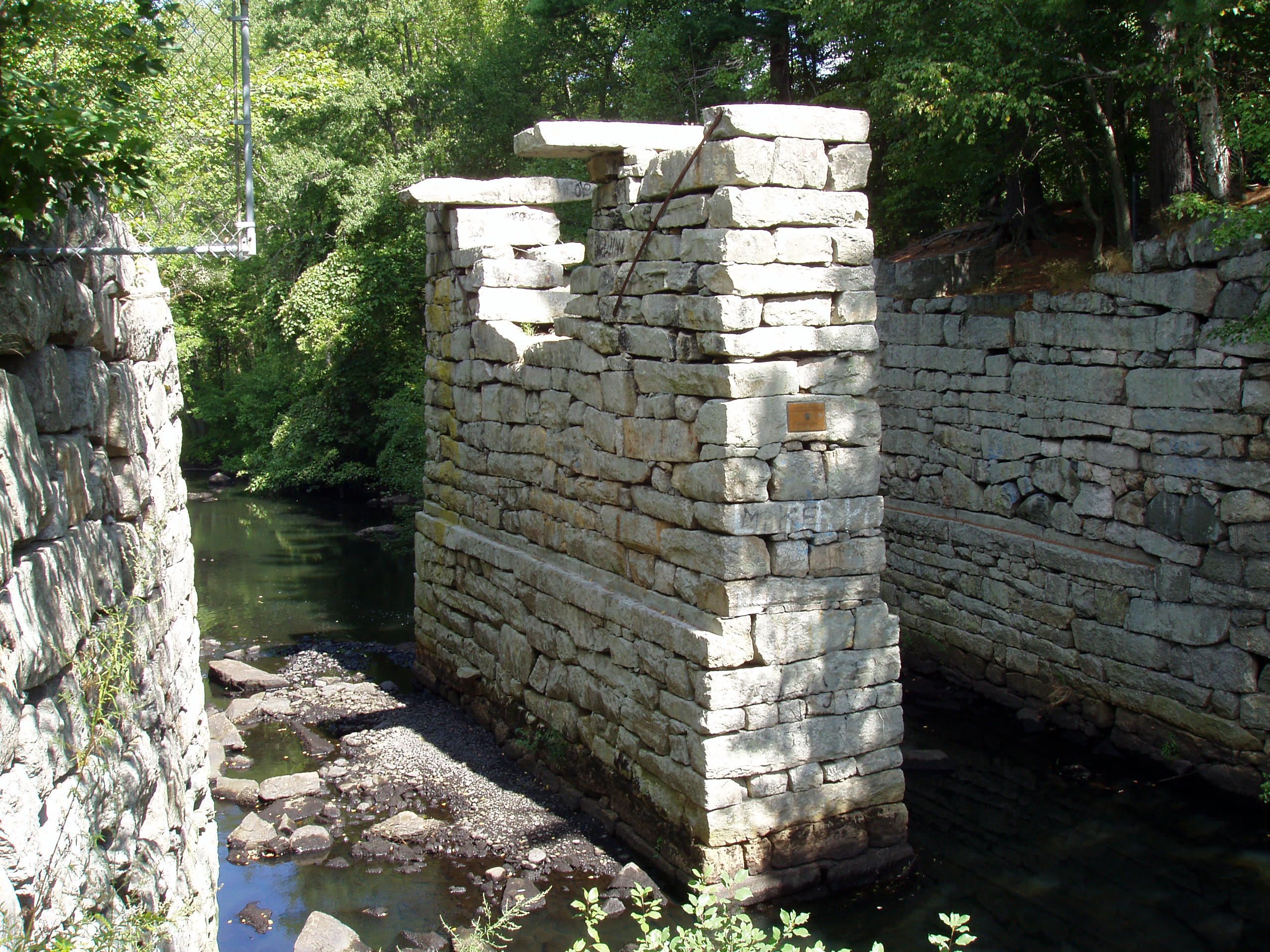
Middlesex Canal |
|
01972-08-21 August 21, 1972 |
Running SE between towns of Lowell and Woburn
42°38′16″N 71°21′02″W / 42.637842°N 71.350586°W / 42.637842; -71.350586 (Middlesex Canal (north end)) to 42°36′27″N 71°19′11″W / 42.607416°N 71.319855°W / 42.607416; -71.319855 (Middlesex Canal (south end of Lowell segment)) |
|
| 23 |
Middlesex Canal Historic and Archaeological District |
 |
02009-11-19 November 19, 2009 |
Numerous locations along the historic route of the Middlesex Canal |
Extends into Suffolk County; encompasses Middlesex Canal and other listings. |
| 24 |
Monarch Diner |
|
02003-11-28 November 28, 2003 |
246 Appleton St.
42°38′21″N 71°18′50″W / 42.63917°N 71.31389°W / 42.63917; -71.31389 (Monarch Diner) |
|
| 25 |
Musketaquid Mills |
 |
01999-12-09 December 9, 1999 |
131 Davidson St.
42°38′37″N 71°18′16″W / 42.64361°N 71.30444°W / 42.64361; -71.30444 (Musketaquid Mills) |
|
| 26 |
Pawtucket Congregational Church |
 |
02007-03-21 March 21, 2007 |
15 Mammoth Rd.
42°39′2″N 71°19′56″W / 42.65056°N 71.33222°W / 42.65056; -71.33222 (Pawtucket Congregational Church) |
|
| 27 |
Rogers Fort Hill Park Historic District |
 |
01999-05-27 May 27, 1999 |
Roughly bounded by High St., Mansur St., Concord R., and Lowell Cemetery
42°38′6″N 71°17′47″W / 42.635°N 71.29639°W / 42.635; -71.29639 (Rogers Fort Hill Park Historic District) |
|
| 28 |
St. George Antiochian Orthodox Church |
 |
02008-06-10 June 10, 2008 |
61 Bowers St.
42°38′52.51″N 71°19′26.37″W / 42.6479194°N 71.3239917°W / 42.6479194; -71.3239917 (St. George Antiochian Orthodox Church) |
|
| 29 |
St. Joseph's Convent and School |
 |
02002-07-19 July 19, 2002 |
517 Moody St.
42°39′2″N 71°19′20″W / 42.65056°N 71.32222°W / 42.65056; -71.32222 (St. Joseph's Convent and School) |
|
| 30 |
Saint Joseph's Roman Catholic College for Boys |
 |
02010-02-24 February 24, 2010 |
760 Merrimack St.
42°38′56.23″N 71°19′13.5″W / 42.6489528°N 71.320417°W / 42.6489528; -71.320417 (Saint Joseph's Roman Catholic College for Boys) |
|
| 31 |
St. Patrick's Church |
 |
01985-01-03 January 3, 1985 |
284 Suffolk St.
42°38′43″N 71°19′03″W / 42.645292°N 71.317517°W / 42.645292; -71.317517 (St. Patrick's Church) |
|
| 32 |
South Common Historic District |
 |
01982-08-10 August 10, 1982 |
Roughly bounded by Summer, Gorham, Horndike, and Highland Sts.
42°38′13″N 71°18′41″W / 42.63694°N 71.31139°W / 42.63694; -71.31139 (South Common Historic District) |
|
| 33 |
Tyler Park Historic District |
|
01989-08-17 August 17, 1989 |
Roughly bounded by Princeton, Foster, and Pine Sts.
42°37′52″N 71°20′27″W / 42.63111°N 71.34083°W / 42.63111; -71.34083 (Tyler Park Historic District) |
|
| 34 |
US Post Office |
 |
01986-03-10 March 10, 1986 |
50 Kearny Sq.
42°38′43″N 71°18′24″W / 42.64528°N 71.30667°W / 42.64528; -71.30667 (US Post Office) |
Renamed the F. Bradford Morse Federal Building in 2006.[4] |
| 35 |
Varnum Building |
 |
01988-12-19 December 19, 1988 |
401–405 Bridge St.
42°39′1″N 71°18′14″W / 42.65028°N 71.30389°W / 42.65028; -71.30389 (Varnum Building) |
Demolished after fire |
| 36 |
Varnum School |
 |
01995-01-24 January 24, 1995 |
103 Sixth St.
42°39′4″N 71°17′58″W / 42.65111°N 71.29944°W / 42.65111; -71.29944 (Varnum School) |
|
| 37 |
Wamesit Canal-Whipple Mill Industrial Complex |
 |
01982-08-11 August 11, 1982 |
576 Lawrence St.
42°37′57″N 71°18′3″W / 42.6325°N 71.30083°W / 42.6325; -71.30083 (Wamesit Canal-Whipple Mill Industrial Complex) |
|
| 38 |
Wannalancit Street Historic District |
 |
01998-05-20 May 20, 1998 |
14–71 Wannalancit St., and 390, 406 Pawtucket St.
42°38′48″N 71°19′46″W / 42.64667°N 71.32944°W / 42.64667; -71.32944 (Wannalancit Street Historic District) |
|
| 39 |
Washington Square Historic District |
 |
01982-08-11 August 11, 1982 |
Roughly bounded by Merrimack, Park, Andover, Oak, Harrison, and Willow Sts.
42°38′35″N 71°17′54″W / 42.64306°N 71.29833°W / 42.64306; -71.29833 (Washington Square Historic District) |
Boundary increase (added 1999-11-12): 140-160 Andover St. |
| 40 |
Wilder Street Historic District |
|
01995-05-26 May 26, 1995 |
284–360 Wilder St.
42°38′11″N 71°19′56″W / 42.63639°N 71.33222°W / 42.63639; -71.33222 (Wilder Street Historic District) |
|
| 41 |
Worcester House |
 |
01983-12-22 December 22, 1983 |
658 Andover St.
42°38′42″N 71°16′50″W / 42.645°N 71.28056°W / 42.645; -71.28056 (Worcester House) |
|