|
Landmark name |
Image |
Date listed |
Location |
Summary |
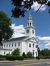
| 1 |
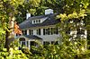
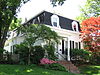
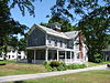
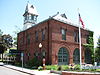
Ace Art Company |
|
01985-02-01 February 1, 1985 |
24 Gould St.
42°31′20″N 71°6′21″W / 42.52222°N 71.10583°W / 42.52222; -71.10583 (Ace Art Company) |
|
| 2 |
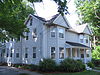
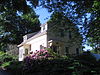
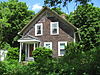
Joseph Bancroft House |
|
01984-07-19 July 19, 1984 |
101 Lowell St.
42°31′41″N 71°6′32″W / 42.52806°N 71.10889°W / 42.52806; -71.10889 (Bancroft, Joseph, House) |
|
| 3 |
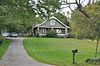
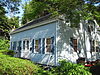
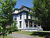
Samuel Bancroft House |
|
01984-07-19 July 19, 1984 |
232 West St.
42°31′07″N 71°07′13″W / 42.518644°N 71.12017°W / 42.518644; -71.12017 (Bancroft, Samuel, House) |
|
| 4 |
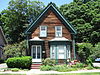
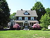
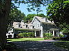
Wendell Bancroft House |
 |
01984-07-19 July 19, 1984 |
20 Washington St.
42°31′20″N 71°6′39″W / 42.52222°N 71.11083°W / 42.52222; -71.11083 (Bancroft, Wendell, House) |
|
| 5 |
Edwin Bassett House |
 |
01984-07-19 July 19, 1984 |
115 Prescott St.
42°31′08″N 71°06′52″W / 42.51877°N 71.114398°W / 42.51877; -71.114398 (Bassett, Edwin, House) |
|
| 6 |
Batchelder House |
|
01984-07-19 July 19, 1984 |
607 Pearl St.
42°33′13″N 71°6′6″W / 42.55361°N 71.10167°W / 42.55361; -71.10167 (Batchelder House) |
|
| 7 |
Alden Batchelder House |
|
01984-07-19 July 19, 1984 |
797 Main St.
42°31′42″N 71°6′11″W / 42.52833°N 71.10306°W / 42.52833; -71.10306 (Batchelder, Alden, House) |
|
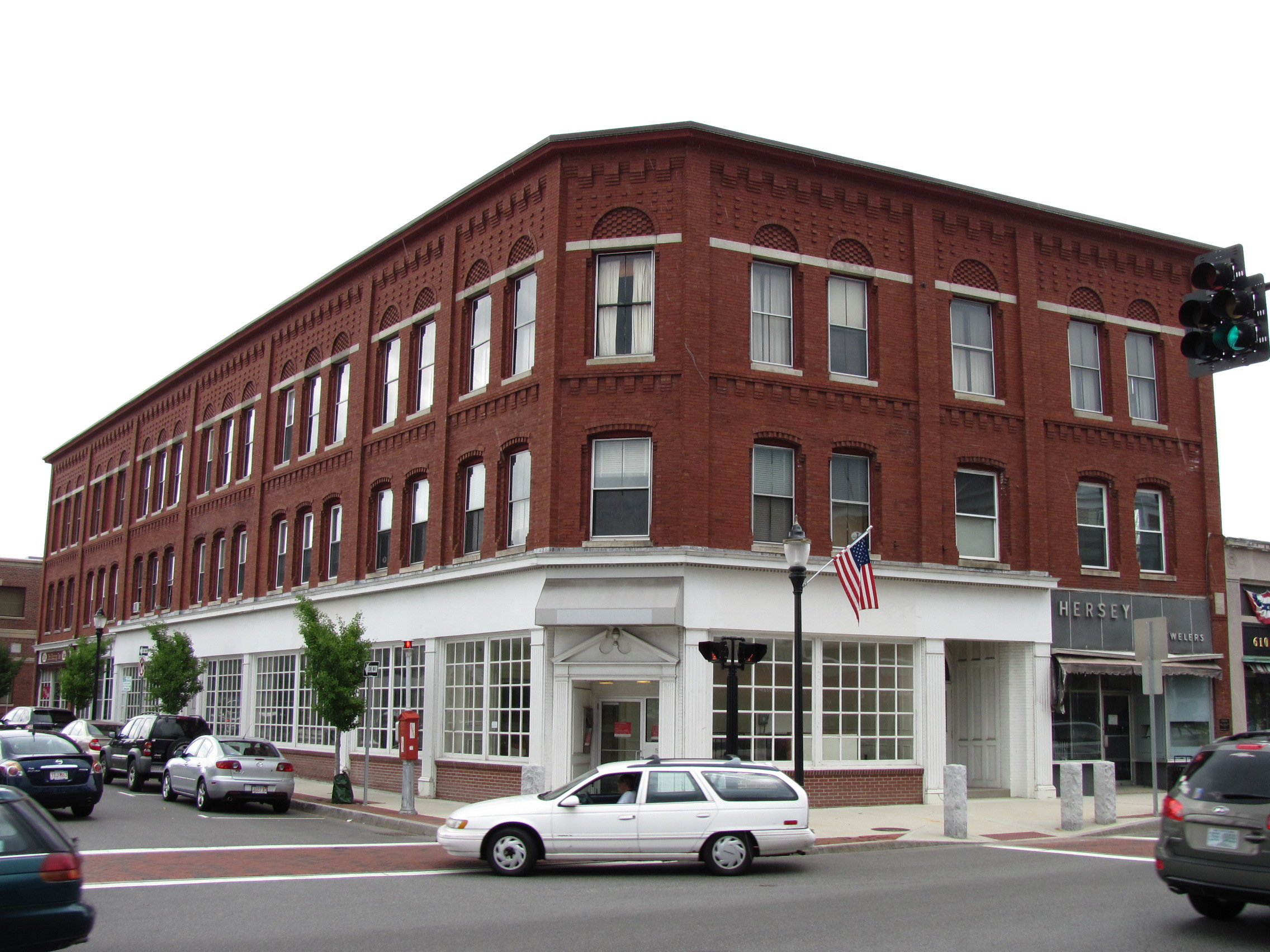
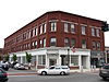
| 8 |
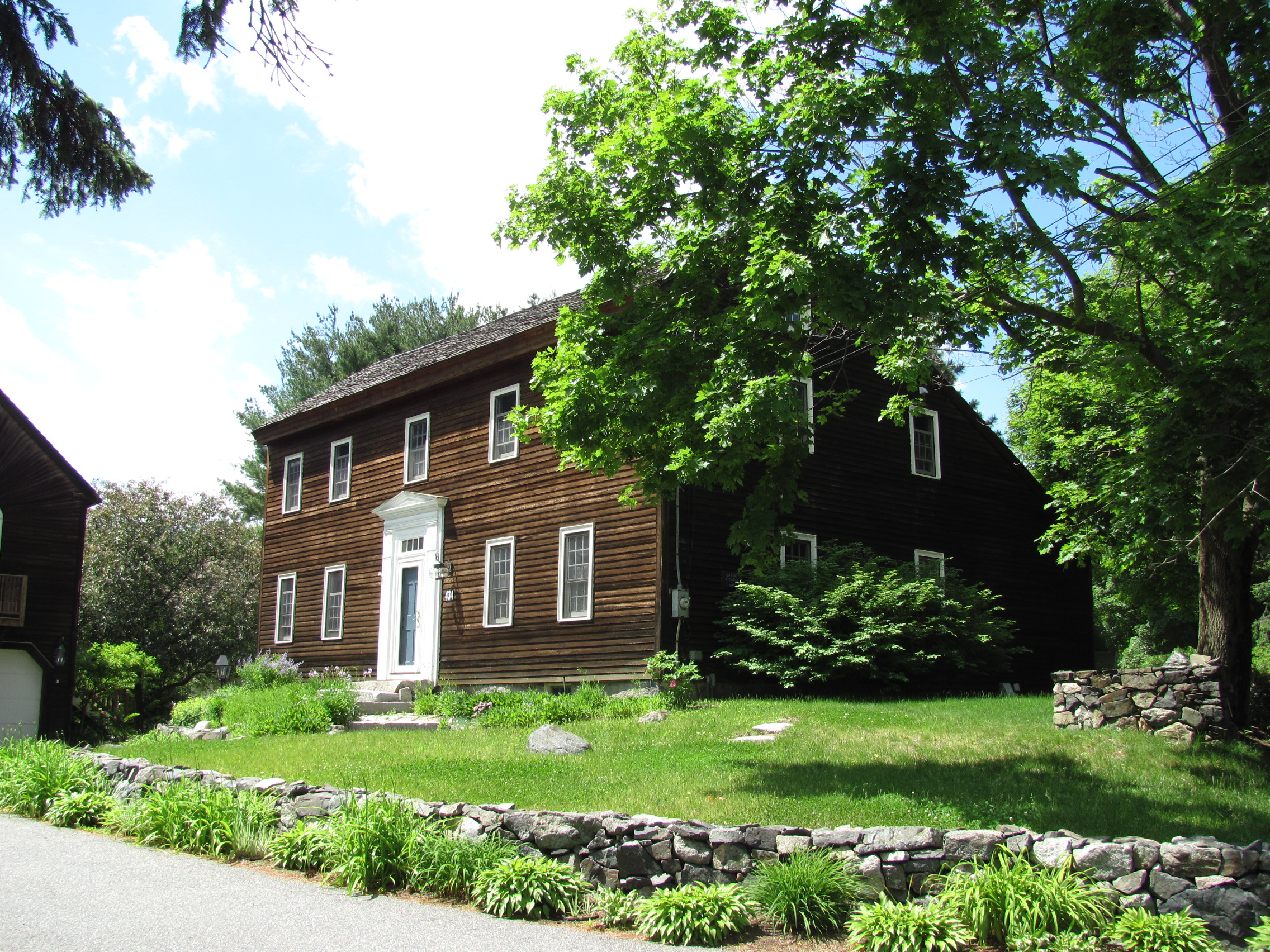
George Batchelder House |
|
01984-07-19 July 19, 1984 |
127-129 Franklin St.
42°33′15″N 71°6′18″W / 42.55417°N 71.105°W / 42.55417; -71.105 (Batchelder, George, House) |
|
| 9 |
Nathaniel Batchelder House |
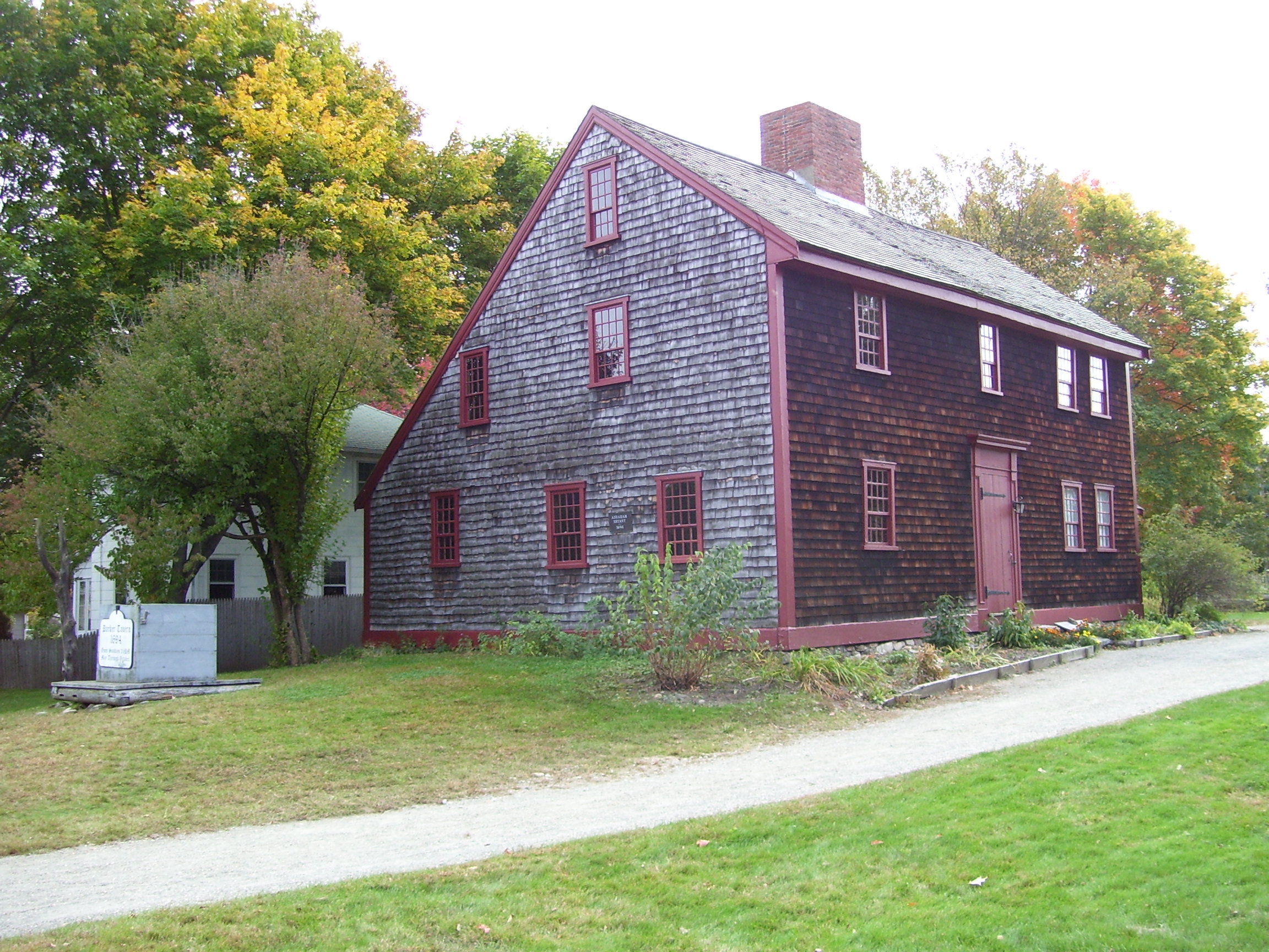
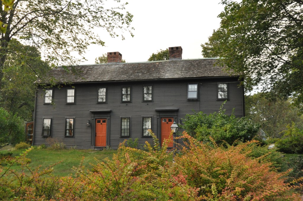
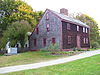
|
01984-07-19 July 19, 1984 |
71 Franklin St.
42°33′15″N 71°6′3″W / 42.55417°N 71.10083°W / 42.55417; -71.10083 (Batchelder, Nathaniel, House) |
|
| 10 |
Battell House |
|
01984-07-19 July 19, 1984 |
293 Haverhill St.
42°32′21″N 71°5′18″W / 42.53917°N 71.08833°W / 42.53917; -71.08833 (Battell House) |
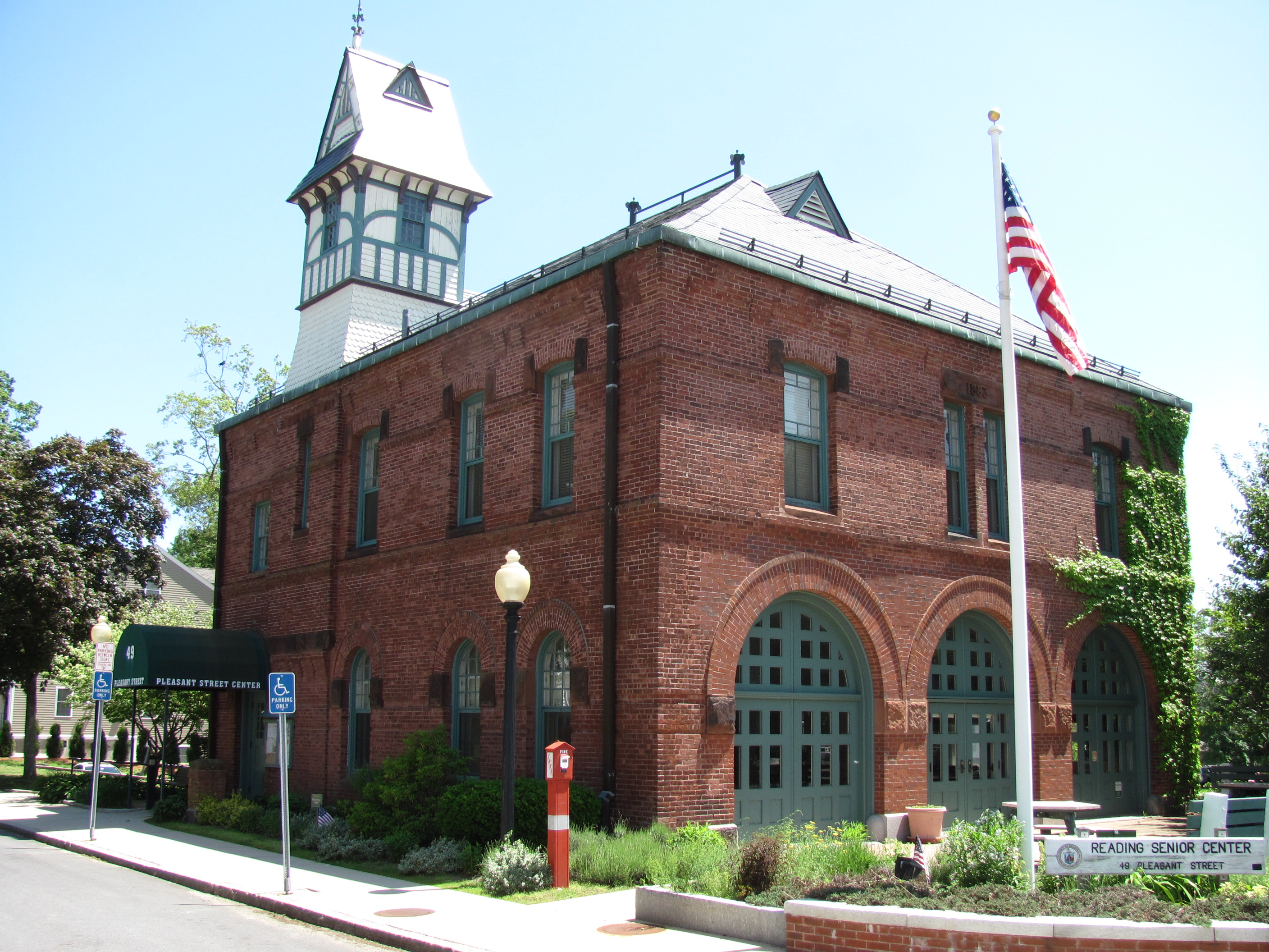
|
| 11 |
Benjamin Beard House |
|
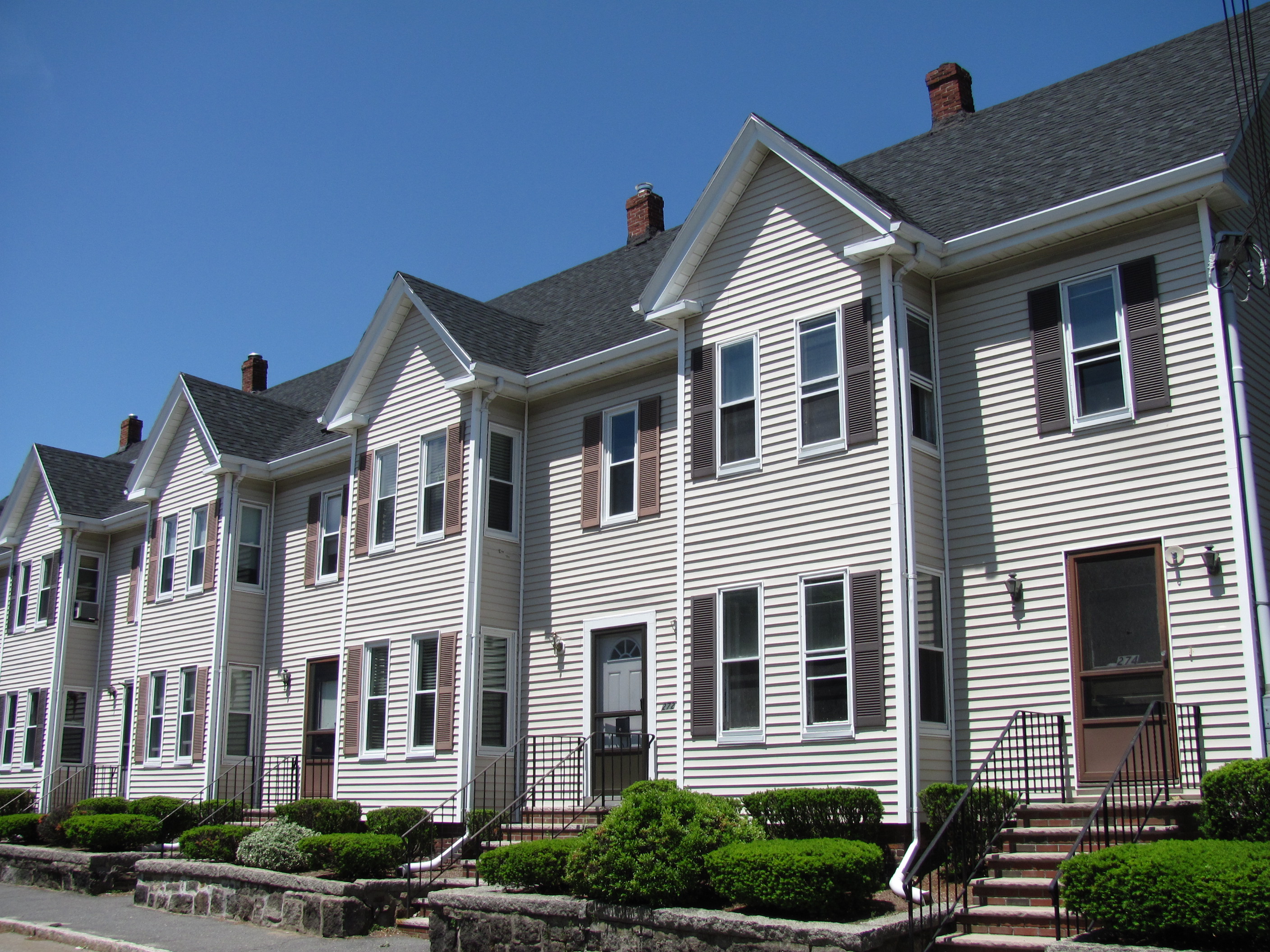
01984-07-19 July 19, 1984 |
251 Ash St.
42°31′00″N 71°06′03″W / 42.516777°N 71.100837°W / 42.516777; -71.100837 (Beard, Benjamin, House) |
|
| 12 |
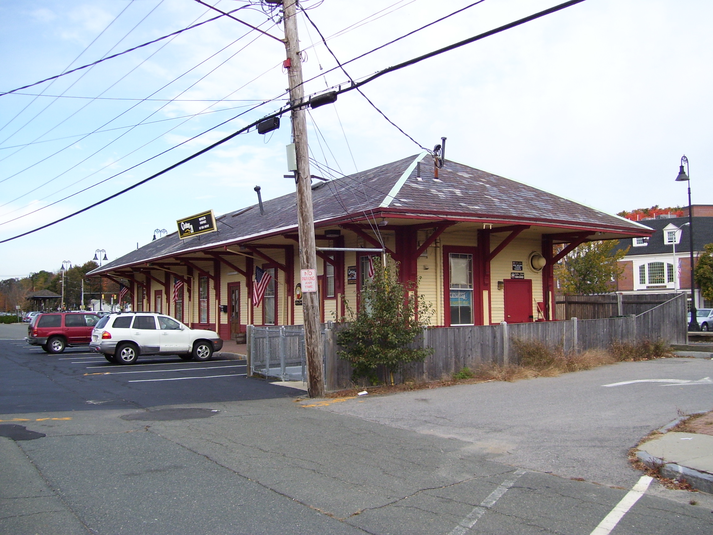
Boston and Maine Railroad Depot |
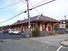 |
01984-07-19 July 19, 1984 |
Lincoln St.
42°31′17″N 71°6′29″W / 42.52139°N 71.10806°W / 42.52139; -71.10806 (Boston and Maine Railroad Depot) |
|
| 13 |
Bowser Gazebo |
|
01984-07-19 July 19, 1984 |
25 Linden St.
42°31′28″N 71°06′20″W / 42.5244°N 71.105622°W / 42.5244; -71.105622 (Bowser Gazebo) |
|
| 14 |
Brackett House |
 |
01984-07-19 July 19, 1984 |
276 Summer Ave.
42°31′4″N 71°6′52″W / 42.51778°N 71.11444°W / 42.51778; -71.11444 (Brackett House) |
|
| 15 |
Brande House |
 |
01984-07-29 July 29, 1984 |
54 Woburn St.
42°31′26″N 71°6′23″W / 42.52389°N 71.10639°W / 42.52389; -71.10639 (Brande House) |
|
| 16 |
Francis Brooks House |
 |
01984-07-19 July 19, 1984 |
78-80 Prescott St.
42°31′10″N 71°06′43″W / 42.51945°N 71.111931°W / 42.51945; -71.111931 (Brooks, Francis, House) |
|
| 17 |
Carroll-Hartshorn House |
|
01984-07-19 July 19, 1984 |
572 Haverhill St.
42°33′2″N 71°5′49″W / 42.55056°N 71.09694°W / 42.55056; -71.09694 (Carroll-Hartshorn House) |
|
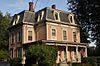
| 18 |
Carter Mansion |
 |
01984-07-19 July 19, 1984 |
89 Woburn St.
42°31′24″N 71°6′31″W / 42.52333°N 71.10861°W / 42.52333; -71.10861 (Carter Mansion) |
|
| 19 |
Gilman Coggin House |
|
01984-07-19 July 19, 1984 |
123 Prescott St.
42°31′07″N 71°06′53″W / 42.518533°N 71.114763°W / 42.518533; -71.114763 (Coggin, Gilman, House) |
|
| 20 |
Common Historic District |
 |
01985-02-01 February 1, 1985 |
Roughly bounded by Main, Highland, and Federal Sts.
42°31′37″N 71°6′15″W / 42.52694°N 71.10417°W / 42.52694; -71.10417 (Common Historic District) |
|
| 21 |
Asa M. Cook House |
 |
01984-07-19 July 19, 1984 |
81 Prospect St.
42°31′24″N 71°07′10″W / 42.523246°N 71.11957°W / 42.523246; -71.11957 (Cook, Asa M., House) |
|
| 22 |
Joseph Damon House |
 |
01984-07-19 July 19, 1984 |
178 South St.
42°30′18″N 71°6′59″W / 42.505°N 71.11639°W / 42.505; -71.11639 (Damon, Joseph, House) |
|
| 23 |
Washington Damon House |
 |
01984-07-19 July 19, 1984 |
38 Salem St.
42°31′35″N 71°6′5″W / 42.52639°N 71.10139°W / 42.52639; -71.10139 (Damon, Washington, House) |
|
| 24 |
Dewey Place |
|
01984-07-19 July 19, 1984 |
176 Summer Ave.
42°31′21″N 71°07′02″W / 42.522408°N 71.117166°W / 42.522408; -71.117166 (Dewey Place) |
|
| 25 |
Durgin House |
 |
01984-07-19 July 19, 1984 |
66 Prospect St.
42°31′20″N 71°7′12″W / 42.52222°N 71.12°W / 42.52222; -71.12 (Durgin House) |
|
| 26 |
Eaton-Prescott House |
 |
01984-07-19 July 19, 1984 |
284 Summer Ave.
42°31′3″N 71°6′52″W / 42.5175°N 71.11444°W / 42.5175; -71.11444 (Eaton-Prescott House) |
|
| 27 |
Luther Elliott House |
|
01984-07-19 July 19, 1984 |
309 Haven St.
42°31′24″N 71°06′03″W / 42.523388°N 71.100794°W / 42.523388; -71.100794 (Elliott, Luther, House) |
|
| 28 |
Samuel Foster House |
|
01990-03-09 March 9, 1990 |
288 Grove St.
42°32′31″N 71°7′37″W / 42.54194°N 71.12694°W / 42.54194; -71.12694 (Foster, Samuel, House) |
|
| 29 |
Stephen Hall House |
|
01984-07-19 July 19, 1984 |
64 Minot St.
42°31′12″N 71°06′20″W / 42.519956°N 71.105579°W / 42.519956; -71.105579 (Hall, Stephen, House) |
|
| 30 |
Harnden-Browne House |
 |
01985-02-01 February 1, 1985 |
60-62 Salem St.
42°31′36″N 71°05′59″W / 42.526567°N 71.099635°W / 42.526567; -71.099635 (Harnden-Browne House) |
|
| 31 |
Timothy Hartshorn House |
|
01984-07-19 July 19, 1984 |
379 Haverhill St.
42°32′35″N 71°5′22″W / 42.54306°N 71.08944°W / 42.54306; -71.08944 (Hartshorn, Timothy, House) |
|
| 32 |
Hartwell House |
 |
01984-07-19 July 19, 1984 |
121 Willow St.
42°31′49″N 71°7′25″W / 42.53028°N 71.12361°W / 42.53028; -71.12361 (Hartwell House) |
|
| 33 |
Haverhill Street Milestone |
|
01985-02-01 February 1, 1985 |
Haverhill St.
42°32′18″N 71°05′14″W / 42.53822°N 71.087344°W / 42.53822; -71.087344 (Haverhill Street Milestone) |
|
| 34 |
Highland School |
 |
01984-07-19 July 19, 1984 |
64 Middlesex Ave.
42°31′33″N 71°6′39″W / 42.52583°N 71.11083°W / 42.52583; -71.11083 (Highland School) |
|
| 35 |
House at 11 Beach Street |
|
01984-07-19 July 19, 1984 |
11 Beach St.
42°31′18″N 71°05′41″W / 42.521696°N 71.094636°W / 42.521696; -71.094636 (House at 11 Beach Street) |
|
| 36 |
House at 26 Center Avenue |
|
01984-07-19 July 19, 1984 |
26 Center Ave.
42°31′5″N 71°6′25″W / 42.51806°N 71.10694°W / 42.51806; -71.10694 (House at 26 Center Avenue) |
|
| 37 |
House at 322 Haven Street |
 |
01984-07-19 July 19, 1984 |
322 Haven St.
42°31′24″N 71°6′5″W / 42.52333°N 71.10139°W / 42.52333; -71.10139 (House at 322 Haven Street) |
|
| 38 |
House at 129 High Street |
|
01984-07-19 July 19, 1984 |
129 High St.
42°31′27″N 71°6′42″W / 42.52417°N 71.11167°W / 42.52417; -71.11167 (House at 129 High Street) |
|
| 39 |
House at 77 Howard Street |
|
01984-07-19 July 19, 1984 |
77 Howard St.
42°30′56″N 71°07′08″W / 42.515686°N 71.118754°W / 42.515686; -71.118754 (House at 77 Howard Street) |
|
| 40 |
House at 1177 Main Street |
|
01984-07-19 July 19, 1984 |
1177 Main St.
42°32′47″N 71°6′16″W / 42.54639°N 71.10444°W / 42.54639; -71.10444 (House at 1177 Main Street) |
|
| 41 |
House at 16 Mineral Street |
 |
01984-07-19 July 19, 1984 |
16 Mineral St.
42°31′33″N 71°6′53″W / 42.52583°N 71.11472°W / 42.52583; -71.11472 (House at 16 Mineral Street) |
|
| 42 |
House at 42 Salem Street |
 |
01984-07-19 July 19, 1984 |
42 Salem St.
42°31′35″N 71°06′02″W / 42.52644°N 71.100578°W / 42.52644; -71.100578 (House at 42 Salem Street) |
|
| 43 |
House at 79-81 Salem Street |
 |
01984-07-19 July 19, 1984 |
79-81 Salem St.
42°31′35″N 71°5′56″W / 42.52639°N 71.09889°W / 42.52639; -71.09889 (House at 79-81 Salem Street) |
|
| 44 |
House at 199 Summer Avenue |
 |
01984-07-19 July 19, 1984 |
199 Summer Ave.
42°31′16″N 71°07′01″W / 42.521095°N 71.116844°W / 42.521095; -71.116844 (House at 199 Summer Avenue) |
|
| 45 |
House at 242 Summer Avenue |
 |
01984-07-19 July 19, 1984 |
242 Summer Ave.
42°31′10″N 71°6′56″W / 42.51944°N 71.11556°W / 42.51944; -71.11556 (House at 242 Summer Avenue) |
|
| 46 |
House at 483 Summer Avenue |
 |
01984-07-19 July 19, 1984 |
483 Summer Ave.
42°30′38″N 71°6′21″W / 42.51056°N 71.10583°W / 42.51056; -71.10583 (House at 483 Summer Avenue) |
|
| 47 |
House at 44 Temple Street |
 |
01984-07-19 July 19, 1984 |
44 Temple St.
42°31′17″N 71°6′55″W / 42.52139°N 71.11528°W / 42.52139; -71.11528 (House at 44 Temple Street) |
|
| 48 |
House at 206 West Street |
|
01984-07-19 July 19, 1984 |
206 West St.
42°31′03″N 71°07′11″W / 42.517473°N 71.119655°W / 42.517473; -71.119655 (House at 206 West Street) |
|
| 49 |
House at 57 Woburn Street |
 |
01984-07-19 July 19, 1984 |
57 Woburn St.
42°31′27″N 71°06′22″W / 42.524289°N 71.106008°W / 42.524289; -71.106008 (House at 57 Woburn Street) |
|
| 50 |
Kemp Barn |
 |
01984-07-19 July 19, 1984 |
186 Summer Ave.
42°31′19″N 71°7′1″W / 42.52194°N 71.11694°W / 42.52194; -71.11694 (Kemp Barn) |
|
| 51 |
Kemp Place |
 |
01984-07-19 July 19, 1984 |
186 Summer Ave.
42°31′17″N 71°7′2″W / 42.52139°N 71.11722°W / 42.52139; -71.11722 (Kemp Place) |
|
| 52 |
Lewis House |
|
01984-07-19 July 19, 1984 |
276 Woburn St.
42°31′08″N 71°07′05″W / 42.51896°N 71.118003°W / 42.51896; -71.118003 (Lewis House) |
|
| 53 |
Charles Manning House |
|
01984-07-19 July 19, 1984 |
145 Salem St.
42°31′36″N 71°5′42″W / 42.52667°N 71.095°W / 42.52667; -71.095 (Manning, Charles, House) |
|
| 54 |
Jacob Manning House |
|
01984-07-19 July 19, 1984 |
140 High St.
42°31′30″N 71°06′44″W / 42.524906°N 71.112295°W / 42.524906; -71.112295 (Manning, Jacob, House) |
|
| 55 |
Masonic Block |
 |
01984-09-19 September 19, 1984 |
600-622 Main St.
42°31′25″N 71°06′11″W / 42.52372°N 71.103004°W / 42.52372; -71.103004 (Masonic Block) |
|
| 56 |
Daniel Nichols Homestead |
 |
01984-07-19 July 19, 1984 |
434 Haverhill St.
42°32′43″N 71°5′28″W / 42.54528°N 71.09111°W / 42.54528; -71.09111 (Nichols, Daniel, Homestead) |
|
| 57 |
James Nichols House |
|
01984-07-19 July 19, 1984 |
273 Pearl St.
42°32′21″N 71°6′2″W / 42.53917°N 71.10056°W / 42.53917; -71.10056 (Nichols, James, House) |
|
| 58 |
Jerry Nichols Tavern |
|
01984-07-19 July 19, 1984 |
51 Mill St.
42°33′37″N 71°06′29″W / 42.560304°N 71.107939°W / 42.560304; -71.107939 (Nichols, Jerry, Tavern) |
|
| 59 |
Richard Nichols House |
|
01984-07-19 July 19, 1984 |
483 Franklin St.
42°32′41″N 71°07′14″W / 42.544655°N 71.120685°W / 42.544655; -71.120685 (Nichols, Richard, House) |
|
| 60 |
Octagon House |
|
01984-07-19 July 19, 1984 |
97 Pleasant St.
42°31′26″N 71°6′3″W / 42.52389°N 71.10083°W / 42.52389; -71.10083 (Octagon House) |
|
| 61 |
Old Hose House |
|
01984-07-19 July 19, 1984 |
1249 Main St.
42°33′0″N 71°6′17″W / 42.55°N 71.10472°W / 42.55; -71.10472 (Old Hose House) |
|
| 62 |
Parker House |
 |
01984-07-19 July 19, 1984 |
52 Salem St.
42°31′35″N 71°06′01″W / 42.52644°N 71.10015°W / 42.52644; -71.10015 (Parker House (Salem Street)) |
|
| 63 |
Parker House |
|
01984-07-19 July 19, 1984 |
316 Haven St.
42°31′24″N 71°06′03″W / 42.523372°N 71.10073°W / 42.523372; -71.10073 (Parker House (Haven Street)) |
|
| 64 |
Parker Tavern |
 |
01975-08-19 August 19, 1975 |
103 Washington St.
42°31′15″N 71°06′24″W / 42.520763°N 71.106716°W / 42.520763; -71.106716 (Parker Tavern) |
|
| 65 |
Capt. Nathaniel Parker Red House |
|
01984-07-19 July 19, 1984 |
77-83 Ash St.
42°31′20″N 71°6′16″W / 42.52222°N 71.10444°W / 42.52222; -71.10444 (Parker, Capt. Nathaniel, Red House) |
|
| 66 |
Joseph Parker House |
|
01984-07-19 July 19, 1984 |
107 Grove St.
42°32′12″N 71°07′15″W / 42.536592°N 71.120771°W / 42.536592; -71.120771 (Parker, Joseph, House) |
|
| 67 |
Samuel Parker House |
 |
01984-07-19 July 19, 1984 |
132 West St.
42°30′50″N 71°7′17″W / 42.51389°N 71.12139°W / 42.51389; -71.12139 (Parker, Samuel, House) |
|
| 68 |
Stillman Parker House |
 |
01984-07-19 July 19, 1984 |
484 Summer Ave.
42°30′39″N 71°6′20″W / 42.51083°N 71.10556°W / 42.51083; -71.10556 (Parker, Stillman, House) |
|
| 69 |
William Parker House |
 |
01984-07-19 July 19, 1984 |
55 Walnut St.
42°30′35″N 71°06′29″W / 42.509802°N 71.107918°W / 42.509802; -71.107918 (Parker, William, House) |
|
| 70 |
Pearl Street School |
|
01997-05-30 May 30, 1997 |
75 Pearl St.
42°31′50″N 71°5′56″W / 42.53056°N 71.09889°W / 42.53056; -71.09889 (Pearl Street School) |
|
| 71 |
Pierce House |
|
01984-07-19 July 19, 1984 |
128 Salem St.
42°31′38″N 71°5′46″W / 42.52722°N 71.09611°W / 42.52722; -71.09611 (Pierce House) |
|
| 72 |
Pierce Organ Pipe Factory |
|
01984-07-19 July 19, 1984 |
10-12 Pierce St.
42°31′40″N 71°05′44″W / 42.527721°N 71.09558°W / 42.527721; -71.09558 (Pierce Organ Pipe Factory) |
|
| 73 |
Pratt House |
|
01984-07-19 July 19, 1984 |
456 Haverhill St.
42°32′46″N 71°5′31″W / 42.54611°N 71.09194°W / 42.54611; -71.09194 (Pratt House) |
|
| 74 |
Stillman Pratt House |
 |
01984-07-19 July 19, 1984 |
472 Summer Ave.
42°30′40″N 71°6′22″W / 42.51111°N 71.10611°W / 42.51111; -71.10611 (Pratt, Stillman, House) |
|
| 75 |
Reading Municipal Building |
 |
01984-07-19 July 19, 1984 |
49 Pleasant St.
42°31′26″N 71°6′7″W / 42.52389°N 71.10194°W / 42.52389; -71.10194 (Reading Municipal Building) |
|
| 76 |
Reading Municipal Light and Power Station |
|
01984-07-19 July 19, 1984 |
226 Ash St.
42°31′5″N 71°6′5″W / 42.51806°N 71.10139°W / 42.51806; -71.10139 (Reading Municipal Light and Power Station) |
|
| 77 |
Reading Standpipe |
|
01985-02-01 February 1, 1985 |
Auburn and Beacon Sts.
42°31′52″N 71°6′21″W / 42.53111°N 71.10583°W / 42.53111; -71.10583 (Reading Standpipe) |
|
| 78 |
Roberts House |
|
01984-07-19 July 19, 1984 |
59 Prospect St.
42°31′20″N 71°07′08″W / 42.522344°N 71.118861°W / 42.522344; -71.118861 (Roberts House) |
|
| 79 |
Rowhouses at 256-274 Haven Street |
 |
01984-07-19 July 19, 1984 |
256-274 Haven St.
42°31′25″N 71°06′07″W / 42.523499°N 71.101888°W / 42.523499; -71.101888 (Rowhouses at 256-274 Haven Street) |
|
| 80 |
Rev. Peter Sanborn House |
|
01984-07-19 July 19, 1984 |
55 Lowell St.
42°31′37″N 71°6′23″W / 42.52694°N 71.10639°W / 42.52694; -71.10639 (Sanborn, Rev. Peter, House) |
|
| 81 |
Smith Shoe Shop |
 |
01985-02-01 February 1, 1985 |
273 Haverhill St.
42°32′19″N 71°05′13″W / 42.538521°N 71.086997°W / 42.538521; -71.086997 (Smith Shoe Shop) |
|
| 82 |
Thomas Symonds House |
|
01984-07-19 July 19, 1984 |
320 Haverhill St.
42°32′25″N 71°5′22″W / 42.54028°N 71.08944°W / 42.54028; -71.08944 (Symonds, Thomas, House) |
|
| 83 |
Joseph Temple House |
 |
01984-07-19 July 19, 1984 |
42 Chute St.
42°31′25″N 71°6′33″W / 42.52361°N 71.10917°W / 42.52361; -71.10917 (Temple, Joseph, House) |
|
| 84 |
Mark Temple House |
 |
01984-07-19 July 19, 1984 |
141 Summer Ave.
42°31′25″N 71°7′9″W / 42.52361°N 71.11917°W / 42.52361; -71.11917 (Temple, Mark, House) |
|
| 85 |
Walnut Street School |
 |
01984-07-19 July 19, 1984 |
55 Hopkins St.
42°30′31″N 71°6′25″W / 42.50861°N 71.10694°W / 42.50861; -71.10694 (Walnut Street School) |
|
| 86 |
Charles Wells House |
 |
01984-07-19 July 19, 1984 |
99 Prescott St.
42°31′9″N 71°6′51″W / 42.51917°N 71.11417°W / 42.51917; -71.11417 (Wells, Charles, House) |
|
| 87 |
Ephrain Weston House |
|
01984-07-19 July 19, 1984 |
224 West St.
42°31′06″N 71°07′12″W / 42.518264°N 71.120063°W / 42.518264; -71.120063 (Weston, Ephrain, House) |
|
| 88 |
Jabez Weston House |
 |
01984-07-19 July 19, 1984 |
86 West St.
42°30′43″N 71°7′22″W / 42.51194°N 71.12278°W / 42.51194; -71.12278 (Weston, Jabez, House) |
|
| 89 |
Wisteria Lodge |
|
01984-07-19 July 19, 1984 |
146 Summer Ave.
42°31′25.05″N 71°7′5.89″W / 42.523625°N 71.1183028°W / 42.523625; -71.1183028 (Wisteria Lodge) |
|
| 90 |
Woburn Street Historic District |
 |
01985-02-01 February 1, 1985 |
Woburn St. from Temple St. to Summer Ave.
42°31′14″N 71°6′53″W / 42.52056°N 71.11472°W / 42.52056; -71.11472 (Woburn Street Historic District) |
|