- National Register of Historic Places listings in Belknap County, New Hampshire
-
 Location of Belknap County in New Hampshire
This is a list of the National Register of Historic Places listings in Belknap County, New Hampshire.
This is intended to be a complete list of the properties and districts on the National Register of Historic Places in Belknap County, New Hampshire, United States. Latitude and longitude coordinates are provided for many National Register properties and districts; these locations may be seen together in a Google map.[1]
There are 44 properties and districts listed on the National Register in the county.
Contents: Counties in New Hampshire Belknap - Carroll - Cheshire - Coos - Grafton - Hillsborough - Merrimack - Rockingham - Strafford - Sullivan -
- This National Park Service list is complete through NPS recent listings posted November 10, 2011.[2]
Current listings
[3] Landmark name [4] Image Date listed Location City or town Summary 1 Alton Bay Railroad Station 
September 22, 1983 NH 11
43°28′24″N 71°14′17″W / 43.473333°N 71.238056°WAlton 2 Bay Meeting House and Vestry 
June 7, 1984 Upper Bay and Steele Rds.
43°32′17″N 71°32′12″W / 43.538056°N 71.536667°WSanbornton 3 Belknap-Sulloway Mill 
January 25, 1971 Mill St.
43°31′38″N 71°28′07″W / 43.527175°N 71.468511°WLaconia Historic Belknap Mill web site 4 Belmont Public Library 
September 12, 1985 Main St.
43°26′37″N 71°28′57″W / 43.443611°N 71.4825°WBelmont 5 John W. Busiel House 
September 19, 1994 30 Church St.
43°31′48″N 71°28′16″W / 43.53°N 71.471111°WLaconia 6 Busiel-Seeburg Mill 
January 25, 1971 Mill St.
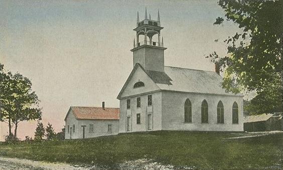
43°31′38″N 71°28′07″W / 43.527175°N 71.468511°WLaconia 7 Centre Congregational Church 
September 8, 1983 Province Rd.
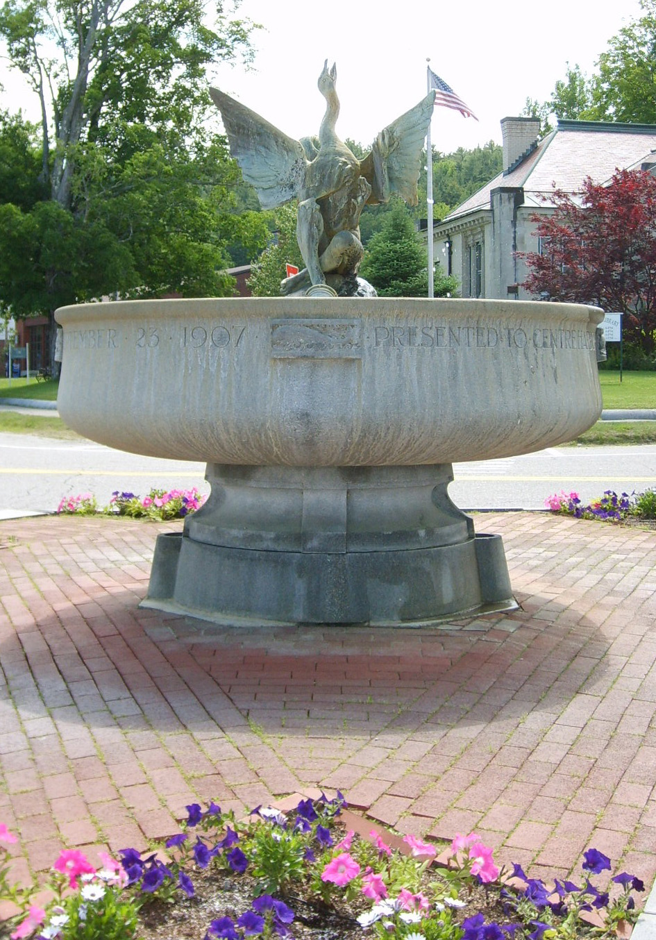
43°25′31″N 71°24′51″W / 43.425278°N 71.414167°WGilmanton 8 Centre Harbor Village Historic District 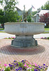
September 8, 1983 Main and Plymouth Sts.
43°42′32″N 71°27′46″W / 43.708889°N 71.462778°WCenter Harbor 9 Dana Meeting House 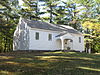
December 13, 1984 Dana Hill Rd.
43°38′34″N 71°38′00″W / 43.642778°N 71.633333°WNew Hampton 10 District No. 9 Schoolhouse March 15, 2000 358 Hoyt Rd.
43°31′48″N 71°23′48″W / 43.53°N 71.396667°WGilford 11 Endicott Rock May 28, 1980 Weirs Channel
43°36′20″N 71°27′22″W / 43.605556°N 71.456111°WLaconia (Weirs Beach) 12 Evangelical Baptist Church 
September 12, 1985 Veterans Sq.
43°31′45″N 71°28′20″W / 43.529167°N 71.472222°WLaconia 13 Federal Building October 25, 2011 719 Main St.
43°31′50″N 71°28′17″W / 43.530556°N 71.471389°WLaconia 14 First Baptist Church of Gilmanton 
December 1, 1989 Province Rd./NH 107, 0.25 miles north of Stage Rd.
43°22′51″N 71°21′14″W / 43.380833°N 71.353889°WGilmanton 15 First Congregational Church 
March 9, 1990 Church St, west of Main St.
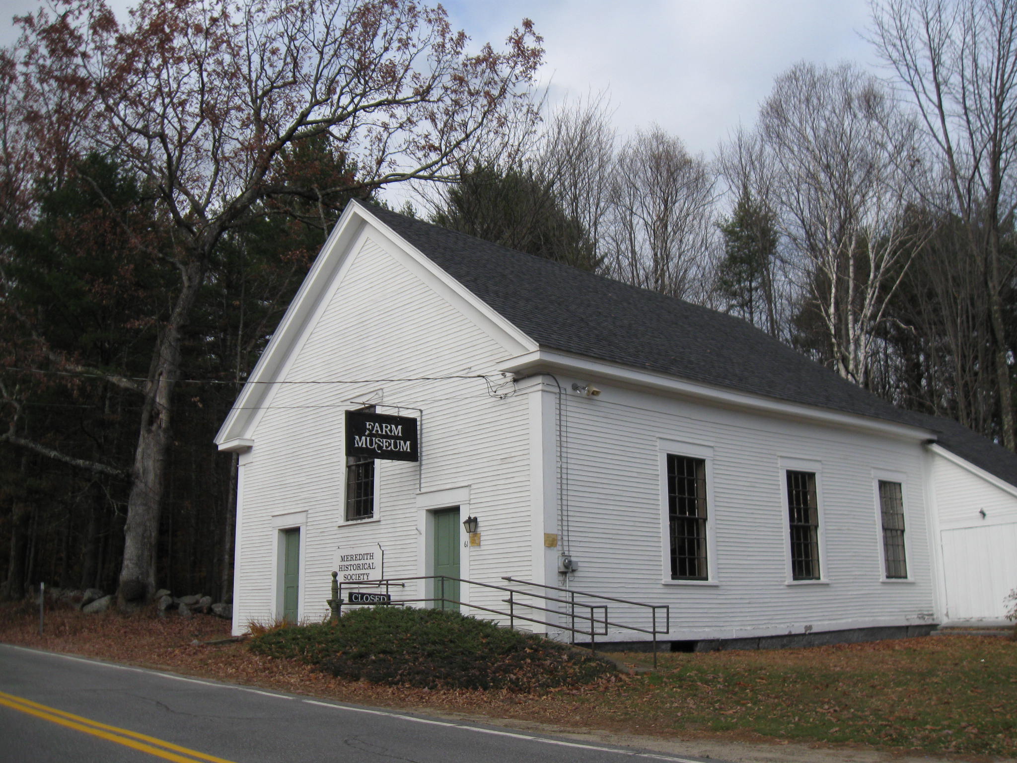
43°27′17″N 71°13′20″W / 43.454722°N 71.222222°WAlton 16 First Free Will Baptist Church in Meredith 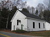
December 1, 1986 Winona Rd.
43°38′48″N 71°32′15″W / 43.646667°N 71.5375°WMeredith 17 First Freewill Baptist Church 
August 2, 1978 North of Lovelock
43°31′09″N 71°12′00″W / 43.519167°N 71.2°WEast Alton 18 Oscar Foss Memorial Library 
November 7, 1985 Main St.
43°20′21″N 71°15′38″W / 43.339167°N 71.260556°WBarnstead 19 Gale Memorial Library 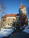
September 12, 1985 695 Main St.
43°31′47″N 71°28′17″W / 43.529722°N 71.471389°WLaconia 20 Gilmanton Academy 
September 8, 1983 Province Rd.
43°25′30″N 71°24′50″W / 43.425°N 71.413889°WGilmanton 21 Gordon-Nash Library 
September 15, 1988 Main St.
43°36′19″N 71°39′09″W / 43.605278°N 71.6525°WNew Hampton 22 Ossian Wilbur Goss Reading Room 
September 4, 1986 188 Elm St.
43°32′57″N 71°27′59″W / 43.549167°N 71.466389°WLaconia (Lakeport) 23 House by the Side of the Road 
November 26, 1980 61 School St.
43°26′51″N 71°35′24″W / 43.4475°N 71.59°WTilton 24 Kimball Castle 
August 16, 1982 Locke's Hill Rd.
43°34′49″N 71°22′48″W / 43.580278°N 71.38°WGilford 25 Laconia District Court 
November 9, 1982 Academy Sq.
43°31′25″N 71°28′11″W / 43.523611°N 71.469722°WLaconia 26 Laconia Passenger Station 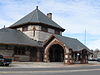
January 11, 1982 Veterans Sq.
43°31′45″N 71°28′21″W / 43.529167°N 71.4725°WLaconia 27 Lochmere Archeological District November 1, 1982 Address Restricted Tilton 28 Meredith Public Library 
December 13, 1984 50 Main St.
43°39′15″N 71°29′59″W / 43.654167°N 71.499722°WMeredith 29 Monument Square Historic District 
March 15, 1984 Main, Factory, Church, and Depot Sts.
43°27′19″N 71°13′11″W / 43.455278°N 71.219722°WAlton 30 Washington Mooney House 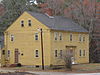
September 4, 1997 Junction of NH 104 and Interstate 93
43°36′52″N 71°38′29″W / 43.614444°N 71.641389°WNew Hampton 31 John J. Morrill Store August 29, 1980 Belknap Mountain Rd.
43°32′52″N 71°24′23″W / 43.547778°N 71.406389°WGilford 32 New Hampshire Veterans' Association Historic District May 22, 1980 North of Laconia on Lakeside Ave.
43°36′21″N 71°27′43″W / 43.605833°N 71.461944°WLaconia (Weirs Beach) 33 New Hampton Community Church 
March 7, 1985 Main St.
43°36′23″N 71°38′55″W / 43.606389°N 71.648611°WNew Hampton 34 New Hampton Town House 
March 23, 1998 Junction of Dana Hill and Town House Roads
43°37′27″N 71°37′43″W / 43.624167°N 71.628611°WNew Hampton 35 Benjamin Rowe House 
April 30, 2008 88 Belknap Mountain Rd.
43°32′37″N 71°24′10″W / 43.543696°N 71.402721°WGilford 36 Sanbornton Square Historic District 
December 8, 1980 Sanbornton Square
43°29′16″N 71°36′59″W / 43.487778°N 71.616389°WSanbornton 37 Second Free Baptist Church 
March 9, 1990 Main St., south of Church St.
43°27′18″N 71°13′14″W / 43.455°N 71.220556°WAlton 38 Smith Meeting House 
March 23, 1998 Junction of Smith Meetinghouse, Parsonage Hill, and Joe Jones Rds.
43°24′57″N 71°21′48″W / 43.415833°N 71.363333°WGilmanton 39 Tilton Downtown Historic District 
July 7, 1983 Roughly Main St. between Central and Bridge Sts.
43°26′34″N 71°35′25″W / 43.442778°N 71.590278°WTilton 40 Tilton Island Park Bridge 
March 21, 1980 Tilton Island Park
43°26′32″N 71°35′13″W / 43.442222°N 71.586944°WTilton Over the Winnipesaukee River 41 Charles E. Tilton Mansion 
August 10, 1982 School St.
43°26′38″N 71°35′28″W / 43.443889°N 71.591111°WTilton 42 United Baptist Church of Lakeport 
June 6, 1985 23 Park St.
43°32′56″N 71°27′48″W / 43.548889°N 71.463333°WLaconia (Lakeport) 43 US Post Office-Laconia Main 
July 18, 1986 33 Church St.
43°31′36″N 71°28′28″W / 43.526667°N 71.474444°WLaconia 44 The Weirs May 12, 1975 Address Restricted Laconia See also
- List of National Historic Landmarks in New Hampshire
- National Register of Historic Places listings in New Hampshire
References
- ^ The latitude and longitude information provided in this table was derived originally from the National Register Information System, which has been found to be fairly accurate for about 99% of listings. For about 1% of NRIS original coordinates, experience has shown that one or both coordinates are typos or otherwise extremely far off; some corrections may have been made. A more subtle problem causes many locations to be off by up to 150 yards, depending on location in the country: most NRIS coordinates were derived from tracing out latitude and longitudes off of USGS topographical quadrant maps created under the North American Datum of 1927, which differs from the current, highly accurate WGS84 GPS system used by Google maps. Chicago is about right, but NRIS longitudes in Washington are higher by about 4.5 seconds, and are lower by about 2.0 seconds in Maine. Latitudes differ by about 1.0 second in Florida. Some locations in this table may have been corrected to current GPS standards.
- ^ "National Register of Historic Places: Weekly List Actions". National Park Service, United States Department of the Interior. Retrieved on November 10, 2011.
- ^ Numbers represent an ordering by significant words. Various colorings, defined here, differentiate National Historic Landmark sites and National Register of Historic Places Districts from other NRHP buildings, structures, sites or objects.
- ^ "National Register Information System". National Register of Historic Places. National Park Service. . http://nrhp.focus.nps.gov/natreg/docs/All_Data.html.
U.S. National Register of Historic Places Topics Lists by states Alabama • Alaska • Arizona • Arkansas • California • Colorado • Connecticut • Delaware • Florida • Georgia • Hawaii • Idaho • Illinois • Indiana • Iowa • Kansas • Kentucky • Louisiana • Maine • Maryland • Massachusetts • Michigan • Minnesota • Mississippi • Missouri • Montana • Nebraska • Nevada • New Hampshire • New Jersey • New Mexico • New York • North Carolina • North Dakota • Ohio • Oklahoma • Oregon • Pennsylvania • Rhode Island • South Carolina • South Dakota • Tennessee • Texas • Utah • Vermont • Virginia • Washington • West Virginia • Wisconsin • WyomingLists by territories Lists by associated states Other Municipalities and communities of Belknap County, New Hampshire City 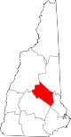
Towns Alton | Barnstead | Belmont | Center Harbor | Gilford | Gilmanton | Meredith | New Hampton | Sanbornton | Tilton
Villages Alton Bay | Center Barnstead | Gilmanton Ironworks | Glendale | Lakeport | Lochmere | Tilton-Northfield‡ | Weirs Beach
Footnotes ‡This populated place also has portions in an adjacent county or counties
Categories:- National Register of Historic Places in New Hampshire by county
- Belknap County, New Hampshire
-


Wikimedia Foundation. 2010.