- New Hampton, New Hampshire
-
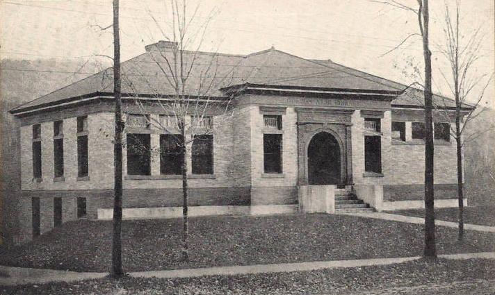
New Hampton, New Hampshire — Town — Gordon-Nash Library c. 1915 Location in Belknap County, New Hampshire
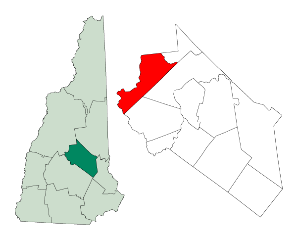
Coordinates: 43°36′19″N 71°39′10″W / 43.60528°N 71.65278°WCoordinates: 43°36′19″N 71°39′10″W / 43.60528°N 71.65278°W Country United States State New Hampshire County Belknap Incorporated 1777 Government – Board of Selectmen Charles W. Bartley
Paul J. Tierney
Kenneth A. MertzArea – Total 38.2 sq mi (99.0 km2) – Land 36.7 sq mi (95.1 km2) – Water 1.5 sq mi (3.9 km2) 3.93% Elevation 525 ft (160 m) Population (2010) – Total 2,165 – Density 56.7/sq mi (21.9/km2) Time zone Eastern (UTC-5) – Summer (DST) Eastern (UTC-4) ZIP code 03256 Area code(s) 603 FIPS code 33-51540 GNIS feature ID 0873679 Website www.new-hampton.nh.us/newhampton New Hampton is a town in Belknap County, New Hampshire, United States. The population was 2,165 at the 2010 census.[1] A winter sports resort area, New Hampton is home to George Duncan State Forest and to the New Hampton School, a private preparatory school established in 1821.
The primary village in town, where 351 people resided at the 2010 census,[1] is defined as the New Hampton census-designated place (CDP), and is located along New Hampshire Route 132, just south of its intersection with Route 104.
Contents
History
Granted in 1765 by Colonial Governor Benning Wentworth, New Hampton was originally known as Moultonborough Addition after then-Colonel Jonathan Moulton, who held the position of town moderator. Moulton, who was born in Hampton, changed the name to New Hampton in 1777 when it was incorporated.[2]
In 1821 the New Hampton School, a Free Will Baptist institution, was founded in the town. From 1854 to 1870, the institute was affiliated with Cobb Divinity School (later part of Bates College).
In 1920, the New Hampton Fish Hatchery, the state's oldest fish hatchery, was established in the town.
-

Lewis Mansion in 1909
-

Berry Hall c. 1912
-

Randall Hall c. 1910
Geography
According to the United States Census Bureau, the town has a total area of 38.2 square miles (99 km2), of which 36.7 sq mi (95 km2) is land and 1.5 sq mi (3.9 km2) is water, comprising 3.93% of the town. New Hampton is bounded on the west and southwest by the Pemigewasset River. Pemigewasset Lake is in the center, and Winona Lake and Lake Waukewan are in the northeast. The highest point in New Hampton is 1,840 feet (561 m) above sea level atop the west ridge of Hersey Mountain, whose 2,001-foot (610 m) summit lies just over the town boundary in Sanbornton.
The geographic center of New Hampshire is located in the eastern part of New Hampton, between Winona Lake and Jackson Pond, at 43.67925 N, 71.580375 W.[3]
The town is served by Interstate 93 and state routes 104 and 132.
Demographics
As of the census[4] of 2000, there were 1,950 people, 726 households, and 538 families residing in the town. The population density was 53.1 people per square mile (20.5/km²). There were 944 housing units at an average density of 25.7 per square mile (9.9/km²). The racial makeup of the town was 97.28% White, 0.31% African American, 0.05% Native American, 0.26% Asian, 0.21% from other races, and 1.90% from two or more races. Hispanic or Latino of any race were 0.62% of the population.
There were 726 households out of which 35.0% had children under the age of 18 living with them, 62.3% were married couples living together, 6.7% had a female householder with no husband present, and 25.8% were non-families. 18.7% of all households were made up of individuals and 8.1% had someone living alone who was 65 years of age or older. The average household size was 2.68 and the average family size was 3.06.
In the town the population was spread out with 26.8% under the age of 18, 6.2% from 18 to 24, 30.0% from 25 to 44, 24.6% from 45 to 64, and 12.4% who were 65 years of age or older. The median age was 38 years. For every 100 females there were 98.8 males. For every 100 females age 18 and over, there were 98.5 males.
The median income for a household in the town was $47,583, and the median income for a family was $52,366. Males had a median income of $32,095 versus $26,181 for females. The per capita income for the town was $20,336. About 2.7% of families and 4.7% of the population were below the poverty line, including 4.2% of those under age 18 and 6.8% of those age 65 or over.
Sites of interest
- Chapel Museum
- Daniel Smith Tavern (c. 1805)
- Dana Meeting House (c. 1800)
- Gordon-Nash Library (c. 1895)
- New Hampton Town House (c. 1798)
Notable inhabitants
- Oliver Blake, businessman and politician
- Adoniram Judson Gordon, minister, founder and namesake of Gordon College
- Orren C. Moore, congressman
- Simon W. Robinson, soldier and businessman
- Ernest Thompson, the author of On Golden Pond, summer resident
References
- ^ a b United States Census Bureau, American FactFinder, 2010 Census figures. Retrieved March 23, 2011.
- ^ Coolidge, Austin J.; John B. Mansfield (1859). A History and Description of New England. Boston, Massachusetts. pp. 597–598. http://books.google.com/books?id=OcoMAAAAYAAJ&lpg=PA9&dq=coolidge%20mansfield%20history%20description%20new%20england%201859&pg=PA597#v=onepage&q&f=false.
- ^ NH Office of Energy and Planning official site - 'Geographic Center of NH'
- ^ "American FactFinder". United States Census Bureau. http://factfinder.census.gov. Retrieved 2008-01-31.
External links
- Town website
- Gordon-Nash Library
- New Hampton Historical Society
- New Hampton School
- New Hampshire Economic and Labor Market Information Bureau Profile
- New Hampshire State Fish Hatcheries & Visitors Centers
Municipalities and communities of Belknap County, New Hampshire City 
Towns Alton | Barnstead | Belmont | Center Harbor | Gilford | Gilmanton | Meredith | New Hampton | Sanbornton | Tilton
Villages Alton Bay | Center Barnstead | Gilmanton Ironworks | Glendale | Lakeport | Lochmere | Tilton-Northfield‡ | Weirs Beach
Footnotes ‡This populated place also has portions in an adjacent county or counties
Categories:- Towns in Belknap County, New Hampshire
- Populated places established in 1777
-


Wikimedia Foundation. 2010.