- New Castle, New Hampshire
-
New Castle, New Hampshire — Town — Fort Point Light from Ocean Street

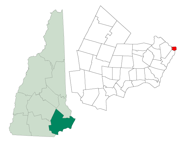
SealLocation in Rockingham County, New Hampshire
Coordinates: 43°04′20″N 70°42′58″W / 43.07222°N 70.71611°WCoordinates: 43°04′20″N 70°42′58″W / 43.07222°N 70.71611°W Country United States State New Hampshire County Rockingham Incorporated 1693 Government – Board of Selectmen Lorn Buxton, Chair
Peter Gamester
Patty Scholz CohenArea – Total 2.4 sq mi (6.2 km2) – Land 0.8 sq mi (2.1 km2) – Water 1.5 sq mi (4.0 km2) 65.13% Elevation 20 ft (6 m) Population (2010) – Total 968 – Density 403.3/sq mi (155.7/km2) Time zone Eastern (UTC-5) – Summer (DST) Eastern (UTC-4) ZIP code 03854 Area code(s) 603 FIPS code 33-50980 GNIS feature ID 0873676 Website http://www.newcastlenh.org/ New Castle is a town in Rockingham County, New Hampshire, United States. The population was 968 at the 2010 census.[1] The smallest town in New Hampshire, and the only one located entirely on islands, it is home to Fort Constitution Historic Site, Fort Stark Historic Site, and the New Castle Common, a 31-acre (13 ha) recreation area on the Atlantic Ocean. New Castle is also home to a United States Coast Guard station, as well as the historic Wentworth by the Sea hotel.
Contents
History

The main island on which the town sits is the largest of several at the mouth of the Piscataqua River and was originally called Great Island. Settled in 1623, an earthwork defense was built on Fort Point which would evolve into Fort William and Mary (rebuilt in 1808 as Fort Constitution). Chartered in 1679 as a parish of Portsmouth, it was incorporated in 1693 and named New Castle after the fort. Until 1719 it included Rye, then called Sandy Beach. The principal industries were trade, tavern-keeping and fishing. There was also agriculture, using the abundant seaweed as fertilizer.
Beginning on June 11, 1682, Great Island experienced a supernatural event—a Lithobolia, or "Stone-Throwing Devil," recorded in a 1698 London pamphlet by Richard Chamberlain. On a Sunday night at about 10 o'clock, the tavern home of George Walton, a planter, was showered with stones thrown "by an invisible hand." Windows were smashed, and the spit in the fireplace leapt into the air, then came down with its point stuck in the back log. When a member of the household retrieved the spit, it flew out the window of its own accord. The gate outside was discovered off its hinges. Rev. Cotton Mather took an interest in the phenomenon, reporting that:
- "This disturbance continued from day to day; and sometimes a dismal hollow whistling would be heard, and sometimes the trotting and snorting of a horse, but nothing to be seen.... A man was much hurt by some of the stones. He was a Quaker, and suspected that a woman, who charged him with injustice in detaining some land from her did, by witchcraft, occasion these preternatural occurrences. However, at last they came to an end."
Fort William and Mary was the site of one of the first acts of the American Revolution. On December 14, 1774, colonists arrived at midnight aboard a gundalow (sailing barge), waded ashore and climbed over the fort's wall. Captain John Cochran and the fort's five soldiers surrendered, whereupon the rebels loaded onto the boat 100 barrels of gunpowder. As a gesture of chivalry, they returned to Cochran his sword—with which he then lunged at them. Nevertheless, the boat was rowed up the Piscataqua River to Durham, where the ammunition was stored in the cellar of the Congregational Church. The next day, the colonists returned to the fort and removed 15 of the lighter cannon and all small arms. The gunpowder was used at the 1775 Battle of Bunker Hill.
A new route to the island was created in 1821 when three bridges (now two bridges and a causeway) connected Frame Point in Portsmouth with the northwestern corner of Great Island. Previously, a bridge on the southwestern point had been the only way to reach New Castle without a boat. The community was then an overlooked fishing village, which helped preserve its colonial architecture. However, in 1874 the Hotel Wentworth was built atop a hill with a view of Little Harbor and the ocean. After early financial difficulties, the establishment was purchased and elaborately refurbished in Second Empire style by Portsmouth alemaker and hotelier, Frank Jones. It became the area's most fashionable resort, growing in size until it was a village unto itself. When President Theodore Roosevelt mediated the 1905 Treaty of Portsmouth to end the Russo-Japanese War, envoys from both countries stayed at the Wentworth by the Sea, ferried by launch to negotiations held at the Portsmouth Naval Shipyard. The hotel was a setting for the 1999 movie, In Dreams.
-

Fort Point Light c. 1908
-

Fort Constitution in 1908
-

Walbach Tower in 1908
-

The Wentworth c. 1920
Geography
According to the United States Census Bureau, the town has a total area of 2.4 square miles (6.2 km2), of which 0.8 sq mi (2.1 km2) is land and 1.5 sq mi (3.9 km2) is water, comprising 65.13% of the town. New Castle occupies an archipelago, consisting of one main island (Great Island) and several smaller islands surrounded by the Piscataqua River and Atlantic Ocean. The highest point of land is located at The Wentworth-by-the-Sea Hotel, where the elevation reaches 60 feet (18 m) above sea level.
Demographics

As of the census[2] of 2000, there were 1,010 people, 443 households, and 314 families residing in the town. The population density was 1,222.6 people per square mile (469.8/km2). There were 488 housing units at an average density of 590.7 per square mile (227.0/km2). The racial makeup of the town was 97.82% White, 0.59% African American, 0.50% Asian, and 1.09% from two or more races. Hispanic or Latino of any race were 0.50% of the population.
There were 443 households out of which 22.1% had children under the age of 18 living with them, 61.6% were married couples living together, 5.0% had a female householder with no husband present, and 29.1% were non-families. 23.9% of all households were made up of individuals and 11.5% had someone living alone who was 65 years of age or older. The average household size was 2.26 and the average family size was 2.65.

In the town the population was spread out with 17.8% under the age of 18, 3.4% from 18 to 24, 20.8% from 25 to 44, 34.0% from 45 to 64, and 24.1% who were 65 years of age or older. The median age was 50 years. For every 100 females there were 95.7 males. For every 100 females age 18 and over, there were 97.1 males.
The median income for a household in the town was $83,708, and the median income for a family was $93,290. Males had a median income of $57,375 versus $35,568 for females. The per capita income for the town was $67,695. None of the families and 0.6% of the population were living below the poverty line, including no under eighteens and none of those over 64. New Castle is New Hampshire's wealthiest town in terms of median per capita income.
In 2004, 352 inhabitants were registered Republicans, and 164 were registered Democrats. [1]
Sites of interest
- Fort Constitution Historic Site
- Fort Stark Historic Site
- Kittery Point Yacht Club
- New Castle Congregational Church
- New Castle Historical Society & Museum
- Portsmouth Harbor Light (or Fort Point Light)
- Portsmouth Yacht Club
- The Wentworth by the Sea
References
- ^ United States Census Bureau, American FactFinder, 2010 Census figures. Retrieved March 23, 2011.
- ^ "American FactFinder". United States Census Bureau. http://factfinder.census.gov. Retrieved 2008-01-31.
Further reading
- John Albee, New Castle, Historic and Picturesque; Cupples, Upham & Company, Boston, Massachusetts 1884
- Charles W. Brewster, Rambles About Portsmouth; C. W. Brewster & Son; Portsmouth, New Hampshire 1859
External links
- New Castle Town Website
- New Hampshire Economic and Labor Market Information Bureau Profile
- Seacoast Forts of Portsmouth Harbor from American Forts Network
Municipalities and communities of Rockingham County, New Hampshire City 
Towns Atkinson | Auburn | Brentwood | Candia | Chester | Danville | Deerfield | Derry | East Kingston | Epping | Exeter | Fremont | Greenland | Hampstead | Hampton | Hampton Falls | Kensington | Kingston | Londonderry | New Castle | Newfields | Newington | Newmarket | Newton | North Hampton | Northwood | Nottingham | Plaistow | Raymond | Rye | Salem | Sandown | Seabrook | South Hampton | Stratham | Windham
Villages Candia Four Corners | East Candia | East Derry | East Hampstead | Hampton Beach | Seabrook Beach
Categories:- Towns in Rockingham County, New Hampshire
- Populated places established in 1623


Wikimedia Foundation. 2010.