- Chester, New Hampshire
-
Chester, New Hampshire — Town — Location in Rockingham County, New Hampshire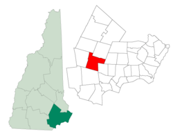
Coordinates: 42°57′24″N 71°15′26″W / 42.95667°N 71.25722°WCoordinates: 42°57′24″N 71°15′26″W / 42.95667°N 71.25722°W Country United States State New Hampshire County Rockingham Incorporated 1722 Government – Board of Selectmen Stephen Landau, Chair
Jack Cannon, Vice
Joseph Castricone
Joseph Hagan
Michael WeiderArea – Total 26.0 sq mi (67.4 km2) – Land 25.9 sq mi (67.1 km2) – Water 0.1 sq mi (0.3 km2) 0.42% Elevation 467 ft (142 m) Population (2010) – Total 4,768 – Density 183.4/sq mi (70.8/km2) Time zone Eastern (UTC-5) – Summer (DST) Eastern (UTC-4) ZIP code 03036 Area code(s) 603 FIPS code 33-12100 GNIS feature ID 0873564 Website www.chesternh.org Chester is a town in Rockingham County, New Hampshire, United States. The population was 4,768 at the 2010 census.[1] It is home to Chester College (formerly White Pines College).
Contents
History
Incorporated in 1722, Chester once included Candia, set off in 1763. First called "the chestnut country," it may have been the first of the settlement grants by Massachusetts selected for expansion of growing populations in the seacoast. The name may be derived from Cheshire, Chester being the county seat of Cheshire in England. Earl of Chester is a title held by the Prince of Wales. Daniel Chester French, sculptor of the Lincoln Memorial in Washington, D.C., was a summer resident and took Chester as his middle name because of his love for the town.[citation needed]
-
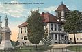
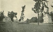
Town Hall in 1913
-
Blacksmith Shop in 1909
-
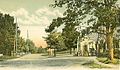
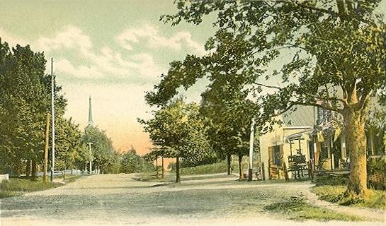
Chester Street c. 1910
Notable residents
- Charles H. Bell, governor; son of John Bell
- John Bell, governor
- Samuel Bell, governor; brother of John Bell
- Samuel Newell Bell, U.S. Representative; grandson of Samuel Bell
- "Lord" Timothy Dexter, eccentric early American businessman
- Daniel Chester French, sculptor (summer resident)
- George Cochrane Hazelton, U.S. Representative from Wisconsin
- Gerry Whiting Hazelton, U.S. Representative from Wisconsin; brother of George
Geography
According to the United States Census Bureau, the town has a total area of 26.0 square miles (67 km2), of which 25.9 sq mi (67 km2) is land and 0.1 sq mi (0.26 km2) (0.42%) is water. The Exeter River rises in Chester. The highest point in town is an unnamed summit, reaching 639 feet (195 m) above sea level, near the town's southwest corner. Chester lies mostly within the Piscataqua River (Coastal) watershed, though the western edge of town is in the Merrimack River watershed.[2]
Demographics
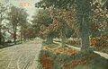
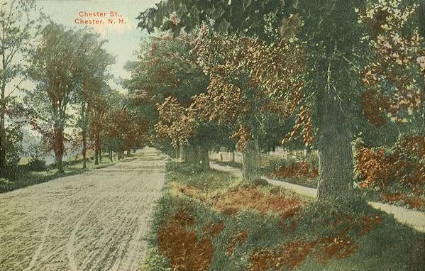
 The Common c. 1910
As of the census[3] of 2000, there were 3,792 people, 1,214 households, and 1,011 families residing in the town. The population density was 146.4 people per square mile (56.5/km²). There were 1,247 housing units at an average density of 48.1 per square mile (18.6/km²). The racial makeup of the town was 97.97% White, 0.26% African American, 0.42% Native American, 0.32% Asian, 0.16% from other races, and 0.87% from two or more races. Hispanic or Latino of any race were 0.82% of the population.
There were 1,214 households out of which 45.0% had children under the age of 18 living with them, 73.3% were married couples living together, 6.6% had a female householder with no husband present, and 16.7% were non-families. 11.8% of all households were made up of individuals and 4.3% had someone living alone who was 65 years of age or older. The average household size was 3.09 and the average family size was 3.38.
In the town the population was spread out with 31.0% under the age of 18, 6.3% from 18 to 24, 32.1% from 25 to 44, 24.6% from 45 to 64, and 6.1% who were 65 years of age or older. The median age was 36 years. For every 100 females there were 97.8 males. For every 100 females age 18 and over, there were 94.4 males.
The median income for a household in the town was $68,571, and the median income for a family was $75,092. Males had a median income of $44,056 versus $35,382 for females. The per capita income for the town was $23,842. About 3.4% of families and 5.0% of the population were below the poverty line, including 5.9% of those under age 18 and 5.2% of those age 65 or over.
According to the most recent figures Chester has the third highest median property values in the state, and Chester residents have the highest median income.[citation needed]
Education
Preschools: Chester Academy (public), Chester Pre-School (private), Country Christian Daycare (private), Imagination Station (private)
Elementary School / Middle School: Chester Academy (public)
High School: Pinkerton Academy, Derry (privately operated, but it contracts with Derry, Chester, and Hampstead. Those three towns pay the academy with tax money.)
References
- ^ United States Census Bureau, American FactFinder, 2010 Census figures. Retrieved March 23, 2011.
- ^ Foster, Debra H.; Batorfalvy, Tatianna N.; and Medalie, Laura (1995). Water Use in New Hampshire: An Activities Guide for Teachers. U.S. Department of the Interior and U.S. Geological Survey. http://nh.water.usgs.gov/Publications/nh.intro.html.
- ^ "American FactFinder". United States Census Bureau. http://factfinder.census.gov. Retrieved 2008-01-31.
External links
- Town website
- Tri-Town Times - Community Newspaper
- Chester Historical Society
- New Hampshire Economic and Labor Market Information Bureau Profile
Municipalities and communities of Rockingham County, New Hampshire City 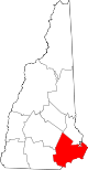
Towns Atkinson | Auburn | Brentwood | Candia | Chester | Danville | Deerfield | Derry | East Kingston | Epping | Exeter | Fremont | Greenland | Hampstead | Hampton | Hampton Falls | Kensington | Kingston | Londonderry | New Castle | Newfields | Newington | Newmarket | Newton | North Hampton | Northwood | Nottingham | Plaistow | Raymond | Rye | Salem | Sandown | Seabrook | South Hampton | Stratham | Windham
Villages Candia Four Corners | East Candia | East Derry | East Hampstead | Hampton Beach | Seabrook Beach
Categories:- Towns in Rockingham County, New Hampshire
-


Wikimedia Foundation. 2010.