- Danville, New Hampshire
-
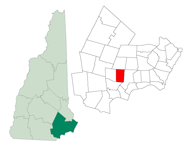
Danville, New Hampshire — Town — Location in Rockingham County, New Hampshire
Coordinates: 42°54′45″N 71°07′28″W / 42.9125°N 71.12444°WCoordinates: 42°54′45″N 71°07′28″W / 42.9125°N 71.12444°W Country United States State New Hampshire County Rockingham Incorporated 1760 Government – Type Town Meeting (SB2) – Board of Selectmen Shawn O'Neil, Chairman
Judi Cogswell
Annemarie Inman
Russ Harding
Chris GiordanoArea – Total 11.9 sq mi (30.8 km2) – Land 11.7 sq mi (30.3 km2) – Water 0.2 sq mi (0.5 km2) 1.68% Elevation 203 ft (62 m) Population (2010) – Total 4,387 – Density 368.7/sq mi (142.3/km2) Time zone Eastern (UTC-5) – Summer (DST) Eastern (UTC-4) ZIP code 03819 Area code(s) 603 FIPS code 33-17140 GNIS feature ID 0873575 Website www.townofdanville.org Danville is a town in Rockingham County, New Hampshire, United States. The population was 4,387 at the 2010 census.[1] Danville is part of the Timberlane Regional School District, with students attending Danville Elementary School, Timberlane Regional Middle School, and Timberlane Regional High School.
Contents
History
Originally a parish of Kingston, it was chartered in 1760 as Hawke, after Admiral Sir Edward Hawke. The town was renamed in 1836 after early settlers, at least three of whom had been named Daniel.
Geography
According to the United States Census Bureau, the town has a total area of 11.9 square miles (31 km2), of which 11.7 sq mi (30 km2) is land and 0.2 sq mi (0.52 km2) is water, comprising 1.68% of the town. The highest named summit in Danville is Rock Rimmon Hill, with an elevation greater than 350 feet (110 m) above sea level on the town's eastern border. An unnamed hill on the town's western border also tops 350 feet. The southern two-thirds of Danville lies within the Merrimack River watershed, and the northern third is in the Piscataqua River (Coastal) watershed.[2]
Demographics
As of the census[3] of 2000, there were 4,023 people, 1,428 households, and 1,122 families residing in the town. The population density was 343.6 people per square mile (132.6/km²). There were 1,479 housing units at an average density of 126.3 per square mile (48.8/km²). The racial makeup of the town was 97.59% White, 0.57% African American, 0.27% Native American, 0.35% Asian, 0.02% Pacific Islander, 0.30% from other races, and 0.89% from two or more races. Hispanic or Latino of any race were 0.85% of the population.
There were 1,428 households out of which 42.3% had children under the age of 18 living with them, 68.3% were married couples living together, 6.8% had a female householder with no husband present, and 21.4% were non-families. 16.5% of all households were made up of individuals and 4.1% had someone living alone who was 65 years of age or older. The average household size was 2.82 and the average family size was 3.18.
In the town the population was spread out with 29.2% under the age of 18, 4.4% from 18 to 24, 37.0% from 25 to 44, 22.2% from 45 to 64, and 7.1% who were 65 years of age or older. The median age was 35 years. For every 100 females there were 104.7 males. For every 100 females age 18 and over, there were 101.5 males.
The median income for a household in the town was $57,287, and the median income for a family was $63,239. Males had a median income of $45,122 versus $29,351 for females. The per capita income for the town was $22,152. About 3.2% of families and 4.0% of the population were below the poverty line, including 5.5% of those under age 18 and 8.4% of those age 65 or over.
References
- ^ United States Census Bureau, American FactFinder, 2010 Census figures. Retrieved March 23, 2011.
- ^ Foster, Debra H.; Batorfalvy, Tatianna N.; and Medalie, Laura (1995). Water Use in New Hampshire: An Activities Guide for Teachers. U.S. Department of the Interior and U.S. Geological Survey. http://nh.water.usgs.gov/Publications/nh.intro.html.
- ^ "American FactFinder". United States Census Bureau. http://factfinder.census.gov. Retrieved 2008-01-31.
External links
- Town of Danville official website
- Danville Elementary School, Grades K-5
- Timberlane Regional Middle School, Grades 6-8, located in Plaistow
- Timberlane Regional High School, Grades 9-12, located in Plaistow
- Danville PTA
- New Hampshire Economic and Labor Market Information Bureau Profile
- SpeakoutDanville.org - Discussion forum for town, school news and other issues
Municipalities and communities of Rockingham County, New Hampshire City 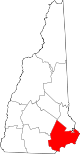
Towns Atkinson | Auburn | Brentwood | Candia | Chester | Danville | Deerfield | Derry | East Kingston | Epping | Exeter | Fremont | Greenland | Hampstead | Hampton | Hampton Falls | Kensington | Kingston | Londonderry | New Castle | Newfields | Newington | Newmarket | Newton | North Hampton | Northwood | Nottingham | Plaistow | Raymond | Rye | Salem | Sandown | Seabrook | South Hampton | Stratham | Windham
Villages Candia Four Corners | East Candia | East Derry | East Hampstead | Hampton Beach | Seabrook Beach
Categories:- Towns in Rockingham County, New Hampshire

Wikimedia Foundation. 2010.