- Raymond, New Hampshire
Infobox Settlement
official_name = Raymond, New Hampshire
nickname =
motto =
image_
imagesize =
image_caption = The Common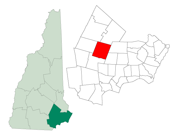
mapsize = 250px
map_caption = Location in Rockingham County,New Hampshire
settlement_type = Town
mapsize1 =
map_caption1 =
subdivision_type = Country
subdivision_name =United States
subdivision_type1 = State
subdivision_name1 =New Hampshire
subdivision_type2 = County
subdivision_name2 = Rockingham
government_type =
leader_title =Board of Selectmen
leader_name = Timothy Auclair, Chair
John S. Barnes, Jr., Vice Chair
Frank Bourque
Cheryl Killam
Joyce Wood
established_title = Incorporated
established_date = 1764
area_magnitude = 1 E8
area_total_km2 = 76.6
area_total_sq_mi = 29.6
area_land_km2 = 74.5
area_land_sq_mi = 28.8
area_water_km2 = 2.0
area_water_sq_mi = 0.8
area_water_percent = 2.67
population_as_of = 2007
population_note =
population_total = 10,195
population_density_km2 = 136.8
population_density_sq_mi = 354.0
timezone = Eastern
utc_offset = -5
timezone_DST = Eastern
utc_offset_DST = -4
latd = 43 |latm = 02 |lats = 10 |latNS = N
longd = 71 |longm = 11 |longs = 00 |longEW = W
elevation_m = 61
elevation_ft = 200
website = [http://www.raymond-nh.com/ www.raymond-nh.com]
postal_code_type =ZIP code
postal_code = 03077
area_code = 603
blank_name = FIPS code
blank_info = 33-64020
blank1_name = GNIS feature ID
blank1_info = 0873705
footnotes =Raymond is a town in Rockingham County,
New Hampshire ,United States . The population was 9,674 at the 2000 census. Part of Pawtuckaway State Park is in the north.The central village in town, where over 29% of the population resides, is defined as the Raymond
census-designated place (CDP), and is located along theLamprey River nearNew Hampshire Route 27 .History
This town was first settled by families from Exeter as a
parish of Chester, and known as Freetown because the tall pine trees, which were for the King's use, were usually taken by the local settlers, therefore it was a "free town". The town was incorporated in 1764 by Colonial GovernorBenning Wentworth . Contrary to a 1970's book by Elmer Munson Hunt, the town was NOT named for Captain William Raymond ofBeverly, Massachusetts . According to Joseph Fullonton, in his History of Raymond, published 1875, the name was chosen as "a new and classical one." Fullonton fancied the name meant "Shining World".In 1906,
Andrew Carnegie awarded a grant of $2000 toward the construction of aCarnegie library in Raymond, and in 1908 the Dudley-Tucker Library opened overlooking the Common.Geography
According to the
United States Census Bureau , the town has a total area of convert|29.6|sqmi|km2, of which convert|28.8|sqmi|km2|abbr=on is land and convert|0.8|sqmi|km2|abbr=on is water, comprising 2.67% of the town. Raymond is drained by theLamprey River . The highest point in town is Dumplingtown Hill, at convert|625|ft|m abovesea level , located near the town's western border.The central village of Raymond, a
census-designated place (CDP), has a total area of convert|4.8|sqmi|km2, of which convert|4.6|sqmi|km2|abbr=on is land and convert|0.1|sqmi|km2|abbr=on (2.94%) is water.The town is crossed by state routes 27, 101, 102 and 107. It borders the towns of Deerfield and Nottingham to the north, Epping and Fremont to the east, Chester to the south and Candia to the west.
Demographics
As of the
census GR|2 of 2000, there were 9,674 people, 3,493 households, and 2,567 families residing in the town. Thepopulation density was 336.1 people per square mile (129.8/km²). There were 3,710 housing units at an average density of 128.9/sq mi (49.8/km²). The racial makeup of the town was 97.79% White, 0.56% Black or African American, 0.24% Native American, 0.19% Asian, 0.05% Pacific Islander, 0.26% from other races, and 0.92% from two or more races. Hispanic or Latino of any race were 0.79% of the population.There were 3,493 households out of which 39.6% had children under the age of 18 living with them, 59.1% were married couples living together, 9.5% had a female householder with no husband present, and 26.5% were non-families. 19.0% of all households were made up of individuals and 5.9% had someone living alone who was 65 years of age or older. The average household size was 2.77 and the average family size was 3.18.
In the town the population was spread out with 29.2% under the age of 18, 7.6% from 18 to 24, 35.3% from 25 to 44, 21.1% from 45 to 64, and 6.9% who were 65 years of age or older. The median age was 34 years. For every 100 females there were 100.2 males. For every 100 females age 18 and over, there were 98.9 males.
The median income for a household in the town was $48,829, and the median income for a family was $50,889. Males had a median income of $35,493 versus $26,778 for females. The
per capita income for the town was $18,430. About 5.3% of families and 6.0% of the population were below thepoverty line , including 7.8% of those under age 18 and 15.8% of those age 65 or over.Town center
As of the
census GR|2 of 2000, there were 2,839 people, 1,116 households, and 738 families residing in the central village, or CDP. Thepopulation density was 614.9 people per square mile (237.3/km²). There were 1,167 housing units at an average density of 252.8/sq mi (97.5/km²). The racial makeup of the CDP was 97.64% White, 0.39% Black or African American, 0.32% Native American, 0.28% Asian, 0.11% from other races, and 1.27% from two or more races. Hispanic or Latino of any race were 0.92% of the population.There were 1,116 households out of which 34.9% had children under the age of 18 living with them, 50.8% were married couples living together, 9.9% had a female householder with no husband present, and 33.8% were non-families. 24.6% of all households were made up of individuals and 8.9% had someone living alone who was 65 years of age or older. The average household size was 2.54 and the average family size was 3.06.
In the CDP the population was spread out with 26.3% under the age of 18, 9.3% from 18 to 24, 33.7% from 25 to 44, 21.2% from 45 to 64, and 9.4% who were 65 years of age or older. The median age was 34 years. For every 100 females there were 101.8 males. For every 100 females age 18 and over, there were 100.1 males.
The median income for a household in the CDP was $49,286, and the median income for a family was $51,371. Males had a median income of $35,750 versus $26,378 for females. The
per capita income for the CDP was $19,710. About 7.6% of families and 6.7% of the population were below thepoverty line , including 5.8% of those under age 18 and 21.8% of those age 65 or over.ites of interest
* [http://www.nhstateparks.com/paw.html Pawtuckaway State Park and Campground]
* [http://raymondhistoricalsociety.home.comcast.net/ Raymond Historical Society & Museum]References
Further reading
* Joseph Fullonton, "History of Raymond, New Hampshire", 1875; Published by the Higginson Book Company, Salem, Massachusetts
External links
* [http://www.raymond-nh.com Town website]
* [http://www.raymond-nh.com/html/library.htm Dudley-Tucker Library]
* [http://www.necarnegies.com/nhraymond.htm The Dudley-Tucker Library -- a Carnegie Library]
* [http://www.nh.gov/nhes/elmi/htmlprofiles/raymond.html New Hampshire Economic and Labor Market Information Bureau Profile]
Wikimedia Foundation. 2010.