- Candia, New Hampshire
Infobox Settlement
official_name = Candia, New Hampshire
nickname =
motto =
image_
imagesize =
image_caption =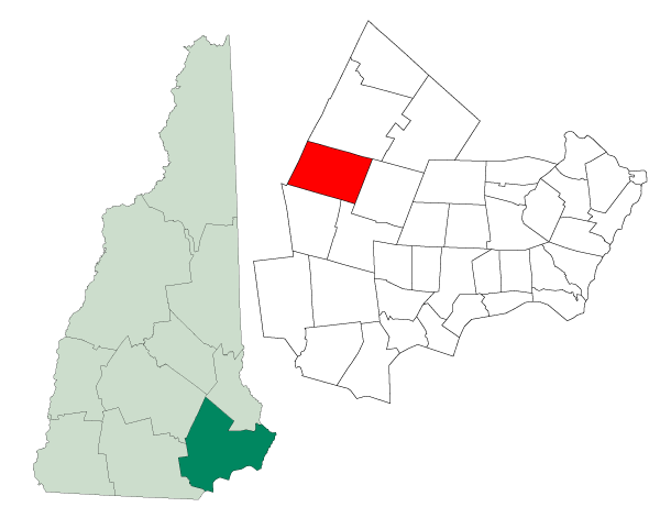
mapsize = 250px
map_caption = Location in Rockingham County,New Hampshire
settlement_type = Town
mapsize1 =
map_caption1 =
subdivision_type = Country
subdivision_name =United States
subdivision_type1 = State
subdivision_name1 =New Hampshire
subdivision_type2 = County
subdivision_name2 = Rockingham
government_type =
leader_title =Board of Selectmen
leader_name = Gary York, Chairman
Clark Thyng
Fred Kelley
established_title = Incorporated
established_date = 1763
area_magnitude = 1 E8
area_total_km2 = 79.2
area_total_sq_mi = 30.6
area_land_km2 = 78.5
area_land_sq_mi = 30.3
area_water_km2 = 0.6
area_water_sq_mi = 0.2
area_water_percent = 0.79
population_as_of = 2007
population_note =
population_total = 4,181
population_density_km2 = 53.3
population_density_sq_mi = 138.0
timezone = Eastern
utc_offset = -5
timezone_DST = Eastern
utc_offset_DST = -4
latd = 43 |latm = 04 |lats = 40 |latNS = N
longd = 71 |longm = 16 |longs = 36 |longEW = W
elevation_m = 107
elevation_ft = 351
website = [http://www.candianh.org/ www.candianh.org]
postal_code_type =ZIP code
postal_code = 03034
area_code = 603
blank_name = FIPS code
blank_info = 33-09300
blank1_name = GNIS feature ID
blank1_info = 0873558
footnotes =Candia is a town in Rockingham County,
New Hampshire ,United States . The population was 3,911 at the 2000 census.History
Settled in 1743, Candia was once part of Chester and known as "Charmingfare", probably because of the many
bridle path s or "parades" through the pleasant scenery. Charmingfare was incorporated in 1763 and named "Candia" by Colonial GovernorBenning Wentworth , possibly after the old name under Venetian domination of the principal city ofCrete , which he had visited after graduation from Harvard.Notable inhabitants
*
Sam Walter Foss , poetGeography
According to the
United States Census Bureau , the town has a total area of convert|30.6|sqmi|km2. convert|30.3|sqmi|km2|abbr=on of it is land and convert|0.2|sqmi|km2|abbr=on of it is water, comprising 0.79% of the town. It is drained by theNorth Branch River , a tributary of theLamprey River . Candia lies almost fully within thePiscataqua River watershed except for the western and southern edges of town, which are in theMerrimack River watershed.cite book |title=Water Use in New Hampshire: An Activities Guide for Teachers |url=http://nh.water.usgs.gov/Publications/nh.intro.html |last=Foster |first=Debra H. |coauthors=Batorfalvy, Tatianna N.; and Medalie, Laura |publisher=U.S. Department of the Interior and U.S. Geological Survey |year=1995] The highest point in town is Hall Mountain, at convert|941|ft|m abovesea level , located inBear Brook State Park in the northwestern part of the town. (The main entrance to the state park and most of its facilities are in neighboring Allenstown.)Candia is bisected by two state highways, Route 43 running north from Route 101 through the Candia Four Corners to the Deerfield,
New Hampshire town line, and Route 27, running east/west from the Hooksett,New Hampshire town line through the Candia Four Corners to the Raymond,New Hampshire town line. Route 101 is the major east/west thoroughfare through southern New Hampshire and travels through the south part of Candia.Demographics
As of the
census GR|2 of 2000, there were 3,911 people, 1,359 households, and 1,108 families residing in the town. Thepopulation density was 129.0/sq mi (49.8/km²). There were 1,384 housing units at an average density of 45.6/sq mi (17.6/km²). The racial makeup of the town was 98.11% White, 0.43% African American, 0.46% Native American, 0.59% Asian, 0.03% Pacific Islander, 0.10% from other races, and 0.28% from two or more races. Hispanic or Latino of any race were 0.87% of the population.There were 1,359 households out of which 40.0% had children under the age of 18 living with them, 72.0% were married couples living together, 5.2% had a female householder with no husband present, and 18.4% were non-families. 12.7% of all households were made up of individuals and 3.2% had someone living alone who was 65 years of age or older. The average household size was 2.88 and the average family size was 3.14.
In the town the population was spread out with 26.6% under the age of 18, 6.0% from 18 to 24, 33.6% from 25 to 44, 26.5% from 45 to 64, and 7.2% who were 65 years of age or older. The median age was 38 years. For every 100 females there were 102.1 males. For every 100 females age 18 and over, there were 102.0 males.
The median income for a household in the town was $61,389, and the median income for a family was $67,163. Males had a median income of $43,260 versus $31,127 for females. The
per capita income for the town was $25,267. About 2.3% of families and 2.6% of the population were below thepoverty line , including 2.3% of those under age 18 and 5.3% of those age 65 or over.Education
Kindergarten through eighth grade public education is provided for Candia residents at the Henry W. Moore School, located near the Candia Four Corners on Deerfield Road. High school education is provided through contract at Manchester High School Central in Manchester,
New Hampshire . Candia is home to the private Christian high school, Jesse Remington.Sites of interest
* Fitts Museum, operated by the Candia Historical Society
* Candia Vineyards, an award winning vineyard with unique varietals
* Charmingfare Farm, a farm and petting zoo.Emergency services
Fire and Emergency Medical Services are provided by [http://www.candiavfd.org Candia Fire-Rescue] , an all-volunteer department organized in 1925. This department provides fire suppression, rescue, and first-responder Emergency Medical Services to the citizens of Candia and the surrounding communities. Ambulance service is provided by [http://www.rockingham.org Rockingham Regional Ambulance] out of Manchester. The closest hospitals are the [http://www.elliothospital.com Elliot Hospital] , a Level Two
Trauma center , and [http://www.catholicmedicalcenter.org Catholic Medical Center] , one of the most advanced cardiac care centers in New England. Both of these facilities are located approximately 20 minutes away in Manchester. [http://www.foreveryday.com/hospital/index.htm Exeter Hospital] is also located about 20 minutes away in Exeter.Police protection is provided by the Candia Police Department, assisted by the New Hampshire State Police and other local municipal police departments.
References
External links
* [http://www.candianh.org Town website]
* [http://www.candiavfd.org Candia Fire-Rescue]
* [http://www.nh.gov/nhes/elmi/htmlprofiles/candia.html New Hampshire Economic and Labor Market Information Bureau Profile]
Wikimedia Foundation. 2010.