- Atkinson, New Hampshire
Infobox Settlement
official_name = Atkinson, New Hampshire
nickname =
motto =
image_
imagesize =
image_caption =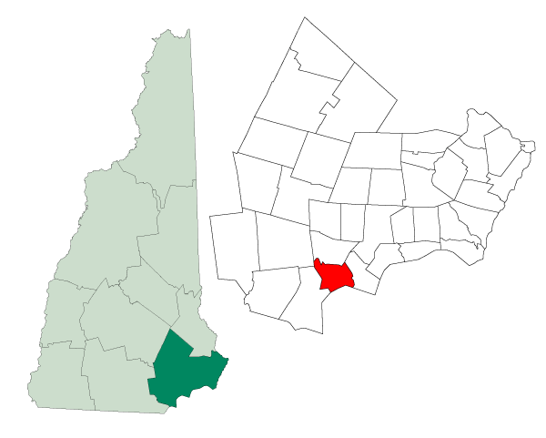
mapsize = 250px
map_caption = Location in Rockingham County,New Hampshire
settlement_type = Town
mapsize1 =
map_caption1 =
subdivision_type = Country
subdivision_name =United States
subdivision_type1 = State
subdivision_name1 =New Hampshire
subdivision_type2 = County
subdivision_name2 = Rockingham
government_type =
leader_title =Board of Selectmen
leader_name = Fred Childs, Chairman
William Friel
Paul Sullivan
established_title = Incorporated
established_date = 1767
area_magnitude = 1 E8
area_total_km2 = 29.2
area_total_sq_mi = 11.3
area_land_km2 = 28.8
area_land_sq_mi = 11.1
area_water_km2 = 0.4
area_water_sq_mi = 0.2
area_water_percent = 1.42
population_as_of = 2007
population_note =
population_total = 6,572
population_density_km2 = 228.2
population_density_sq_mi = 592.1
timezone = Eastern
utc_offset = -5
timezone_DST = Eastern
utc_offset_DST = -4
latd = 42 |latm = 50 |lats = 18 |latNS = N
longd = 71 |longm = 08 |longs = 49 |longEW = W
elevation_m = 92
elevation_ft = 302
website = [http://www.town-atkinsonnh.com/ www.town-atkinsonnh.com]
postal_code_type =ZIP code
postal_code = 03811
area_code = 603
blank_name = FIPS code
blank_info = 33-02340
blank1_name = GNIS feature ID
blank1_info = 0873535
footnotes =Atkinson is a town in Rockingham County,
New Hampshire ,United States . The population was 6,178 at the 2000 census.History
Atkinson has a rich history, dating back to the
American Revolution .Atkinson Academy , the oldest co-educational school in the country, was founded as a boys' school in 1787 by Reverend Stephen Peabody, GeneralNathaniel Peabody and Doctor William Cogswell; it began admitting girls in 1791. The school building burnt to the ground in 1802, and was rebuilt in 1803 at a cost of $2,500. That building remains a part of the Academy, housing the fifth-grade classrooms. Other historic buildings, such the Atkinson Historical Society and Library, Rockwell School (current police station), and many more, grace this southern NH town with their rich historical value and education of the history of the area.Relatives of former President
John Quincy Adams live in Atkinson, along with famous politicians and businessmen. Atkinson’s history can be read about in depth in the book "Atkinson Then and Now", which can be purchased at the Atkinson Public Library on Academy Avenue.Notable inhabitants
*
Brad Delp (1951 - 2007), lead singer of BostonGeography
According to the
United States Census Bureau , the town has a total area of convert|11.3|sqmi|km2, of which convert|11.1|sqmi|km2|abbr=on is land and convert|0.2|sqmi|km2|abbr=on is water, comprising 1.42% of the town. The highest point in Atkinson is Hog Hill, at convert|430|ft|m abovesea level . Atkinson lies fully within theMerrimack River watershed.cite book |title=Water Use in New Hampshire: An Activities Guide for Teachers |url=http://nh.water.usgs.gov/Publications/nh.intro.html |last=Foster |first=Debra H. |coauthors=Batorfalvy, Tatianna N.; and Medalie, Laura |publisher=U.S. Department of the Interior and U.S. Geological Survey |year=1995]Demographics
As of the
census GR|2 of 2000, there were 6,178 people, 2,317 households, and 1,777 families residing in the town. Thepopulation density was 555.2 people per square mile (214.3/km²). There were 2,431 housing units at an average density of 218.5/sq mi (84.3/km²). The racial makeup of the town was 97.62% White, 0.26% African American, 0.06% Native American, 1.18% Asian, 0.21% from other races, and 0.66% from two or more races. Hispanic or Latino of any race were 0.70% of the population.There were 2,317 households out of which 32.5% had children under the age of 18 living with them, 68.8% were married couples living together, 5.7% had a female householder with no husband present, and 23.3% were non-families. 19.0% of all households were made up of individuals and 6.4% had someone living alone who was 65 years of age or older. The average household size was 2.66 and the average family size was 3.08.
In the town the population was spread out with 24.5% under the age of 18, 5.0% from 18 to 24, 28.4% from 25 to 44, 30.7% from 45 to 64, and 11.4% who were 65 years of age or older. The median age was 41 years. For every 100 females there were 94.9 males. For every 100 females age 18 and over, there were 96.1 males.
The median income for a household in the town was $69,729, and the median income for a family was $77,631. Males had a median income of $53,229 versus $34,760 for females. The
per capita income for the town was $30,412. About 2.3% of families and 3.3% of the population were below thepoverty line , including 4.5% of those under age 18 and 2.2% of those age 65 or over.References
External links
* [http://www.town-atkinsonnh.com Town website]
* [http://www.atkinsonrecreation.org/ Town of Atkinson, NH Recreation Website"]
* [http://www.atkinsonweather.com/ AtkinsonWeather.com - forecasts for Atkinson and New England!]
* [http://www.nh.gov/nhes/elmi/htmlprofiles/atkinson.html New Hampshire Economic and Labor Market Information Bureau Profile]
* [http://www.atkinsonacademy.com/ Atkinson Academy, Grades 1-5]
* [http://www.timberlanems.com/ Timberlane Regional Middle School, Grades 6-8, Located in Plaistow]
* [http://www.timberlanehs.com/ Timberlane Regional High School, Grades 9-12, Located in Plaistow]
Wikimedia Foundation. 2010.