- Brentwood, New Hampshire
Infobox Settlement
official_name = Brentwood, New Hampshire
nickname =
motto =
image_
imagesize =
image_caption =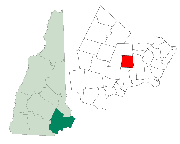
mapsize = 250px
map_caption = Location in Rockingham County,New Hampshire
settlement_type = Town
mapsize1 =
map_caption1 =
subdivision_type = Country
subdivision_name =United States
subdivision_type1 = State
subdivision_name1 =New Hampshire
subdivision_type2 = County
subdivision_name2 = Rockingham
government_type =
leader_title =Board of Selectmen
leader_name =
established_title = Incorporated
established_date = 1742
area_magnitude = 1 E8
area_total_km2 = 44.0
area_total_sq_mi = 17.0
area_land_km2 = 43.6
area_land_sq_mi = 16.8
area_water_km2 = 0.4
area_water_sq_mi = 0.2
area_water_percent = 0.94
population_as_of = 2007
population_note =
population_total = 3,904
population_density_km2 = 89.5
population_density_sq_mi = 232.4
timezone = Eastern
utc_offset = -5
timezone_DST = Eastern
utc_offset_DST = -4
latd = 42 |latm = 58 |lats = 43 |latNS = N
longd = 71 |longm = 04 |longs = 22 |longEW = W
elevation_m = 35
elevation_ft = 115
website = [http://www.brentwoodnh.gov/ www.brentwoodnh.gov]
postal_code_type =ZIP code
postal_code = 03833
area_code = 603
blank_name = FIPS code
blank_info = 33-07220
blank1_name = GNIS feature ID
blank1_info = 0873550
footnotes =Brentwood is a town in Rockingham County,
New Hampshire ,United States . Brentwood is thecounty seat of Rockingham County.GR|6 It is drained by the Piscassic, Little and Exeter rivers. The newRockingham County Botanical Garden is now taking shape in Brentwood.History
Long before Europeans settled the area, Brentwood was home to the
Pennacook Abenaki tribes which farmed, fished and hunted there. Two main foot trails ran through the town, one along the Exeter River, wherearrowhead s and other stone and wooden artifacts have been found. At Pickpocket Dam, this pathway joined with the historic Pentucket Trail leading to Haverhill,Massachusetts , or points north.The town was once a part of Exeter known as "Brentwood Parish". It was named after Brentwood,
Essex , aLondon suburb originally called "Burnt Wood", where, in 1177, King Henry II granted permission for 40 acres of the king's forest to be cut, burned and cultivated. As early as 1738, residents living in the southeastern portion of Exeter, now Brentwood and Fremont, petitioned to be set off, but were denied. In 1742, however, permission was granted, and Brentwood was incorporated by Colonial GovernorBenning Wentworth .But almost from the beginning, a dispute arose between districts regarding the placement of a meetinghouse. It divided the community. Consequently, Gov. Wentworth, acting without approval of the General Assembly, in 1744 issued a King's Patent to establish a new town within Brentwood called "Keeneborough Parish", named after his friend, Sir Benjamin Keene (1697 - 1757), English minister to
Spain . Factions would reconcile in 1750, however, when Keeneborough reunited with Brentwood.Mills along the rivers produced
lumber and manufactured goods in the early days, although the community would shift towards the cultivation ofagriculture . It is now predominantly residential.Geography
According to the
United States Census Bureau , the town has a total area of convert|17.0|sqmi|km2, of which convert|16.8|sqmi|km2|abbr=on is land and convert|0.2|sqmi|km2|abbr=on is water, comprising 0.94% of the town. The highest point in Brentwood is Great Hill, at convert|275|ft|m abovesea level , whose summit is in the southeast corner of the town. The town is drained by theExeter River and its tributaries. Brentwood lies fully within thePiscataqua River (Coastal) watershed.cite book |title=Water Use in New Hampshire: An Activities Guide for Teachers |url=http://nh.water.usgs.gov/Publications/nh.intro.html |last=Foster |first=Debra H. |coauthors=Batorfalvy, Tatianna N.; and Medalie, Laura |publisher=U.S. Department of the Interior and U.S. Geological Survey |year=1995]Demographics
As of the
census GR|2 of 2000, there were 3,197 people, 911 households, and 777 families residing in the town. Thepopulation density was 190.1 people per square mile (73.4/km²). There were 920 housing units at an average density of 54.7/sq mi (21.1/km²). The racial makeup of the town was 96.47% White, 0.84% African American, 0.25% Native American, 0.88% Asian, 0.06% Pacific Islander, 0.72% from other races, and 0.78% from two or more races. Hispanic or Latino of any race were 1.47% of the population.There were 911 households out of which 45.2% had children under the age of 18 living with them, 76.0% were married couples living together, 6.8% had a female householder with no husband present, and 14.6% were non-families. 10.8% of all households were made up of individuals and 3.6% had someone living alone who was 65 years of age or older. The average household size was 2.99 and the average family size was 3.22.
In the town the population was spread out with 24.7% under the age of 18, 6.6% from 18 to 24, 30.3% from 25 to 44, 23.5% from 45 to 64, and 14.8% who were 65 years of age or older. The median age was 39 years. For every 100 females there were 102.0 males. For every 100 females age 18 and over, there were 103.7 males.
The median income for a household in the town was $68,971, and the median income for a family was $71,875. Males had a median income of $46,081 versus $33,359 for females. The
per capita income for the town was $22,027. About 3.3% of families and 3.7% of the population were below thepoverty line , including 4.3% of those under age 18 and 6.3% of those age 65 or over.References
External links
* [http://brentwood.town-center.org Town website]
* [http://www.nh.gov/nhes/elmi/htmlprofiles/brentwood.html New Hampshire Economic and Labor Market Information Bureau Profile]
Wikimedia Foundation. 2010.