- Cardwell, Montana
Infobox Settlement
official_name = Cardwell, Montana
settlement_type = CDP
nickname =
motto =
imagesize =
image_caption =
image_
imagesize =
image_caption =
image_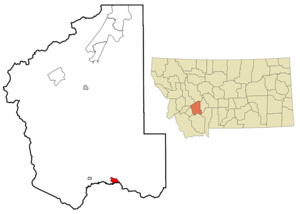
mapsize = 250px
map_caption = Location of Cardwell, Montana
mapsize1 =
map_caption1 =subdivision_type = Country
subdivision_name =United States
subdivision_type1 = State
subdivision_name1 =Montana
subdivision_type2 = County
subdivision_name2 = Jefferson
government_footnotes =
government_type =
leader_title =
leader_name =
leader_title1 =
leader_name1 =
established_title =
established_date =unit_pref = Imperial
area_footnotes =area_magnitude =
area_total_km2 = 6.0
area_land_km2 = 5.9
area_water_km2 = 0.1
area_total_sq_mi = 2.3
area_land_sq_mi = 2.3
area_water_sq_mi = 0.0population_as_of = 2000
population_footnotes =
population_total = 40
population_density_km2 = 6.8
population_density_sq_mi = 17.5timezone = Mountain (MST)
utc_offset = -7
timezone_DST = MDT
utc_offset_DST = -6
elevation_footnotes =
elevation_m = 1306
elevation_ft = 4285
latd = 45 |latm = 51 |lats = 54 |latNS = N
longd = 111 |longm = 57 |longs = 32 |longEW = Wpostal_code_type =
ZIP code
postal_code = 59721
area_code = 406
blank_name = FIPS code
blank_info = 30-12400
blank1_name = GNIS feature ID
blank1_info = 0780936
website =
footnotes =Cardwell is a
census-designated place (CDP) in Jefferson County,Montana ,United States . The population was 40 at the 2000 census. It is part of the Helena Micropolitan Statistical Area.Geography
Cardwell is located at coor dms|45|51|54|N|111|57|32|W|city (45.864890, -111.959007)GR|1.
According to the
United States Census Bureau , the CDP has a total area of 2.3square mile s (6.0km² ), of which, 2.3 square miles (5.9 km²) of it is land and 0.04 square miles (0.1 km²) of it (1.72%) is water.Demographics
As of the
census GR|2 of 2000, there were 40 people, 19 households, and 9 families residing in the CDP. Thepopulation density was 17.5 people per square mile (6.8/km²). There were 19 housing units at an average density of 8.3/sq mi (3.2/km²). The racial makeup of the CDP was 97.50% White, 2.50% from other races. Hispanic or Latino of any race were 2.50% of the population.There were 19 households out of which 10.5% had children under the age of 18 living with them, 42.1% were married couples living together, 5.3% had a female householder with no husband present, and 52.6% were non-families. 42.1% of all households were made up of individuals and 15.8% had someone living alone who was 65 years of age or older. The average household size was 2.11 and the average family size was 2.67.
In the CDP the population was spread out with 22.5% under the age of 18, 2.5% from 18 to 24, 27.5% from 25 to 44, 32.5% from 45 to 64, and 15.0% who were 65 years of age or older. The median age was 44 years. For every 100 females there were 81.8 males. For every 100 females age 18 and over, there were 106.7 males.
The median income for a household in the CDP was $21,250, and the median income for a family was $23,750. Males had a median income of $23,750 versus $0 for females. The
per capita income for the CDP was $9,716. There were no families and 9.7% of the population living below thepoverty line , including no under eighteens and 60.0% of those over 64.History
Prominent American newscaster
Chet Huntley was born in Cardwell in 1911.References
External links
Wikimedia Foundation. 2010.