- Montana City, Montana
-
Montana City, Montana — CDP — Location of Montana City, Montana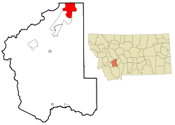
Coordinates: 46°32′14″N 111°55′54″W / 46.53722°N 111.93167°WCoordinates: 46°32′14″N 111°55′54″W / 46.53722°N 111.93167°W Country United States State Montana County Jefferson Area - Total 28.3 sq mi (73.2 km2) - Land 28.2 sq mi (73.1 km2) - Water 0.0 sq mi (0.1 km2) Elevation 4,055 ft (1,236 m) Population (2000) - Total 2,094 - Density 74.2/sq mi (28.6/km2) Time zone Mountain (MST) (UTC-7) - Summer (DST) MDT (UTC-6) ZIP code 59634 Area code(s) 406 FIPS code 30-51175 GNIS feature ID 0787566 Montana City is a census-designated place (CDP) in Jefferson County, Montana, United States. The population was 2,094 at the 2000 census. It is part of the Helena Micropolitan Statistical Area.
Contents
Geography
Montana City is located at 46°32′14″N 111°55′54″W / 46.53722°N 111.93167°W (46.537357, -111.931705)[1].
According to the United States Census Bureau, the CDP has a total area of 28.3 square miles (73 km2), of which, 28.2 square miles (73 km2) of it is land and 0.04 square miles (0.10 km2) of it (0.11%) is water.
Demographics
As of the census[2] of 2000, there were 2,094 people, 697 households, and 627 families residing in the CDP. The population density was 74.2 people per square mile (28.6/km²). There were 709 housing units at an average density of 25.1/sq mi (9.7/km²). The racial makeup of the CDP was 98.19% White, 0.05% African American, 0.48% Native American, 0.10% Asian, 0.14% Pacific Islander, 0.10% from other races, and 0.96% from two or more races. Hispanic or Latino of any race were 1.10% of the population.
There were 697 households out of which 46.1% had children under the age of 18 living with them, 84.4% were married couples living together, 2.9% had a female householder with no husband present, and 9.9% were non-families. 7.5% of all households were made up of individuals and 2.3% had someone living alone who was 65 years of age or older. The average household size was 2.99 and the average family size was 3.14.
In the CDP the population was spread out with 30.9% under the age of 18, 4.7% from 18 to 24, 28.2% from 25 to 44, 29.4% from 45 to 64, and 6.7% who were 65 years of age or older. The median age was 39 years. For every 100 females there were 98.5 males. For every 100 females age 18 and over, there were 101.5 males.
The median income for a household in the CDP was $66,027, and the median income for a family was $67,240. Males had a median income of $40,909 versus $29,508 for females. The per capita income for the CDP was $21,774. About 3.5% of families and 4.0% of the population were below the poverty line, including 4.3% of those under age 18 and 11.3% of those age 65 or over.
History
Montana City is located on top of one of the oldest prehistoric sites in the state of Montana. As early as 9,000 BCE, Native Americans came to Montana City to collect chert, a rock similar to flint which was used to make spear tips, arrowheads, and knives.[3] White American explorers discovered gold at the site on July 2, 1862, and later that year United States Army Captain Jason L. Fisk brought a mule train from Minnesota which stopped at the site and built the first houses that became Montana City.[4] The town became one of the most important mining centers in Montana during the height of the gold rush in the 1860s.[5] The Montana Town Company laid out the city in 1864, naming it after the state's new territorial name.[6] Chinese miners took over from whites when the mines began to play out in 1868, and the town saw a brief revival after the arrival of the railroads and the establishment of a post office in the 1880s.[6] At its height in the 1880s, Montana City had 3,000 residents and competed for the location of the state capital.[7]
Montana City was almost a ghost town for most of the 20th century until the Permanente Cement Company built a cement manufacturing plant there in 1940.[6] Today, Montana City is a bedroom community serving Helena.[6][8]
References
- ^ "US Gazetteer files: 2010, 2000, and 1990". United States Census Bureau. 2011-02-12. http://www.census.gov/geo/www/gazetteer/gazette.html. Retrieved 2011-04-23.
- ^ "American FactFinder". United States Census Bureau. http://factfinder.census.gov. Retrieved 2008-01-31.
- ^ Kidston, Martin J. "Prehistoric Find." Helena Independent Record. June 20, 2004.
- ^ Hedges, Cornelius. "Centennial Address on Lewis and Clarke County, Delivered July Fourth, 1876." Contributions to the Historical Society of Montana. 1896.
- ^ Miller, Donald C. and Miller, Shari. Ghost Towns of Montana: A Classic Tour Through the Treasure State's Historical Sites. Guilford, Conn.: Globe Pequot, 2008. ISBN 0762745177
- ^ a b c d Aarstad, Rich. Montana Place Names: From Alzada to Zortman. Helena, Mont.: Montana Historical Society, 2009. ISBN 097591961X
- ^ Federal Writers' Project. Montana: A State Guide Book. Helena, Mont.: Department of Agriculture, Labor, and Industry, State of Montana, 1939. ISBN 1603540253
- ^ Holmes, Krys; Walter, Dave; and Dailey, Susan C. Montana: Stories of the Land. Helena, Mont.: Montana Historical Society, 2008. ISBN 0975919636
External links
Municipalities and communities of Jefferson County, Montana County seat: Boulder Towns 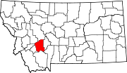
CDPs Basin | Cardwell | Clancy | Jefferson City | Montana City
Ghost towns Categories:- Populated places in Jefferson County, Montana
- Census-designated places in Montana
- Helena micropolitan area


Wikimedia Foundation. 2010.