- Greenland, New Hampshire
Infobox Settlement
official_name = Greenland, New Hampshire
nickname =
motto =
image_
imagesize =
image_caption =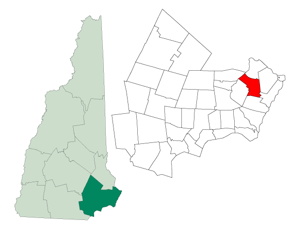
mapsize = 250px
map_caption = Location in Rockingham County,New Hampshire
settlement_type = Town
mapsize1 =
map_caption1 =
subdivision_type = Country
subdivision_name =United States
subdivision_type1 = State
subdivision_name1 =New Hampshire
subdivision_type2 = County
subdivision_name2 = Rockingham
government_type =
leader_title =Board of Selectmen
leader_name = Mo Sodini, Chairman
Dan Kern
Paul Sanderson
established_title = Incorporated
established_date = 1704
area_magnitude = 1 E8
area_total_km2 = 34.4
area_total_sq_mi = 13.3
area_land_km2 = 27.2
area_land_sq_mi = 10.5
area_water_km2 = 7.3
area_water_sq_mi = 2.8
area_water_percent = 21.07
population_as_of = 2007
population_note =
population_total = 3,395
population_density_km2 = 124.8
population_density_sq_mi = 323.3
timezone = Eastern
utc_offset = -5
timezone_DST = Eastern
utc_offset_DST = -4
latd = 43 |latm = 02 |lats = 10 |latNS = N
longd = 70 |longm = 49 |longs = 58 |longEW = W
elevation_m = 18
elevation_ft = 59
website = [http://www.greenland-nh.com/ www.greenland-nh.com]
postal_code_type =ZIP code
postal_code = 03840
area_code = 603
blank_name = FIPS code
blank_info = 33-31700
blank1_name = GNIS feature ID
blank1_info = 0873612
footnotes =Greenland is a town in Rockingham County,
New Hampshire ,United States . The population was 3,208 at the 2000 census. It is drained by theWinnicut River , and bounded on the northwest by Great Bay.History
One of the earliest settlements in the state, Greenland was a
parish of Portsmouth (then calledStrawbery Banke ) operating in 1638. Captain Francis Champernowne moved from Strawbery Banke in 1640 and settled in the area of the present Portsmouth Country Club. He would call his farm "Greenland". His extensive landholdings included a farm which is now the town of Madbury, named for his ancestral home in Devon,England .Residents requested and were granted a separate parish in 1706. In c. 1710, Captain Samuel Weeks constructed a substantial brick house, thought to be the oldest brick house in
New Hampshire still standing. It survived theearthquake of 1755. Only the 18" thick beams that supported the structure were cracked during the quake. Greenland would incorporate in 1721.Greenland annexed parts of Stratham in 1805 and 1847.
Geography
According to the
United States Census Bureau , the town has a total area of convert|13.3|sqmi|km2, of which convert|10.5|sqmi|km2|abbr=on is land and convert|2.8|sqmi|km2|abbr=on is water, comprising 21.07% of the town. The highest point in Greenland is Breakfast Hill, at convert|151|ft|m abovesea level ), on the town's border with Rye. Greenland abuts Great Bay to the north and is primarily drained by theWinnicut River . Greenland lies fully within theMerrimack River watershed.cite book |title=Water Use in New Hampshire: An Activities Guide for Teachers |url=http://nh.water.usgs.gov/Publications/nh.intro.html |last=Foster |first=Debra H. |coauthors=Batorfalvy, Tatianna N.; and Medalie, Laura |publisher=U.S. Department of the Interior and U.S. Geological Survey |year=1995]Demographics
As of the
census GR|2 of 2000, there were 3,208 people, 1,204 households, and 892 families residing in the town. Thepopulation density was 305.9 people per square mile (118.1/km²). There were 1,244 housing units at an average density of 118.6/sq mi (45.8/km²). The racial makeup of the town was 97.79% White, 0.28% African American, 0.03% Native American, 1.22% Asian, 0.03% Pacific Islander, 0.12% from other races, and 0.53% from two or more races. Hispanic or Latino of any race were 0.72% of the population.There were 1,204 households out of which 36.2% had children under the age of 18 living with them, 62.5% were married couples living together, 8.1% had a female householder with no husband present, and 25.9% were non-families. 19.2% of all households were made up of individuals and 6.4% had someone living alone who was 65 years of age or older. The average household size was 2.65 and the average family size was 3.07.
In the town the population was spread out with 26.5% under the age of 18, 4.4% from 18 to 24, 32.9% from 25 to 44, 26.2% from 45 to 64, and 10.1% who were 65 years of age or older. The median age was 38 years. For every 100 females there were 92.1 males. For every 100 females age 18 and over, there were 89.5 males.
The median income for a household in the town was $62,172, and the median income for a family was $67,188. Males had a median income of $44,592 versus $31,815 for females. The
per capita income for the town was $31,270. About 3.6% of families and 5.9% of the population were below thepoverty line , including 10.1% of those under age 18 and 5.7% of those age 65 or over.References
External links
* [http://www.greenland-nh.com Town website]
* [http://www.weekslibrary.org/ Weeks Library "Website" -- with town historical information]
* [http://www.nh.gov/nhes/elmi/htmlprofiles/greenland.html New Hampshire Economic and Labor Market Information Bureau Profile]
Wikimedia Foundation. 2010.