- National Register of Historic Places listings in Cheshire County, New Hampshire
-
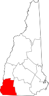 Location of Cheshire County in New Hampshire
This is a list of the National Register of Historic Places listings in Cheshire County, New Hampshire
This is intended to be a complete list of the properties and districts on the National Register of Historic Places in Cheshire County, New Hampshire, United States. Latitude and longitude coordinates are provided for many National Register properties and districts; these locations may be seen together in a Google map.[1]
There are 149 properties and districts listed on the National Register in the county, including 1 National Historic Landmark.
Contents: Counties in New Hampshire Belknap - Carroll - Cheshire - Coos - Grafton - Hillsborough - Merrimack - Rockingham - Strafford - Sullivan -
- This National Park Service list is complete through NPS recent listings posted November 10, 2011.[2]
Current listings
[3] Landmark name [4] Image Date listed Location City or town Summary 1 The Acre January 14, 1988 South of the lower part of the village of Harrisville at an S-curve in the road to Dublin
42°56′12″N 72°05′30″W / 42.936667°N 72.091667°WHarrisville 2 Adams Farm January 14, 1988 Off MacVeagh Rd. near Fansnacloich
42°55′41″N 72°07′24″W / 42.928056°N 72.123333°WHarrisville 3 Dr. Daniel Adams House June 8, 1989 324 Main St.
42°55′30″N 72°16′38″W / 42.925°N 72.277222°WKeene 4 John Adams Homestead-Wellscroft January 14, 1988 West of Sunset Hill Rd.
42°56′54″N 72°09′00″W / 42.948333°N 72.15°WHarrisville 5 Aldworth Manor January 14, 1988 On hill above IP-14 on the northern side of Chesham-Harrisville Rd.
42°56′59″N 72°06′58″W / 42.949722°N 72.116111°WHarrisville 6 Capt. Samuel Allison House December 18, 1983 Keene Rd.
42°54′45″N 72°07′09″W / 42.9125°N 72.119167°WDublin 7 Amory Ballroom May 2, 1985 Off Old Troy Rd.
42°53′33″N 72°05′53″W / 42.8925°N 72.098056°WDublin 8 Amory House December 15, 1983 Off Old Troy Rd.
42°53′38″N 72°06′00″W / 42.893889°N 72.1°WDublin 9 Amory-Appel Cottage May 2, 1985 Off Old Troy Rd.
42°53′36″N 72°05′42″W / 42.893333°N 72.095°WDublin 10 Appleton Farm December 18, 1983 Hancock Rd.
42°54′26″N 72°01′24″W / 42.907222°N 72.023333°WDublin 11 Appleton-Hannaford House December 15, 1983 Hancock Rd.
42°54′37″N 72°00′25″W / 42.910278°N 72.006944°WDublin 12 Asbury United Methodist Church December 21, 1983 NH 63
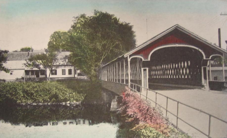
42°53′17″N 72°28′14″W / 42.888056°N 72.470556°WChesterfield 13 Ashuelot Covered Bridge 
February 20, 1981 NH 119 and Bolton Rd.
42°46′35″N 72°25′26″W / 42.776389°N 72.423889°WAshuelot Over Ashuelot River 14 Ballou-Newbegin House December 18, 1983 Old Marlborough Rd.
42°53′39″N 72°08′38″W / 42.894167°N 72.143889°WDublin 15 Timothy Bancroft House January 14, 1988 Northern side of the access road to Mosquitobush, off Tolman Pond Rd.
42°57′54″N 72°05′57″W / 42.965°N 72.099167°WHarrisville 16 Persia Beal House January 14, 1988 Northern side of Chesham Rd., west of IP-13
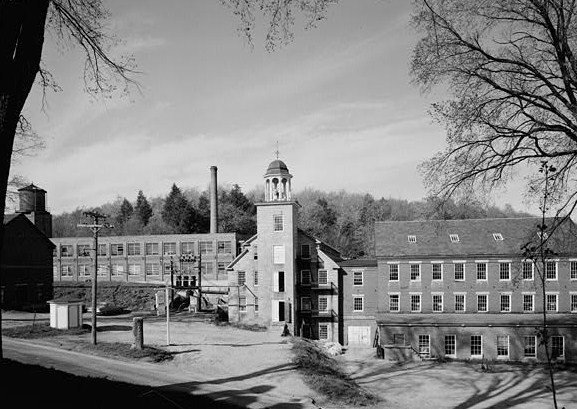
42°56′40″N 72°06′20″W / 42.944444°N 72.105556°WHarrisville 17 Beaver Mills December 9, 1999 93-115 Railroad St.
42°55′56″N 72°16′27″W / 42.932222°N 72.274167°WKeene 18 Beech Hill December 15, 1983 Off New Harrisville Rd.
42°54′39″N 72°04′00″W / 42.910833°N 72.066667°WDublin 19 Beech Hill Summer Home District January 14, 1988 Roughly Venable, Appleton, and Old Harrisville Rds.
42°55′31″N 72°05′11″W / 42.925278°N 72.086389°WHarrisville 20 Elbridge G. Bemis House January 14, 1988 Chesham Rd.
42°56′14″N 72°08′33″W / 42.937222°N 72.1425°WHarrisville 21 George Bemis House January 14, 1988 Chesham Rd.
42°56′15″N 72°08′31″W / 42.9375°N 72.141944°WHarrisville 22 Brackett House December 18, 1983 High Ridge Rd.
42°52′45″N 71°59′45″W / 42.879167°N 71.995833°WDublin 23 Stephen Rowe Bradley House December 22, 2005 43 Westminster St.
43°04′46″N 72°25′49″W / 43.079444°N 72.430278°WWalpole 24 Burpee Farm December 18, 1983 Burpee Rd.
42°52′19″N 72°04′15″W / 42.871944°N 72.070833°WDublin 25 Louis Cabot House December 18, 1983 Windmill Hill Rd.
42°53′25″N 72°02′11″W / 42.890278°N 72.036389°WDublin 26 T. H. Cabot Cottage December 15, 1983 Snow Hill Rd.
42°53′53″N 72°04′07″W / 42.898056°N 72.068611°WDublin 27 Carleton Bridge June 10, 1975 On Carleton Rd. over South Branch Ashuelot River
42°51′14″N 72°16′28″W / 42.853889°N 72.274444°WEast Swanzey 28 George Cheever Farm January 14, 1988 Intersection of Nelson and Tolman Pond Rds.
42°57′19″N 72°06′30″W / 42.955278°N 72.108333°WHarrisville 29 Chesham Village District December 29, 1986 Roughly bounded by Yellow Wings, Seaver, Chesham, and Marienfield Rds.
42°56′06″N 72°08′43″W / 42.935°N 72.145278°WHarrisville 30 Cheshire County Courthouse December 13, 1978 12 Court St.
42°56′03″N 72°16′48″W / 42.934167°N 72.28°WKeene 31 Clymer House January 14, 1988 Off Tolman Pond Rd. at the end of the entry road
42°57′38″N 72°06′19″W / 42.960556°N 72.105278°WHarrisville 32 Colony House September 9, 2005 104 West St.
42°56′05″N 72°16′56″W / 42.934722°N 72.282222°WKeene 33 Colony's Block March 24, 1983 4-7 Central Square
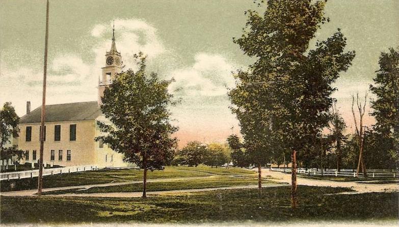
42°56′02″N 72°16′39″W / 42.933889°N 72.2775°WKeene 34 Conant Public Library 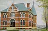
August 27, 1987 Main St.
42°46′19″N 72°23′03″W / 42.771944°N 72.384167°WWinchester 35 Noah Cooke House April 23, 1973 West of Keene on Daniels Hill Rd.
42°55′32″N 72°20′24″W / 42.925556°N 72.34°WKeene 36 Coombs Covered Bridge November 21, 1976 North of Winchester off NH 10
42°50′17″N 72°21′43″W / 42.838056°N 72.361944°WWinchester Over Ashuelot River 37 Corey Farm December 15, 1983 Parsons Rd.
42°53′01″N 72°02′59″W / 42.883611°N 72.049722°WDublin 38 Derby Shop-Goodnow Pail Factory-Holman & Merriman Machine Shop-L. A. Carpenter Machine Shop-Streeter Shop December 11, 2007 63 Canal St.
42°47′17″N 72°28′30″W / 42.788056°N 72.475°WHinsdale 39 Dinsmoor-Hale House April 26, 1976 Main and Winchester Sts.
42°55′39″N 72°16′40″W / 42.9275°N 72.277778°WKeene 40 Drewsville Mansion September 13, 1996 Old Cheshire Turnpike at the southern end of the Drewsville village common
43°07′36″N 72°23′34″W / 43.126667°N 72.392778°WWalpole 41 Dublin Lake Historic District December 18, 1983 Lake, E. Lake, W. Lake, and Old Harrisville Rds.
42°54′30″N 72°05′00″W / 42.908333°N 72.083333°WDublin Around Dublin Pond 42 Dublin Town Hall June 25, 1980 NH 101
42°54′20″N 72°03′41″W / 42.905556°N 72.061389°WDublin 43 Dublin Village Historic District December 15, 1983 Old Common and Harrisville Rds. and Main and Church Sts.
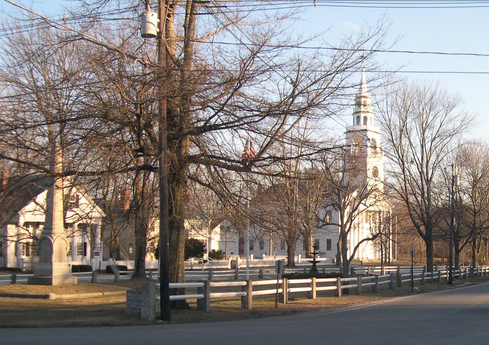
42°54′16″N 72°03′46″W / 42.904444°N 72.062778°WDublin 44 East Jaffrey Historic District 
June 14, 2002 Roughly along NH 124 through Jaffrey
42°49′38″N 72°03′16″W / 42.827229°N 72.054563°WJaffrey 45 Moses Eaton, Jr., House January 14, 1988 NH 137
42°56′05″N 72°01′13″W / 42.934722°N 72.020278°WHarrisville 46 Elliot Mansion April 30, 1976 305 Main St.
42°55′33″N 72°16′41″W / 42.925833°N 72.278056°WKeene 47 Eveleth Farm December 18, 1983 Burpee Rd.
42°52′20″N 72°04′24″W / 42.872222°N 72.073333°WDublin 48 Far Horizons December 15, 1983 Learned Rd.
42°52′48″N 72°04′23″W / 42.88°N 72.073056°WDublin 49 Corban C. Farwell Homestead January 14, 1988 Northern side of Childs Bog Rd.
42°56′34″N 72°08′03″W / 42.942778°N 72.134167°WHarrisville 50 Fasnacloich January 14, 1988 Four Hill Rd., north of the Dublin town line
42°55′27″N 72°06′30″W / 42.924167°N 72.108333°WHarrisville 51 Fisk Barn December 18, 1983 Gerry Rd.
42°53′38″N 72°01′42″W / 42.893889°N 72.028333°WDublin 52 Catherine Fiske Seminary For Young Ladies May 3, 1976 251 Main St.
42°55′37″N 72°16′40″W / 42.926944°N 72.277778°WKeene 53 Fitzwilliam Common Historic District May 2, 1997 Junction of NH 119, Richmond Rd., and the Templeton Highway
42°46′45″N 72°08′47″W / 42.779167°N 72.146389°WFitzwilliam 54 Foothill Farm December 15, 1983 Old Troy Rd.
42°53′47″N 72°06′16″W / 42.896389°N 72.104444°WDublin 55 Frost Farm December 15, 1983 Old Marlborough Rd. Dublin 56 Frost Farm December 18, 1983 Korpi Rd.
42°52′15″N 72°01′35″W / 42.870833°N 72.026389°WDublin 57 Gilchrest January 14, 1988 NH 137
42°55′48″N 72°01′16″W / 42.93°N 72.021111°WHarrisville 58 Gilsum Stone Arch Bridge August 31, 1989 Surry Rd. over the Ashuelot River, west of its junction with NH 10
43°02′20″N 72°16′14″W / 43.038889°N 72.270556°WGilsum 59 Glenchrest January 14, 1988 NH 137
42°56′07″N 72°01′06″W / 42.935278°N 72.018333°WHarrisville 60 Golden Rod Grange No. 114 March 17, 1994 Western side of NH 32, 0.1 mi (0.16 km) south of its junction with Eaton Rd.
42°52′20″N 72°16′57″W / 42.872222°N 72.2825°WSwanzey 61 James Gowing Farm December 18, 1983 Page Rd.
42°52′41″N 72°02′13″W / 42.878056°N 72.036944°WDublin 62 Joseph Gowing Farm December 15, 1983 Page Rd.
42°52′53″N 72°02′13″W / 42.881389°N 72.036944°WDublin 63 Grace United Methodist Church March 7, 1985 34 Court St.
42°56′04″N 72°17′03″W / 42.934444°N 72.284167°WKeene 64 Isaac Greenwood House December 18, 1983 Peterborough Rd.
42°54′28″N 72°02′43″W / 42.907778°N 72.045278°WDublin 65 Moses Greenwood House December 15, 1983 Pierce and Old County Rds.
42°54′16″N 72°02′33″W / 42.904444°N 72.0425°WDublin 66 Harrisville Historic District 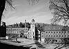
September 17, 1971 Central Harrisville and its environs
42°56′52″N 72°05′49″W / 42.947778°N 72.096944°WHarrisville and vicinity A picturesque mill town. 67 Harrisville Rural District February 18, 1987 Roughly along Venable, Old Harrisville, New Harrisville, and Bonds Corner Rds.
42°55′36″N 72°04′42″W / 42.926667°N 72.078333°WHarrisville 68 High Tops School December 13, 1984 Reynolds and River Rds.
42°57′45″N 72°29′16″W / 42.9625°N 72.487778°WWestmoreland 69 Ivanov-Rinov House December 18, 1983 Pierce Rd.
42°53′58″N 72°02′34″W / 42.899444°N 72.042778°WDublin 70 Jaffrey Center Historic District June 11, 1975 Northwest of Jaffrey on NH 124
42°49′38″N 72°03′13″W / 42.827222°N 72.053611°WJaffrey 71 Jaffrey Mills August 10, 1982 41 Main St.
42°48′54″N 72°01′25″W / 42.815°N 72.023611°WJaffrey 72 Jewett-Kemp-Marlens House May 30, 1997 North Rd., 2 mi (3.2 km) north of its junction with NH 123
43°09′26″N 72°17′36″W / 43.157222°N 72.293333°WAlstead 73 Jones Hall June 7, 1984 Church St.
43°06′59″N 72°11′59″W / 43.116389°N 72.199722°WMarlow 74 Kendall Cottage January 14, 1988 Northern side of Silver Lake Rd.
42°56′45″N 72°08′22″W / 42.945833°N 72.139444°WHarrisville 75 Knollwood December 18, 1983 Windmill Hill Rd.
42°53′35″N 72°03′34″W / 42.893056°N 72.059444°WDublin 76 Lattice Cottage December 15, 1983 Off Old Troy Rd.
42°53′31″N 72°05′38″W / 42.891944°N 72.093889°WDublin 77 Lawrence Farm June 9, 2000 9 Lawrence Rd.
42°50′39″N 72°11′11″W / 42.844167°N 72.186389°WTroy 78 Learned Homestead December 15, 1983 Upper Jaffrey Rd.
42°53′41″N 72°03′37″W / 42.894722°N 72.060278°WDublin 79 Amos Learned Farm December 15, 1983 NH 137
42°53′34″N 72°01′27″W / 42.892778°N 72.024167°WDublin 80 Benjamin Learned House December 18, 1983 Upper Jaffrey Rd.
42°53′46″N 72°03′37″W / 42.896111°N 72.060278°WDublin 81 Markham House December 18, 1983 Snow Hill Rd.
42°54′11″N 72°04′06″W / 42.903056°N 72.068333°WDublin 82 Benjamin Marshall House December 15, 1983 Peterborough Rd.
42°54′05″N 72°01′28″W / 42.901389°N 72.024444°WDublin 83 Micajah Martin Farm December 18, 1983 Old Peterborough Rd.
42°53′44″N 72°00′44″W / 42.895556°N 72.012222°WDublin 84 Mason House December 15, 1983 Snow Hill Rd.
42°54′06″N 72°03′57″W / 42.901667°N 72.065833°WDublin 85 Mason-Watkins House March 11, 1982 RD # 2
42°59′12″N 72°20′18″W / 42.986667°N 72.338333°WSurry 86 McKenna Cottage December 18, 1983 Windmill Hill Rd.
42°53′44″N 72°03′30″W / 42.895556°N 72.058333°WDublin 87 Moore Farm and Twitchell Mill Site December 18, 1983 Off Page Rd.
42°51′58″N 72°02′04″W / 42.866111°N 72.034444°WDublin 88 Asa Morse Farm December 15, 1983 NH 101
42°54′47″N 72°05′39″W / 42.913056°N 72.094167°WDublin 89 Capt. Thomas Morse Farm December 15, 1983 Old Marlborough Rd.
42°54′01″N 72°06′22″W / 42.900278°N 72.106111°WDublin 90 Eli Morse Farm April 11, 1983 Lake Rd.
42°53′43″N 72°05′08″W / 42.895278°N 72.085556°WDublin 91 Eli Morse Sawmill Foundations December 18, 1983 Off Old Marlborough Rd.
42°53′57″N 72°05′31″W / 42.899167°N 72.091944°WDublin 92 Mountain View Farm December 18, 1983 Upper Jaffrey Rd.
42°53′20″N 72°04′03″W / 42.888889°N 72.0675°WDublin 93 Needham House January 14, 1988 Meadow Rd.
42°55′43″N 72°09′10″W / 42.928611°N 72.152778°WHarrisville 94 Nelson Schoolhouse April 23, 1973 Old Sullivan Rd.
42°59′21″N 72°07′42″W / 42.989167°N 72.128333°WNelson 95 New Hampshire Conservatory of Music and the Arts May 15, 1980 Central Sq.
42°46′24″N 72°22′59″W / 42.773333°N 72.383056°WWinchester 96 Old Patch Place August 15, 1980 West of Fitzwilliam on Rhododendron Rd.
42°47′02″N 72°11′28″W / 42.783889°N 72.191111°WFitzwilliam 97 Park Hill Meetinghouse September 8, 1980 Park Hill
42°58′31″N 72°27′24″W / 42.975278°N 72.456667°WWestmoreland 98 Parsons Studio and Casino December 18, 1983 Parsons Rd.
42°53′07″N 72°03′07″W / 42.885278°N 72.051944°WDublin 99 Peck-Porter House August 31, 2000 Main St., junction with Middle St.
43°04′41″N 72°25′37″W / 43.078056°N 72.426944°WWalpole 100 Ivory Perry Homestead December 15, 1983 Corner Valley and Dooe Rds.
42°52′38″N 72°00′01″W / 42.877222°N 72.000278°WDublin 101 John Perry Homestead December 18, 1983 Dooe Rd.
42°52′45″N 72°00′18″W / 42.879167°N 72.005°WDublin 102 Rufus Piper Homestead December 15, 1983 Pierce Rd.
42°52′22″N 72°00′05″W / 42.872778°N 72.001389°WDublin 103 Solomon Piper Farm December 18, 1983 Valley Rd.
42°52′22″N 72°00′05″W / 42.872778°N 72.001389°WDublin 104 Point Comfort January 14, 1988 S. Skatutakee Rd.
42°56′09″N 72°05′05″W / 42.935833°N 72.084722°WHarrisville 105 Pottersville District December 29, 1986 Roughly intersection of Roxbury and Meadow Rds., and along Brown Rd. northeast of Chesham Rd.
42°55′44″N 72°08′41″W / 42.928889°N 72.144722°WHarrisville 106 Pumpelly Studio December 15, 1983 Snow Hill Rd.
42°53′56″N 72°04′13″W / 42.898889°N 72.070278°WDublin 107 Raubold House January 14, 1988 Northern side of Chesham Rd. west of IP-9A
42°56′41″N 72°06′14″W / 42.944722°N 72.103889°WHarrisville 108 Abijah Richardson, Sr. Homestead December 18, 1983 Hancock Rd.
42°54′46″N 72°00′06″W / 42.912778°N 72.001667°WDublin 109 Deacon Abijah Richardson House December 15, 1983 Hancock Rd.
42°54′42″N 72°00′04″W / 42.911667°N 72.001111°WDublin 110 John Richardson Homestead December 18, 1983 Hancock Rd.
42°55′00″N 72°00′06″W / 42.916667°N 72.001667°WDublin 111 Luke Richardson House December 15, 1983 Hancock Rd.
42°54′35″N 72°00′44″W / 42.909722°N 72.012222°WDublin 112 Richmond Community Church 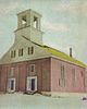
March 24, 1983 Fitzwilliam Rd.
42°45′16″N 72°16′17″W / 42.754444°N 72.271389°WRichmond 113 Richmond School House No. 6 November 25, 1980 NH 119
42°45′19″N 72°16′27″W / 42.755278°N 72.274167°WRichmond 114 Richmond Town Hall December 19, 1979 NH 32
42°45′46″N 72°16′08″W / 42.762778°N 72.268889°WRichmond 115 James Robbe, Jr., House December 18, 1983 Old Peterborough Rd.
42°53′29″N 72°00′01″W / 42.891389°N 72.000278°WDublin 116 Sawyer Tavern May 15, 1980 63 Arch St.
42°56′21″N 72°19′00″W / 42.939167°N 72.316667°WKeene 117 Sawyers Crossing Covered Bridge November 14, 1978 North of Swanzey off NH 32
42°53′10″N 72°17′12″W / 42.886111°N 72.286667°WSwanzey Over Ashuelot River 118 Second Rindge Meetinghouse, Horsesheds and Cemetery 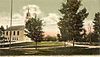
October 5, 1979 U.S. Route 202 and Rindge Common
42°44′59″N 72°00′37″W / 42.749722°N 72.010278°WRindge 119 Shedd-Porter Memorial Library December 27, 2010 3 Main St.
43°08′56″N 72°21′40″W / 43.148889°N 72.361111°WAlstead 120 Silver Lake District December 29, 1986 Roughly along Old Nelson, Eastside, and Westside Rds.
42°57′01″N 72°08′13″W / 42.950278°N 72.136944°WHarrisville Around Silver Lake 121 Silver Lake Farm January 14, 1988 Between Silver Lake and Seaver Rds. near the intersection with Old Nelson Rd.
42°56′30″N 72°08′35″W / 42.941667°N 72.143056°WHarrisville 122 Slate Covered Bridge November 14, 1978 Off NH 10
42°50′51″N 72°20′29″W / 42.8475°N 72.341389°WWestport Over Ashuelot River 123 Smith-Mason Farm January 14, 1988 Northwest of the intersection of Meadow and Old Roxbury Roads
42°55′52″N 72°09′25″W / 42.931111°N 72.156944°WHarrisville 124 Spur House December 15, 1983 Off Old Common Rd.
42°54′32″N 72°04′05″W / 42.908889°N 72.068056°WDublin 125 Stationmaster's House January 14, 1988 Jaquith Rd.
42°56′03″N 72°02′13″W / 42.934167°N 72.036944°WHarrisville 126 Stone Farm December 18, 1983 Old Marlborough Rd.
42°53′41″N 72°08′54″W / 42.894722°N 72.148333°WDublin 127 Stone-Darracott House December 15, 1983 Old Marlborough Rd.
42°53′34″N 72°08′54″W / 42.892778°N 72.148333°WDublin 128 Stonehenge December 18, 1983 Windmill Hill Rd.
42°53′41″N 72°03′01″W / 42.894722°N 72.050278°WDublin 129 Capt. Richard Strong House December 18, 1983 Peterborough Rd.
42°54′14″N 72°01′46″W / 42.903889°N 72.029444°WDublin 130 Richard Strong Cottage December 15, 1983 Off Peterborough Rd.
42°54′12″N 72°01′37″W / 42.903333°N 72.026944°WDublin 131 Henry Strongman House December 15, 1983 Peterborough Rd.
42°54′19″N 72°01′54″W / 42.905278°N 72.031667°WDublin 132 William Strongman House December 18, 1983 Old County Rd.
42°54′19″N 72°02′20″W / 42.905278°N 72.038889°WDublin 133 Third Fitzwilliam Meetinghouse 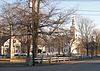
August 26, 1977 Village Green
42°46′46″N 72°08′41″W / 42.779444°N 72.144722°WFitzwilliam 134 Todd Block June 14, 1988 27-31 Main St.
42°47′12″N 72°29′33″W / 42.786667°N 72.4925°WHinsdale 135 Townsend Farm December 15, 1983 E. Harrisville Rd.
42°55′04″N 72°02′20″W / 42.917778°N 72.038889°WDublin 136 Jabez Townsend House January 14, 1988 E. Harrisville and Cherry Hill Rds.
42°55′48″N 72°02′15″W / 42.93°N 72.0375°WHarrisville 137 Troy Village Historic District 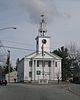
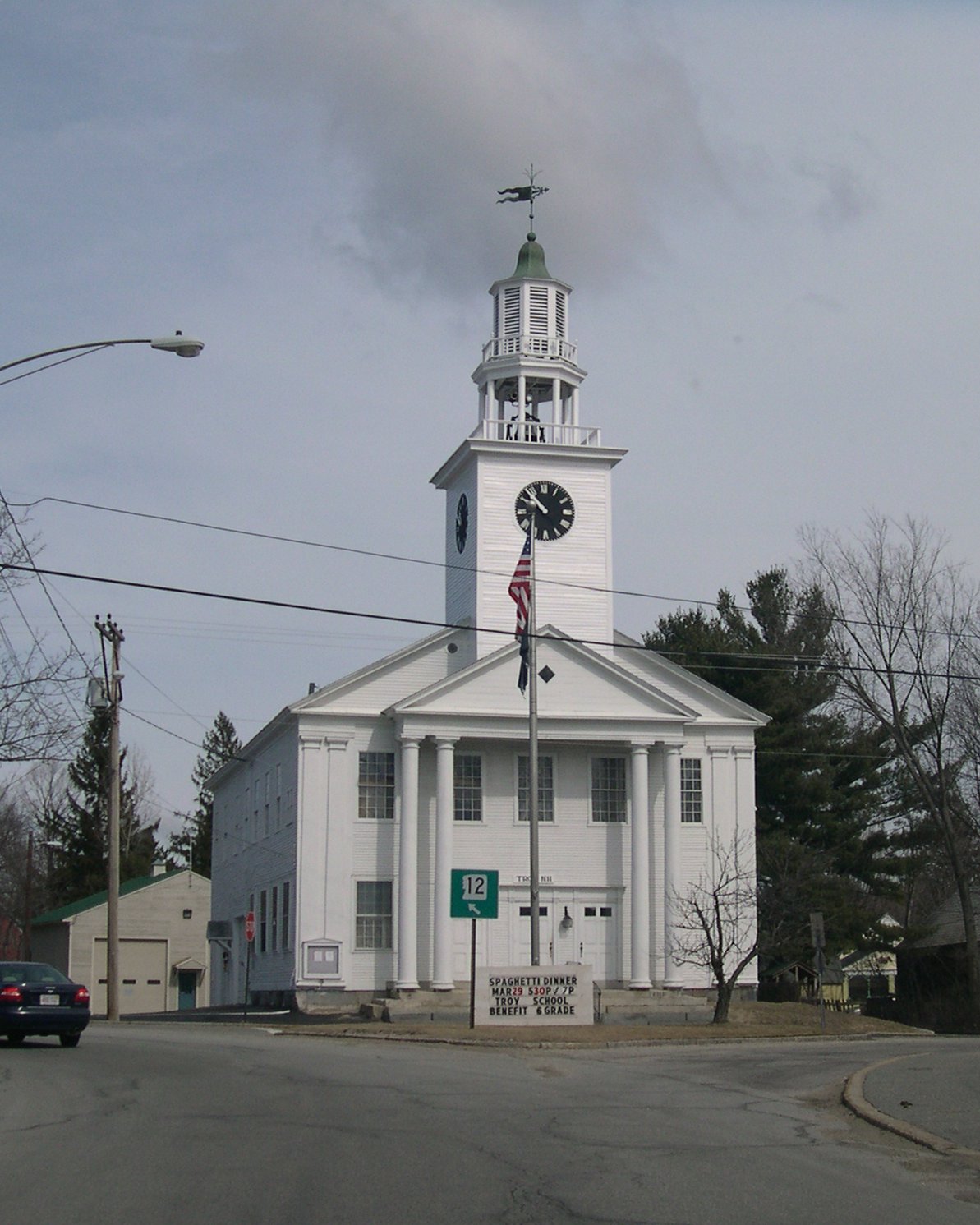
December 13, 2002 Encompassing the village center, mostly along NH 12
42°49′28″N 72°10′57″W / 42.824444°N 72.1825°WTroy 138 United Church of Christ in Keene March 9, 1982 23 Central Sq.
42°56′04″N 72°16′43″W / 42.934444°N 72.278611°WKeene 139 Veterans' Memorial Hall September 4, 1986 NH 32
42°45′53″N 72°16′09″W / 42.764722°N 72.269167°WRichmond 140 Mary Anne Wales House December 18, 1983 Snow Hill Rd.
42°54′14″N 72°04′01″W / 42.903889°N 72.066944°WDublin 141 Walpole Academy May 21, 1975 Main St.
43°04′44″N 72°25′32″W / 43.078889°N 72.425556°WWalpole 142 Weldwood December 15, 1983 Old Troy Rd.
42°53′17″N 72°06′25″W / 42.888056°N 72.106944°WDublin 143 West Swanzey Covered Bridge 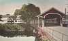
February 29, 1980 Main St.
42°52′18″N 72°19′42″W / 42.871667°N 72.328333°WWest Swanzey Over Ashuelot River 144 Wildwood Cottage January 14, 1988 South of access road to Mosquitobush, off Tolman Pond Rd.
42°57′52″N 72°06′00″W / 42.964444°N 72.1°WHarrisville 145 Willard Homestead January 14, 1988 Sunset Hill Ave.
42°56′30″N 72°09′21″W / 42.941667°N 72.155833°WHarrisville 146 Winchester Town Hall 
August 27, 1987 Main St.
42°46′22″N 72°23′02″W / 42.772778°N 72.383889°WWinchester 147 Windmill Hill December 18, 1983 Windmill Hill Rd.
42°53′14″N 72°02′09″W / 42.887222°N 72.035833°WDublin 148 Wood House December 15, 1983 NH 101 and NH 137
42°54′00″N 72°01′25″W / 42.9°N 72.023611°WDublin 149 Wyman Tavern April 3, 1972 339 Main St.
42°55′30″N 72°16′42″W / 42.925°N 72.278333°WKeene See also
- List of National Historic Landmarks in New Hampshire
- National Register of Historic Places listings in New Hampshire
References
- ^ The latitude and longitude information provided in this table was derived originally from the National Register Information System, which has been found to be fairly accurate for about 99% of listings. For about 1% of NRIS original coordinates, experience has shown that one or both coordinates are typos or otherwise extremely far off; some corrections may have been made. A more subtle problem causes many locations to be off by up to 150 yards, depending on location in the country: most NRIS coordinates were derived from tracing out latitude and longitudes off of USGS topographical quadrant maps created under North American Datum of 1927, which differs from the current, highly accurate GPS system used by Google maps. Chicago is about right, but NRIS longitudes in Washington are higher by about 4.5 seconds, and are lower by about 2.0 seconds in Maine. Latitudes differ by about 1.0 second in Florida. Some locations in this table may have been corrected to current GPS standards.
- ^ "National Register of Historic Places: Weekly List Actions". National Park Service, United States Department of the Interior. Retrieved on November 10, 2011.
- ^ Numbers represent an ordering by significant words. Various colorings, defined here, differentiate National Historic Landmark sites and National Register of Historic Places Districts from other NRHP buildings, structures, sites or objects.
- ^ "National Register Information System". National Register of Historic Places. National Park Service. . http://nrhp.focus.nps.gov/natreg/docs/All_Data.html.
U.S. National Register of Historic Places Topics Lists by states Alabama • Alaska • Arizona • Arkansas • California • Colorado • Connecticut • Delaware • Florida • Georgia • Hawaii • Idaho • Illinois • Indiana • Iowa • Kansas • Kentucky • Louisiana • Maine • Maryland • Massachusetts • Michigan • Minnesota • Mississippi • Missouri • Montana • Nebraska • Nevada • New Hampshire • New Jersey • New Mexico • New York • North Carolina • North Dakota • Ohio • Oklahoma • Oregon • Pennsylvania • Rhode Island • South Carolina • South Dakota • Tennessee • Texas • Utah • Vermont • Virginia • Washington • West Virginia • Wisconsin • WyomingLists by territories Lists by associated states Other  Category:National Register of Historic Places •
  Portal:National Register of Historic Places
Municipalities and communities of Cheshire County, New Hampshire County seat: Keene City 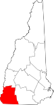
Towns Alstead | Chesterfield | Dublin | Fitzwilliam | Gilsum | Harrisville | Hinsdale | Jaffrey | Marlborough | Marlow | Nelson | Richmond | Rindge | Roxbury | Stoddard | Sullivan | Surry | Swanzey | Troy | Walpole | Westmoreland | Winchester
Villages Ashuelot | Chesham | Drewsville | East Swanzey | North Walpole | Poocham | Spofford | West Swanzey
Categories:- National Register of Historic Places in New Hampshire by county
- Cheshire County, New Hampshire
-


Wikimedia Foundation. 2010.