- Hinsdale, New Hampshire
Infobox Settlement
official_name = Hinsdale, New Hampshire
nickname =
motto =
image_
imagesize =
image_caption =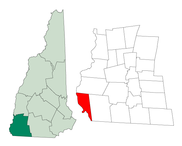
mapsize = 250px
map_caption = Location inCheshire County, New Hampshire
settlement_type = Town
mapsize1 =
map_caption1 =
subdivision_type = Country
subdivision_name =United States
subdivision_type1 = State
subdivision_name1 =New Hampshire
subdivision_type2 = County
subdivision_name2 = Cheshire
government_type =
leader_title =Board of Selectmen
leader_name = Robert M. Johnson
John D. Smith
Jerome Ebbighausen, Jr.
Kathy Stephens
Bruce Bellville
established_title = Incorporated
established_date = 1753
area_magnitude = 1 E8
area_total_km2 = 59.0
area_total_sq_mi = 22.8
area_land_km2 = 53.6
area_land_sq_mi = 20.7
area_water_km2 = 5.4
area_water_sq_mi = 2.1
area_water_percent = 9.22
population_as_of = 2000
population_note =
population_total = 4082
population_density_km2 = 76.2
population_density_sq_mi = 197.4
timezone = Eastern
utc_offset = -5
timezone_DST = Eastern
utc_offset_DST = -4
latd = 42 |latm = 47 |lats = 10 |latNS = N
longd = 72 |longm = 29 |longs = 11 |longEW = W
elevation_m = 66
elevation_ft = 217
website = [http://www.town.hinsdale.nh.us/ www.town.hinsdale.nh.us]
postal_code_type =ZIP code
postal_code = 03451
area_code = 603
blank_name = FIPS code
blank_info = 33-36660
blank1_name = GNIS feature ID
blank1_info = 0873626
footnotes =Hinsdale is a town in Cheshire County,
New Hampshire ,United States . The population was 4,082 at the 2000 census. Hinsdale is home to part ofPisgah State Park in the northeast, and part ofWantastiquet Mountain State Forest in the northwest.The primary settlement in town, where over 41% of the population resides, is defined as the Hinsdale
census-designated place (CDP), and is located at the junction of New Hampshire Routes 63 and 119.History
Tucked into the farthest southwestern corner of the state, Hinsdale was chartered in 1753 by Colonial Governor
Benning Wentworth . It was named for Colonel Ebenezer Hinsdale, member of a prominentDeerfield, Massachusetts family, whose mother had been taken captive in the famedDeerfield Massacre of 1704. Graduated fromHarvard College , Hinsdaleordain ed to become amissionary for Indians of the Connecticut River Valley. Instead, he would serve as chaplain atFort Dummer , an importanttrading post on theConnecticut River , later enlisting as an officer in the army. Then, in 1742, he established Fort Hinsdale, including atrading post andgristmill , reportedly at his own expense. The town's earliest history recounts Indian assaults, raids and captivities.Located beside the Connecticut River and connected to Brattleboro,
Vermont by bridge, Hinsdale contains excellent farmland, but has been a significant center of industry as well, especially in the manufacture of paper. In amachine shop here, George A. Long built a self-propelled steam vehicle in 1875, for which he received one of the nation's earliestautomobile patent s.Geography
According to the
United States Census Bureau , the town has a total area of convert|22.8|sqmi|km2, of which convert|20.7|sqmi|km2|abbr=on is land and convert|2.1|sqmi|km2|abbr=on is water, comprising 9.22% of the town. The town center, orcensus-designated place , has a total area of convert|2.5|sqmi|km2|abbr=on. convert|2.4|sqmi|km2|abbr=on of it is land and convert|0.1|sqmi|km2|abbr=on of it (2.40%) is water.The highest point in town is Wantastiquet Mountain, at convert|1378|ft|m above
sea level , located on the town's northern boundary and overlooking theConnecticut River andBrattleboro, Vermont to the west. The entire town lies within theConnecticut River watershed, with roughly the northwestern two-thirds of town draining into small streams that feed directly into the Connecticut, and with the southeastern third of the town draining into theAshuelot River , a major tributary of the Connecticut.cite book |title=Water Use in New Hampshire: An Activities Guide for Teachers |url=http://nh.water.usgs.gov/Publications/nh.intro.html |last=Foster |first=Debra H. |coauthors=Batorfalvy, Tatianna N.; and Medalie, Laura |publisher=U.S. Department of the Interior and U.S. Geological Survey |year=1995]Demographics
As of the
census of 2000, there were 4,082 people, 1,622 households, and 1,088 families residing in the town. Thepopulation density was 197.4 people per square mile (76.2/km²). There were 1,714 housing units at an average density of 32.0 persons/km² (82.9 persons/sq mi). The racial makeup of the town was 97.50% White, 0.42%African American , 0.20% Native American, 0.32%Asia n, 0.29% Pacific Islander, 0.22% from other races, and 1.05% from two or more races. 0.47% of the population wereHispanic orLatino of any race.There were 1,622 households out of which 32.2% had children under the age of 18 living with them, 51.6% were married couples living together, 10.3% have a woman whose husband does not live with her, and 32.9% were non-families. 24.8% of all households were made up of individuals and 9.9% had someone living alone who was 65 years of age or older. The average household size was 2.52 and the average family size was 3.00.
In the town the population was spread out with 26.0% under the age of 18, 7.6% from 18 to 24, 30.3% from 25 to 44, 23.8% from 45 to 64, and 12.2% who were 65 years of age or older. The median age was 37 years. For every 100 females there were 94.8 males. For every 100 females age 18 and over, there were 93.2 males.
The median income for a household in the town was $36,124, and the median income for a family was $43,413. Males had a median income of $31,440 versus $23,000 for females. The
per capita income for the town was $16,611. 6.4% of the population and 3.2% of families were below the poverty line. Out of the total people living in poverty, 9.1% are under the age of 18 and 7.2% are 65 or older.Town center
As of the
census of 2000, there were 1,713 people, 707 households, and 431 families residing in the Hinsdalecensus-designated place (CDP), the primary settlement in town. Thepopulation density was 703.7 people per square mile (272.2/km²). There were 746 housing units at an average density of 118.5 persons/km² (306.5 persons/sq mi). The racial makeup of the town was 97.49% White, 0.35%African American , 0.41% Native American, 0.29%Asia n, 0.29% Pacific Islander, 0.41% from other races, and 0.76% from two or more races. 0.23% of the population wereHispanic orLatino of any race.There were 707 households out of which 30.1% had children under the age of 18 living with them, 45.4% were married couples living together, 10.0% have a woman whose husband does not live with her, and 39.0% were non-families. 30.8% of all households were made up of individuals and 14.1% had someone living alone who was 65 years of age or older. The average household size was 2.42 and the average family size was 3.04.
In the CDP the population was spread out with 25.8% under the age of 18, 8.5% from 18 to 24, 29.1% from 25 to 44, 21.9% from 45 to 64, and 14.7% who were 65 years of age or older. The median age was 37 years. For every 100 females there were 92.7 males. For every 100 females age 18 and over, there were 92.3 males.
The median income for a household is $35,417, and the median income for a family was $42,308. Males had a median income of $31,983 versus $25,385 for females. The
per capita income for the town was $15,122. 10.9% of the population and 5.8% of families were below the poverty line. Out of the total people living in poverty, 16.7% are under the age of 18 and 16.2% are 65 or older.References
External links
* [http://www.town.hinsdale.nh.us Town website]
* [http://www.keenenh.com/hinsdale/library.asp Hinsdale Public Library]
* [http://www.nh.gov/nhes/elmi/htmlprofiles/hinsdale.html New Hampshire Economic and Labor Market Information Bureau Profile]
* [http://www.nhstateparks.org/state-parks/alphabetical-order/pisgah-state-park/ Pisgah State Park]
Wikimedia Foundation. 2010.