- Rindge, New Hampshire
Infobox Settlement
official_name = Rindge, New Hampshire
nickname =
motto =
imagesize =
image_caption = "Rindge Center" ca. 2004
image_
mapsize = 250px
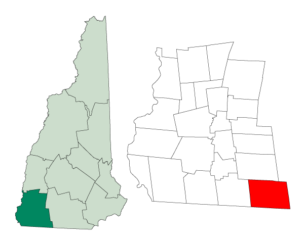
map_caption = Location in Cheshire County,New Hampshire
settlement_type = Town
mapsize1 =
map_caption1 =
subdivision_type = Country
subdivision_name =United States
subdivision_type1 = State
subdivision_name1 =New Hampshire
subdivision_type2 = County
subdivision_name2 = Cheshire
government_type =
leader_title =Board of Selectmen
leader_name = Timothy Halliday
Patricia Lang Barry
Jed Brummer
established_title = Incorporated
established_date = 1768
area_magnitude = 1 E8
area_total_km2 = 103.5
area_total_sq_mi = 40.0
area_land_km2 = 96.3
area_land_sq_mi = 37.2
area_water_km2 = 7.2
area_water_sq_mi = 2.8
area_water_percent = 6.93
population_as_of = 2000
population_note =
population_total = 5451
population_density_km2 = 56.6
population_density_sq_mi = 146.6
timezone = Eastern
utc_offset = -5
timezone_DST = Eastern
utc_offset_DST = -4
latd = 42 |latm = 44 |lats = 59 |latNS = N
longd = 72 |longm = 00 |longs = 37 |longEW = W
elevation_m = 395
elevation_ft = 1296
website = [http://www.town.rindge.nh.us/ www.town.rindge.nh.us]
postal_code_type =ZIP code
postal_code = 03461
area_code = 603
blank_name = FIPS code
blank_info = 33-64580
blank1_name = GNIS feature ID
blank1_info = 0873707
footnotes =Rindge is a town in Cheshire County,
New Hampshire ,United States . The population was 5,451 at the 2000 census. The estimated population was 6,331 in 2007, according to the State Data Center. [cite web| url=http://www.nh.gov/oep/programs/DataCenter/Population/documents/2007_population_estimates.pdf| title="2007 Population Estimates of New Hampshire Cities and Towns"| date=June 2008| publisher=NH Office of Energy and Planning| accessdate=2008-06-03] Rindge is home toFranklin Pierce University , the Cathedral of the Pines, and part of Annett State Forest.History
Native American inhabitants
The land in and around Rindge was originally inhabited by ancestors of the
Abenaki tribe of Native Americans. Archeological evidence from nearby Swanzey,New Hampshire indicates that the region was inhabited as much as 11,000 years ago (coinciding with the end of the last glacial period). As much as half of the Western Abenakis were victims of a wave of epidemics that coincided with the arrival of Europeans in the late 16th and early 17th centuries. Later, many of the Western Abenaki present in southwestern New Hampshire chose to relocate toCanada during Colonial times, primarily due to their allegiance with the French during theFrench and Indian War .Settlement by European-Americans
In the eighteenth century, Massachusetts granted unappropriated land to the veterans of Sir William Phipps' expedition against French-held Canada in 1690 as compensation for their services. Whole townships were granted to certain military companies and became known as Canada townships. Despite the name, none of these townships were ever considered to be part of Canada. Granted in 1736 by Massachusetts Colonial Governor
Jonathan Belcher to soldiers from Rowley,Massachusetts returning from the war inCanada , the town was first known as "Rowley-Canada." The colony of New Hampshire was making competing claims to the area, and in 1740 commissioners of the king decided that the boundary between Massachusetts and New Hampshire lay south of what would become Rindge. [Stearns, Ezra. "History of the Town of Rindge." Boston: George Ellis, 1875, Reprinted by Phoenix Publishing, 1988. p. 37.] In 1749, it was re-granted by New Hampshire GovernorBenning Wentworth as "Monadnock No. 1," or "South Monadnock." The town would be incorporated in 1768 by Governor John Wentworth as "Rindge," in honor of Captain Daniel Rindge of Portsmouth, one of the original grant holders, and the one who represented New Hampshire's claim to the land before the king. [Stearns, p. 35.]Captain Abel Platts is credited as being Rindge's first settler, arriving in 1738 to take possession of his family's land grant. [cite web|url=http://www.nh.searchroots.com/documents/History_Rindge_NH.txt|title="HISTORY OF RINDGE, CHESHIRE COUNTY, NEW HAMPSHIRE"|publisher=www.nh.searchroots.com|accessdate=2008-03-07] However, the disputes about the grants, combined with the beginning of the French and Indian War in 1744, made it too difficult to remain in Rindge, and the early settlers temporarily abandoned it. Platts and others returned around 1751, and starting in 1758, settlement increased steadily. [Stearns, p. 66-67.]
Notable inhabitants
*
Addison Gardiner (D), Lieutenant Governor of New York and Chief Judge of theNew York Court of Appeals , born in Rindge in 1797
*George P. Barker ,New York State Attorney General , born in Rindge in 1807*
Ellen Elvira Gibson , the first female chaplain to serve the U.S. military, assigned to the First Wisconsin Heavy Artillery during the Civil War [Stearns, p. 530-531.]
*Enoch Hale ,New Hampshire Militia officer during theAmerican Revolutionary War
*Nathan Hale, not the famous spy, but the brother of Enoch Hale and Colonel of the2nd New Hampshire Regiment
*Amasa Norcross (R), mayor of Fitchburg,Massachusetts (1873-74) and U.S. Representative fromMassachusetts ' 10th District (1877-1883), born in Rindge in 1824Geography
According to the
United States Census Bureau , the town has a total area of convert|40.0|sqmi|km2, of which convert|37.2|sqmi|km2|abbr=on is land and convert|2.8|sqmi|km2|abbr=on is water, comprising 6.93% of the town. Rindge is located in a hilly lake region. Hubbard Pond is in the northeast,Contoocook Lake on the northern boundary, andLake Monomonac on the southern boundary. The town is located on a regional watershed divide and is the headwaters for two river systems (the Contoocook and the Millers). [cite web|url=http://www.topoquest.com/map.asp?lat=42.75111&lon=-72.01028&datum=nad27&u=4&layer=DRG&size=l&s=200|publisher=TopoQuest.com|author=U.S. Geological Survey|title="Rindge, USGS Monadnock Mountain (NH) Topo Map"|accessdate=2008-06-29] [cite web|url=http://www.town.rindge.nh.us/ch3.pdf|author=Town of Rindge|title="Master Plan, Chapter 3: Natural Resources"|accessdate=2008-03-07] Rindge's highest point is on its eastern border, on the lower slopes ofPratt Mountain , where the elevation reaches convert|1505|ft|m abovesea level .Rindge is home to the villages of Rindge Center, East Rindge, Converseville, and West Rindge.
Demographics
As of the
census GR|2 of 2000, there were 5,451 people, 1,502 households, and 1,138 families residing in the town. Thepopulation density was 146.6 people per square mile (56.6/km²). There were 1,863 housing units at an average density of 50.1/sq mi (19.3/km²). The racial makeup of the town was 97.21% White, 1.16% African American, 0.15% Native American, 0.33% Asian, 0.02% Pacific Islander, 0.40% from other races, and 0.73% from two or more races. Hispanic or Latino of any race were 0.88% of the population. 15.1% were of English, 11.2% Finnish, 11.0% Irish, 9.5% French, 9.3%French Canadian , 8.9% American and 7.5% Italian ancestry according toCensus 2000 .There were 1,502 households out of which 38.3% had children under the age of 18 living with them, 65.4% were married couples living together, 6.6% had a female householder with no husband present, and 24.2% were non-families. 18.6% of all households were made up of individuals and 5.3% had someone living alone who was 65 years of age or older. The average household size was 2.87 and the average family size was 3.30.
In the town the population was spread out with 24.1% under the age of 18, 26.3% from 18 to 24, 22.0% from 25 to 44, 19.8% from 45 to 64, and 7.7% who were 65 years of age or older. The median age was 24 years. For every 100 females there were 103.5 males. For every 100 females age 18 and over, there were 102.4 males.
The median income for a household in the town was $50,494, and the median income for a family was $52,500. Males had a median income of $36,268 versus $27,204 for females. The
per capita income for the town was $18,495. About 4.3% of families and 7.6% of the population were below thepoverty line , including 11.5% of those under age 18 and 3.3% of those age 65 or over.Education
Rindge belongs to the Jaffrey-Rindge Cooperative School District, which has a total of four schools. Rindge is also the home of Franklin Pierce University.
;Colleges and universities
*Franklin Pierce University ;Public high schools
*Conant High School (located in Jaffrey);Public middle and grade schools
*Rindge Memorial School
* Jaffrey Grade School (located in Jaffrey)
*Jaffrey-Rindge Middle School (located in Jaffrey);Private schools
* [http://www.hampshirecountryschool.org Hampshire Country School]
* [http://www.heritagecs.org Heritage Christian School]
*The Meeting School , a small Quaker farm alternative high schoolSites of interest
* [http://www.nhparks.state.nh.us/ParksPages/Annett/Annett.html Annett Wayside Park] , part of Annett State Forest, includes picnic tables, toilets, and a hiking trail to Black Reservoir.
* [http://www.cathedralofthepines.org Cathedral of the Pines] , a national memorial for all American war dead. The location had been selected by LieutenantSanderson Sloane and his wife as the place to build their home when he returned fromWorld War II . A cathedral was created by his parents, Dr. and Mrs.Douglas Sloane , after learning that their son was lost when thebomber he flew was shot down overGermany onFebruary 22 ,1944 .
* [http://www.town.rindge.nh.us/History.cfm Rindge Historical Society] .
* The Rindge Meeting House, built in 1796, is one of the largest town meeting houses in northern New England and one of the few civic buildings in the region that still straddles the separation of church and state. The building is owned by the town, and the second floor is leased to the [http://www.rindgeucc.org First Congregational Church] which uses it for services and other church functions. The first floor is still used for town functions such as Zoning Board meetings as well as community functions such as fairs, Scout meetings, exercise classes, and the like.References
External links
* [http://www.town.rindge.nh.us Town website]
* [http://www.rindgechamber.org/Public/ Rindge Chamber of Commerce]
* [http://www.sau47.k12.nh.us Jaffrey-Rindge Cooperative School District]
* [http://www.genealogybuff.com/nh/nh-rindge-deaths.htm Rindge, NH - Index of Deaths 2003-2006]
* [http://www.nh.gov/nhes/elmi/htmlprofiles/rindge.html New Hampshire Economic and Labor Market Information Bureau Profile]
Wikimedia Foundation. 2010.