- Millers River
-
For the river in Rhode Island, see Millers River (Rhode Island). For the former river in eastern Massachusetts, see Millers River (Middlesex).
Millers River 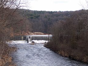
Millers River at Athol, MassachusettsOrigin Lake Watatic, Ashburnham, Massachusetts Mouth Connecticut River at Millers Falls, Massachusetts Length 52 miles (84 km) Source elevation 1,124 feet (343 m) at Lake Watatic Mouth elevation 175 feet (53 m) Avg. discharge 1000 ft³/s (28.32 m³/s) Basin area 390 square miles (1,000 km2) Coordinates: 42°35′50″N 72°29′48″W / 42.59722°N 72.49667°W
The Millers River is a 52.1-mile-long (83.8 km)[1] river in northern Massachusetts, originating in Ashburnham[2] and joining the Connecticut River just downstream from Millers Falls, Massachusetts. The river was formerly known as Paquag or Baquag, a Nipmuc word meaning "clear water."[3]
Sections of the river are used for whitewater kayaking, and a section upriver is popular with flatwater racers (canoe racing).
Contents
Topography
The Millers River drains a total area of about 390 square miles (1,000 km2), about 313 square miles (810 km2) of which are in Massachusetts, with the remainder in New Hampshire. About 78 percent of the basin is forested, 11 percent is open land, 8 percent is wetland, and 3 percent contains urban areas. The watershed is made up of all or part of 17 municipalities, with a population of approximately 87,000 people. Population centers are concentrated around Gardner, Athol, and Orange.[4]
Many wetlands in the basin indicate areas of former shallow lakes and ponds that have gradually been filled. There are a total of 107 lakes and ponds in the basin, 72 of which have an area of 10 acres (40,000 m2) or more. Only one lake, 592-acre (2.40 km2) Lake Monomonac in Winchendon, Massachusetts, and Rindge, New Hampshire, is larger than 500 acres (2.0 km2).[4]
Origin
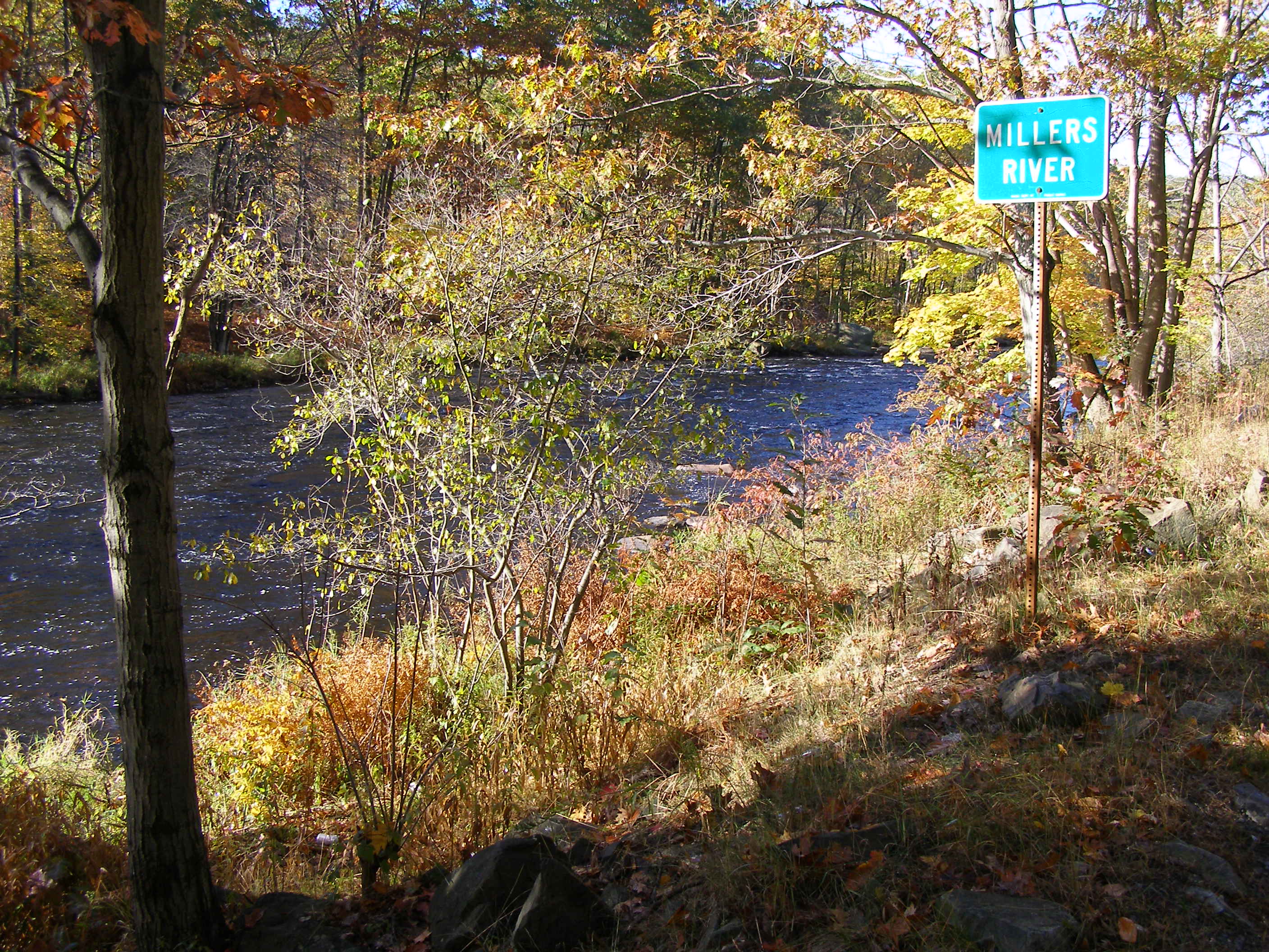
 Millers River near Erving at autumn
The Millers River formed at the end of the last glacial period when several glacial lakes joined and, eventually, drained into the Connecticut River. The river's headwaters are in Ashburnham and Winchendon, Massachusetts, and the headwaters of the North Branch are in Mountain Pond, at the western foot of the Wapack Range in New Ipswich, New Hampshire.[4]
Information
The North Branch and the main stem of the river join in Winchendon, and the river flows westward to the Connecticut River. Major tributaries of the Millers River are the Otter River, which enters the Millers River in Winchendon in Otter River State Forest, and the Tully River, which enters the Millers River in Athol. Both tributaries flow mainly through wetlands. Overall, the Millers River has a moderate gradient, averaging about 18 feet/mile from the headwaters area to the USGS streamflow-gaging station at Erving, a stream distance of about 43 miles (69 km).
However, a 5-mile (8.0 km) reach of the Millers River through a wooded area between South Royalston and Athol (the "Bear's Den") has an average gradient of about 43 feet/mile, which is about five times the average for rivers in Massachusetts, and some of the most rugged and steep terrain of the state's central upland. The gradient of the tributary Otter River averages about 18 feet/mile for a distance of about 11.5 miles (18.5 km), and that of the East Branch Tully River, the major tributary of the Tully River, averages about 52 feet/mile over a distance of about 13 miles (21 km).[4]
Flood control
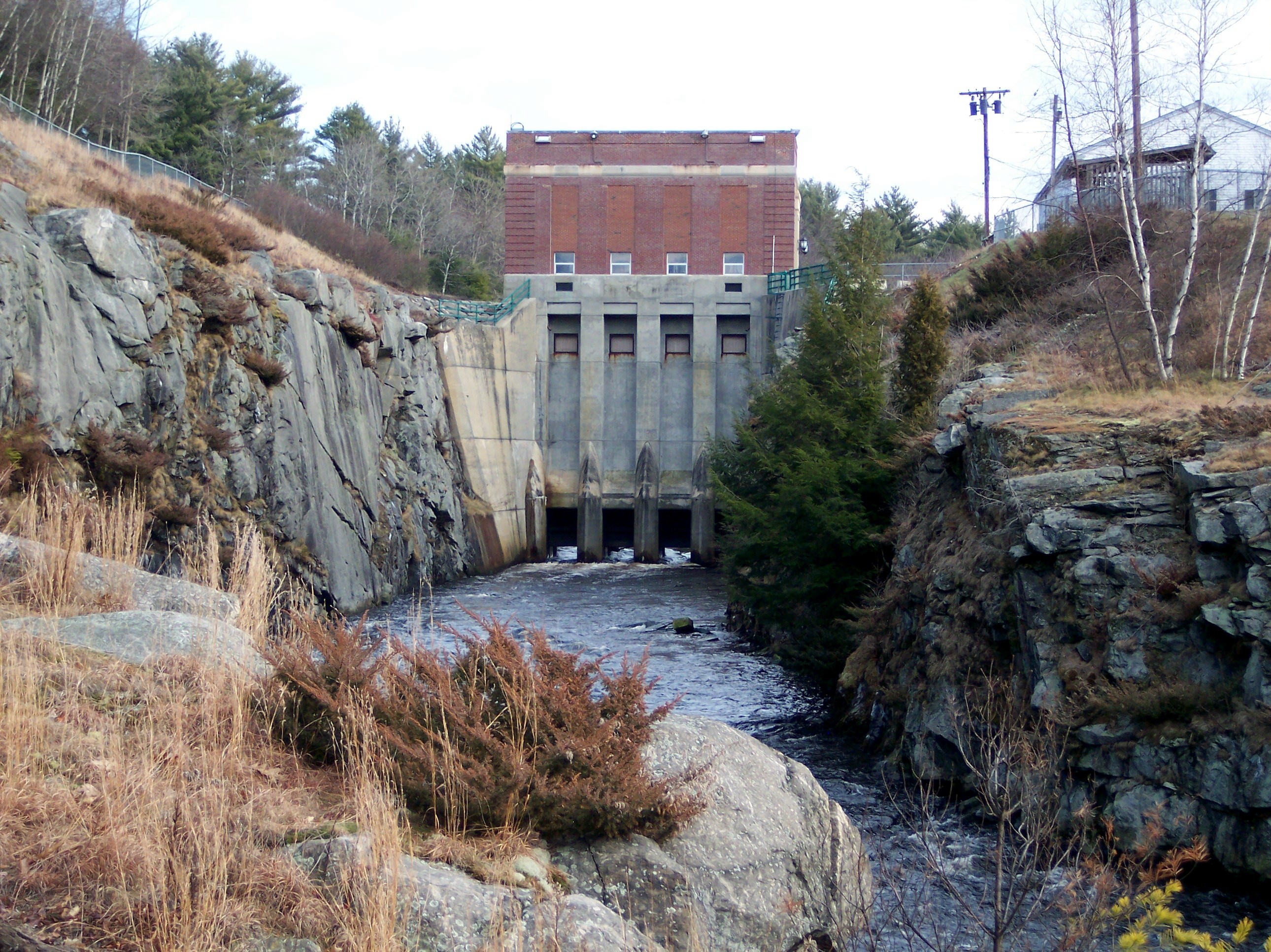
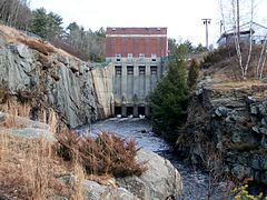 Birch Hill Dam on the Millers River
The Birch Hill Dam is a flood control dam located on the Millers River in South Royalston, Massachusetts. It is a part of a network of flood control dams on tributaries of the Connecticut River. Completed in 1941 at a cost of US$4 million, Birch Hill Dam was one of the first dams the Army Corps of Engineers built in New England to prevent floods like those that devastated Athol and Orange in 1936 and 1938. It has a storage capacity of 16.3 billion US gallons (62,000,000 m3).[5]
The Reservoir Regulation Team (RRT) is the "nerve center" for the New England flood control dams such as Birch Hill Dam. Using radio and satellite communications, RRT constantly monitors river levels and weather conditions that influence flood control decisions.[5] Corps personnel, in conjunction with RRT, regulate the amount of water released downstream by raising or lowering the four 6 ft (1.8 m) by 12 ft (3.7 m) gates located in the gatehouse at the dam. In a time of high water, the gates are lowered in order to hold back the water, only to be released when downstream river conditions begin to recede. In April 1987, two storms dropped over 6 inches (150 mm) of rain, raising the water level to over 33 feet (10 m) at the dam, utilizing 80% of the storage capacity. It is estimated that Birch Hill Dam prevented over $9 million in damages to downstream property from this one storm.[5]
References
- ^ U.S. Geological Survey. National Hydrography Dataset high-resolution flowline data. The National Map, accessed April 1, 2011
- ^ "TopoQuest map for main branch". http://www.topoquest.com/map.asp?lat=42.68&lon=-71.94&size=l&u=4&datum=nad27&layer=DRG. Retrieved 2008-06-29.
- ^ NIAC Publications ~ Nipmuc Place Names - Maine & Massachusetts
- ^ a b c d "Millers River Drainage Basin". http://ri.water.usgs.gov/basins/millers.htm. Retrieved 2007-01-02.[dead link]
- ^ a b c "USACE Birch Hill Dam". http://www.nae.usace.army.mil/recreati/bhd/bhdfc.htm. Retrieved 2007-01-02.
External links
Categories:- Rivers of New Hampshire
- Rivers of Worcester County, Massachusetts
- Rivers of Franklin County, Massachusetts
Wikimedia Foundation. 2010.