- Millers Ferry, Alabama
-
Millers Ferry, Alabama Location within the state of Alabama
 Millers Ferry, Alabama
Coordinates: 32°5′58.52″N 87°22′2.98″W / 32.0995889°N 87.3674944°W Country United States State Alabama County Wilcox Elevation 131 ft (40 m) Time zone Central (CST) (UTC-6) – Summer (DST) CDT (UTC-5) ZIP code Area code(s) 334 Millers Ferry is an unincorporated community in Wilcox County, Alabama, United States.[1] The Millers Ferry Lock and Dam is located near the community on the Alabama River.
Geography
Millers Ferry is located at 32°05′58″N 87°22′03″W / 32.09958°N 87.36749°WCoordinates: 32°05′58″N 87°22′03″W / 32.09958°N 87.36749°W and its elevation is 131 feet (40 m).[1]
Tornadoes
On March 1, 2007, Millers Ferry was struck by a deadly tornado. One person was killed, 2 injured, and over 70 houses were damaged or destroyed. The tornado caused well over $2 million in damage.
References
Municipalities and communities of Wilcox County, Alabama City 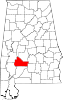
Towns CDPs Boykin | Catherine
Unincorporated
communitiesAckerville | Alberta | Anne Manie | Arlington | Canton Bend | Coy | Furman | Gastonburg | Kimbrough | Lamison | Lower Peach Tree | McWilliams | Millers Ferry | Prairie | Snow Hill | Sunny South
Ghost town Categories:- Unincorporated communities in Alabama
- Populated places in Wilcox County, Alabama
- Alabama geography stubs


Wikimedia Foundation. 2010.