- Alstead, New Hampshire
Infobox Settlement
official_name = Alstead, New Hampshire
nickname =
motto =
image_
imagesize =
image_caption =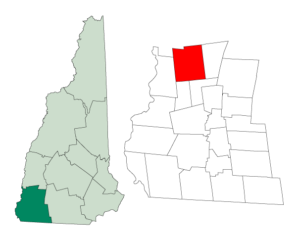
mapsize = 250px
map_caption = Location in Cheshire County,New Hampshire
settlement_type = Town
mapsize1 =
map_caption1 =
subdivision_type = Country
subdivision_name =United States
subdivision_type1 = State
subdivision_name1 =New Hampshire
subdivision_type2 = County
subdivision_name2 = Cheshire
government_type =
leader_title =Board of Selectmen
leader_name = Joel C. McCarty, Chairman
William H. Moran
Matthew D. Saxton
established_title = Incorporated
established_date =
area_magnitude = 1 E8
area_total_km2 = 102.0
area_total_sq_mi = 39.4
area_land_km2 = 100.8
area_land_sq_mi = 38.9
area_water_km2 = 1.2
area_water_sq_mi = 0.5
area_water_percent = 1.19
population_as_of = 2000
population_note =
population_total = 1944
population_density_km2 = 19.3
population_density_sq_mi = 50.0
timezone = Eastern
utc_offset = -5
timezone_DST = Eastern
utc_offset_DST = -4
latd = 43 |latm = 08 |lats = 56 |latNS = N
longd = 72 |longm = 21 |longs = 38 |longEW = W
elevation_m = 146
elevation_ft = 479
website = [http://www.alsteadnh.org/ www.alsteadnh.org]
postal_code_type =ZIP code
postal_code = 03602
area_code = 603
blank_name = FIPS code
blank_info = 33-00820
blank1_name = GNIS feature ID
blank1_info = 0873529
footnotes =Alstead is a town in Cheshire County,
New Hampshire ,United States . The population was 1,944 at the 2000 census. Alstead is home to Feuer State Forest.History
The town was chartered by
Massachusetts Colonial GovernorJonathan Belcher in 1735 as one in a line of nine forts intended to protect southwesternNew Hampshire from Indian attack. It was granted as Newton in 1752 by GovernorBenning Wentworth , but would be incorporated in 1763 as Alstead. It was named forJohann Heinrich Alsted , who compiled an earlyencyclopedia that was popular atHarvard College . Settled about 1764, Alstead would be one of the towns that wavered in its allegiance after the Revolutionary War. It decided to joinVermont in April 1781, but at the insistence ofGeorge Washington , returned to New Hampshire authority early the next year.Also known as Paper Mill Village, Alstead is the location of the state's first
paper mill . It was established in 1793 on the Cold River by Ephraim and Elisha Kingsbury. Paper was then a rare and expensive product, made by chopping rags oflinen andcotton cloth into pulp. The mill was destroyed by fire in 1880. While Alstead was basically anagricultural community, its streams and ponds once powered a variety of small mills. Aturbine water mill at East Alstead is probably the last of its type anywhere in the region.Shedd-Porter Memorial Library, built in 1909-1910 in the Beaux-Arts style, was a gift to Alstead and Langdon by native son
John G. Shedd , president ofMarshall Field's department store inChicago . Another native sonphilanthropist , Charles M. Vilas, gave a large public recreation area, school building and the onlycarillon in Cheshire County.On
October 9 ,2005 , parts of Alstead were devastated by a severeflood . Heavy rain in Cheshire County caused the Cold River and its tributaries to swell, washing away homes, cars and 4 miles of Route 123. Four inhabitants of the town were killed. A "Save Our History " grant fromThe History Channel provided funding to the Alstead Historical Society and several students of the local high school, who wrote and printed a book called "Too Much Water, Too Much Rain"cite book |last=Alstead Historical Society |first= |authorlink= |coauthors= |title=Too Much Water, Too Much Rain |year=2006 |publisher=PublishingWorks |location= |isbn=1933002387 ] , chronicling the disaster and its aftermath.Notable residents
*
Sarah Hall Boardman , missionary
*Titus Brown , congressman
*Salma Hale , printer & congressman
*John G. Shedd , merchant
*Samuel Thomson , founder of the Thomsonion System of Medicineites of interest
* Alstead Historical Society Museum
Geography
According to the
United States Census Bureau , the town has a total area of convert|39.4|sqmi|km2, of which convert|38.9|sqmi|km2|abbr=on is land and convert|0.5|sqmi|km2|abbr=on is water, comprising 1.19% of the town. Alstead is drained by the Cold River. Lake Warren is in the east. The highest point in Alstead is Smith Hill, at convert|1795|ft|m abovesea level ). Alstead lies fully within theConnecticut River watershed.cite book |title=Water Use in New Hampshire: An Activities Guide for Teachers |url=http://nh.water.usgs.gov/Publications/nh.intro.html |last=Foster |first=Debra H. |coauthors=Batorfalvy, Tatianna N.; and Medalie, Laura |publisher=U.S. Department of the Interior and U.S. Geological Survey |year=1995]Demographics
As of the
census GR|2 of 2000, there were 1,944 people, 771 households, and 534 families residing in the town. Thepopulation density was 50.0 people per square mile (19.3/km²). There were 941 housing units at an average density of 24.2/sq mi (9.3/km²). The racial makeup of the town was 98.20% White, 0.21% African American, 0.62% Native American, 0.51% Asian, and 0.46% from two or more races. Hispanic or Latino of any race were 0.51% of the population.There were 771 households out of which 33.6% had children under the age of 18 living with them, 56.7% were married couples living together, 8.9% had a female householder with no husband present, and 30.7% were non-families. 24.5% of all households were made up of individuals and 8.0% had someone living alone who was 65 years of age or older. The average household size was 2.51 and the average family size was 2.99.
In the town the population was spread out with 26.0% under the age of 18, 6.1% from 18 to 24, 28.5% from 25 to 44, 26.7% from 45 to 64, and 12.7% who were 65 years of age or older. The median age was 40 years. For every 100 females there were 104.4 males. For every 100 females age 18 and over, there were 98.2 males.
The median income for a household in the town was $43,191, and the median income for a family was $47,311. Males had a median income of $35,481 versus $23,785 for females. The
per capita income for the town was $20,444. About 3.5% of families and 7.9% of the population were below thepoverty line , including 10.9% of those under age 18 and 4.7% of those age 65 or over.References
External links
* [http://www.alsteadnh.org/main.php Town of Alstead]
* [http://www.nh.gov/nhes/elmi/htmlprofiles/alstead.html New Hampshire Economic and Labor Market Information Bureau Profile]
* [http://cbs4boston.com/slideshows/local_slideshow_286185101 Pictures of the 2005 Flooding from CBS 4 in Boston]
Wikimedia Foundation. 2010.