- Roxbury, New Hampshire
Infobox Settlement
official_name = Roxbury, New Hampshire
nickname =
motto =
image_
imagesize =
image_caption =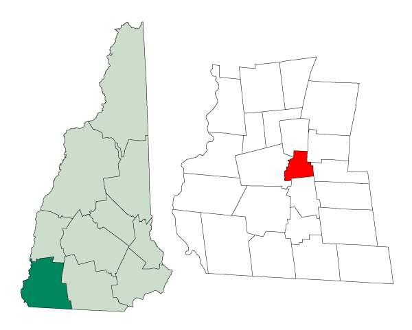
mapsize = 250px
map_caption = Location in Cheshire County,New Hampshire
settlement_type = Town
mapsize1 =
map_caption1 =
subdivision_type = Country
subdivision_name =United States
subdivision_type1 = State
subdivision_name1 =New Hampshire
subdivision_type2 = County
subdivision_name2 = Cheshire
government_type =
leader_title =Board of Selectmen
leader_name = Louis “Chip” Drogue
Dan Stockwell
Chris Kaufer
established_title = Incorporated
established_date = 1812
area_magnitude = 1 E8
area_total_km2 = 31.6
area_total_sq_mi = 12.2
area_land_km2 = 30.8
area_land_sq_mi = 11.9
area_water_km2 = 0.8
area_water_sq_mi = 0.3
area_water_percent = 2.38
population_as_of = 2000
population_note =
population_total = 237
population_density_km2 = 7.7
population_density_sq_mi = 19.9
timezone = Eastern
utc_offset = -5
timezone_DST = Eastern
utc_offset_DST = -4
latd = 42 |latm = 57 |lats = 18 |latNS = N
longd = 72 |longm = 12 |longs = 21 |longEW = W
elevation_m = 419
elevation_ft = 1375
website = [http://www.keenenh.com/roxbury/ www.keenenh.com/roxbury]
postal_code_type =ZIP code
postal_code = 03431
area_code = 603
blank_name = FIPS code
blank_info = 33-65700
blank1_name = GNIS feature ID
blank1_info = 0873710
footnotes =Roxbury is a town in Cheshire County,
New Hampshire ,United States . The population was 237 at the 2000 census.History
Much of Roxbury was abandoned in the
American Civil War as a very high percentage of itsmale population was killed in battle. The smallest town in Cheshire County, it was incorporated in 1812 from portions of Nelson, Marlborough, and Keene. Roxbury'sgranite quarries, among the most extensive in the Granite State at the time, provided the stone for the capitol building of New York in Albany. Otter Brook Lake, constructed by theArmy Corps of Engineers in 1956-58 to control flooding of theConnecticut River , occupies part of the town's western boundary.Geography
According to the
United States Census Bureau , the town has a total area of convert|12.2|sqmi|km2|1, of which convert|11.9|sqmi|km2|abbr=on|1 is land and convert|0.3|sqmi|km2|abbr=on|1 is water, comprising 2.38% of the town. The highest point in Roxbury is the summit Bassett Hill, at convert|1644|ft|m abovesea level .Demographics
As of the
census GR|2 of 2000, there were 237 people, 89 households, and 66 families residing in the town. Thepopulation density was 19.9 people per square mile (7.7/km²). There were 90 housing units at an average density of 7.6/sq mi (2.9/km²). The racial makeup of the town was 98.73% White, 0.42% Asian, and 0.84% from two or more races.There were 89 households out of which 32.6% had children under the age of 18 living with them, 67.4% were married couples living together, 6.7% had a female householder with no husband present, and 25.8% were non-families. 20.2% of all households were made up of individuals and 5.6% had someone living alone who was 65 years of age or older. The average household size was 2.66 and the average family size was 3.12.
In the town the population was spread out with 25.3% under the age of 18, 3.8% from 18 to 24, 28.7% from 25 to 44, 32.9% from 45 to 64, and 9.3% who were 65 years of age or older. The median age was 41 years. For every 100 females there were 99.2 males. For every 100 females age 18 and over, there were 88.3 males.
The median income for a household in the town was $49,375, and the median income for a family was $56,875. Males had a median income of $33,984 versus $23,750 for females. The
per capita income for the town was $21,124. None of the families and 0.9% of the population were living below thepoverty line .References
External links
* [http://www.keenenh.com/roxbury Town website]
* [http://www.nh.gov/nhes/elmi/htmlprofiles/roxbury.html New Hampshire Economic and Labor Market Information Bureau Profile]
Wikimedia Foundation. 2010.