- Gilsum, New Hampshire
Infobox Settlement
official_name = Gilsum, New Hampshire
nickname =
motto =
image_
imagesize =
image_caption =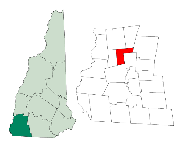
mapsize = 250px
map_caption = Location in Cheshire County,New Hampshire
settlement_type = Town
mapsize1 =
map_caption1 =
subdivision_type = Country
subdivision_name =United States
subdivision_type1 = State
subdivision_name1 =New Hampshire
subdivision_type2 = County
subdivision_name2 = Cheshire
government_type =
leader_title =Board of Selectmen
leader_name = Louise Cook
William G. Hasbrouck
Raymond Britton Jr.
established_title = Incorporated
established_date = 1787
area_magnitude = 1 E8
area_total_km2 = 43.2
area_total_sq_mi = 16.7
area_land_km2 = 43.1
area_land_sq_mi = 16.7
area_water_km2 = 0.1
area_water_sq_mi = 0.04
area_water_percent = 0.12
population_as_of = 2000
population_note =
population_total = 777
population_density_km2 = 18.0
population_density_sq_mi = 46.6
timezone = Eastern
utc_offset = -5
timezone_DST = Eastern
utc_offset_DST = -4
latd = 43 |latm = 02 |lats = 54 |latNS = N
longd = 72 |longm = 15 |longs = 46 |longEW = W
elevation_m = 266
elevation_ft = 873
website = [http://www.keenenh.com/gilsum/ www.keenenh.com/gilsum/]
postal_code_type =ZIP code
postal_code = 03448
area_code = 603
blank_name = FIPS code
blank_info = 33-29220
blank1_name = GNIS feature ID
blank1_info = 0873605
footnotes =Gilsum is a town in Cheshire County,
New Hampshire ,United States . The population was 777 at the 2000 census. Home to the Bear's Den Natural Area, Gilsum includes Gilsum Lower Village.History
The land was originally named "Boyle" after Richard Boyle,
Earl of Burlington , when the land was granted by Colonial GovernorBenning Wentworth in 1752, but Native American hostilities prevented settlement. When the grant lapsed, the town was rechartered in 1763 as "Gilsum," supposedly combining the surnames of its two major families, Gilbert and Sumner. It would be incorporated in 1787. Lucy Mack, the mother of theLatter Day Saint movement founder Joseph Smith, was born in Gilsum in 1775. The town contains the Stone Arch Bridge, completed in 1863 with the highest vault (36 feet, 6 inches) of any mortarless bridge in New Hampshire. In 1989, it was added to the National Register.Gilsum used to be a center for the
mining ofmica andfeldspar . High-quality crystals, especiallyberyl ,tourmaline , andquartz , can also be found. TheAshuelot River once providedwater power forwoolen mills. Today, Gilsum is headquarters to the W.S. Badger Company, makers of "balm s,potion s andnatural remedies ."Geography
According to the
United States Census Bureau , the town has a total area of convert|16.7|sqmi|km2, of which convert|16.7|sqmi|km2|abbr=on is land and convert|0.04|sqmi|km2|abbr=on is water, comprising 0.12% of the town. The highest point in Gilsum is an unnamed hill along the town's eastern boundary, where the elevation reaches convert|1657|ft|m abovesea level . Gilsum is drained by the Ashuelot River and lies fully within theConnecticut River watershed.cite book |title=Water Use in New Hampshire: An Activities Guide for Teachers |url=http://nh.water.usgs.gov/Publications/nh.intro.html |last=Foster |first=Debra H. |coauthors=Batorfalvy, Tatianna N.; and Medalie, Laura |publisher=U.S. Department of the Interior and U.S. Geological Survey |year=1995]Demographics
As of the
census GR|2 of 2000, there were 777 people, 310 households, and 220 families residing in the town. Thepopulation density was 46.6 people per square mile (18.0/km²). There were 343 housing units at an average density of 20.6/sq mi (7.9/km²). The racial makeup of the town was 98.46% White, 0.39% Native American, 0.13% Asian, and 1.03% from two or more races. Hispanic or Latino of any race were 0.51% of the population.There were 310 households out of which 26.5% had children under the age of 18 living with them, 58.7% were married couples living together, 8.7% had a female householder with no husband present, and 29.0% were non-families. 23.9% of all households were made up of individuals and 6.5% had someone living alone who was 65 years of age or older. The average household size was 2.48 and the average family size was 2.90.
In the town the population was spread out with 22.3% under the age of 18, 5.0% from 18 to 24, 30.0% from 25 to 44, 31.9% from 45 to 64, and 10.8% who were 65 years of age or older. The median age was 41 years. For every 100 females there were 98.2 males. For every 100 females age 18 and over, there were 104.1 males.
The median income for a household in the town was $43,359, and the median income for a family was $50,469. Males had a median income of $35,150 versus $24,205 for females. The
per capita income for the town was $20,955. About 1.9% of families and 7.0% of the population were below thepoverty line , including 1.3% of those under age 18 and 13.7% of those age 65 or over.Sites of Interest
* Gilsum Historical Society Museum
* Stone Arch BridgeReferences
External links
* [http://www.keenenh.com/gilsum Town website]
* [http://www.nh.searchroots.com/documents/History_Gilsum_NH.txt History of Gilsum, NH]
* [http://www.nh.gov/nhes/elmi/htmlprofiles/gilsum.html New Hampshire Economic and Labor Market Information Bureau Profile]
Wikimedia Foundation. 2010.