- National Register of Historic Places listings in Bee County, Texas
-
List of Registered Historic Places in Bee County, Texas
This is intended to be a complete list of properties and districts listed on the National Register of Historic Places in Bee County, Texas. The locations of National Register properties and districts (at least for all showing latitude and longitude coordinates below) may be seen in a Google map by clicking on "Map of all coordinates".[1]
-
- This National Park Service list is complete through NPS recent listings posted November 10, 2011.[2]
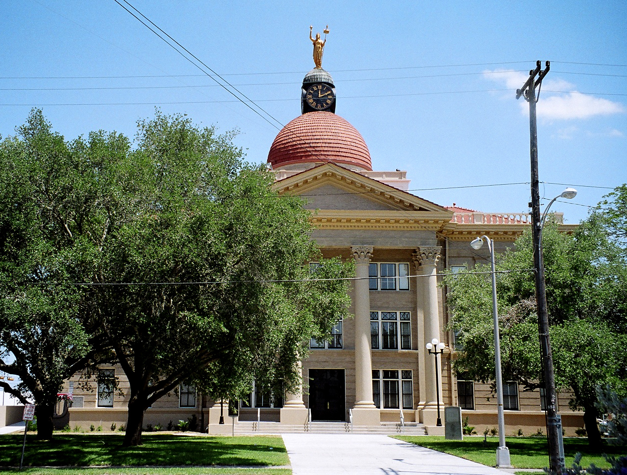
[3] Landmark name [4] Image Date listed Location City or town Summary 1 Bee County Courthouse 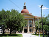
February 9, 2001 105 W. Corpus Christi St.
28°24′04″N 97°44′53″W / 28.401111°N 97.748056°WBeeville Ref. #01000105 2 Beeville Post Office April 4, 2007 111 N. St. Mary's St.
28°24′15″N 97°44′56″W / 28.404167°N 97.748889°WBeeville Ref. #07000272 3 Lott-Canada School December 7, 2010 900 W. Corpus Christi St.
28°23′53″N 97°45′26″W / 28.398194°N 97.757153°WBeeville Ref. #10000981; Rosenwald School Building Program in Texas MPS 4 Medio Creek Bridge October 13, 1988 CR 241
28°31′46″N 97°47′39″W / 28.529444°N 97.794167°WNormanna Ref. #88002000, aka Normanna Bridge 5 NAS Chase Field-Building 1001 February 23, 1994 Independence St., 0.45 mi. S of jct. with TX 202
28°22′24″N 97°39′49″W / 28.373333°N 97.663611°WBeeville Ref. #94000050, Administration Building 6 NAS Chase Field-Building 1009 February 23, 1994 Essex St. 0.68 mi. SSE of the jct. of TX 202 and Independence St.
28°22′23″N 97°39′41″W / 28.373056°N 97.661389°WBeeville Ref. #94000051, Enlisted WAVES Barracks 7 NAS Chase Field-Building 1015 February 23, 1994 Byrd St. 0.82 mi. SSE of jct. of TX 202 and Independence St.
28°22′09″N 97°39′39″W / 28.369167°N 97.660833°WBeeville Ref. #94000052, Landplane Hangar 8 NAS Chase Field-Building 1040 February 23, 1994 Enterprise St. 0.37 mi. SSE of the jct. of TX 202 and Independence St.
28°22′32″N 97°39′46″W / 28.375556°N 97.662778°WBeeville Ref. #94000053, Auditorium/Gym/Chapel 9 NAS Chase Field-Building 1042 February 23, 1994 Ofstie Rd. 0.6 mi. SSE of the jct. of TX 202 and Independence St.
28°22′22″N 97°39′39″W / 28.372778°N 97.660833°WBeeville Ref. #94000054, Brig 10 NAS Chase Field-Quarters R February 23, 1994 Essex St. 0.43 mi. SSW of the jct. of TX 202 and Independence St.
28°22′28″N 97°39′51″W / 28.374444°N 97.664167°WBeeville Ref. #94000055, Commanding Officer's Quarters 11 NAS Chase Field-Quarters S February 23, 1994 Essex St. 0.45 mi. SSW of the jct. of TX 202 and Independence St.
28°22′29″N 97°39′55″W / 28.374722°N 97.665139°WBeeville Ref. #94000056, Executive Officer's Quarters 12 Praeger Building September 9, 1982 110 W. Corpus Christi St.
28°24′06″N 97°44′57″W / 28.401667°N 97.749167°WBeeville Ref. #82004490 13 Rialto Theater 
November 21, 2001 112-114 N. Washington St.
28°24′08″N 97°44′57″W / 28.402222°N 97.749167°WBeeville Ref. #01001265, aka Hall-Rialto Theater See also
- Registered Historic Places in Texas, Counties A-C
References
- ^ The latitude and longitude information provided in this table was derived originally from the National Register Information System, which has been found to be fairly accurate for about 99% of listings. For about 1% of NRIS original coordinates, experience has shown that one or both coordinates are typos or otherwise extremely far off; some corrections may have been made. A more subtle problem causes many locations to be off by up to 150 yards, depending on location in the country: most NRIS coordinates were derived from tracing out latitude and longitudes off of USGS topographical quadrant maps created under North American Datum of 1927, which differs from the current, highly accurate GPS system used by Google maps. Chicago is about right, but NRIS longitudes in Washington are higher by about 4.5 seconds, and are lower by about 2.0 seconds in Maine. Latitudes differ by about 1.0 second in Florida. Some locations in this table may have been corrected to current GPS standards.
- ^ "National Register of Historic Places: Weekly List Actions". National Park Service, United States Department of the Interior. Retrieved on November 10, 2011.
- ^ Numbers represent an ordering by significant words. Various colorings, defined here, differentiate National Historic Landmark sites and National Register of Historic Places Districts from other NRHP buildings, structures, sites or objects.
- ^ "National Register Information System". National Register of Historic Places. National Park Service. . http://nrhp.focus.nps.gov/natreg/docs/All_Data.html.
U.S. National Register of Historic Places Topics Lists by states Alabama • Alaska • Arizona • Arkansas • California • Colorado • Connecticut • Delaware • Florida • Georgia • Hawaii • Idaho • Illinois • Indiana • Iowa • Kansas • Kentucky • Louisiana • Maine • Maryland • Massachusetts • Michigan • Minnesota • Mississippi • Missouri • Montana • Nebraska • Nevada • New Hampshire • New Jersey • New Mexico • New York • North Carolina • North Dakota • Ohio • Oklahoma • Oregon • Pennsylvania • Rhode Island • South Carolina • South Dakota • Tennessee • Texas • Utah • Vermont • Virginia • Washington • West Virginia • Wisconsin • WyomingLists by territories Lists by associated states Other  Category:National Register of Historic Places •
  Portal:National Register of Historic PlacesCategories:
- Bee County, Texas
- National Register of Historic Places in Texas
- Buildings and structures in Bee County, Texas
-

Wikimedia Foundation. 2010.