- National Register of Historic Places listings in Clay County, Indiana
-
 Location of Clay County in Indiana
This is a list of the National Register of Historic Places listings in Clay County, Indiana.
This is intended to be a complete list of the properties and districts on the National Register of Historic Places in Clay County, Indiana, United States. Latitude and longitude coordinates are provided for many National Register properties and districts; these locations may be seen together in a Google map.[1]
There are 14 properties and districts listed on the National Register in the county.
-
- This National Park Service list is complete through NPS recent listings posted November 10, 2011.[2]
Current listings
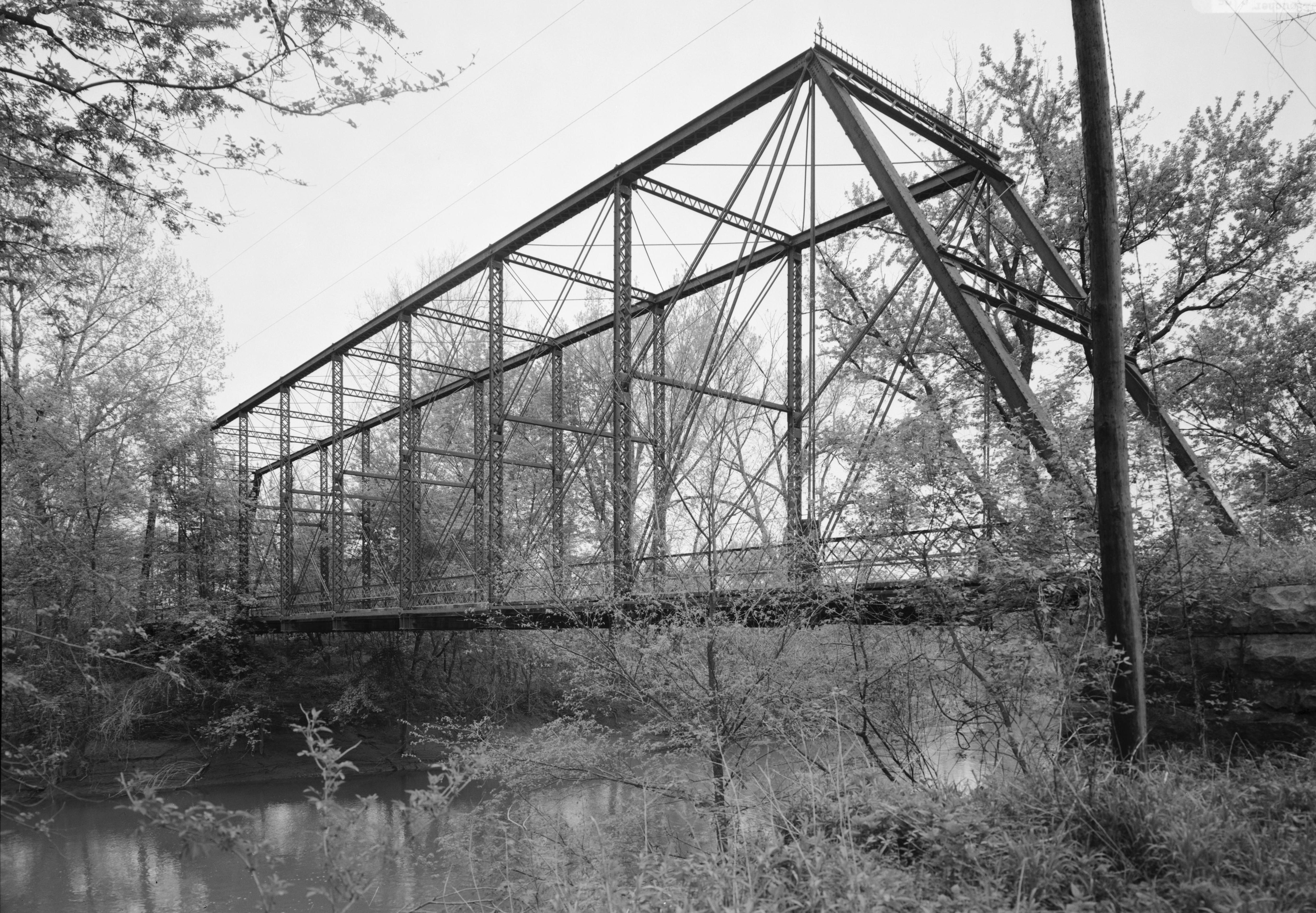
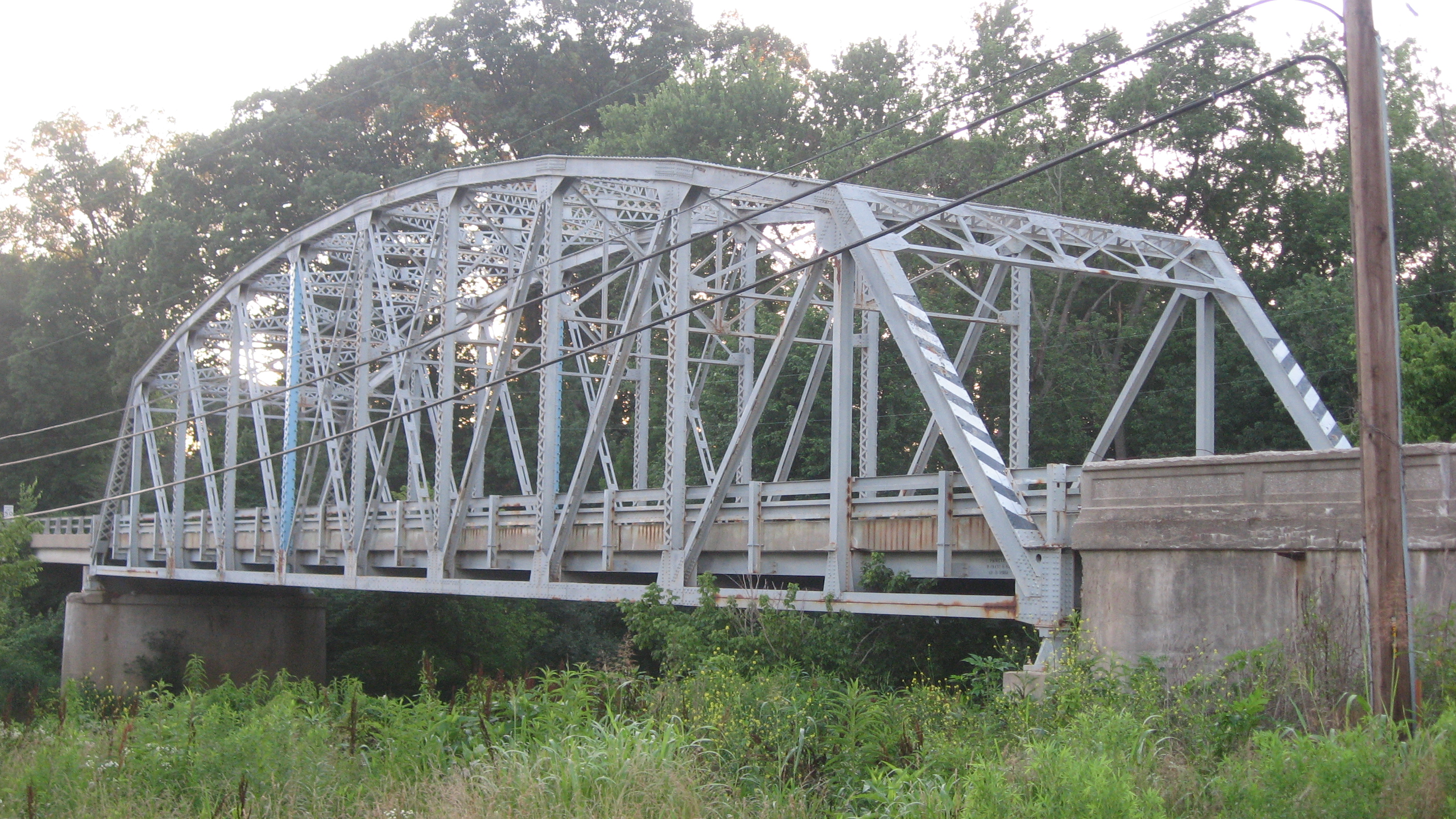
[3] Landmark name [4] Image Date listed Location City or town Summary 1 Aqueduct Bridge 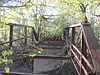
March 15, 2000 Towpath Rd. over Birch Creek
39°19′36″N 87°10′46″W / 39.326667°N 87.179444°WClay City 2 Brazil Downtown Historic District June 25, 1997 E. and W. National Ave. between Depot and Forest Aves.
39°31′23″N 87°07′39″W / 39.523056°N 87.1275°WBrazil 3 Clay County Courthouse 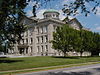
September 9, 1999 Bounded by U.S. Route 40, Harrison, Jackson, and Alabama Sts.
39°31′28″N 87°07′11″W / 39.524444°N 87.119722°WBrazil 4 Clay County Hospital October 1, 1999 1200 E. National Ave.
39°31′43″N 87°06′41″W / 39.528611°N 87.111389°WBrazil 5 Eaglefield Place August 28, 1998 4870 E. U.S. Route 40
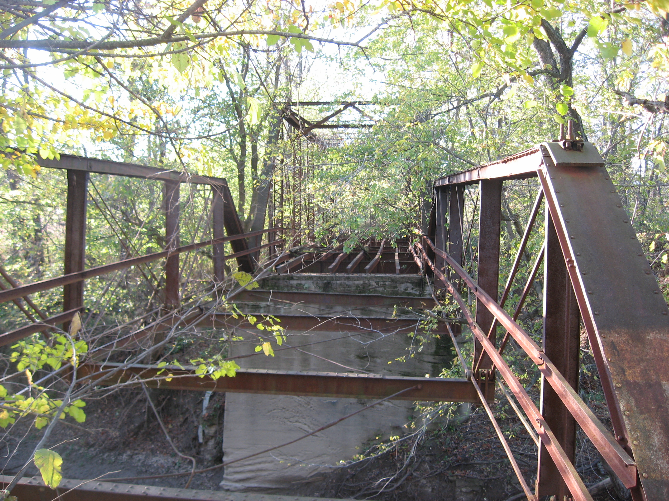
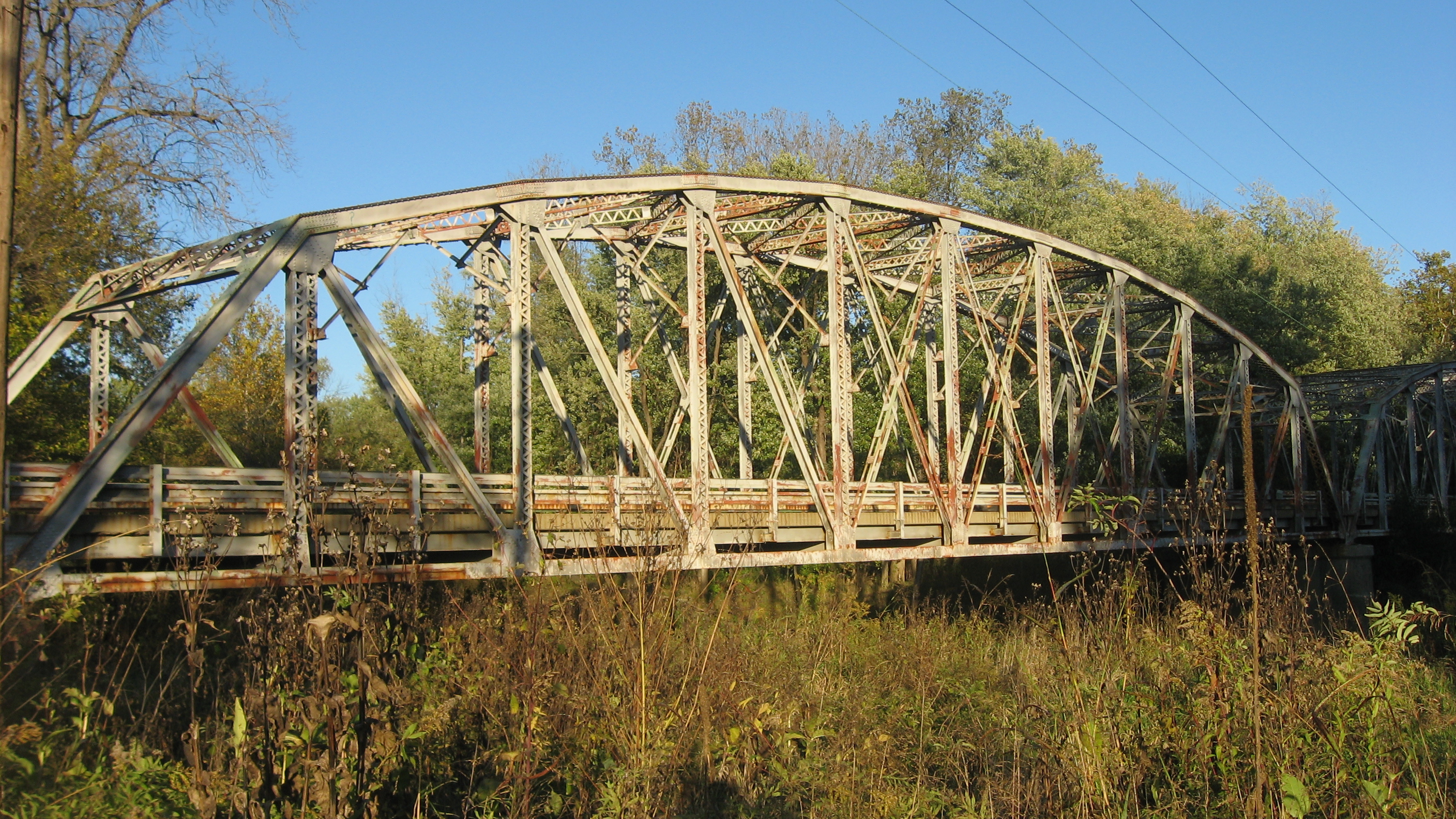
39°32′50″N 87°00′56″W / 39.547222°N 87.015556°WBrazil 6 Feeder Dam Bridge 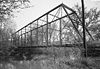
March 15, 2000 Towpath Rd. over the Eel River
39°20′09″N 87°06′49″W / 39.335833°N 87.113611°WClay City 7 Indiana State Highway Bridge 42-11-3101 
March 15, 2000 State Road 42 over the Eel River
39°26′40″N 86°59′37″W / 39.444444°N 86.993611°WPoland 8 Indiana State Highway Bridge 46-11-1316 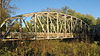
March 15, 2000 State Road 46 over the Eel River
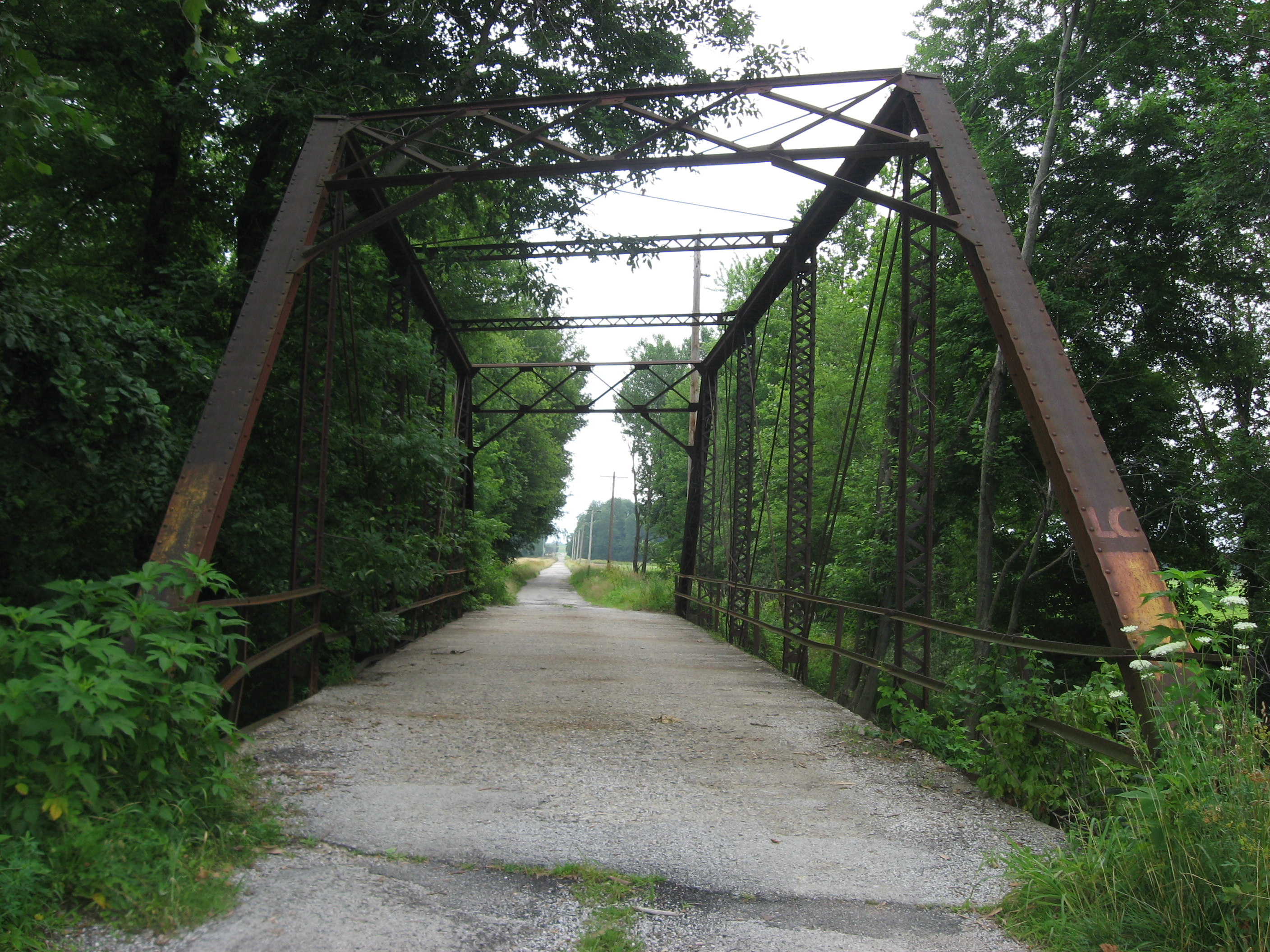
39°23′03″N 87°01′14″W / 39.384167°N 87.020556°WBowling Green 9 Jeffers Bridge 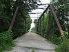
March 15, 2000 County Road 200S over Birch Creek
39°21′31″N 87°08′32″W / 39.358611°N 87.142222°WClay City 10 Meridian-Forest Historic District June 26, 1997 Roughly bounded by N. Meridian, E. Chestnut, N. Forest, E. and W. Church, and State Sts.
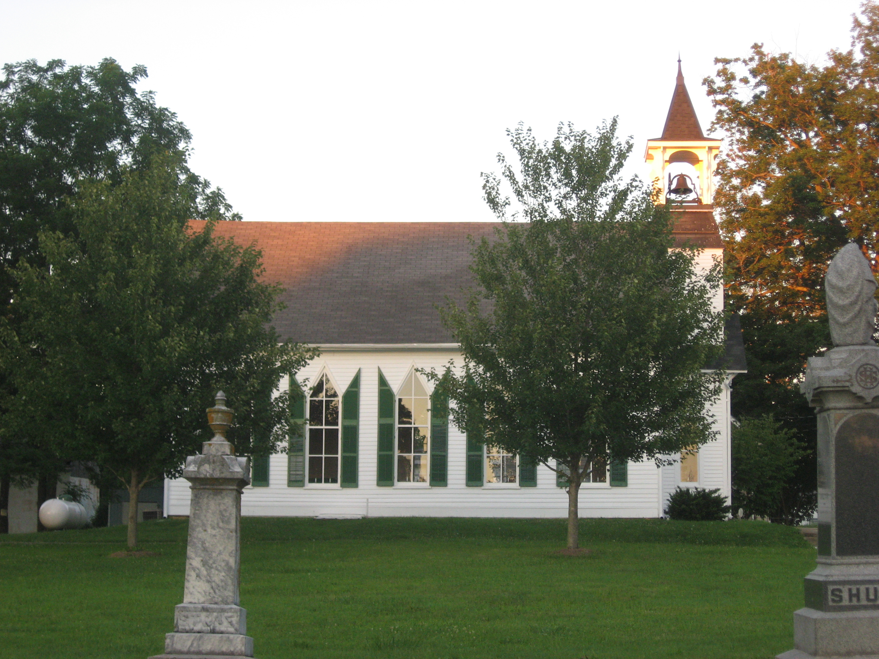
39°31′41″N 87°07′41″W / 39.528056°N 87.128056°WBrazil 11 Poland Presbyterian Church and Cemetery 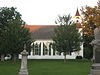
December 18, 1990 State Road 42 near County Road 56S
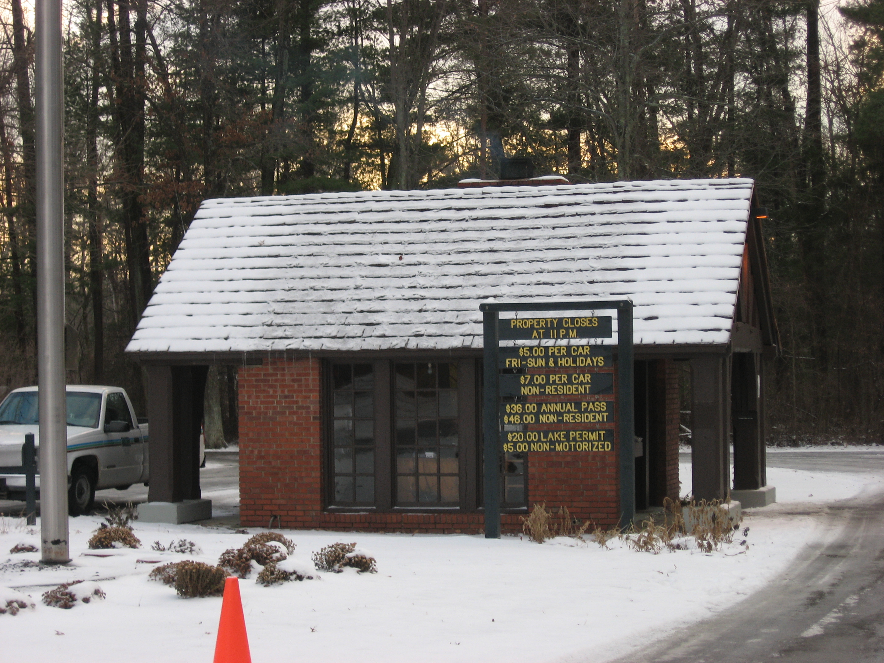
39°26′41″N 86°57′14″W / 39.444722°N 86.953889°WPoland 12 Shakamak State Park Historic District 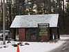
March 15, 2000 6265 W. State Road 48
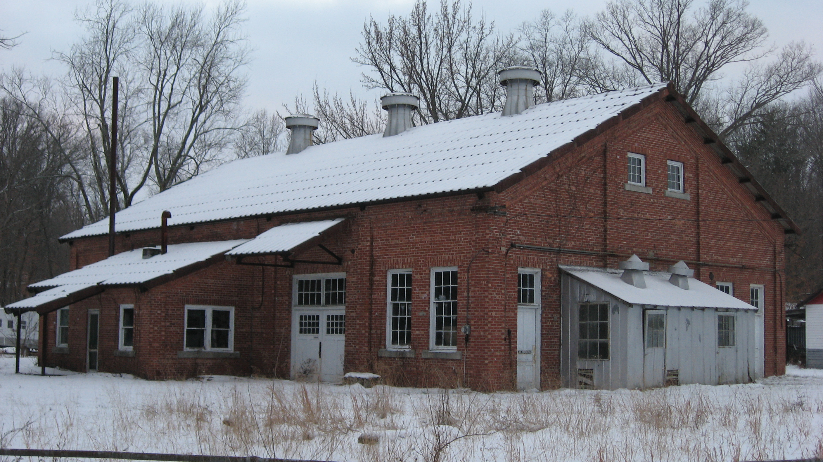
39°10′35″N 87°14′04″W / 39.17625°N 87.2345°WJasonville 13 Tide Water Pumping Station 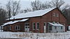
September 3, 1999 Southwestern corner of the junction of 900S and 300E
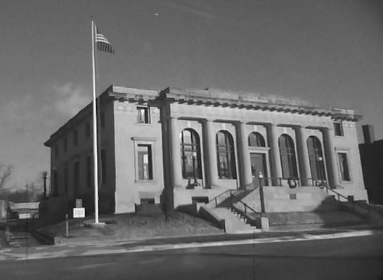
39°15′16″N 87°03′21″W / 39.254444°N 87.055833°WCoal City 14 US Post Office-Brazil 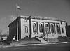
September 8, 1994 100 E. National Ave.
39°31′26″N 87°07′33″W / 39.523889°N 87.125833°WBrazil See also
- List of National Historic Landmarks in Indiana
- National Register of Historic Places listings in Indiana
References
- ^ The latitude and longitude information provided in this table was derived originally from the National Register Information System, which has been found to be fairly accurate for about 99% of listings. For about 1% of NRIS original coordinates, experience has shown that one or both coordinates are typos or otherwise extremely far off; some corrections may have been made. A more subtle problem causes many locations to be off by up to 150 yards, depending on location in the country: most NRIS coordinates were derived from tracing out latitude and longitudes off of USGS topographical quadrant maps created under North American Datum of 1927, which differs from the current, highly accurate GPS system used by Google maps. Chicago is about right, but NRIS longitudes in Washington are higher by about 4.5 seconds, and are lower by about 2.0 seconds in Maine. Latitudes differ by about 1.0 second in Florida. Some locations in this table may have been corrected to current GPS standards.
- ^ "National Register of Historic Places: Weekly List Actions". National Park Service, United States Department of the Interior. Retrieved on November 10, 2011.
- ^ Numbers represent an ordering by significant words. Various colorings, defined here, differentiate National Historic Landmark sites and National Register of Historic Places Districts from other NRHP buildings, structures, sites or objects.
- ^ "National Register Information System". National Register of Historic Places. National Park Service. . http://nrhp.focus.nps.gov/natreg/docs/All_Data.html.
U.S. National Register of Historic Places Topics Lists by states Alabama • Alaska • Arizona • Arkansas • California • Colorado • Connecticut • Delaware • Florida • Georgia • Hawaii • Idaho • Illinois • Indiana • Iowa • Kansas • Kentucky • Louisiana • Maine • Maryland • Massachusetts • Michigan • Minnesota • Mississippi • Missouri • Montana • Nebraska • Nevada • New Hampshire • New Jersey • New Mexico • New York • North Carolina • North Dakota • Ohio • Oklahoma • Oregon • Pennsylvania • Rhode Island • South Carolina • South Dakota • Tennessee • Texas • Utah • Vermont • Virginia • Washington • West Virginia • Wisconsin • WyomingLists by territories Lists by associated states Other  Category:National Register of Historic Places •
  Portal:National Register of Historic Places
Municipalities and communities of Clay County, Indiana County seat: Brazil City 
Towns Carbon | Center Point | Clay City | Harmony | Knightsville | Staunton
Townships Brazil | Cass | Dick Johnson | Harrison | Jackson | Lewis | Perry | Posey | Sugar Ridge | Van Buren | Washington
Unincorporated
communitiesArt | Ashboro | Asherville | Barrick Corner | Bee Ridge | Benwood | Billtown | Billville | Bogle Corner | Bowling Green | Brunswick | Buchanan Corner | Cardonia | Cloverland | Coalmont | Cory | Cottage Hill | Eel River | Hoffman Crossing | Hoosierville | Howesville | Lap Corner | Middlebury | Old Hill | Perth | Poland | Pontiac | Prairie City | Purdy Hill | Roadman Corner | Saline City | Shady Lane | Six Points | Stearleyville | Turner | Twin Beach
Categories:- Clay County, Indiana
- National Register of Historic Places in Indiana by county
-


Wikimedia Foundation. 2010.