- National Register of Historic Places listings in Spencer County, Indiana
-
 Location of Spencer County in Indiana
This is a list of the National Register of Historic Places listings in Spencer County, Indiana.
This is intended to be a complete list of the properties and districts on the National Register of Historic Places in Spencer County, Indiana, United States. Latitude and longitude coordinates are provided for many National Register properties and districts; these locations may be seen together in a Google map.[1]
There are 8 properties and districts listed on the National Register in the county, including 1 National Historic Landmark.
-
- This National Park Service list is complete through NPS recent listings posted November 10, 2011.[2]
Current listings
[3] Landmark name [4] Image Date listed Location City or town Summary 1 Deutsch Evangelische St. Paul's Kirche 
September 27, 1984 South of Santa Claus on Sante Fe Rd.
38°06′40″N 86°54′33″W / 38.111111°N 86.909167°WSanta Claus 2 Huffman Mill Covered Bridge 
April 1, 1998 CR 1490N over the Anderson River
38°06′14″N 86°46′37″W / 38.103889°N 86.776944°WFulda Extends into Perry County 3 Col. William Jones House 
May 12, 1975 West of Gentryville on Troy-Vincennes Rd.
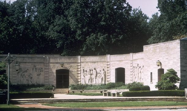
38°06′50″N 87°02′35″W / 38.113889°N 87.043056°WGentryville 4 Lincoln Boyhood National Memorial 
October 15, 1966 State Road 162
38°07′06″N 86°59′49″W / 38.118333°N 86.996944°WLincoln City 5 Lincoln Pioneer Village 
April 20, 1998 Junction of 9th St. and Eureka Rd.
37°52′48″N 87°03′28″W / 37.88°N 87.057778°WRockport 6 St. Boniface Church 
October 23, 1980 State Road 545
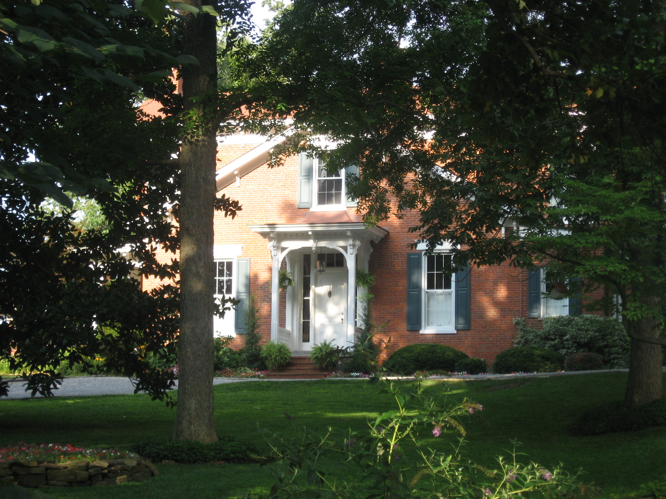
38°06′41″N 86°50′08″W / 38.111389°N 86.835556°WFulda 7 Mathias Sharp House 
June 16, 1983 319 S. 2nd St.
37°52′48″N 87°02′40″W / 37.88°N 87.044444°WRockport 8 Spencer County Courthouse 
March 12, 1999 Bounded by 2nd, 3rd, Main, and Walnut Sts.
37°52′57″N 87°02′47″W / 37.8825°N 87.046389°WRockport See also
- List of National Historic Landmarks in Indiana
- National Register of Historic Places listings in Indiana
References
- ^ The latitude and longitude information provided in this table was derived originally from the National Register Information System, which has been found to be fairly accurate for about 99% of listings. For about 1% of NRIS original coordinates, experience has shown that one or both coordinates are typos or otherwise extremely far off; some corrections may have been made. A more subtle problem causes many locations to be off by up to 150 yards, depending on location in the country: most NRIS coordinates were derived from tracing out latitude and longitudes off of USGS topographical quadrant maps created under North American Datum of 1927, which differs from the current, highly accurate GPS system used by Google maps. Chicago is about right, but NRIS longitudes in Washington are higher by about 4.5 seconds, and are lower by about 2.0 seconds in Maine. Latitudes differ by about 1.0 second in Florida. Some locations in this table may have been corrected to current GPS standards.
- ^ "National Register of Historic Places: Weekly List Actions". National Park Service, United States Department of the Interior. Retrieved on November 10, 2011.
- ^ Numbers represent an ordering by significant words. Various colorings, defined here, differentiate National Historic Landmark sites and National Register of Historic Places Districts from other NRHP buildings, structures, sites or objects.
- ^ "National Register Information System". National Register of Historic Places. National Park Service. . http://nrhp.focus.nps.gov/natreg/docs/All_Data.html.
U.S. National Register of Historic Places Topics Lists by states Alabama • Alaska • Arizona • Arkansas • California • Colorado • Connecticut • Delaware • Florida • Georgia • Hawaii • Idaho • Illinois • Indiana • Iowa • Kansas • Kentucky • Louisiana • Maine • Maryland • Massachusetts • Michigan • Minnesota • Mississippi • Missouri • Montana • Nebraska • Nevada • New Hampshire • New Jersey • New Mexico • New York • North Carolina • North Dakota • Ohio • Oklahoma • Oregon • Pennsylvania • Rhode Island • South Carolina • South Dakota • Tennessee • Texas • Utah • Vermont • Virginia • Washington • West Virginia • Wisconsin • WyomingLists by territories Lists by associated states Other Municipalities and communities of Spencer County, Indiana City 
Towns Chrisney | Dale | Gentryville | Grandview | Richland City | Santa Claus
Townships Unincorporated
communitiesAfrica | Bloomfield | Buffaloville | Centerville | Clay City | Enterprise | Eureka | Evanston | Fulda | Hatfield | Huffman | Kennedy | Lake Mill | Lamar | Liberal | Lincoln City | Mariah Hill | Maxville | Midway | New Boston | Newtonville | Patronville | Pueblo | Reo | Rock Hill | Rockport Junction | Saint Meinrad | Sand Ridge | Santa Fe | Schley | Silverdale
Categories:- Spencer County, Indiana
- National Register of Historic Places in Indiana by county
-


Wikimedia Foundation. 2010.