- National Register of Historic Places listings in Perry County, Indiana
-
 Location of Perry County in Indiana
This is a list of the National Register of Historic Places listings in Perry County, Indiana.
This is intended to be a complete list of the properties and districts on the National Register of Historic Places in Perry County, Indiana, United States. Latitude and longitude coordinates are provided for many National Register properties and districts; these locations may be seen together in a Google map.[1]
There are 9 properties and districts listed on the National Register in the county, including 1 National Historic Landmark.
-
- This National Park Service list is complete through NPS recent listings posted November 10, 2011.[2]
Current listings
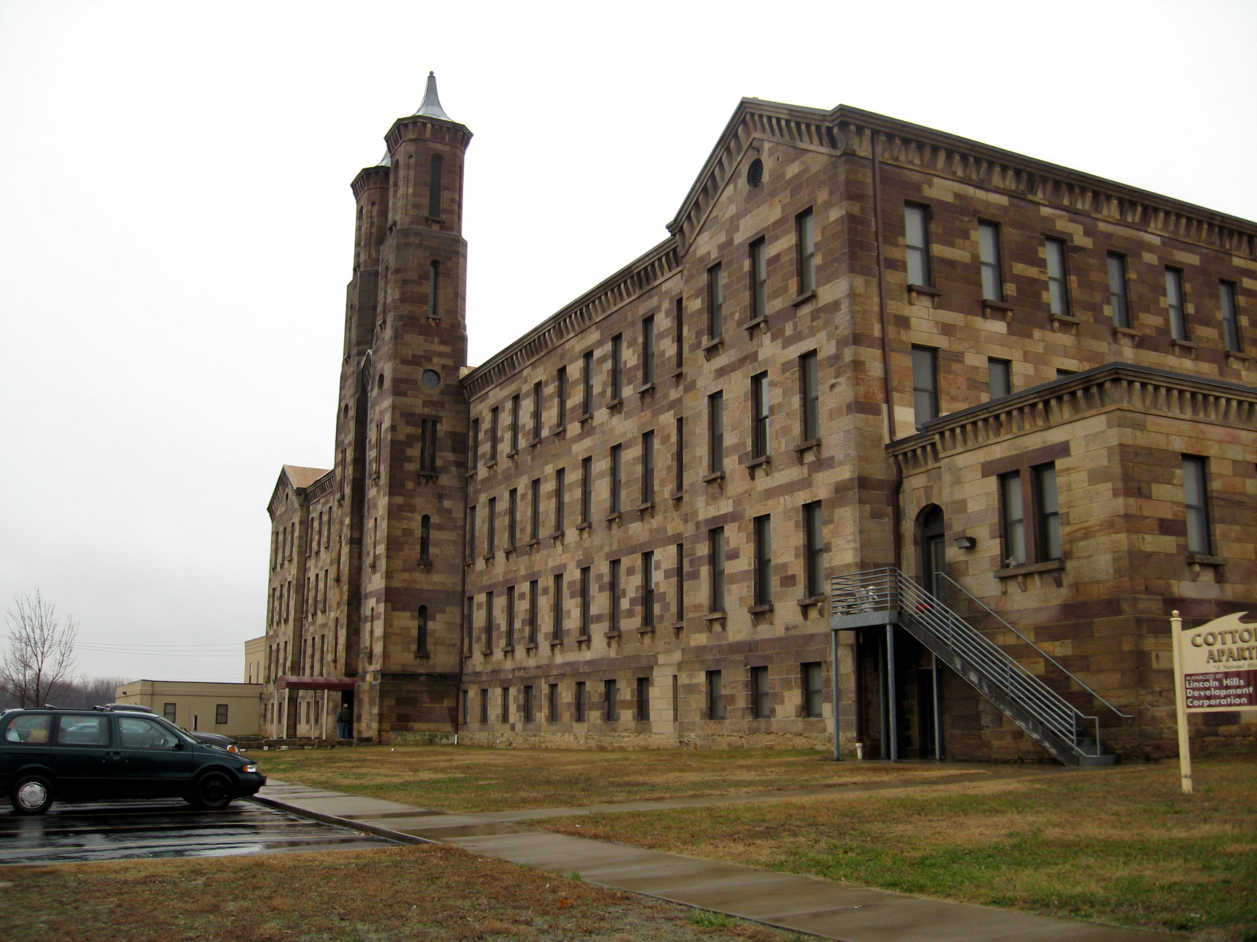
[3] Landmark name[4] Image Date listed Location City or Town Summary 1 Cannelton Cotton Mills 
August 22, 1975 Bounded by Front, 4th, Washington, and Adams Sts.
37°54′41″N 86°44′44″W / 37.91139°N 86.74556°WCannelton 2 Cannelton Historic District 
February 12, 1987 Roughly bounded by Richardson, Taylor, 1st, and Madison Sts.
37°54′44″N 86°44′35″W / 37.91222°N 86.74306°WCannelton 3 Hall of Tell City Lodge, No. 206, IOOF 
November 27, 1992 701 Main St.
37°57′3″N 86°46′12″W / 37.95083°N 86.77°WTell City 4 Huffman Mill Covered Bridge 
April 1, 1998 CR 1490N over the Anderson River
38°6′14″N 86°46′37″W / 38.10389°N 86.77694°WFulda Extends into Spencer County 5 Nester House 
October 11, 1990 300 Water St.
37°59′40″N 86°48′19″W / 37.99444°N 86.80528°WTroy 6 Old Perry County Courthouse 
May 12, 1981 Town Square
37°55′25″N 86°31′25″W / 37.92361°N 86.52361°WRome 7 Rickenbaugh House 
April 6, 1984 Southwest of St. Croix in the Hoosier National Forest
38°11′18″N 86°36′44″W / 38.18833°N 86.61222°WSt. Croix 8 Rockhouse Cliffs Rock Shelters (12PE98; 12PE100) 
April 25, 1986 About 50 feet (15 m) from the spring in Rockhouse Hollow
38°3′35″N 86°34′29″W / 38.05972°N 86.57472°W[5]Derby 9 St. Luke's Episcopal Church 
March 3, 1983 3rd and Washington Sts.
37°54′39″N 86°44′40″W / 37.91083°N 86.74444°WCannelton See also
- List of National Historic Landmarks in Indiana
- National Register of Historic Places listings in Indiana
References
- ^ The latitude and longitude information provided in this table was derived originally from the National Register Information System, which has been found to be fairly accurate for about 99% of listings. For about 1% of NRIS original coordinates, experience has shown that one or both coordinates are typos or otherwise extremely far off; some corrections may have been made. A more subtle problem causes many locations to be off by up to 150 yards, depending on location in the country: most NRIS coordinates were derived from tracing out latitude and longitudes off of USGS topographical quadrant maps created under North American Datum of 1927, which differs from the current, highly accurate GPS system used by Google maps. Chicago is about right, but NRIS longitudes in Washington are higher by about 4.5 seconds, and are lower by about 2.0 seconds in Maine. Latitudes differ by about 1.0 second in Florida. Some locations in this table may have been corrected to current GPS standards.
- ^ "National Register of Historic Places: Weekly List Actions". National Park Service, United States Department of the Interior. Retrieved on November 10, 2011.
- ^ Numbers represent an ordering by significant words. Various colorings, defined here, differentiate National Historic Landmark sites and National Register of Historic Places Districts from other NRHP buildings, structures, sites or objects.
- ^ "National Register Information System". National Register of Historic Places. National Park Service. 2009-03-13. http://nrhp.focus.nps.gov/natreg/docs/All_Data.html.
- ^ Location derived from Kellar, James H. An Archaeological Survey of Perry County. Indianapolis: Indiana Historical Bureau, 1958, 31. The NRIS lists the site as "Address Restricted".
U.S. National Register of Historic Places Topics Lists by states Alabama • Alaska • Arizona • Arkansas • California • Colorado • Connecticut • Delaware • Florida • Georgia • Hawaii • Idaho • Illinois • Indiana • Iowa • Kansas • Kentucky • Louisiana • Maine • Maryland • Massachusetts • Michigan • Minnesota • Mississippi • Missouri • Montana • Nebraska • Nevada • New Hampshire • New Jersey • New Mexico • New York • North Carolina • North Dakota • Ohio • Oklahoma • Oregon • Pennsylvania • Rhode Island • South Carolina • South Dakota • Tennessee • Texas • Utah • Vermont • Virginia • Washington • West Virginia • Wisconsin • WyomingLists by territories Lists by associated states Other  Category:National Register of Historic Places •
  Portal:National Register of Historic Places
Municipalities and communities of Perry County, Indiana County seat: Tell City Cities 
Town Townships Unincorporated
communitiesAdyeville | Apalona | Bandon | Branchville | Bristow | Celina | Derby | Dexter | Dodd | Doolittle Mills | Fenn Haven | Gatchel | Gerald | Kitterman Corners | Leopold | Lilly Dale | Magnet | Mount Pleasant | Oriole | Ranger | Rome | St. Croix | Sassafras | Siberia | Terry | Tobinsport
Categories:- Perry County, Indiana
- National Register of Historic Places in Indiana by county
- National Register of Historic Places in Perry County, Indiana
-


Wikimedia Foundation. 2010.